
The Pyrenees is a mountain range straddling the border of France and Spain. It extends nearly 500 km (310 mi) from its union with the Cantabrian Mountains to Cap de Creus on the Mediterranean coast. It reaches a maximum altitude of 3,404 metres (11,168 ft) at the peak of Aneto.

Mont Blanc is the highest mountain in the Alps and Western Europe, rising 4,807.81 m (15,774 ft) above sea level. It is the second-most prominent mountain in Europe, after Mount Elbrus, and it is the eleventh most prominent mountain summit in the world. The mountain stands between the regions of Aosta Valley, Italy, and Savoie and Haute-Savoie, France. It gives its name to the Mont Blanc massif, bordering Switzerland and forming part of a larger range referred to as the Graian Alps. The location of the summit of Mont Blanc is on the watershed line between the valleys of Ferret and Veny in Italy and the valleys of Montjoie, and Arve in France, on the border between the two countries. Ownership of the summit area has long been a subject of historical dispute between the two countries.

Jura is a department in the Bourgogne-Franche-Comté region in Eastern France. Named after the Jura Mountains, its prefecture is Lons-le-Saunier. Its subprefectures are Dole and Saint-Claude. In 2016, Jura had a population of 260,517. Its INSEE code is 39. It has a short portion of the border of Switzerland.

Chamonix-Mont-Blanc, more commonly known as Chamonix, is a commune in the Haute-Savoie department in the Auvergne-Rhône-Alpes region of southeastern France. It was the site of the first Winter Olympics in 1924. In 2017, it had a population of 8,611.

The Jura Mountains are a sub-alpine mountain range a short distance north of the Western Alps and mainly demarcate a long part of the French–Swiss border. While the Jura range proper is located in France and Switzerland, the range continues as the Table Jura northeastwards through northern Switzerland and Germany.

Valais, or Wallis, more formally the Canton of Valais, is one of the 26 cantons forming the Swiss Confederation. It is composed of thirteen districts and its capital and largest city is Sion. The flag of the canton is made of thirteen stars representing the districts, on a white-red background.
The Vosges are a range of low mountains in Eastern France, near its border with Germany. Together with the Palatine Forest to the north on the German side of the border, they form a single geomorphological unit and low mountain range of around 8,000 km2 (3,100 sq mi) in area. It runs in a north-northeast direction from the Burgundian Gate to the Börrstadt Basin, and forms the western boundary of the Upper Rhine Plain.
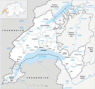
Vaud, more formally the canton of Vaud, is one of the 26 cantons forming the Swiss Confederation. It is composed of ten districts and its capital city is Lausanne. Its flag bears the motto "Liberté et patrie" on a white-green background.

The Japanese dry garden or Japanese rock garden, often called a zen garden, is a distinctive style of Japanese garden. It creates a miniature stylized landscape through carefully composed arrangements of rocks, water features, moss, pruned trees and bushes, and uses gravel or sand that is raked to represent ripples in water. Zen gardens are commonly found at temples or monasteries. A zen garden is usually relatively small, surrounded by a wall or buildings, and is usually meant to be seen while seated from a single viewpoint outside the garden, such as the porch of the hojo, the residence of the chief monk of the temple or monastery. Many, with gravel rather than grass, are only stepped into for maintenance. Classical zen gardens were created at temples of Zen Buddhism in Kyoto during the Muromachi period. They were intended to imitate the essence of nature, not its actual appearance, and to serve as an aid for meditating about the true meaning of existence.

The French Alps are the portions of the Alps mountain range that stand within France, located in the Auvergne-Rhône-Alpes and Provence-Alpes-Côte d'Azur regions. While some of the ranges of the French Alps are entirely in France, others, such as the Mont Blanc massif, are shared with Switzerland and Italy.

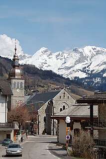
Les Houches is a commune in the Haute-Savoie department in the Auvergne-Rhône-Alpes region of Eastern France. In 2017, it had a population of 2,943.

Les Gets is a commune in the Haute-Savoie department in the Auvergne-Rhône-Alpes region in south-eastern France.

Le Bourg-d'Oisans is a commune in the Isère department in southeastern France.
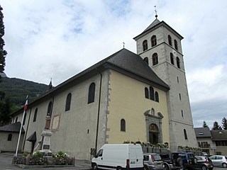
Sallanches is a commune in the Haute-Savoie department of France. Located close to the Mont Blanc massif, many visitors pass through the town en route to well-known alpine resorts such as Chamonix, Megève and Saint-Gervais-les-Bains. Sallanches is also one of the towns in the Arve Valley, made popular by the presence of many high-tech industries. Over 300 retail stores are located in Sallanches, making the town a commercial hub. In 2017, the commune had a population of 16,088, and its urban area had 44,192 inhabitants.
Pine Le Moray Provincial Park is a provincial park in British Columbia, Canada. The park, 70 km southwest of Chetwynd covers 43,289 hectares. It is located within the Hart Ranges ecosection near the Rocky Mountains. It is within the Engelmann Spruce-Subalpine Fir biogeoclimatic zone. Water courses include Link and Mountain Creeks, the Pine River, and Heart Lake. It provides habitat for trout, Arctic grayling, mountain whitefish, high elevation caribou, moose, wolverine, and grizzly bear. It is recognized by the province as an area traditionally used by First Nations people. Its topography has examples of Karst topography and alpine areas.

Mount Le Conte is a mountain located within the Great Smoky Mountains National Park in Sevier County, Tennessee. At 6,593 ft (2,010 m) it is the third highest peak in the national park, behind Clingmans Dome and Mount Guyot. It is also the highest peak that is completely within Tennessee. From its immediate base to its summit, Mount Le Conte is the mountain with the highest relief east of the Rocky Mountains, rising 5,301 feet (1,616 m) from its base, near Gatlinburg, Tennessee.
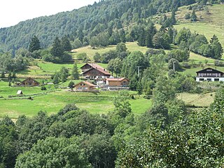
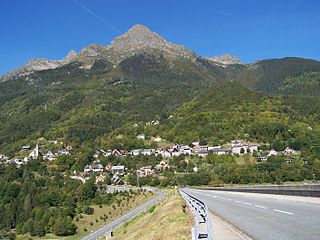
Le Grand-Bornand is a commune in the eastern French department of Haute-Savoie. The commune is a ski resort and takes its name from the river that runs through it. The inhabitants of Le Grand-Bornand are called Bornandins.
Allemond is a commune in the Isère department in the Auvergne-Rhône-Alpes region of south-eastern France.

Le Ménil is a commune in the Vosges department in Grand Est in northeastern France. It is sometimes called Le Ménil-Thillot to distinguish it from nearby Ménil-de-Senones.
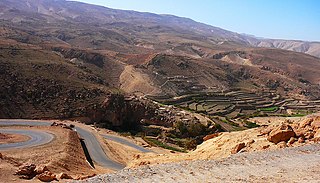
The Sinjar Mountains are a 100-kilometre-long (62 mi) mountain range that runs east to west, rising above the surrounding alluvial steppe plains in northwestern Iraq to an elevation of 1,463 meters (4,800 ft). The highest segment of these mountains, about 75 km (47 mi) long, lies in the Nineveh Governorate. The western and lower segment of these mountains lies in Syria and is about 25 km (16 mi) long. The city of Sinjar is just south of the range. These mountains are regarded as sacred by the Yazidis.
