Cannock Chase, often referred to locally as The Chase, is a mixed area of countryside in the county of Staffordshire, England. The area has been designated as the Cannock Chase Area of Outstanding Natural Beauty and is managed by Forestry England. The Chase gives its name to the Cannock Chase local government district. It is a former Royal forest.

The Taff Trail is a popular walking and cycle path that runs for 55 miles (89 km) between Cardiff Bay and Brecon in Wales. It is so named because it follows the course of the River Taff. Along much of its length, it follows the National Cycle Network Route 8 that continues to Holyhead, and is substantially off-road.

The Bukit Timah Nature Reserve is a 1.7-square-kilometre (0.66 sq mi) nature reserve near the geographic centre of Singapore, located on the slopes of Bukit Timah Hill, the country's highest natural peak standing at a height of approximately 165-metre (541 ft), and parts of the surrounding area, located actually in Bukit Panjang. The nature reserve is about 15 kilometres from the Downtown Core, Singapore's central business district (CBD).

The River Suck is a river within the Shannon River Basin in Ireland, 133 km (82.5 mi) in length. It is the main tributary of the River Shannon. It meets the Shannon a kilometre south of the village of Shannonbridge.

The 7stanes are seven mountain biking centres spanning the south of Scotland, from the heart of the Scottish Borders to Dumfries and Galloway. They are all in Forestry and Land Scotland forests and are known as the 7stanes because each venue features a 'stane', created by artist Gordon Young, somewhere along the forest trails.

Tarleton Academy is a secondary Academy situated in Tarleton, Lancashire, England; the headteacher is Simon Day. The school caters for 11 to 16-year-olds. The academy is scheduled a complete building renewal to be completed in September 2023, with a total cost of 23 million pounds.
The Ribble way is a long-distance walk between the Lancashire coast and the Yorkshire Dales National Park largely following the course of the River Ribble.
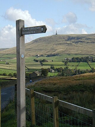
The Preston and Longridge Railway (P&LR) was a branch line in Lancashire, England. Originally designed to carry quarried stone in horse-drawn wagons, it became part of an ambitious plan to link the Lancashire coast to the heart of Yorkshire. The ambition was never achieved, but the line continued to carry passengers until 1930 and goods until 1967.

Buntzen Lake is a 4.8 kilometres (3 mi) long lake in Anmore, British Columbia, Canada, in the Greater Vancouver area. It is named after the first general manager of the B.C. Electric Co., Johannes Buntzen. There is a smaller lake just to the north named McCombe Lake.

Cadomin is a hamlet in the west-central Alberta, Canada within Yellowhead County. It is located along the McLeod River in the foothills of the Rocky Mountains, approximately 50 kilometres (31 mi) south of Hinton near the Bighorn Highway. It is served by a spur of the Canadian National Railway.

Dalby Forest is a forest located on the southern slopes of the North York Moors National Park in North Yorkshire, England. It is maintained by Forestry England. Dalby Forest, along with Langdale Forest and Cropton Forest, forms part of the North Riding Forest Park, found within the North York Moors National Park.

Buffalo Pound Provincial Park is in southern Saskatchewan, Canada, about 30 kilometres (19 mi) north-east of Moose Jaw and 86 kilometres (53 mi) north-west of the city of Regina. Access to the provincial park is from Highways 301 and 202.

The Trough of Bowland is a valley and high pass in the Forest of Bowland Area of Outstanding Natural Beauty, Lancashire, England.

Tegg's Nose is a hill east of Macclesfield in Cheshire, England. It has a short ridge with a high point of 380 metres (1246 feet) at SJ947725, terminating in a promontory at the southern end. It lies on the western edge of the Peak District, although outside the boundary of the national park. Much of the hill's area falls within the Tegg's Nose Country Park, managed by Cheshire East Council Countryside Management Service; Tegg's Nose is also part of the Environmentally Sensitive Area Scheme.

A long-distance trail is a longer recreational trail mainly through rural areas used for hiking, backpacking, cycling, horse riding or cross-country skiing. They exist on all continents except Antarctica.
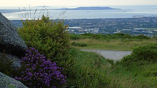
Ticknock or Tiknock is a townland southwest of Sandyford in Dublin at the northeastern foothills of the Dublin Mountains. The townland of Tiknock is in the electoral division of Dundrum, and has an area of approximately 2.6 square kilometres (1.0 sq mi).

Burbage Rocks is a gritstone escarpment in South Yorkshire, overlooking the village of Hathersage in the Peak District. The highest point along the escarpment is 429 metres (1,407 ft) above sea level, whilst Burbage Moor rises above to 438 metres (1,437 ft). Burbage Rocks is a southern extension of Stanage Edge. Burbage Brook runs from the northern end of the Burbage Rocks, past the southern end, through Padley Gorge and into the RIver Derwent.