Leeuwergem | |
|---|---|
Village | |
 Leeuwergem Castle (2008) | |
 Leeuwergem Location in Belgium | |
| Coordinates: 50°53′N3°49′E / 50.883°N 3.817°E | |
| Country | |
| Region | Flemish Region |
| Province | East Flanders |
| Municipality | Zottegem |
| Area | |
• Total | 2.49 km2 (0.96 sq mi) |
| Population (2021) [1] | |
• Total | 1,776 |
| • Density | 710/km2 (1,800/sq mi) |
| Time zone | CET |
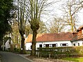
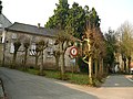
Leeuwergem is a village within the municipality of Zottegem. It is located on the Molenbeek, within the Denderstreek and Flemish Ardennes, a hilly region in the southern part of the East Flanders province, Belgium.
Contents
Leeuwergem was formerly part of the heerlijkheid of Zottegem. From 1271 onwards, it formed a heerlijkheid with Massemen. [2] It was an independent municipality until 1970, when it was merged into Zottegem. [3]
Leeuwergem and the neighbouring village of Elene are home to the 18th-century Leeuwergem Castle domain, a private estate spanning 32 hectares. [4]