Bavegem is a village in the Denderstreek in East Flanders in Belgium, part of the municipality of Sint-Lievens-Houtem.
Belsele is a village and a deelgemeente of the municipality of Sint-Niklaas, which is situated in the Belgian province of East Flanders.

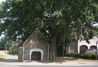
Kemzeke is a village in the Belgian municipality of Stekene in the province of East-Flanders. Until 1977, it was an independent municipality. It is located between the Dutch border and Sint-Niklaas.
Grembergen is a town in the municipality of Dendermonde in the Denderstreek in the province of East Flanders in Belgium. It is often confused with the municipality of Grimbergen in the province of Flemish Brabant.

Klein-Sinaai is a village near the Dutch border in the Belgian municipality of Stekene in the province of East Flanders. Until 1977 it was a part of the municipality of Sinaai.

Nederbrakel is a town in the municipality of Brakel. It is located in the Denderstreek and in the Flemish Ardennes, the hilly southern part of the province of East Flanders, Belgium. With 5,972 residents as of 2000, it forms the largest individual part of the municipality. Nederbrakel is located near the language border.
Michelbeke is a village in the municipality of Brakel, Belgium. It is located in the Denderstreek and in the Flemish Ardennes, the hilly southern part of the province of East Flanders, Belgium. It was itself a municipality until the fusion of the municipalities on 1 January 1971.
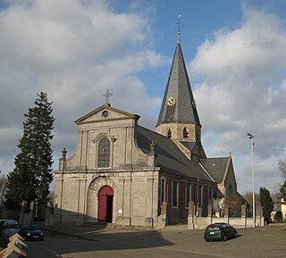
Sint-Maria-Oudenhove is a village in the Denderstreek and in the Flemish Ardennes, the hilly southern part of the province of East Flanders, Belgium.
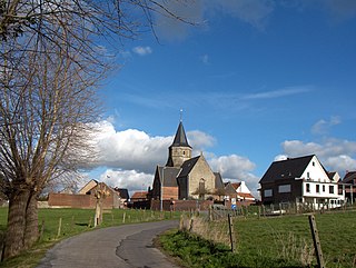
Godveerdegem is a village belonging to the municipality of Zottegem. It is located on the Molenbeek-Ter Erpenbeek in the Denderstreek and in the Flemish Ardennes, the hilly southern part of the province of East Flanders, Belgium.

Grotenberge is a village belonging to the municipality of Zottegem. It is located on the Molenbeek and the Molenbeek-Ter Erpenbeek within the Denderstreek and the Flemish Ardennes, the hilly southern part of the East Flanders province, Belgium.
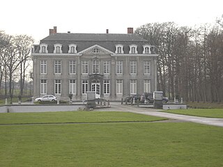
Leeuwergem is a village belonging to the municipality of Zottegem. It is located on the Molenbeek, in the Denderstreek and Flemish Ardennes, which is part of the hilly southern part of the East Flanders province, Belgium.

Opbrakel is a village and deelgemeente (sub-municipality) of the municipality of Brakel. It is located in the Denderstreek in the province of East Flanders in Belgium. It used to be an independent municipality until 1971 when it was merged into Brakel.

Parika is a village and deelgemeente (sub-municipality) of the municipality of Brakel. It is located in the Denderstreek in the province of East Flanders in Belgium. It used to be an independent municipality until 1977 when it was merged into Brakel.

Eine is a village located in the province of East Flanders, Belgium. Since 1965, it has been a deelgemeente (subdivision) of the municipality of Oudenaarde.

Erwetegem is a village and deelgemeente (sub-municipality) belonging to the municipality of Zottegem. It is located in the Denderstreek and in the Flemish Ardennes, the hilly southern part of the province of East Flanders, Belgium. Erwetegem used to an independent municipality until 1970.

Verrebroek is a village and deelgemeente in the municipality of Beveren in East Flanders, Belgium. Verrebroek was an independent municipality until 1 January 1977, when it merged with Beveren as part of the fusion of municipalities in Belgium.

Kieldrecht is a village and deelgemeente (sub-municipality) of Beveren in East Flanders, Belgium. Kieldrecht was an independent municipality until 1977, when it merged with Beveren as part of the fusion of municipalities in Belgium. The village is located on the border with the Netherlands, and forms a single urban area with the Dutch village of Nieuw-Namen.

Nieuwkerken-Waas is a village in the Belgian province East Flanders. Since 1977, it has been a subdivision (deelgemeente) of the municipality of Sint-Niklaas.

Kallo is a village and deelgemeente (sub-municipality) of Beveren in East Flanders, Belgium. Kallo was an independent municipality until 1 January 1977, when it merged with Beveren as part of the fusion of municipalities in Belgium. Most of the deelgemeente consists of harbours and industrial zones.

Wortegem is a village and seat of the municipality of Wortegem-Petegem in the Belgian province of East Flanders. It is located about 17 kilometres (11 mi) east of Kortrijk.


