Erwetegem

Last updated
Erwetegem
Village
ErwetegemDorp.JPG
St Pieters Banden Church
Belgium location map.svg
Red pog.svg
Erwetegem
Location in Belgium
Coordinates: 50°51′17″N3°48′54″E / 50.8546°N 3.8150°E / 50.8546; 3.8150 Coordinates: 50°51′17″N3°48′54″E / 50.8546°N 3.8150°E / 50.8546; 3.8150
Country Flag of Belgium (civil).svg  Belgium
Region Flemish Region
Province East Flanders
Municipality Zottegem
Area
[1]
  Total9.40 km2 (3.63 sq mi)
Population
 (2021) [1]
  Total3,128
  Density330/km2 (860/sq mi)
Time zone CET

Erwetegem is a village and deelgemeente (sub-municipality) belonging to the municipality of Zottegem. It is located in the Denderstreek and in the Flemish Ardennes, the hilly southern part of the province of East Flanders, Belgium. Erwetegem used to be an independent municipality until 1970.

Contents

History

The village was first mentioned in 1116 as Herwetengem. Saint Peter's Abbey in Ghent and the Abbey of Mont-Saint-Martin  [ nl; fr ] used to have many possessions in Erwetegem. Erwetegem used to be an independent heerlijkheid until the 13th century when it became part of the heerlijkheid of Zottegem. [2]

The St Pieters Banden Church was first mentioned in 1162. The current church dates from dates 1779 and is a three aisled brick and sandstone stone. [3] In 2022, stones fell off the tower even though the church had been restored several decades ago. [4] Near the church there is a memorial for the military and cilivian casualties during World War I and II. [5]

The highest point in Zottegem used to contain a grist mill from 1728. On 9 November 1914, the Germans arrived in Erwetegem and discovered that you could see all the way to Ghent from the windmill. Therefore, the windmill was blown up with dynamite to prevent it being used as observation point. [6]

The monastery of the Dominican Sisters was built in 1906, and used to contain a school and orphanage. During World War II, it was used as temporary refuge for weakened Jewish girls. After the war, it became a sanatorium for weakened children. The monastery was sold in 1991, and contains several organisations as well as a training and congress centre. [7] [8]

Erwetegem was an independent municipality until 1970, when it was merged into Zottegem. [9]

Related Research Articles

<span class="mw-page-title-main">Sint-Goriks-Oudenhove</span> Village in East Flanders, Belgium

Sint-Goriks-Oudenhove is a village situated in the municipality of Zottegem, Belgium. It is located in the Flemish Ardennes, the hilly southern part of the province of East Flanders.

<span class="mw-page-title-main">Bouwel</span> Village in Flemish Region

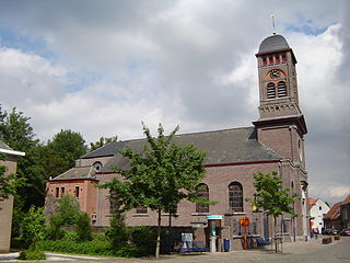
Bouwel is a deelgemeente in the Belgian province of Antwerp; it is attached to the municipality of Grobbendonk.

<span class="mw-page-title-main">Nederbrakel</span> Town in Flemish Region

Nederbrakel is a town in the municipality of Brakel. It is located in the Denderstreek and in the Flemish Ardennes, the hilly southern part of the province of East Flanders, Belgium. With 5,972 residents as of 2000, it forms the largest individual part of the municipality. Nederbrakel is located near the language border.

<span class="mw-page-title-main">Sint-Maria-Oudenhove</span> Village in Flemish Region

Sint-Maria-Oudenhove is a village in the Denderstreek and in the Flemish Ardennes, the hilly southern part of the province of East Flanders, Belgium.

<span class="mw-page-title-main">Leeuwergem</span> Village in Flemish Region

Leeuwergem is a village belonging to the municipality of Zottegem. It is located on the Molenbeek, in the Denderstreek and Flemish Ardennes, which is part of the hilly southern part of the East Flanders province, Belgium.

<span class="mw-page-title-main">Welden, Belgium</span> Village in Flemish Region

Welden is a village in the municipality of Oudenaarde in the province of East Flanders, Belgium, and is situated along the Scheldt. It is located about 20 kilometres (12 mi) south of Ghent.

<span class="mw-page-title-main">Opbrakel</span> Village in Flemish Region

Opbrakel is a village and deelgemeente (sub-municipality) of the municipality of Brakel. It is located in the Denderstreek in the province of East Flanders in Belgium. It used to be an independent municipality until 1971 when it was merged into Brakel.

<span class="mw-page-title-main">Parike</span> Village in Flemish Region

Parike is a village and deelgemeente (sub-municipality) of the municipality of Brakel. It is located in the Denderstreek in the province of East Flanders in Belgium. It used to be an independent municipality until 1977 when it was merged into Brakel.

<span class="mw-page-title-main">Doornzele</span> Village in Flemish Region

Doornzele is a village in the municipality of Evergem in the province of East Flanders, Belgium. The village is notable for its dries which is one of the largest in Belgium and in near original condition. Doornzele is located on the Ghent–Terneuzen Canal about 11 kilometres (6.8 mi) north of Ghent.

<span class="mw-page-title-main">Vinderhoute</span> Village in Flemish Region

Vinderhoute is a village in the municipality of Lievegem in the province of East Flanders in Belgium. It is located in the Flemish Valley about 6 kilometres (3.7 mi) north-west of Ghent.

<span class="mw-page-title-main">Zevergem</span> Village in Flemish Region

Zevergem is a village and deelgemeente (sub-municipality) of De Pinte in East Flanders, Belgium. It is located on the Scheldt about 8 kilometres (5.0 mi) south of Ghent.

<span class="mw-page-title-main">Bellem</span> Village in East Flanders, Belgium

Bellem is a village and deelgemeente (sub-municipality) in the municipality of Aalter in the Belgian province of East Flanders. The village was originally called Bethlehem. Bellem is located about 16 kilometres (9.9 mi) west of Ghent.

<span class="mw-page-title-main">Waarloos</span> Village in Flemish Region

Waarloos is a village and deelgemeente (sub-municipality) of the municipality of Kontich in the province of Antwerp, Belgium. The village is located about 13 kilometres (8.1 mi) south of the city of Antwerp.

<span class="mw-page-title-main">Astene</span> Village in East Flanders, Belgium

Astene is a village and deelgemeente (sub-municipality) in the municipality of Deinze in the Belgian province of East Flanders. The village is located along the Leie River and about 13 kilometres (8.1 mi) south-west of Ghent.

<span class="mw-page-title-main">Sleidinge</span> Village in Flemish Region

Sleidinge is a village in the municipalities of Evergem in the province of East Flanders, Belgium. It is located about 10 kilometres (6.2 mi) north-west of Ghent.

<span class="mw-page-title-main">Kluizen</span> Village in Flemish Region

Kluizen is a village in the municipalities of Evergem and Ghent in the province of East Flanders, Belgium. Large parts of the original municipality have become part of the Port of Ghent.

<span class="mw-page-title-main">Wortegem</span> Village in Flemish Region

Wortegem is a village and seat of the municipality of Wortegem-Petegem in the Belgian province of East Flanders. It is located about 17 kilometres (11 mi) east of Kortrijk.

<span class="mw-page-title-main">Zegelsem</span> Village in Flemish Region

Zegelsem is a village in the municipality of Brakel in the province of East Flanders, Belgium. Zegelsem is an agricultural community in the Flemish Ardennes. It is located about 26 kilometres (16 mi) south of Ghent.

<span class="mw-page-title-main">Ouwegem</span> Village in East Flanders, Belgium

Ouwegem is a village and deelgemeente (sub-municipality) in the municipality of Kruisem in the province of East Flanders in Belgium. The village is located on the edge of the Flemish Ardennes and about 17 kilometres (11 mi) south-west of Ghent.

<span class="mw-page-title-main">Tongerlo</span> Village in Flemish Region

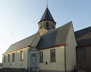
Tongerlo is a village and deelgemeente (sub-municipality) of the municipality of Westerlo in the province of Antwerp, Belgium. The village is located about 10 kilometres (6.2 mi) south-east of the city of Herentals. Tongerlo is best known for Tongerlo Abbey founded in 1128 which became one of the most important abbeys of Belgium.

References

  1. 1 2 "Bevolking per statistische sector - Sector 41081F". Statistics Belgium. Retrieved 5 May 2022.
  2. "Erwetegem". Agentschap Onroerend Erfgoed (in Dutch). Retrieved 22 October 2020.
  3. "Parochiekerk Sint-Pieters-Banden met kerkhof". Agentschap Onroerend Erfgoed (in Dutch). Retrieved 22 October 2020.
  4. "Vallende brokstukken van toren Sint-Pieters-Bandenkerk". Het Laatste Nieuws (in Dutch). 4 February 2022. Retrieved 5 May 2022.
  5. "Erwetegem". Bel Memorial (in Dutch). Retrieved 5 May 2022.
  6. "Molen gedynamiteerd in Erwetegem". Zottegem (in Dutch). Retrieved 5 May 2022.
  7. "Aanbod". Kloosterstraat 40 (in Dutch). Retrieved 5 May 2022.
  8. "Ondergedoken Joden tijdens WO II in Zottegem". Nuus (in Dutch). Retrieved 5 May 2022.
  9. "Zottegem". Agentschap Onroerend Erfgoed (in Dutch). Retrieved 5 May 2022.