
Zottegem is a municipality located in Belgium and more particularly in Flanders, in the province of East Flanders. The municipality comprises the town of Zottegem proper and the villages of Elene, Erwetegem, Godveerdegem, Grotenberge, Leeuwergem, Oombergen, Sint-Goriks-Oudenhove, Sint-Maria-Oudenhove, Strijpen and Velzeke-Ruddershove. On January 1, 2018, Zottegem had a total population of 26,373. The total area is 56.66 km2 which gives a population density of 470 inhabitants per km2.

Turnhout is a Belgian municipality and city located in the Flemish province of Antwerp. The municipality comprises only the city of Turnhout proper. On January 1, 2015, Turnhout had a total population of 42,637. The total area is 56.06 km2 (21.64 sq mi) which gives a population density of 835.5/km2 (2,164/sq mi). The agglomeration, however, is much larger, accounting up to 81,473 inhabitants. Turnhout is known for its playing card industry, as it houses the head office of the world's largest manufacturer of playing cards, Cartamundi. Turnhout is also the capital of the administrative district with the same name. The Turnhout city council often promotes the city as "the capital of the Kempen area". This designation is entirely unofficial, since the Kempen area is far larger than the Turnhout district and does not form an administrative unit.

Mouscron is a city and municipality of Wallonia located in the Belgian province of Hainaut, along the border with the French city of Tourcoing, which is part of the Lille metropolitan area.

Everbeek is a village situated in the Flemish Ardennes and in the Denderstreek in Belgium. In 1977, it was included into the municipality of Brakel. Although it is Dutch speaking, this village was part of the Walloon province of Hainaut (Henegouwen) until 1963, when it became part of the Flemish province of East Flanders.

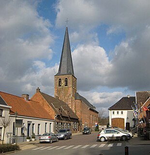
Sint-Goriks-Oudenhove is a village situated in the municipality of Zottegem, Belgium. It is located in the Flemish Ardennes, the hilly southern part of the province of East Flanders.
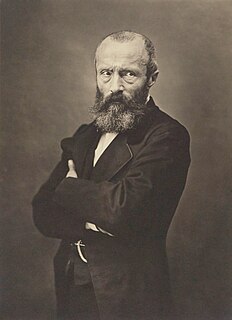
Étienne-Joseph-Théophile Thoré was a French journalist and art critic. He is best known today for his rediscovery of the work of painter Johannes Vermeer.

The Francization of Brussels refers to the evolution, over the past two centuries, of this historically Dutch-speaking city into one where French has become the majority language and lingua franca. The main cause of this transition was the rapid, yet compulsory assimilation of the Flemish population, amplified by immigration from France and Wallonia.

Nederbrakel is a town in the municipality of Brakel. It is located in the Denderstreek and in the Flemish Ardennes, the hilly southern part of the province of East Flanders, Belgium. With 5,972 residents as of 2000, it forms the largest individual part of the municipality. Nederbrakel is located near the language border.
Michelbeke is a village in the municipality of Brakel, Belgium. It is located in the Denderstreek and in the Flemish Ardennes, the hilly southern part of the province of East Flanders, Belgium. It was itself a municipality until the fusion of the municipalities on 1 January 1971.
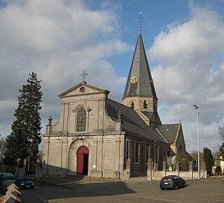
Sint-Maria-Oudenhove is a village in the Denderstreek and in the Flemish Ardennes, the hilly southern part of the province of East Flanders, Belgium.

Geistingen is a historic village that is now a submunicipality of Kinrooi, in the Limburg province in the Flemish Community of Belgium.

Beerlegem is a village belonging to the municipality of Zwalm. It is located in the Flemish Ardennes, the hilly southern part of the province of East Flanders, Belgium. Until 1970, it was an independent municipality.
Godveerdegem is a village belonging to the municipality of Zottegem. It is located on the Molenbeek-Ter Erpenbeek in the Denderstreek and in the Flemish Ardennes, the hilly southern part of the province of East Flanders, Belgium.

Grotenberge is a village belonging to the municipality of Zottegem. It is located on the Molenbeek and the Molenbeek-Ter Erpenbeek within the Denderstreek and the Flemish Ardennes, the hilly southern part of the East Flanders province, Belgium.
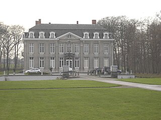
Leeuwergem is a village belonging to the municipality of Zottegem. It is located on the Molenbeek, in the Denderstreek and Flemish Ardennes, which is part of the hilly southern part of the East Flanders province, Belgium.

Melden is a village belonging partly to the municipality of Oudenaarde and partly to the municipality of Kluisbergen. It is located in the Flemish Ardennes, the hilly southern part of the province of East Flanders, Belgium.

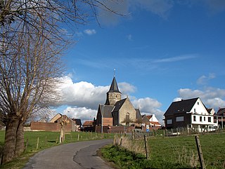
Erwetegem is a village and deelgemeente (sub-municipality) belonging to the municipality of Zottegem. It is located in the Denderstreek and in the Flemish Ardennes, the hilly southern part of the province of East Flanders, Belgium. Erwetegem used to an independent municipality until 1970.
Hans-Georg Pflaum was a German-born French historian.

The Paddestraat is a 2.3 km long cobbled road in the municipality of Zottegem, in East Flanders, Belgium. The road is a regular location of the springtime cycling classics in Flanders. In 1995, the cobbled road of the Paddestraat was classified as a protected monument by the Flemish government.

Joannes "Jan" De Lichte was an 18th-century Flemish outlaw and gang leader. Motivated by poverty during the upheavals of the Austrian War of Succession (1740–48), de Lichte led a gang of bandits who committed burglaries, robberies, and several murders in Flanders. Captured and executed in 1748, he was subsequently rehabilitated in the fictional works of Louis Paul Boon in 1958 and has subsequently inspired a sculpture and film series.

