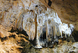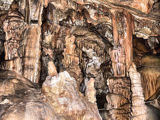
Wookey Hole Caves are a series of limestone caverns, a show cave and tourist attraction in the village of Wookey Hole on the southern edge of the Mendip Hills near Wells in Somerset, England. The River Axe flows through the cave. It is a Site of Special Scientific Interest (SSSI) for both biological and geological reasons. Wookey Hole cave is a "solutional cave", one that is formed by a process of weathering in which the natural acid in groundwater dissolves the rocks. Some water originates as rain that flows into streams on impervious rocks on the plateau before sinking at the limestone boundary into cave systems such as Swildon's Hole, Eastwater Cavern and St Cuthbert's Swallet; the rest is rain that percolates directly through the limestone. The temperature in the caves is a constant 11 °C (52 °F).

Mammoth Cave National Park is a national park in south-central Kentucky, encompassing portions of Mammoth Cave, the longest cave system known in the world. The park's 52,830 acres (21,380 ha) are located primarily in Edmonson County, with small areas extending eastward into Hart and Barren counties. The Green River runs through the park, with a tributary called the Nolin River feeding into the Green just inside the park.

The Rock of Gibraltar is a monolithic limestone promontory located in the British territory of Gibraltar, near the southwestern tip of Europe on the Iberian Peninsula, and near the entrance to the Mediterranean. It is 426 m (1,398 ft) high. Most of the Rock's upper area is covered by a nature reserve, which is home to around 300 Barbary macaques. These macaques, as well as a labyrinthine network of tunnels, attract many tourists each year.

At 150.4 miles (242.0 km), Lechuguilla Cave is the eighth-longest explored cave in the world and the second deepest in the continental United States. It is most famous for its unusual geology, rare formations, and pristine condition.

The Cango Caves are located in Precambrian limestones at the foothills of the Swartberg range near the town of Oudtshoorn, in the Western Cape Province of South Africa. The principal cave is one of the country's finest, best known, and most popular tourist caves and attracts many visitors from overseas. Although the extensive system of tunnels and chambers go on for over 4 km, only about a quarter of this is open to visitors, who may proceed into the cave only in groups supervised by a guide.

The Marble Arch Caves are a series of natural limestone caves located near the village of Florencecourt in County Fermanagh, Northern Ireland. The caves are named after the nearby Marble Arch, a natural limestone arch at the upstream end of Cladagh Glen under which the Cladagh River flows. The caves are formed from three rivers draining off the northern slopes of Cuilcagh mountain, which combine underground to form the Cladagh. On the surface, the river emerges from the largest karst resurgence in Ireland, and one of the largest in the United Kingdom. At 11.5 kilometres (7.1 mi) the Marble Arch Caves form the longest known cave system in Northern Ireland, and the karst is considered to be among the finest in the British Isles.
Lamb Leer is a 14.59 hectare geological Site of Special Scientific Interest between East Harptree and Priddy in the Mendip Hills, Somerset, notified in 1983. The cavern is a fragment of a very ancient major cave system which now contains one of the largest chambers in the Mendip Hills.

Carlsbad Caverns National Park is an American national park in the Guadalupe Mountains of southeastern New Mexico. The primary attraction of the park is the show cave Carlsbad Cavern. Visitors to the cave can hike in on their own via the natural entrance or take an elevator from the visitor center.

St. Michael's Cave or Old St. Michael's Cave is the name given to a network of limestone caves located within the Upper Rock Nature Reserve in the British Overseas Territory of Gibraltar, at a height of over 300 metres (980 ft) above sea level. According to Alonso Hernández del Portillo, the first historian of Gibraltar, its name is derived from a similar grotto in Monte Gargano near the Sanctuary of Monte Sant'Angelo in Apulia, Italy, where the archangel Michael is said to have appeared.

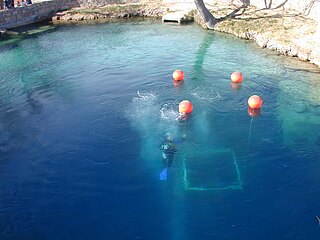
The Blue Hole of Santa Rosa, or simply the Blue Hole, is a circular, bell-shaped pool or small lake located along Route 66 east of Santa Rosa, New Mexico that is a tourist attraction and swimming venue, and one of the most popular dive destinations in the US for scuba diving and training. The Blue Hole is an artesian well and cenote that was once used as a fish hatchery.

Operation Tracer was a secret Second World War military operation in Gibraltar, a British Overseas Territory and military base. The impetus for the plan was the 1940 scheme by Germany to capture Gibraltar, code-named Operation Felix. Operation Tracer was the brainchild of Rear Admiral John Henry Godfrey, the Director of the Naval Intelligence Division of the Admiralty.
The Gibraltar Caving Group is an organisation based in the British Overseas Territory of Gibraltar. It forms the Caves and Cliffs Section of the Gibraltar Ornithological and Natural History Society. The group of skilled cavers and climbers has multiple roles, engaging in cave exploration and research, avian rescue, and rare plant discovery. It performs surveys and clears areas with limited access. However, it is perhaps most well known for the discovery that four of its members made in December 1996. While exploring tunnels in the southern portion of the Rock of Gibraltar, they found the entrance to Operation Tracer, also known colloquially as Stay Behind Cave. Rumours of a covert World War II observation post had circulated in Gibraltar for decades. The Gibraltar Caving Group continued its exploration and evaluation of the facility under the auspices of the Gibraltar Museum.

Lord Airey's Shelter is a subterranean military shelter in the British Overseas Territory of Gibraltar. It is located near the southern end of the Upper Rock Nature Reserve, adjacent to Lord Airey's Battery. It was named after the Governor of Gibraltar, General Sir Richard Airey. The tunnel system for the shelter was chosen as the site for the highly classified, Second World War military operation known as Operation Tracer.

Martin's Cave is a cave in the British Overseas Territory of Gibraltar. It opens on the eastern cliffs of the Rock of Gibraltar, below its summit at O'Hara's Battery. It is an ancient sea cave, though it is now located over 700 feet (210 m) above the shore of the Mediterranean Sea. It is only accessible because Martin's Path was constructed.
The Genista Caves are a series of caves located under Windmill Hill in the British Overseas Territory of Gibraltar. Fossils of various mammals and human remains were discovered here in the mid-1860s. The name of the caves is a play on words based on Captain Frederick Brome's name, who discovered them.
Judge's Cave is a cave in the British Overseas Territory of Gibraltar. Human remains dated to the late prehistoric period have been unearthed in the cave.

New St. Michael's Cave, also known as Lower St. Michael's Cave, is a cave system in the British Overseas Territory of Gibraltar. Unlike its namesake, St. Michael's Cave (proper), which has been known for over 2,000 years, this cave was discovered as recently as World War II.
Ragged Staff Cave is a cave bordering the harbour in the British Overseas Territory of Gibraltar. The cave was converted into Ragged Staff Magazine in 1901.

The Caves of Hercules is an archaeological cave complex located in Cape Spartel, Morocco.


