
The Grand Combin is a mountain massif in the western Pennine Alps in the canton of Valais. At a height of 4,314 metres (14,154 ft) the summit of Combin de Grafeneire is one of the highest peaks in the Alps and the second most prominent of the Pennine Alps. The Grand Combin is also a large glaciated massif consisting of several summits, among which three are above 4000 metres. The highest part of the massif is wholly in Switzerland, although the border with Italy lies a few kilometres south.
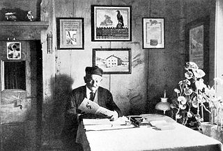
Christian Klucker was a Swiss mountain guide who made many first ascents in the Alps, particularly in the Bernina Range, the Bregaglia and the Pennine Alps.

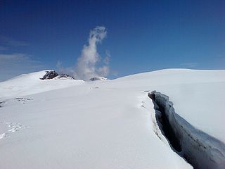
The Weissmies 4,017 m (13,179 ft) is a mountain in the Pennine Alps in the canton of Valais in Switzerland near the village of Saas-Fee. It is the easternmost four-thousander of its range.

Lyskamm, also known as Silberbast, is a mountain in the Pennine Alps lying on the border between Switzerland and Italy. It consists of a five-kilometre-long ridge with two distinct peaks. The mountain has gained a reputation for seriousness because of the many cornices lying on the ridge and the frequent avalanches, thus leading to its nickname the Menschenfresser.

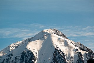
The Strahlhorn is a mountain of the Swiss Pennine Alps, located south of Saas-Fee and east of Zermatt in the canton of Valais. It lies on the range that separates the Mattertal from the Saastal and is located approximately halfway between the Rimpfischhorn and the Schwarzberghorn.

The Zinalrothorn is a mountain in the Pennine Alps in Switzerland. Its name comes from the village of Zinal lying on the north side and from the German word Rothorn which means Red Peak. When it was first climbed in 1864 the mountain was known locally as Moming.

The Rimpfischhorn is a mountain in the Pennine Alps of Switzerland.

Pollux is a mountain in the Pennine Alps on the border between Valais, Switzerland and the Aosta Valley in Italy. It is the lower of a pair of twin peaks, the other being Castor, named after the Gemini twins of Roman mythology. Pollux' peak is at an elevation of 4,092 m (13,425 ft). It is separated from Castor by a pass at 3,847 m (12,621 ft), named Passo di Verra in Italian, Col de Verra in French and Zwillingsjoch in German.

Le Pleureur is a mountain of the Pennine Alps. It is located in Valais, between Lac de Mauvoisin and Lac des Dix.

La Ruinette is a mountain of the Swiss Pennine Alps, overlooking the Lake of Mauvoisin in the canton of Valais. With an altitude of 3,875 metres above sea level, it is the highest summit between the Grand Combin and the Dent Blanche. La Ruinette lies close to the better known Mont Blanc de Cheilon which has almost the same height.

Le Parrain is a mountain of the Swiss Pennine Alps, located east of Fionnay in the canton of Valais. Its summit lies within the valley of Bagnes but near the watershed with the valley of Hérens.

Tête de Milon is a mountain of the Swiss Pennine Alps, located east of Zinal in the canton of Valais. It belongs to the massif of the Weisshorn and lies west of the Turtmann Glacier.
The Cima di Jazzi is a mountain of the Pennine Alps, located on the Swiss-Italian border, just north of Monte Rosa. It overlooks Macugnaga on its east (Italian) side. The west (Swiss) side is entirely covered by glaciers.
Le Catogne is a mountain on the extreme north-eastern edge of the Mont Blanc massif, overlooking Champex in the Swiss canton of Valais. Some sources consider this summit as being within the Pennine Alps.
Le Mourin is a mountain of the Swiss Pennine Alps, located west of Bourg-Saint-Pierre in the canton of Valais. On its south-east side the mountain overlooks the Lac des Toules.
The Turtmann Glacier is a 5 km long glacier (2005) situated in the Pennine Alps in the canton of Valais in Switzerland. In 1973 it had an area of 5.91 km2. The glacier is located north of Bishorn and Weisshorn.
The Grande Aiguille is a mountain of the Swiss Pennine Alps, situated near Bourg Saint Pierre in the canton of Valais. With an elevation of 3,682 metres above sea level, it the culminating point of the ridge named Les Maisons Blanches that lies west of the Corbassière Glacier, in the Grand Combin massif.
Le Moine is a mountain of the Pennine Alps, situated east of Bourg Saint Pierre in the canton of Valais, Switzerland. It is located on the ridge Les Maisons Blanches in the Grand Combin massif.
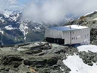
The Tracuit Hut is a mountain hut of the Swiss Alpine Club, located above Zinal in the canton of Valais. The hut lies at an elevation of 3,256 metres (10,682 ft) above sea level, at the Tracuit Pass, between Les Diablons and the Tête de Milon in the Pennine Alps.
The Petit Col Ferret is an Alpine pass between the canton of Valais and the Aosta Valley.

