Lethbridge, Victoria

Last updated

Lethbridge
Victoria
Lethbridge General Store.JPG
General store
Australia Victoria Golden Plains Shire location map.svg
Red pog.svg
Lethbridge
Coordinates 37°58′0″S144°08′0″E / 37.96667°S 144.13333°E / -37.96667; 144.13333
Population1,181 (2021 census) [1]
Postcode(s) 3332
Location
LGA(s) Golden Plains Shire
State electorate(s) Eureka
Federal division(s) Corangamite
Localities around Lethbridge:
Meredith Meredith She Oaks
Bamganie Lethbridge Maude
Shelford Teesdale Russells Bridge
Bannockburn

Lethbridge is a rural township outside Geelong, Victoria, Australia. Bluestone from Lethbridge quarries was used to build several significant buildings in Melbourne, including the steps to the Parliament House. At the 2016 census, Lethbridge had a population of 1,014. [1]

Contents

Lethbridge Post Office opened on 10 September 1857 and closed in 1980. [2]

The community of Lethbridge has a range of facilities and services including:

History

The rural township was formally named Muddy Water Holes, the original name was most likely because of the line of ponds across Bruce's Creek. In 1854 the township was proclaimed and named as Lethbridge. [3] Lethbridge was along the horse and carriage tracks that connected Geelong and Ballarat to connect Geelong's port access with Ballarat's goldfields, which became the primary route between the two cities which is now Midland Highway. [4]

The railway came to the town with the opening of the Geelong-Ballarat line in 1862, [5] with the local railway station opened soon after, but today only grain and fruit trains use the line.

Throughout the 19th century, Lethbridge became a growing community. Multiple schools including a catholic school and a Presbyterian school opened up, however, they were all shut down when the township introduced a government school in 1874, [3] known now as Lethbridge Primary School. The original site for Lethbridge Primary School continued to be used up until 2010, the school was relocated to a brand new premise in Stephenson Street, the original bluestone schoolhouse still remains intact at the former site. [6]

Local bluestone was sourced from Lethbridge quarries, the shire hall in Bannockburn and the war memorial in Inverleigh have also used bluestone in their construction. Football, cricket clubs, and even a mechanics' institute were introduced to Lethbridge. [3]

Lethbridge introduced its first Catholic church built in the early 1860s, St Mary's church. Before the 1860s Lethbridge was included in the parish of St Mary's Geelong. Lethbridge Uniting Church was built in 1868–69, originally built on the Midland Highway but later relocated to opposite the local railway station. [7] The sites for both St Mary's church and Lethbridge uniting church still exist today,

Moranghurk, a Lethbridge homestead dating from approximately the 1840s, located on the Midland Highway, is listed on the Victorian Heritage Register. [8] The Moranghurk shearer's quarters have been restored and can accommodate for up to 30 guests. [9]

During the 1900s, Lethbridge was not as busy as it once was. A portion of the population were farms settled by soldiers when part of the Moranghurk estate was subdivided during World War II. The population census even recorded a population as low as 172 in 1966. [3]

Peter Lalor, the leader of the Eureka Stockade rebellion, hid overnight in Lethbridge while fleeing from Ballarat to Geelong in November 1854.

George Elmslie, first Labor Premier of Victoria, was born in Lethbridge in 1861. [10]

Present day

Population and activity in Lethbridge has declined since its peak during the mid-19th century. At the 2016 census, Lethbridge had a population of 1,014, as opposed to the 1861 population of 1,267. [3] The predicted population for Lethbridge (and surrounding areas such as Meredith and She Oaks) in 2021 is 2,460 and expected to reach 3,007 in 2041. [11]

Many of the facilities mentioned above are located in one central area, despite Lethbridge being located on the Midland Highway, the central area is located away from the highway. Although the history of Lethbridge is preserved through buildings such as the railway station and old school site. At the Lethbridge lake, the former railway water tank still exists today, used to supply water for steam engines that needed to take on water at the railway station.

Sports

Cricket

Lethbridge has a cricket club that was established in 1879, playing at the sports facilities.

Football

Lethbridge offers football teams for junior players, also playing at the sports facilities in Lethbridge.

Equestrian

Lethbridge has an indoor equestrian arena for horse sports

Related Research Articles

<span class="mw-page-title-main">Ballarat</span> City in Victoria, Australia

Ballarat is a city in the Central Highlands of Victoria, Australia. Ballarat has a population of 117,240, making it the third largest city in Victoria.

<span class="mw-page-title-main">Fyansford, Victoria</span> Suburb of Geelong, Victoria, Australia

Fyansford is a township on the western edge of Geelong, Victoria, Australia, named after Captain Foster Fyans who came to Geelong as a Police magistrate in October, 1837. It is located at the junction of the Barwon and Moorabool rivers. At the 2016 census, Fyansford had a population of 196.

Gheringhap is a rural township near Geelong, Victoria, Australia, located approximately 83 km southwest of Melbourne, between Geelong and Meredith on the Midland Highway. Gheringhap is located in the Golden Plains Shire.

<span class="mw-page-title-main">Bannockburn, Victoria</span> Town in Victoria, Australia

Bannockburn is a town near Geelong, Victoria, Australia, 88 km southwest of Melbourne. It is located in Golden Plains Shire. In the 2021 census, Bannockburn had a population of 6,470.

<span class="mw-page-title-main">Bacchus Marsh</span> Town in Victoria, Australia

Bacchus Marsh is a peri-urban town in Victoria, Australia located approximately 50 kilometres (30 mi) north-west of the state capital Melbourne, at a near equidistance to the major cities of Melbourne, Ballarat and Geelong.

<span class="mw-page-title-main">Meredith, Victoria</span> Town in Victoria, Australia

Meredith is a town in Victoria, Australia, located on the Midland Highway between Ballarat and Geelong, in the local government area of the Golden Plains Shire. At the 2016 census, Meredith had a population of 788.

<span class="mw-page-title-main">Moorabool River</span> River in Victoria, Australia

The Moorabool River is a river in Victoria, Australia, which runs for 160 kilometres through several small towns such as Meredith, Anakie, and Staughton Vale. It runs into the Barwon River at Fyansford. It is believed that the name Moorabool derives from an Aboriginal word meaning the cry of a curlew or a ghost.

<span class="mw-page-title-main">Buninyong</span> Town in Victoria, Australia

Buninyong is a town 11 km from Ballarat in Victoria, Australia. The town is on the Midland Highway, south of Ballarat on the road to Geelong.

<span class="mw-page-title-main">Batesford, Victoria</span> Town in Victoria, Australia

Batesford is a town located approximately 10 kilometres west of Geelong and 67 kilometres south-west of the state capital, Melbourne.

<span class="mw-page-title-main">Ballan, Victoria</span> Town in Victoria, Australia

Ballan is a small town in Victoria, Australia. At the 2021 census, Ballan had a population of 3,392.

<span class="mw-page-title-main">Newlyn, Victoria</span> Town in Victoria, Australia

Newlyn is a town in the Shire of Hepburn, in Victoria, Australia. It is situated on the Midland Highway between Creswick and Daylesford. At the 2021 census, Newlyn had a population of 136.

<span class="mw-page-title-main">Elaine, Victoria</span> Town in Victoria, Australia

Elaine is a town in Victoria, Australia, located on the Midland Highway between Ballarat and Geelong. At the 2016 census, Elaine and the surrounding area had a population of 228.

<span class="mw-page-title-main">Gordon, Victoria</span> Town in Victoria, Australia

Gordon is a small town in Victoria, Australia, named after settler George Gordon. The town is located on the Old Melbourne Road in the Shire of Moorabool local government area, 95 kilometres (59 mi) west of the state capital, Melbourne. At the 2021 census, Gordon had a population of 1,393.

<span class="mw-page-title-main">Smythesdale</span> Town in Victoria, Australia

Smythesdale is a town in Victoria, Australia. The town is located on the Glenelg Highway. Most of the town is located in the Golden Plains Shire local government area; however, a small section lies in the Shire of Pyrenees. Smythesdale is 19 kilometres (12 mi) west of Ballarat and 135 kilometres (84 mi) west of the state capital, Melbourne. At the 2016 census, Smythesdale and the surrounding area had a population of 1,032. Smythesdale Primary School is a part of the Woady Yaloak PS with Ross Creek, Scarsdale, and Snake Valley as the other campus'.

<span class="mw-page-title-main">Moorabool railway station</span> Former railway station in Victoria, Australia

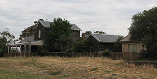
Moorabool is a closed railway station on the Geelong–Ballarat railway line, in the locality of Moorabool, Victoria, Australia. Until 1864 it was called Steiglitz Road. The station building was constructed for the Victorian Railways in 1861, by a private contractor, and comprises a single-storey, gable-roofed, bluestone station building, with an attached two-storey residence.

<span class="mw-page-title-main">Lethbridge railway station</span> Former railway station in Victoria, Australia

Lethbridge Railway Station is a railway station on the Geelong-Ballarat railway line located in the township of Lethbridge, Victoria, Australia. It was built in 1862 by contractors John Campbell and Co. Currently, only freight trains pass the station, as the V/Line passenger trains have been replaced by a bus service.

Mount Clear is a semi-rural suburb of Ballarat, Victoria, Australia south of the CBD in the Canadian Creek Valley. At the 2021 census, Mount Clear had a population of 3,671.

<span class="mw-page-title-main">Snake Valley, Victoria</span> Town in Victoria, Australia

Snake Valley is a town in central Western Victoria, Australia, on Linton-Carngham Road, 27 kilometres (17 mi) west of Ballarat and 153 kilometres (95 mi) west of Melbourne, in the Shire of Pyrenees. A post office was opened on 1 March 1859. At the 2016 Census, Snake Valley had a population of 743, up from 329 in 2006.

Freshwater Creek is a small rural community in the Surf Coast Shire, Victoria, Australia. In the 2016 census, Freshwater Creek had a population of 414 people.

<span class="mw-page-title-main">Yendon, Victoria</span> Town in Victoria, Australia

Yendon is a small town in Victoria, Australia. The town is located in the Shire of Moorabool, 108 kilometres (67 mi) west of the state capital, Melbourne and approximately 13 kilometres (8.1 mi) south east of Ballarat. The town was originally called Buninyong East, but was changed in 1879 to Yendon, believed to be an Indigenous Australian word meaning "waterhole".

References

  1. 1 2 Australian Bureau of Statistics (28 June 2022). "Lethbridge (State Suburb)". 2021 Census QuickStats. Retrieved 27 February 2023. OOjs UI icon edit-ltr-progressive.svg
  2. Phoenix Auctions History. "Post Office List" . Retrieved 28 March 2021.
  3. 1 2 3 4 5 "Lethbridge | Victorian Places". www.victorianplaces.com.au. Retrieved 7 March 2021.
  4. "Golden Plains Planning Scheme - Lethbridge Heritage Precinct Statement of Significance" (PDF).
  5. "Rail Geelong - Geelong Line Guide". www.railgeelong.com. Retrieved 23 April 2008.
  6. "Lethbridge Primary School". IntraSpace. Retrieved 7 March 2021.
  7. Eric, McGillivary (1996). The Heritage of Lethbridge. Neptune Press Pty Ltd. pp. 22–27.
  8. "Moranghurk (H0266)". Victorian Heritage Register . Heritage Victoria . Retrieved 7 July 2014.
  9. "Moranghurk Shearer's Quarters". Moranghurk. Retrieved 7 March 2021.
  10. Jones, Barry O. (1981). "George Alexander Elmslie (1861–1918)". Australian Dictionary of Biography . Vol. 8. National Centre of Biography, Australian National University. ISSN   1833-7538 . Retrieved 7 March 2021.
  11. "About the forecast areas | Golden Plains Shire | Population forecast". forecast.id.com.au. Retrieved 7 March 2021.

Commons-logo.svg Media related to Lethbridge, Victoria at Wikimedia Commons