
The Lewitz is a protected landscape in the German state of Mecklenburg-Vorpommern, a land of broad, flat pastures and farmland, fish ponds and occasional woodlands.
The Lewitz is a protected landscape in the German state of Mecklenburg-Vorpommern, a land of broad, flat pastures and farmland, fish ponds and occasional woodlands.


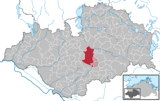
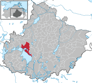
The terrain of the Lewitz lies in the southwest of Mecklenburg, south of Schwerin between the settlements of Crivitz, Parchim, Neustadt-Glewe and Banzkow. Its area is about 16,800 hectares. [1] The landscape is crossed by the River Elde, whose original river bed survives in places, its canalised course, the Müritz-Elde Waterway (MEW), the Stör Canal, which empties here into the MEW, the New Canal and the Brenz Canal. The Lewitz, which is a protected landscape, is also dissected by numerous drainage ditches. Amongst the standing waterbodies are the protected, [2] extensive Friedrichsmoor Carp Ponds and Neuhof Carp Ponds north of Neustadt-Glewe and the Neustädter See.
Within the Lewitz are the nature reserves of Klinker Plage , Fischteiche in der Lewitz , Friedrichsmoor und Töpferberg .
The origin of the name has various theories. One common one is the belief that the word Lewitz comes from the Slavic lowit which means "gathering", "hunting" or "game-rich region". [3] Another possible derivation is lowej (Bohemian for "wood" or "woodland"). [4] It is also possibly related to the Old Slavic li-, liv-, lijati meaning "to water" or "rain", the Russian lyva or liva meaning "swamp wood" or the Bulgarian/Serbian livada meaning "pasture". [5]
The Lewitz was formed, like the whole of Mecklenburg, in the last ice age. When the glacier melted it filled the Lewitz and the Stör valley with meltwater which scoured out a basin, 12,000 hectares in area. A 16 metre deep lake was formed. Later it suddenly emptied southwards. The lake became marshy and turned into peat over the course of the following millennia. Shallow waterbodies and fens (Niedermoore). In the Middle Stone Age its island-like hills, small lakes and woods offered hunters, gatherers and fishers suitable places to settle. Likewise the dried out, sandy moorlands were suitable for the arable farmers and cattle breeders of the New Stone Age. During that time several Funnelbeaker culture earthworks were constructed.
In the 13th century the Lewitz depression was still covered by oak, beech, black alder and birch. The expanding towns during the Hanseatic period obtained their wood from the Lewitz and other areas. From the early 16th century to the 18th century Neustadt-Glewe was one of the centres of bog iron ore smelting. The iron was surface-mined. The Lewitz was well suited to this wood-hungry industry with its river system and extensive woodlands. Charcoal was made from the wood and this in turn became fuel for the smelting ovens. In 1577 alone, 6,300 tonnes of coal and 8,300 cubic metres of wood were needed. In addition, so-called Holzdeputanten ("wood deputies") of the princely house and court, "wood taxes" paid to the surrounding towns and a flourishing timber trade led to a shrinkage of the stocks of timber. By the 17th century these stood at only 25% of their original size. In 1620 the last beech and oak trees were felled in Tuckhude for the construction of Kraaker Castle. The timber industry was unsustainable, with the result that the last iron smeltery in Neustadt closed in 1717 due to a lack of wood. At that time the forests of the surrounding area were almost entirely gone and in their place boggy pastures emerged that were harvested for hay. The Friedrichsmoor Forest Office (Forstamt Friedrichsmoor) that was established in the 18th century managed the reforestation of small areas of land in the years that followed. However, a complete restoration of the original forests was not carried out, because as early as the end of the 1820s, people expected that income from the management of pasture would exceed that of the timber industry.
In 1862/63 the Brenz Canal was constructed in order to drain the land northwest of Brenz and enable it to be used for agriculture. In 1862 the head office for the administrative department of the ducal court in the Lewitz was established in Tuckhude. It was responsible for the maintenance of the ditches, paths, bridges, control of irrigation and drainage, monitoring the water levels and ensuring the harvest.
By 1938 parts of the Lewitz were already being placed under conservation orders due to their importance as breeding areas for waders. Breeding species here include the curlew, redshank, black-tailed godwit and ruff. During the GDR period, from 1958 to 1962 and 1976 to 1980, with the introduction of industrial agricultural production methods, complex, large-scale land improvement work was carried out in order to create grassland for cattle breeding. Many animal and plant species disappeared, as did the population of breeding birds on the pasture land.
In the Neustadt village of Hohes Feld horses were bred for riding at the Lewitz VEG along with cattle breeding. Since 1971 there has been a new breed of horse, the Lewitzer or Lewitzschecken from its piebald (gescheckt) colour. [6] The Lewitz estate has been run since the Wende by German show jumper and businessman, Paul Schockemöhle.
Since 1990 land improvement measures have been partially reversed. Wet biotopes with wet meadows and bogs have been recreated out of pasture and arable land. As a result, several threatened species of plant and animal have established themselves here. osprey, falcon, otter, great crested newt and grass snake have been seen once more. The Lewitz is a popular stopover for wild geese, crane and other migratory birds. Amongst the rare plants in the Lewitz are orchids, Pasqueflower, common tormentil and marsh gentian. The Lewitz is today both a protected area and nature reserve. Parts of the landscape were also designated as a European Bird Reserve at the end of the 20th century. [7]

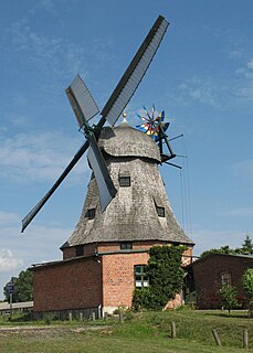
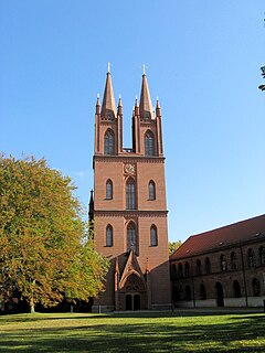
There are attempts to market the Lewitz as a destination for sustainable tourism. Brown tourist signs to "The Lewitz", with outlines of Neustadt Castle and the countryside, have been installed on the A 24 motorway. The aim is to attract especially nature lovers and water explorers. Also worth seeing are the Friedrichsmoor hunting lodge, the preserve of former dukes, the Tuckhude Land Office (Wiesenmeisterei) and the Banzkow Mill.

Mecklenburg-Vorpommern, also known by its anglicized name Mecklenburg-Western Pomerania or Mecklenburg-West Pomerania, is a state in the north-east of Germany. Of the country's sixteen states, Mecklenburg-Vorpommern ranks 14th in population, 6th in area, and 16th in population density. Schwerin is the state capital and Rostock is the largest city. Other major cities include Neubrandenburg, Stralsund, Greifswald, Wismar and Güstrow.
Neustadt-Glewe is a German town, in Mecklenburg-Western Pomerania, in the district of Ludwigslust-Parchim.

Mirow is a town in the district of Mecklenburgische Seenplatte in southern Mecklenburg-Vorpommern, Germany.
Waren (Müritz) is a town and climatic spa in the state of Mecklenburg-Vorpommern, Germany. It was the capital of the former district of Müritz until the district reform of 2011. It is situated at the northern end of Lake Müritz, approximately 40 kilometres west of Neubrandenburg. Waren is home to the offices of the sub-district (Amt) of Seenlandschaft Waren, although the town itself is independent of any Amt. Its borough is the second largest in Mecklenburg-Hither Pomerania by area.

Grabow is a town in the Ludwigslust-Parchim district, in Mecklenburg-Western Pomerania, Germany. It is situated on the river Elde, 7 km (4.35 mi) southeast of Ludwigslust, and 34 km (21.12 mi) northwest of Wittenberge. It is twinned with Whitstable, in Kent.
Malchow is a municipality in the Mecklenburgische Seenplatte district, in Mecklenburg-Western Pomerania, Germany.

Lake Schwerin is a lake in Mecklenburg-Vorpommern, northern Germany. It was named after the city Schwerin, on its southwestern shore. The smaller town Bad Kleinen is on the north shore of the lake. Its surface is approximately 61.54 square kilometres (23.76 sq mi), and its maximum depth is 52.4 metres (172 ft). The natural outflow of the lake is the (channelized) river Stör, a tributary of the Elde, and part of the Elbe watershed. The Wallensteingraben, a 16th-century canal, connects the lake with the Baltic Sea at Wismar.

Plauer See (help·info) is a lake in Mecklenburg-Vorpommern, Germany, located at 53°27′57″N12°18′27″E. Its surface is approximately 38.4 km2 and its maximum depth is 25.5 metres (84 ft).

Picher is a municipality in the district of Ludwigslust-Parchim in the state of Mecklenburg-Vorpommern, Germany. Picher's population is 748.

The Müritz (help·info) is a lake in Mecklenburg-Vorpommern, northern Germany. Its area is 117 km2 (45 sq mi), which makes it the second largest lake in Germany and the largest lake located entirely within German territory.

Muchow is a municipality in the Ludwigslust-Parchim district, in Mecklenburg-Vorpommern, Germany.

Fincken is a municipality in the Mecklenburgische Seenplatte district, in Mecklenburg-Vorpommern, Germany.
Dobbertin is a municipality in the Ludwigslust-Parchim district, in Mecklenburg-Vorpommern, Germany. An important sight is Dobbertin Abbey. The municipality is situated in a landscape with many lakes and woods. It stands on the largest lake in the area, the Dobbertiner See.

In the area of present-day Mecklenburg-Vorpommern, Germany, up to 5,000 megalith tombs were erected as burial sites by people of the Neolithic Funnelbeaker (TRB) culture. More than 1,000 of them are preserved today and protected by law. Though varying in style and age, megalith structures are common in Western Europe, with those in Mecklenburg-Vorpommern belonging to the youngest and easternmost—further east, in the modern West Pomeranian Voivodeship of Poland, monuments erected by the TRB people did not include lithic structures, while they do in the south (Brandenburg), west and north (Denmark).
Vorpommern-Rügen is a district in the north of Mecklenburg-Vorpommern, Germany. It is bounded by the Baltic Sea and the districts Vorpommern-Greifswald, Mecklenburgische Seenplatte and Rostock. The district seat is the Hanseatic city of Stralsund.
Pribislaw I, Lord of Parchim-Richenberg, was Lord of Parchim-Richenberg from 1238 to 1256.

The Southeast Rügen Biosphere Reserve is a biosphere reserve in the German state of Mecklenburg-Vorpommern, which covers the southeastern part of the island of Rügen, the lagoon of Rügischer Bodden between Putbus and Thiessow, the outer coast between Thiessow and Binz and the island of Vilm.
Ewald Schuldt, full name Ewald Adolf Ludwig Wilhelm Schuldt, was a German prehistorian who carried out significant research into the megaliths of northern Germany.

Ahlbeck is a municipality in the Vorpommern-Greifswald district, in Mecklenburg-Vorpommern, Germany.

The Lordship of Parchim-Richenberg was a short-lived state of the Holy Roman Empire which existed during the 13th century. It arose from the first partition of Mecklenburg after the death of Henry Borwin II, Lord of Mecklenburg in 1226. Initially it was named after its capital Parchim. Later, following the transferral of the seat to Richenberg, the name shifted to Richenberg. The Lordship comprised the lands of Parchim, the rural area of Ture and the later Vogteis of Plau, Goldberg, Sternberg and finally Richenberg. It was the shortest-lived of the four partitioned principalities of Mecklenburg.
| Wikimedia Commons has media related to Lewitz . |
| Authority control |
|
|---|