U.S. Route 641 (US 641) is a U.S. Route in Tennessee and Kentucky. It runs for 165.45 miles (266.27 km) from US 64 south of Clifton, Tennessee to an intersection with US 60 in Marion, Kentucky. While it is considered a spur route of U.S. Route 41, the two routes no longer connect.

Kentucky Route 80 (KY 80) is a 483.55-mile-long (778.20 km) state highway in the southern part of the U.S. state of Kentucky. The route originates on the state's western border at Columbus in Hickman County and stretches across the southern portion of the state, terminating southeast of Elkhorn City on the Virginia state line. It is the longest Kentucky State Highway, though the official distance as listed in route logs is much less due to multiple concurrencies with U.S. Route 68 (US 68) and US 23.

The Wendell H. Ford Western Kentucky Parkway is a 98.5-mile-long (158.5 km) controlled-access highway running from Elizabethtown, Kentucky to near Nortonville, Kentucky. It intersects with Interstate 65 (I-65) at its eastern terminus, and I-69 at its western terminus. It is one of seven highways that are part of the Kentucky parkway system. The road was renamed for Wendell H. Ford, a former Kentucky governor and United States senator, in 1998. Previously, it was simply the Western Kentucky Parkway, and often called the "WK Parkway" or "the WK" because of the acronym once used on its signs. The parkway carries the unsigned designation Kentucky Route 9001 for its entire length.

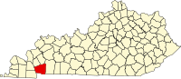
Golden Pond was a town in western Trigg County, Kentucky, United States. It is now the site of the headquarters of Land Between the Lakes National Recreation Area, 11 miles (18 km) west-southwest of Cadiz. Golden Pond was established in the 19th century and became known for its moonshining activity during the Prohibition era. This town was in an area altered during the 1930s and later by the Tennessee Valley Authority, which constructed dams to control flooding and generate electricity for a large rural area. The TVA evicted the last residents of Golden Pond in 1969, when the recreation area was established.
Asphalt is an unincorporated community located in Edmonson County, Kentucky, United States.
Windyville is an unincorporated community located in Edmonson County, Kentucky, United States.

Pruden is an unincorporated community located partly in Bell County, Kentucky and partly in Claiborne County, Tennessee, in the southeastern United States. It is located along Tennessee State Route 90 and Kentucky Route 74, which intersect at the state line, in the upper Clearfork Valley.

Kentucky Route 1508 is a state highway located in northwestern Kentucky. The route starts at KY 109, west of Sturgis. It travels westward to unincorporated area of Caseyville, and turns north near the Ohio River. KY 1508 then travels through the community of Dekoven, before ending at KY 109, northwest of its southern terminus. The route was designated around 1967, after the KY 130 designation was removed from the section in Caseyville, which was connected to the community since 1939.
Jonkan is a ghost town in Pike County, Kentucky, United States. Jonkan was located along Jonican Branch and Jonican Road 7.2 miles (11.6 km) east-southeast of Pikeville. The community is still marked on county highway maps.

Kentucky Route 93 is a 27.734-mile state highway in western Kentucky.

Several special routes of U.S. Route 68 exist from Kentucky to Ohio. In order from west to east in Kentucky, and south to north in Ohio, these special routes are listed from the beginning of U.S. Route 68 to the end.

Kentucky Route 107 (KY 107) is a 56.907-mile-long (91.583 km) east–west state highway in west–central Kentucky. The western (southern) terminus of the route is an "end of state maintenance" terminus near the Fort Campbell military reservation south of Donaldson Creek near La Fayette, and its northern (eastern) terminus is at an intersection with U.S. Route 431 (US 431) in Lewisburg.

Kentucky Route 453 (KY 453) is a 16.040-mile-long (25.814 km) state highway in Kentucky that runs from The Trace at the northern entrance of Land Between the Lakes National Recreation Area south of Grand Rivers to U.S. Route 60 and North Court Street in Smithland.

The Woodlands Trace National Scenic Byway, also known as "The Trace," is the major north–south roadway that traverses the Land Between the Lakes National Recreation Area in two counties in western Kentucky and northwestern Stewart County in northwest Middle Tennessee. It is estimated to be 43.1 miles (69.4 km) in length. The road is part of the National Scenic Byway system. Although it is not signed, it is listed on LBL's road logs as FD-100.

Kentucky Route 164 (KY 164) is a 36.247-mile-long (58.334 km) state highway in western Kentucky.
Segal is an unincorporated community in west-central Edmonson County in south-central Kentucky, United States. Segal is part of the Bowling Green Metropolitan Statistical Area.