List of Aare bridges in Bern

Last updated

The Aare peninsula and the Old City. Along the river from left to right: Kirchenfeldbrucke, Nydeggbrucke, Untertorbrucke, Kornhausbrucke. Bern luftaufnahme.png
The Aare peninsula and the Old City. Along the river from left to right: Kirchenfeldbrücke, Nydeggbrücke, Untertorbrücke, Kornhausbrücke.

This is a list of the 18 bridges spanning the river Aare on the territory of the city of Bern, Switzerland.

Contents

Map all coordinates using: OpenStreetMap  
Download coordinates as: KML

With the historical city core situated on a steeply-flanked peninsula formed by the river, the Aare is a defining part of Bern's cityscape and features prominently in the city's 800-year history. Given its topography, the city's development in modern times was dependent on the construction of long high level bridges. Their construction in the 19th and 20th century at times stretched the limits of the possible. [1]

The building of the great bridges was a continuous topic of political controversy in Bern up until World War II. The disputes about the location and even the construction materials of the bridges – stone or iron – reflected the rivalry between the city's conservative and liberal factions. [2]

Bridge locations

Bern Switzerland Regional Map.png
Red pog.svg
Neubrügg
Red pog.svg
Tiefenau
Red pog.svg
Schönausteg
Red pog.svg
Seftausteg
Red pog.svg
Tiefenau (RBS)
Red pog.svg
Stauwehr Engehalde
Red pog.svg
Halen
Red pog.svg
Lorraine railway viaduct
Red pog.svg
Monbijou
Red pog.svg
Felsenauviadukt
Red pog.svg
Felsenau
Aare bridges near Bern
Bern Switzerland Old City Map.png
Red pog.svg
Kirchenfeld
Red pog.svg
Kornhaus
Red pog.svg
Altenbergsteg
Red pog.svg
Nydegg
Red pog.svg
Untertor
Red pog.svg
Lorraine
Red pog.svg
Dalmazi

Current bridges

In the table, "length" refers to the distance between abutments. The height is measured from the pavement to the mean water level.

ImageName and descriptionOpenedLengthHeightSpanLocation [3]
Panorama Nydeggbruecke Bern.jpg Untertorbrücke: Built in wood 1256, rebuilt in stone 1489. The city's only Aare bridge up until 1834. [4] 1256 / 148952.5 m (172 ft)8 m (26 ft)15 m (49 ft), also twice 14 m (46 ft) 46°56′57″N7°27′30″E / 46.9493°N 7.4584°E / 46.9493; 7.4584 (Untertorbrücke) 6
Neubrucke Westseite.jpg Neubrügg ("new bridge"): First built in 1466 to replace a ferry, rebuilt in 1535. Covered bridge on sandstone pillars, oldest wooden bridge in the Canton. [5] 1466 / 153591 m (299 ft)6 m (20 ft)21 m (69 ft) to 16 m (52 ft), 5 spans 46°58′26″N7°25′41″E / 46.9738°N 7.4281°E / 46.9738; 7.4281 (Neubrügg) 17
Altenbergsteg.jpg Altenbergsteg: Footbridge built to connect the city to the Altenberg residential area. Built in wood in 1834 to replace an 1823 ferry, rebuilt in iron 1857. [4] 1834 / 185757 m (187 ft)5 m (16 ft)57 m (187 ft) 46°57′01″N7°26′55″E / 46.9502°N 7.4485°E / 46.9502; 7.4485 (Altenbergsteg) 7
Nydeggbruecke Untertorbruecke Bern.jpg Nydeggbrücke: First high level bridge, sheathed in sandstone. [6] Its main arch is the widest stone arch in continental Europe. [7] Built by a consortium of conservative burghers and financed through usage fees. [6] 1840148 m (486 ft)23 m (75 ft)46 m (151 ft) (main arch), 17 m (56 ft) (side arches) 46°56′55″N7°27′30″E / 46.9485°N 7.4584°E / 46.9485; 7.4584 (Nydeggbrücke) 5
Tiefenaubrucke.jpg Tiefenaubrücke: High level stone bridge built by the liberal government in reaction to the Nydeggbrücke. [8] Original design marred by 1977 broadening. [9] Parallel railway bridge opened 1965.185092 m (302 ft)31 m (102 ft)25 m (82 ft), thrice 46°58′37″N7°27′24″E / 46.9770°N 7.4568°E / 46.9770; 7.4568 (Tiefenaubrücke) 14
Dalmazibrucke Bern.JPG Dalmazibrücke: Riverbank-level bridge in the Marzili neighbourhood, originally built as an iron bridge in 1872; demolished and rebuilt in prestressed concrete in 1958. [10] 1872 / 195863 m (207 ft)4 m (13 ft)20 m (66 ft), thrice 46°56′40″N7°26′45″E / 46.9445°N 7.4458°E / 46.9445; 7.4458 (Dalmazibrücke) 3
Aare river in Bern.jpg Kirchenfeldbrücke: First iron high level bridge, inspired by contemporary English designs. Built to develop the Kirchenfeld neighbourhood  [ de ]. [10] 1883229 m (751 ft)39 m (128 ft)86 m (282 ft), twice 46°56′45″N7°26′55″E / 46.9459°N 7.4485°E / 46.9459; 7.4485 (Kirchenfeldbrücke) 4
Kornhausbrucke.jpg Kornhausbrücke: High level bridge of stone and iron intended to develop the Lorraine neighbourhood. [11] 1898355 m (1,165 ft)48 m (157 ft)115 m (377 ft) and five times 36 m (118 ft) 46°57′02″N7°26′55″E / 46.9506°N 7.4485°E / 46.9506; 7.4485 (Kornhausbrücke) 8
Schonausteg.JPG Schönausteg: Iron footbridge in the style of the Altenbergsteg, near the Dählhölzli zoo. [12] 190654 m (177 ft)4 m (13 ft)54 m (177 ft) 46°56′04″N7°26′46″E / 46.9344°N 7.4460°E / 46.9344; 7.4460 (Schönausteg) 1
Halenbrucke.jpg Halenbrücke: High level concrete bridge, only lightly reinforced, leading to Kirchlindach. [13] 1913234 m (768 ft)38 m (125 ft)87 m (285 ft) and four times 21 m (69 ft) 46°58′16″N7°25′07″E / 46.971137°N 7.418502°E / 46.971137; 7.418502 (Halenbrücke) 18
Seftausteg.jpg Seftausteg: Iron footbridge at the Felsenau power plant. [12] 192153 m (174 ft)5 m (16 ft)53 m (174 ft) 46°58′10″N7°26′20″E / 46.9694°N 7.4389°E / 46.9694; 7.4389 (Seftausteg) 16
Felsenaubrucke.jpg Felsenaubrücke: First built by the army as a wooden bridge in 1929, rebuilt as a solid-web girder bridge made of packed concrete in 1949. [14] Not to be confused with the later Felsenauviadukt.1928 / 194963 m (207 ft)8 m (26 ft)16 m (52 ft), thrice 46°58′34″N7°26′26″E / 46.9760°N 7.4405°E / 46.9760; 7.4405 (Felsenaubrücke) 15
Lorrainebrucke.jpg Lorrainebrücke: First reinforced concrete high level bridge, built in the then-popular Heimatstil to resemble the older stone bridges. [15] 1930178 m (584 ft)38 m (125 ft)82 m (269 ft) 46°57′10″N7°26′36″E / 46.9529°N 7.4433°E / 46.9529; 7.4433 (Lorrainebrücke) 9
Railway bridge over the Aar Berne.jpg Lorraine railway viaduct or Lorraineviadukt: Built in concrete by the Federal Railways to replace the aging Rote Brücke. It was the longest four-track railway viaduct in Europe at the time of construction. [16] 19411,093 m (3,586 ft)43 m (141 ft)150 m (490 ft) 46°57′14″N7°26′31″E / 46.9540°N 7.4419°E / 46.9540; 7.4419 (Railway viaduct) 10
Monbijoubrucke Bern.jpg Monbijoubrücke: Designed as a high-traffic four-lane automobile bridge at a peak of general automobile enthusiasm; executed in prestressed concrete. [17] 1962338 m (1,109 ft)22 m (72 ft)86 m (282 ft) twice and 81 m (266 ft) twice 46°56′24″N7°26′41″E / 46.9400°N 7.4447°E / 46.9400; 7.4447 (Monbijoubrücke) 2
Tiefenaubrucke RBS.jpg Tiefenaubrücke (RBS): High level bridge in prestressed concrete built alongside the Tiefenaubrücke for the RBS railway. [18] 1965200 m (660 ft)30 m (98 ft)97 m (318 ft) 46°58′37″N7°27′26″E / 46.9770°N 7.4571°E / 46.9770; 7.4571 (Tiefenaubrücke (RBS)) 13
Felsenauviadukt.jpg Felsenauviadukt: Longest viaduct of the A1 highway and the world's first single-cell box girder bridge built with the cantilever method, a pioneer work in prestressed concrete construction. [19] Design by Christian Menn. [17] 19751,116 m (3,661 ft)63 m (207 ft)156 m (512 ft) twice, 48 m (157 ft) twice 46°58′09″N7°26′52″E / 46.9693°N 7.4477°E / 46.9693; 7.4477 (Felsenauviadukt) 12
Stauwehr Engehalde.jpg Stauwehr Engehalde: Steel walkway across the Engehalde weir. [20] 1998 [20] 61 m (200 ft) [21]
46°57′56″N7°26′42″E / 46.9655°N 7.4449°E / 46.9655; 7.4449 (Stauwehr Engehalde) 11

Former bridges

Apart from the bridges that were rebuilt in the same spot, as noted above, one bridge no longer exists:

   Name and descriptionIn operationLengthHeightSpanLocation
Rote Brucke, Bern, 1920.jpg Rote Brücke (Red Bridge): High level bridge on stone pillars; the first railway bridge, iron bridge and double-decker bridge in Bern. Generally referred to by its red colour, it also acquired the sobriquet Würgengel ("Angel of Death") because of frequent fatal accidents. [22] [23] [24] Replaced by the Lorrainebrücke and the modern railway bridge. [22] 1858–1941164 m (538 ft)43 m (141 ft) (lower deck)57 m (187 ft) and twice 50 m (160 ft) 46°57′11″N7°26′34″E / 46.9531°N 7.4429°E / 46.9531; 7.4429 (Rote Brücke (demolished 1941))

Ferries

The Reichenbach ferry. Reichenbach ferry, Bern.jpg
The Reichenbach ferry.

Before the building of the major bridges, a number of ferries existed in Bern to carry passengers and cargo across the Aare. Two remain in service: [25]

See also

Related Research Articles

Nydeggbrücke Bridge in Bern, Switzerland which connects the old city to the new part

The Nydeggbrücke is a bridge in Bern, Switzerland which connects the eastern part of the old city to the new part. It crosses over the Aare and is located very close to the Bärengraben. It was built in parallel to the Untertorbrücke in 1840, which until then had been the only bridge crossing the Aare. The Nydeggbrücke is in total 190 meters long and took three years to build. It is a Swiss heritage site of national significance.

Untertorbrücke Stone arch bridge that spans the Aare in the city of Bern

The Untertorbrücke is a stone arch bridge that spans the Aare at the easternmost point of the Enge peninsula in the city of Bern, Switzerland, connecting the Mattequartier in the Old City to the Schosshalde neighbourhood. Built in its current form in 1461–89, it is the oldest of Bern's Aare bridges, and was the city's only bridge up until the middle of the 19th century. It is a Swiss heritage site of national significance.

Old City (Bern) Medieval city center of Bern

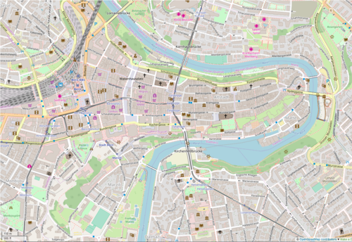
The Old City is the medieval city center of Bern, Switzerland. Built on a narrow hill bordered on three sides by the river Aare, its compact layout has remained essentially unchanged since its construction during the twelfth to the fifteenth century. Despite a major fire in 1405, after which much of the city was rebuilt in sandstone, and substantial construction efforts in the eighteenth century, Bern's old city has retained its medieval character.

Kramgasse

The Kramgasse is one of the principal streets in the Old City of Bern, the medieval city centre of Bern, Switzerland. It was the center of urban life in Bern until the 19th century. Today, it is a popular shopping street. Its length, slight curve and long line of Baroque façades combine to produce Bern's most impressive streetscape.

Gerechtigkeitsgasse

The Gerechtigkeitsgasse is one of the principal streets in the Old City of Bern, the medieval city center of Bern, Switzerland. Together with its extension, the Kramgasse, it is the heart of the inner city. Hans Gieng's most famous fountain figure, the statue of Lady Justice on the Gerechtigkeitsbrunnen, commands the view of the street's gentle slopes and curves.

Gerechtigkeitsbrunnen (Bern) Fountain in the Old City of Bern, Switzerland

The Gerechtigkeitsbrunnen is a 16th-century fountain in the Gerechtigkeitsgasse in the Old City of Bern, Switzerland. It is the only Bernese fountain to retain all original design elements, and is listed as a cultural heritage of national significance.

Junkerngasse

The Junkerngasse is a street in the Old City of Bern, the medieval city center of Bern, Switzerland. It connects the tip of the Aar peninsula to the Münster.

Felsenau power plant

The Felsenau power plant is a hydroelectric power plant located on the river Aar in Bern, Switzerland. It was built in 1909 by the city's utility company, Energie Wasser Bern. After a 1989 modernisation, the turbine hall is now used as a museum. The plant's current power output is 11.5 megawatts.

Bümpliz-Oberbottigen is a Stadtteil (district) of the city of Bern, Switzerland. It is situated to the west of the city center and consists of the Quartiere (quarters) Bümpliz, Oberbottigen, Stöckacker, Bethlehem and Brünnen.

Gottstatt Monastery

Gottstat Monastery is a former Premonstratensian monastery in the municipality of Orpund in the Canton of Bern, Switzerland.

Swiss Alpine Museum Museum in Bern, Switzerland

The Swiss Alpine Museum is a museum dedicated to the nature and culture of the Swiss Alps. It is located at Helvetiaplatz 4 in Bern.

Zähringerstadt

The Zähringerstadt is a historic section in the Old City of Bern in Bern, Switzerland.

Herrengasse 23 (Bern)

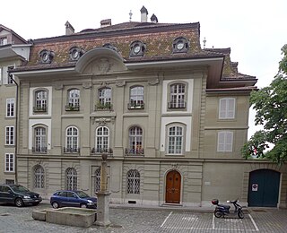
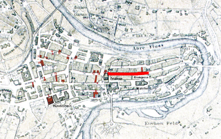
The von Wattenwyl house on Herrengasse 23 is a historic building in Bern, Switzerland, named after the von Wattenwyl family who owned it for over 200 years.

Läuferbrunnen

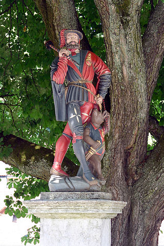
The Läuferbrunnen is a fountain on Läuferplatz in the Old City of Bern, Switzerland. It is a Swiss Cultural Property of National Significance and is part of the UNESCO World Heritage Site of the Old City of Bern.

The Zähringerbrunnen is a fountain on Kramgasse in the Old City of Bern, Switzerland. It is a Swiss Cultural Property of National Significance and is part of the UNESCO World Heritage Site of the Old City of Bern.

Blumenstein Castle

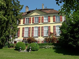
Blumenstein Castle is an estate house in the municipality of Solothurn of the Canton of Solothurn in Switzerland. It is a Swiss heritage site of national significance. In 1952 it became the home of the Historical Museum of Solothurn.

Lorraine railway viaduct

The Lorraine railway viaduct, or Lorraineviadukt, is a railway viaduct in the Swiss city of Bern. It carries the Olten–Bern railway across the River Aare immediately to the north of Bern railway station. The Lorraine road bridge is adjacent.

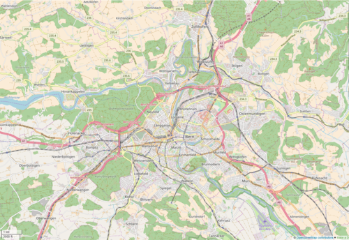
The following is a timeline of the history of the municipality of Bern, Switzerland.

Trachslau Village in Schwyz, Switzerland

Trachslau is a village inside the municipality of Einsiedeln, in the Swiss canton of Schwyz. The village is in the flow of the Alp river. First documented in 1331 as Trechsellum.

Ellen Judith Beer was a Swiss art historian. She focused on Medieval art.

References

The data in this list are taken from Furrer, p. 154–164, unless otherwise noted.

  1. von Bergen, 25.
  2. von Bergen, 39.
  3. Sequence downstream: numbers bridges from Schönausteg downstream.
  4. 1 2 von Bergen, 26.
  5. Furrer, 11–13.
  6. 1 2 von Bergen, 28.
  7. Furrer, 156.
  8. Furrer, 19.
  9. Furrer, 20.
  10. 1 2 von Bergen, 30.
  11. von Bergen, 32–34.
  12. 1 2 Furrer, 36.
  13. Furrer, 33–34.
  14. Furrer, 37.
  15. von Bergen, 35–37.
  16. von Bergen, 36.
  17. 1 2 von Bergen, 37.
  18. Furrer, 20–21.
  19. Caviezel, 248.
  20. 1 2 "Dotierkraftwerk Engehalde". Energie Wasser Bern. Archived from the original on 19 February 2009.
  21. Satellite photography measurement in Google Earth.
  22. 1 2 von Bergen, 31.
  23. Weber, "Eisenbahnbrücke, Rote" Archived 2008-06-18 at the Wayback Machine
  24. Furrer, 23.
  25. "Fähren Schweiz". Archived from the original on 24 June 2008.
  26. Weber.
  27. Fähre Reichenbach (in German)

Bibliography

Map all coordinates using: OpenStreetMap  
Download coordinates as: KML