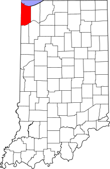
Marker title Image Year placed Location Topics First Physician [2] 1949 2985 West 73rd Place in Merrillville 41°29′6″N 87°22′23″W / 41.48500°N 87.37306°W / 41.48500; -87.37306 (First Physician ) Science, Medicine, and Inventions, Underground Railroad, African American Great Sauk (Sac) Trail (east–west through this point) [3] 1966 Along Van Buren Street at its junction with West 73rd Avenue/Old U.S. Route 30 /Lincoln Highway on a traffic median east of Calumet Cemetery and west of Broadway (State Road 53 ) in Merrillville 41°29′9″N 87°20′46.2″W / 41.48583°N 87.346167°W / 41.48583; -87.346167 (Great Sauk (Sac) Trail (east–west through this point) ) Transportation, American Indian/Native American St. John's Lutheran Church Tolleston [4] 1976 2235 West 10th Avenue in Gary 41°35′34″N 87°21′57″W / 41.59278°N 87.36583°W / 41.59278; -87.36583 (St. John's Lutheran Church Tolleston ) Religion, Immigration and Ethnic Groups Dutch in the Calumet Region [5] 1992 8941 Kleinman Road in Highland 41°33′2″N 87°26′14″W / 41.55056°N 87.43722°W / 41.55056; -87.43722 (Dutch in the Calumet Region ) Immigration and Ethnic Groups, Agriculture St. John Township School, District #2 [6] 1995 1515 Joliet Street/Lincoln Highway/U.S. Route 30 , east of St. John Road at the St. John Township Community Center in Schererville 41°29′27.6″N 87°29′17.4″W / 41.491000°N 87.488167°W / 41.491000; -87.488167 (St. John Township School, District #2 ) Education The Lincoln Highway – The "Ideal Section" [7] 1996 Northeastern corner of the junction of Joliet Street/U.S. Route 30 and Janice Drive in Schererville 41°29′27.6″N 87°28′52.5″W / 41.491000°N 87.481250°W / 41.491000; -87.481250 (The Lincoln Highway The "Ideal Section" ) Transportation Froebel School [8] 2014 15th Avenue and Madison Street in Gary 41°35′16.9″N 87°20′29.9″W / 41.588028°N 87.341639°W / 41.588028; -87.341639 (Forebel School ) Education Stewart Settlement House [9] 2014 1501 East Massachusetts Street in Gary 41°35′16.0″N 87°20′06.2″W / 41.587778°N 87.335056°W / 41.587778; -87.335056 (Stewart Settlement House ) African American Rep. Katie Hall (1938-2012), Origin of Dr MLK Day Law [10] 2019 1927 Madison St., Gary 41°35′00″N 87°20′29″W / 41.58333°N 87.34139°W / 41.58333; -87.34139 (Rep. Katie Hall Marker ) African American; Politics City Church [11] 2019 577 Washington St., Gary 41°36′01″N 87°20′18″W / 41.60028°N 87.33833°W / 41.60028; -87.33833 (City Church ) Religion, African American, Immigration, Business, Industry and Labor Mt Zion MB Church [12] 2019 1047 Kenwood St., Hammond 41°35′56″N 87°30′08″W / 41.59889°N 87.50222°W / 41.59889; -87.50222 (Mt Zion MB Church ) Religion, African American Gary Roosevelt High School [13] 2020 730 W 25th Ave, Gary 41°34′24.3″N 87°20′42.5″W / 41.573417°N 87.345139°W / 41.573417; -87.345139 (Gary Roosevelt High School ) Education, African American Indiana University Northwest [14] 2021 Indiana University Northwest, Anderson Library Conference Center, 3400 Broadway, Gary 41°33′20″N 87°20′17″W / 41.55556°N 87.33806°W / 41.55556; -87.33806 (Indiana University Northwest ) Education & Library Hagenbeck-Wallace Circus / 1918 Circus Train Wreck [15] 2022 Ivanhoe South Nature Preserve, Colfax St., just off US 12/20 near Cline Avenue, Gary 41°35′51.8″N 87°24′48″W / 41.597722°N 87.41333°W / 41.597722; -87.41333 (Hagenbeck-Wallace Circus / 1918 Circus Train Wreck ) Transportation; Arts & Culture 


