
State Route 39 is a state highway in the U.S. state of California that travels through Orange and Los Angeles counties. Its southern terminus is at Pacific Coast Highway, in Huntington Beach. SR 39's northern terminus is at Islip Saddle on Angeles Crest Highway in the Angeles National Forest, but its northernmost 4.5-mile (7.2 km) segment has been closed to public highway traffic since 1978 due to a massive mud and rockslide.

Interstate 495 (I-495) is an 11.47-mile-long (18.46 km) auxiliary Interstate Highway in the US state of Delaware. The highway, named the Vietnam Veterans Memorial Highway, serves as a six-lane bypass of I-95 around the city of Wilmington. I-495 begins at an interchange with I-95 and I-295 near Newport to the southwest of Wilmington. From here, the road heads east to the Port of Wilmington, where it turns northeast and crosses the Christina River as it heads to the east of downtown Wilmington. Upon reaching Edgemoor, I-495 runs between the Delaware River to the east and U.S. Route 13 (US 13) to the west, continuing to Claymont. In Claymont, I-495 turns north and merges into northbound I-95 at an interchange with Delaware Route 92 (DE 92) just south of the Pennsylvania state line.

New York State Route 25 (NY 25) is an east–west state highway in downstate New York in the United States. The route extends along the central parts and North Shore of Long Island for just over 105 miles (169 km) from east midtown Manhattan in New York City to the Cross Sound Ferry terminal at Orient Point on the end of Long Island's North Fork. NY 25 is carried from Manhattan to Queens by way of the double-decked Queensboro Bridge over the East River.
New Mexico State Road 14 (NM 14) is an approximately 54-mile-long (87 km) state road located in northern New Mexico. The highway connects Albuquerque to Santa Fe and comprises most of the Turquoise Trail, a National Scenic Byway which also includes NM 536.
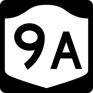
New York State Route 9A (NY 9A) is a state highway in the vicinity of New York City in the United States. Its southern terminus is at Battery Place near the northern end of the Brooklyn–Battery Tunnel in New York City, where it intersects with both the unsigned Interstate 478 (I-478) and FDR Drive. The northern terminus of NY 9A is at U.S. Route 9 (US 9) in Peekskill. It is predominantly an alternate route of US 9 between New York City and Peekskill; however, in New York City, it is a major route of its own as it runs along the West Side Highway and Henry Hudson Parkway. It is also one of only two signed New York State routes in Manhattan. In northern Westchester County, NY 9A follows the Briarcliff–Peekskill Parkway.

State Route 92 (SR 92) is a 97.81-mile-long (157.41 km) state highway in the U.S. state of Georgia. Its southern terminus is an intersection with US 19 Bus./US 41 Bus./SR 16 in Griffin. Its northern terminus is an intersection with SR 9/SR 120/SR 140 in Roswell. The highway connects Griffin to Roswell, via Fayetteville, Fairburn, Douglasville, Hiram, Acworth, and Woodstock. Primarily signed from south to north, SR 92 is a rural highway that travels through three county seats. It can be seen as a western bypass of the city of Atlanta.

State Route 13 (SR 13) is a 49.5-mile-long (79.7 km) state highway in the north-central part of the U.S. state of Georgia, that travels through portions of Fulton, DeKalb, Gwinnett, and Hall counties.

U.S. Route 101 (US 101) is a major north–south United States Numbered Highway, stretching from Los Angeles, California, to Tumwater, Washington. The California portion of US 101 is one of the last remaining and longest U.S. Routes still active in the state, and the longest highway of any kind in California. US 101 was also one of the original national routes established in 1926. Significant portions of US 101 between the Los Angeles area and the San Francisco Bay Area follow El Camino Real, the commemorative route connecting the former Alta California's 21 missions.

State Highway 130 (SH 130), also known as the Pickle Parkway, is a freeway from Interstate 35 (I-35) in San Antonio along I-410 and I-10 to east of Seguin, then north as a toll road from there to I-35 north of Georgetown. SH 130 runs in a 91-mile (146 km) corridor east and south of Austin. The route parallels I-35 and is intended to relieve the Interstate's traffic volume through the San Antonio–Austin corridor by serving as an alternate route.

The historic U.S. Route 66 ran east–west across the central part of the state of New Mexico, along the path now taken by Interstate 40 (I-40). However, until 1937, it took a longer route via Los Lunas, Albuquerque, and Santa Fe, now roughly New Mexico State Road 6 (NM 6), I-25, and US 84. Large portions of the old road parallel to I-40 have been designated NM 117, NM 118, NM 122, NM 124, NM 333, three separate loops of I-40 Business, and state-maintained frontage roads.

Delaware Route 9 (DE 9) is a 57.83-mile (93.07 km) state highway that runs from DE 1 near Dover Air Force Base in Kent County north to DE 2 in the city of Wilmington in New Castle County. DE 9 is a designated scenic highway known as the Delaware Bayshore Byway south of New Castle, running through mostly rural areas to the west of the Delaware Bay and the Delaware River as a two-lane undivided road. Between New Castle and Wilmington, DE 9 is a four-lane road that runs through urban and suburban areas. DE 9 passes through several cities and towns including Little Creek, Leipsic, Port Penn, Delaware City, and New Castle. DE 9 has an auxiliary route, DE 9A, that provides access to the Port of Wilmington. In addition, it has a truck route, DE 9 Truck, located to the south of New Castle.

Delaware Route 9A (DE 9A) is a two- to four-lane road in Wilmington, Delaware that serves as the primary access route to the Port of Wilmington as well as provide access to Interstate 495 (I-495). The official designation of the route runs 0.78 miles (1.26 km) along Terminal Avenue between DE 9 and the Port of Wilmington, interchanging with I-495. Signage has the route continuing north along Christiana Avenue to an intersection with U.S. Route 13 (US 13) and DE 9 for a total length of 2.0 mi (3.2 km). Christiana Avenue originally became a state highway in the 1920s, serving as part of US 40 that connected to a ferry across the Delaware River to Penns Grove, New Jersey. US 40 was removed from this road in the 1930s and it later became part of DE 48, which was subsequently removed in the 1950s following the discontinuance of the ferry. DE 9A was designated by 1971.

Interstate 40 (I-40), a major east–west route of the Interstate Highway System, runs east–west through Albuquerque in the US state of New Mexico. It is the direct replacement for the historic U.S. Highway 66 (US 66).
New Mexico State Road 2 (NM 2) is a state highway in the state of New Mexico. It travels southeast from U.S. Route 285, outside of Roswell, New Mexico, passing through Midway. While in Dexter, it turns right as Old Dexter Highway and passes through Greenfield, Hagerman, and Lake Arthur, before ending back at US 285.

Highway 326 is a designation for two state highways in Pope County. One route of 9.96 miles (16.03 km) in Russellville begins at Highway 7 and Highway 7 Truck and runs northeast to Highway 7. A second route of 6.52 miles (10.49 km) begins at Highway 124 and runs east to Highway 105. All routes are maintained by the Arkansas State Highway and Transportation Department (AHTD).

U.S. Route 366 or US 366 was the designation of two child routes of the former U.S. Route 66 in New Mexico and Texas during the late 1920s and 1930s. Both alignments of US 366 were original U.S. Routes created in 1927. The first alignment was a route from El Paso, Texas to Amarillo, Texas crossing through New Mexico that existed until 1931. The second was a route from Albuquerque, New Mexico to Willard, New Mexico that was previously assigned a different route number before 1932. That alignment was canceled in 1939.

U.S. Route 366 or US 366 was the designation of two child routes of the former U.S. Route 66 in New Mexico and Texas during the late 1920s and 1930s. Both alignments of US 366 were original U.S. Routes created in 1927. The first alignment was a route from El Paso, Texas to Amarillo, Texas crossing through New Mexico that existed until 1932. The second was a route from Albuquerque to Willard that was previously designated U.S. Route 470 before 1932. That alignment was canceled in 1939.
U.S. Bicycle Route 10 (USBR 10) is a United States Bicycle Route that is planned to follow U.S. Route 2 across the northern United States, beginning in Anacortes, Washington and ending in St. Ignace, Michigan. As of 2015, only 666 miles (1,072 km) of the planned corridor is designated, within the states of Washington, Idaho, and Michigan.

U.S. Route 70 (US 70) is a part of the U.S. Highway System that travels from Globe, Arizona, east to Atlantic, North Carolina. In the U.S. state of New Mexico, US 70 extends from the Arizona state line south of Virden and ends at the Texas state line in Texico.