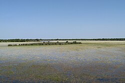
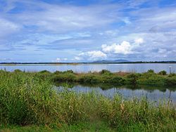
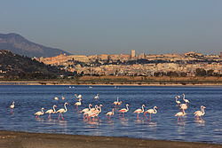
Name Region Area Designated Image Park status Coords. Ref. Bacino dell'Angitola Calabria 875 ha 1989-04-11 N/A 38°44′N 16°14′E / 38.733°N 16.233°E / 38.733; 16.233 (Bacino dell'Angitola ) Stagno di S'Ena Arrubia [it] Sardinia 223 ha 1976-12-14 N/A 39°49′N 08°33′E / 39.817°N 8.550°E / 39.817; 8.550 (Stagno di S'Ena Arrubia ) Lago di San Giuliano Basilicata 2,118 ha 2003-08-07 N/A 40°37′N 16°28′E / 40.617°N 16.467°E / 40.617; 16.467 (Lago di San Giuliano ) Stagno di Cábras [it] Sardinia 3,575 ha 1979-03-28 N/A 39°57′N 03°30′E / 39.950°N 3.500°E / 39.950; 3.500 (Stagno di Cábras ) Trappola marshland - Ombrone River mouth Tuscany 536 ha 2016-10-13 Maremma Regional Park 42°40′N 11°01′E / 42.667°N 11.017°E / 42.667; 11.017 (Trappola Marshland - Ombrone River Mouth ) Lago di Fogliano [it] Lazio 395 ha 1976-12-14 Circeo National Park 41°24′N 12°54′E / 41.400°N 12.900°E / 41.400; 12.900 (Lago di Fogliano ) Lago di Tovel Trentino Alto Adige 37 ha 1980-09-19 N/A 46°15′N 10°57′E / 46.250°N 10.950°E / 46.250; 10.950 (Lago di Tovel ) Laguna di Venezia : Valle Averto [it] Veneto 500 ha 1989-04-11 N/A 45°21′N 12°09′E / 45.350°N 12.150°E / 45.350; 12.150 (Laguna di Venezia: Valle Averto ) Le Cesine Apulia 620 ha 1977-12-06 N/A 40°21′N 18°19′E / 40.350°N 18.317°E / 40.350; 18.317 (Le Cesine ) Ortazzo e Ortazzino [it] Emilia-Romagna 440 ha 1981-09-04 Po Delta Regional Park [it] 44°21′N 12°18′E / 44.350°N 12.300°E / 44.350; 12.300 (Ortazzo e Ortazzino ) Palude Brabbia [it] Lombardy 459 ha 1985-12-05 N/A 41°24′N 12°54′E / 41.400°N 12.900°E / 41.400; 12.900 (Palude Brabbia ) Palude del Brusà [it] - Le Vallette Veneto 171 ha 2010-09-27 N/A 45°10′N 11°13′E / 45.167°N 11.217°E / 45.167; 11.217 (Palude del Brusà - Le Vallette ) Palude della Diaccia Botrona Tuscany 2,500 ha 1991-05-22 N/A 42°46′N 10°55′E / 42.767°N 10.917°E / 42.767; 10.917 (Palude della Diaccia Botrona ) Palude di Ostiglia [it] Lombardy 123 ha 1984-12-05 N/A 45°06′N 11°06′E / 45.100°N 11.100°E / 45.100; 11.100 (Palude di Ostiglia ) Biviere di Gela [it] Sicily 256 ha 1988-04-12 N/A 37°00′N 14°20′E / 37.000°N 14.333°E / 37.000; 14.333 (Biviere di Gela ) Isola Boscone [it] Lombardy 201 ha 1989-04-11 N/A 45°01′N 11°13′E / 45.017°N 11.217°E / 45.017; 11.217 (Isola Boscone ) Lago di Caprolace Lazio 229 ha 1976-12-14 Circeo National Park 41°21′N 12°58′E / 41.350°N 12.967°E / 41.350; 12.967 (Lago di Caprolace ) Valle Campotto e Bassarone [it] Emilia-Romagna 1,363 ha 1979-03-28 Po Delta Regional Park [it] 44°35′N 11°50′E / 44.583°N 11.833°E / 44.583; 11.833 (Valle Campotto e Bassarone ) Saline di Margherita di Savoia Apulia 3,871 ha 1979-08-02 N/A 41°24′N 16°03′E / 41.400°N 16.050°E / 41.400; 16.050 (Saline di Margherita di Savoia ) Pantano di Pignola [it] Basilicata 172 ha 2003-08-07 N/A 40°34′N 15°43′E / 40.567°N 15.717°E / 40.567; 15.717 (Pantano di Pignola ) Palude di Colfiorito [it] Umbria 157 ha 1976-12-14 Colfiorito Regional Park [it] 43°00′N 12°52′E / 43.000°N 12.867°E / 43.000; 12.867 (Palude di Colfiorito ) Stagno di Corru S'Ittiri, Stagni di San Giovanni e Marceddì [it] Sardinia 2,610 ha 1979-03-28 N/A 39°44′N 08°30′E / 39.733°N 8.500°E / 39.733; 8.500 (Stagno di Corru S'Ittiri, Stagni di San Giovanni e Marceddì ) Stagno di Pauli Maiori [it] Sardinia 287 ha 1979-03-28 N/A 39°52′N 08°37′E / 39.867°N 8.617°E / 39.867; 8.617 (Stagno di Pauli Maiori ) Stagno di Sale Porcus [it] Sardinia 330 ha 1982-05-03 N/A 40°00′N 08°25′E / 40.000°N 8.417°E / 40.000; 8.417 (Stagno di Sale Porcus ) Vincheto di Cellarda [it] Veneto 99 ha 1976-12-14 N/A 46°00′N 11°58′E / 46.000°N 11.967°E / 46.000; 11.967 (Vincheto di Cellarda ) Palude di Bolgheri [it] Tuscany 518 ha 1976-12-14 N/A 43°13′N 10°33′E / 43.217°N 10.550°E / 43.217; 10.550 (Palude di Bolgheri ) Stagno di Molentargius [it] Sardinia 1,401 ha 1976-12-14 Molentargius - Saline Regional Park 39°13′N 09°10′E / 39.217°N 9.167°E / 39.217; 9.167 (Stagno di Molentargius ) Laguna di Orbetello Tuscany 887 ha 1976-12-14 N/A 42°28′N 11°12′E / 42.467°N 11.200°E / 42.467; 11.200 (Laguna di Orbetello ) Lago di Burano Tuscany 410 ha 1976-12-14 N/A 42°24′N 11°22′E / 42.400°N 11.367°E / 42.400; 11.367 (Lago di Burano ) Lake Barrea Abruzzo 241.4 ha 1976-12-14 Abruzzo, Lazio and Molise National Park 41°45′N 13°58′E / 41.750°N 13.967°E / 41.750; 13.967 (Lake Barrea ) Trapani and Paceco salt ponds Sicily 971 ha 2017-10-19 N/A 37°59′N 12°30′E / 37.983°N 12.500°E / 37.983; 12.500 (Trapani and Paceco salt ponds ) Busatello marsh [ro] Veneto 443 ha 2017-10-03 N/A 37°59′N 12°30′E / 37.983°N 12.500°E / 37.983; 12.500 (Busatello marsh ) Punte Alberete [it] Emilia-Romagna 480 ha 1976-12-14 Po Delta Regional Park [it] 44°30′N 12°13′E / 44.500°N 12.217°E / 44.500; 12.217 (Punte Alberete ) Oasis of the Sele - Serre Persano [it] Campania 174 ha 2003-08-07 N/A 40°36′N 15°08′E / 40.600°N 15.133°E / 40.600; 15.133 (Oasis of the Sele - Serre Persano ) Posada River Mouth [it] Sardinia 736 ha 2021-02-25 N/A 40°38′N 09°43′E / 40.633°N 9.717°E / 40.633; 9.717 (Posada River Mouth ) Oasis of Castelvolturno - Variconi [it] Campania 195 ha 2003-08-07 N/A 41°01′N 13°56′E / 41.017°N 13.933°E / 41.017; 13.933 (Oasis of Castelvolturno - Variconi ) Massaciuccoli lake and marsh Tuscany 11,135 ha 2017-06-22 N/A 43°45′N 10°18′E / 43.750°N 10.300°E / 43.750; 10.300 (Massaciuccoli lake and marsh ) Piallassa della Baiona e Risega [it] Emilia-Romagna 1,630 ha 1981-09-04 Po Delta Regional Park [it] 44°30′N 12°15′E / 44.500°N 12.250°E / 44.500; 12.250 (Piallassa della Baiona e Risega ) Pian di Spagna - Lago di Mezzola Lombardy 1,740 ha 1976-12-14 N/A 46°10′N 09°25′E / 46.167°N 9.417°E / 46.167; 9.417 (Pian di Spagna - Lago di Mezzola ) Saline di Cervia [it] Emilia-Romagna 785 ha 1981-09-04 Regional Park 44°15′N 12°20′E / 44.250°N 12.333°E / 44.250; 12.333 (Saline di Cervia ) Stagno di Mistras [it] Sardinia 680 ha 1982-05-03 N/A 39°54′N 08°27′E / 39.900°N 8.450°E / 39.900; 8.450 (Stagno di Mistras ) Sacca di Bellocchio [it] Emilia-Romagna 223 ha 1976-12-14 Po Delta Regional Park [it] 44°37′N 12°16′E / 44.617°N 12.267°E / 44.617; 12.267 (Sacca di Bellocchio ) Stagno di Cagliari Sardinia 3,466 ha 1976-12-14 N/A 39°12′N 09°03′E / 39.200°N 9.050°E / 39.200; 9.050 (Stagno di Cagliari ) Valle Santa [it] Emilia-Romagna 261 ha 1976-12-14 Po Delta Regional Park [it] 44°34′N 11°50′E / 44.567°N 11.833°E / 44.567; 11.833 (Valle Santa ) Torre Guaceto [it] Apulia 940 ha 1981-07-21 N/A 40°43′N 17°48′E / 40.717°N 17.800°E / 40.717; 17.800 (Torre Guaceto ) Torbiere d'Iseo [it] Lombardy 325 ha 1984-12-05 N/A 45°39′N 10°01′E / 45.650°N 10.017°E / 45.650; 10.017 (Torbiere d'Iseo ) Valle Bertuzzi [ro] Emilia-Romagna 3,100 ha 1981-09-04 Regional Park 44°46′N 12°13′E / 44.767°N 12.217°E / 44.767; 12.217 (Valle Bertuzzi ) Valle di Gorino Emilia-Romagna 1,330 ha 1981-09-04 Regional Park 44°48′N 12°21′E / 44.800°N 12.350°E / 44.800; 12.350 (Valle di Gorino ) Valli del Mincio [it] Lombardy 1,082 ha 1984-12-05 N/A 45°10′N 10°42′E / 45.167°N 10.700°E / 45.167; 10.700 (Valli del Mincio ) Valli residue del comprensorio di Comacchio Emilia-Romagna 13,500 ha 1981-09-04 Po Delta Regional Park [it] 44°37′N 12°11′E / 44.617°N 12.183°E / 44.617; 12.183 (Valli residue del comprensorio di Comacchio ) Vendicari Sicily 1,450 ha 1989-04-11 N/A 36°48′N 15°06′E / 36.800°N 15.100°E / 36.800; 15.100 (Vendicari ) Lago di Sabaudia Lazio 1,474 ha 1976-12-14 Circeo National Park 41°15′N 13°03′E / 41.250°N 13.050°E / 41.250; 13.050 (Lago di Sabaudia ) Lago dei Monaci Lazio 94 ha 1976-12-14 Circeo National Park 41°22′N 12°55′E / 41.367°N 12.917°E / 41.367; 12.917 (Lago dei Monaci ) Lago di Nazzano [it] Lazio 265 ha 1976-12-14 N/A 42°13′N 12°37′E / 42.217°N 12.617°E / 42.217; 12.617 (Lago di Nazzano ) Lagustelli di Percile [it] Lazio 256 ha 2008-08-27 Monti Lucretili Regional Park 42°06′N 12°55′E / 42.100°N 12.917°E / 42.100; 12.917 (Lagustelli di Percile ) Laguna di Marano : Foci dello Stella [it] Friuli-Venezia Giulia 1,400 ha 1979-05-14 N/A 45°44′N 13°06′E / 45.733°N 13.100°E / 45.733; 13.100 (Laguna di Marano: Foci dello Stella ) Valle Cavanata Friuli-Venezia Giulia 243 ha 1978-03-10 N/A 45°43′N 13°28′E / 45.717°N 13.467°E / 45.717; 13.467 (Valle Cavanata )