List of county routes in Sullivan County, New York

Last updated

Sullivan 172 at Wurtsboro Auto.jpg
CR 172 passing a local auto body shop in Wurtsboro
Highway names
Interstates Interstate X (I-X)
US Highways U.S. Route X (US X)
State New York State Route X (NY X)
County:County Route X (CR X)
System links

County routes in Sullivan County, New York, are maintained by the Sullivan County Division of Public Works and signed with the Manual on Uniform Traffic Control Devices-standard yellow-on-blue pentagon route marker. The county highway system comprises roughly 140 routes arranged across the county in groups of nine. For the most part, state routes in Sullivan County are county-maintained and co-signed with county routes. However, the converse is not true; that is, not all county routes overlap state routes for their entire length. Typically, each series consists of county routes along a single roadway, often overlapping with state highways in the process. The lowest numbered route in the system is County Route 11 (CR 11); the highest is CR 183C. Note that routes 160 through 169 do not conform to any style, and coincidentally the 170 through 179 series (with the exception of the spur designated 174A) follows the pre-expressway routing of New York State Route 17 (NY 17).

Contents

Sullivan County posted signage of their routes in 1958. [1]

Routes 1–50

Barryville to Claryville (11–19)

The Barryville to Claryville series encompasses routes 11 through 17 and CR 19, the non-suffixed of which form a mostly continuous roadway between the two communities. Most of the routes are concurrent to NY 55, which follows the Barryville–Claryville route from Barryville north to Curry. At Curry, CR 19 splits from NY 55 to access Claryville. The Barryville–Claryville route is interrupted four times by three state-maintained stretches of NY 55 (from CR 13 to CR 14; from CR 16 to CR 17; and from CR 17 to CR 19) and a locally maintained section within the village of Liberty.

Route list
RouteLength
(mi) [2]
Length
(km)
FromViaToNotes
CR 11 jct.svg CR 113.816.13 NY 97 Brook Road in Highland CR 12 at Eldred StreetEntire length overlaps with NY 55
CR 11A jct.svg CR 11A0.641.03 NY 97 River Road in Highland Dead end near NY 55  / NY 97 junction
CR 12 jct.svg CR 127.3811.88CR 11 at Eldred Street in Highland Board RoadCR 13 / CR 26 in Bethel Entire length overlaps with NY 55
CR 13 jct.svg CR 134.076.55CR 12 / CR 26White Lake Road in Bethel NY 17B Entire length overlaps with NY 55
CR 14 jct.svg CR 146.2910.12 NY 17B Swan Lake Road in Bethel Liberty town lineEntire length overlaps with NY 55
CR 15 jct.svg CR 153.595.78 Bethel town lineLiberty Road in Liberty Liberty village lineEntire length overlaps with NY 55
CR 16 jct.svg CR 163.926.31 Liberty village line in Liberty Neversink RoadAden Road in Neversink Entire length overlaps with NY 55
CR 17 jct.svg CR 172.303.70Wilson Shields RoadNeversink Road in Neversink Wagners RoadEntire length overlaps with NY 55
CR 19 jct.svg CR 19 5.288.50 NY 55 Claryville Road in Neversink Ulster County linePart south of CR 157 was formerly part of NY 42

Barryville to Narrowsburg (21–26)

The Barryville to Narrowsburg series encompasses routes 21 through 26. CR 21, CR 22, and CR 23 form a continuous roadway north to an intersection with NY 97 near Narrowsburg, while CR 24 follows two county-maintained sections of NY 52 in the town of Tusten. The remaining routes are assigned to various connectors in the towns of Tusten and Highland.

Route list
RouteLength
(mi) [2]
Length
(km)
FromViaToNotes
CR 21 jct.svg CR 213.836.16 NY 97 Barryville–Yulan RoadCR 22 / CR 33
CR 21A jct.svg CR 21A0.090.14 NY 97 River Road in Highland CR 21
CR 22 jct.svg CR 224.326.95CR 21 / CR 33 in Highland Beaver Brook RoadCR 23 / CR 26 in Tusten
CR 23 jct.svg CR 233.876.23 NY 97 Lumberland–Mount Hope Road in Tusten CR 22 / CR 26
CR 24 jct.svg CR 24 4.156.68Main StreetBridge Street and Narrowsburg Road in Tusten CR 111 at Cochecton town lineEntire length overlaps with NY 52; discontinuous at NY 97
CR 25 jct.svg CR 251.392.24 NY 97 Eckes Road in Tusten NY 52  / CR 24
CR 26 jct.svg CR 266.2510.06CR 22 / CR 23 in Tusten Crystal Lake Road NY 55  / CR 13 in Bethel

Mongaup to Yulan (31–33)

The Mongaup to Yulan series is only CR 31 through CR 33, as routes 34 through 39 do not currently exist within the county. The roadway begins as CR 31 at NY 97 in Mongaup and heads northwest to a junction with CR 21 and CR 22 in Yulan. CR 31 and CR 32 do not directly intersect each other; instead, they are connected by the northernmost portion of CR 41.

Route list
RouteLength
(mi) [2]
Length
(km)
FromViaToNotes
CR 31 jct.svg CR 315.288.50 NY 97 Upper Mongaup Road in Lumberland CR 41
CR 32 jct.svg CR 325.148.27 NY 55  / CR 12 / CR 33 in Highland Proctor RoadCR 41 / CR 42 in Lumberland
CR 33 jct.svg CR 332.824.54CR 21 / CR 22Eldred–Yulan Road in Highland NY 55  / CR 12 / CR 32

Pond Eddy to Monticello (41–49)

The Pond Eddy to Monticello series is made up of CR 41 through CR 45 and CR 47 through CR 49, including CR 45A. The Pond Eddy–Monticello roadway begins at NY 97 in Pond Eddy and progresses north as CR 41 through CR 45, from south to north, to a terminus at NY 42 south of Monticello. CR 47 is a spur off CR 32 from Eldred to Highland Lake. The route itself does not connect to any other route in the Pond Eddy-Monticello series; however, the unnumbered Mohican Lake Road continues east from the eastern terminus of CR 47 to intersect CR 42 near Glen Spey. The remaining routes are spurs off the main Pond Eddy–Monticello route.

Route list
RouteLength
(mi) [2]
Length
(km)
FromViaToNotes
CR 41 jct.svg CR 412.924.70 Pennsylvania state line High Road in Lumberland CR 32 / CR 42
CR 42 jct.svg CR 423.315.33CR 32 / CR 41Forestburgh Road in Lumberland CR 43 at Leers Road
CR 43 jct.svg CR 435.058.13CR 42 at Leers Road in Lumberland Forestburgh Road NY 42  / CR 48 in Forestburgh
CR 44 jct.svg CR 443.485.60CR 43Plank and Sackett Lake roads in Forestburgh CR 45 at Thompson town line
CR 45 jct.svg CR 453.976.39CR 44 at Forestburgh town lineSackett Lake Road in Thompson NY 42
CR 45A jct.svg CR 45A0.100.16CR 45Sackett Lake Road in Thompson NY 42
CR 47 jct.svg CR 472.033.27CR 32Highland Lake Road in Highland Lakeview Drive
CR 48 jct.svg CR 483.715.97 NY 42  / CR 43Hartwood Road in Forestburgh CR 49 / CR 101
CR 49 jct.svg CR 493.455.55 Orange County line (becomes CR 7)Oakland Valley Road in Forestburgh CR 48 / CR 101

Routes 51–100

Liberty to Spring Glen (51–59)

The Liberty to Spring Glen series consists of routes 51 through 59. Routes 51 through 55 follow a single roadway across eastern Sullivan County from Liberty to the Ulster County line, with a brief gap between CR 53 and CR 54 in Woodridge. In Ulster County, the road continues as the short CR 80, terminating at US 209 in Spring Glen. CR 59 is a connector between NY 17B and CR 174 near Monticello and does not connect to any other route in the Liberty-Spring Glen series. The remaining routes are connectors in the vicinity of Woodridge.

Route list
RouteLength
(mi) [2]
Length
(km)
FromViaToNotes
CR 51 jct.svg CR 512.133.43 NY 52 Hilldale Road in Fallsburg CR 52 / CR 104
CR 52 jct.svg CR 523.495.62CR 51 / CR 104Brickman Road in Fallsburg NY 42  / CR 53
CR 53 jct.svg CR 532.033.27Roosevelt AvenueOld Falls Road in Fallsburg NY 42  / CR 52
CR 54 jct.svg CR 541.652.660.13 miles (0.21 km) west of Woodridge east village lineMountaindale RoadCR 55 / CR 56 in Fallsburg
CR 55 jct.svg CR 556.5910.61CR 54 / CR 56 in Fallsburg Main Street and Mountaindale Road Ulster County line in Mamakating (becomes CH 80)
CR 56 jct.svg CR 567.5212.10CR 172 in Mamakating Masten Lake RoadCR 54 / CR 55 in Fallsburg
CR 58 jct.svg CR 585.679.12Rock Hill Drive at NY 17 exit 109 in Thompson Glen Wild Road Woodridge village line in Fallsburg
CR 59 jct.svg CR 591.101.77 NY 17B Kaufman Road in Thompson NY 17 eastbound on-ramp

New Vernon to Burlingham (61–66)

The New Vernon to Burlingham series consists of routes 61–65. CR 62 (Winterton Road) runs from the Orange County line near New Vernon to the village of Bloomingburg, where it connects to the village-maintained South Road. The road changes names to North Road at Main Street, and county maintenance of the highway resumes at the north village line as CR 61. It heads northeast from the village as Burlingham Road to the Ulster County line. The other four routes in the series are spurs off the primary New Vernon–Burlingham highway.

Route list
RouteLength
(mi) [2]
Length
(km)
FromViaToNotes
CR 61 jct.svg CR 615.028.08 Bloomingburg village lineBurlingham Road in Mamakating Ulster County line (becomes CR 7)
CR 62 jct.svg CR 624.186.73 Orange County line (becomes CR 18)Winterton Road in Mamakating Bloomingburg village line
CR 63 jct.svg CR 630.470.76CR 62Camp Bell Road in Mamakating Orange County lineOnce crossed Shawangunk Kill to connect to Hubbard Road
CR 64 jct.svg CR 640.510.82CR 65Spruce Road in Mamakating Orange County line
CR 65 jct.svg CR 651.842.96 Orange County line (becomes CR 90)Upper Road in Mamakating CR 62
CR 66 jct.svg CR 660.360.58CR 61Hamilton Road in Mamakating Orange County line (becomes CR 48)

Mongaup Valley to Liberty (71–75)

The route from Mongaup Valley to Liberty comprises routes 71 through 75, with routes 71 through 73 serving as the primary roadway between the hamlet of Mongaup Valley and the village of Liberty. CR 74 and CR 75 are spurs leading away from the main route.

Route list
RouteLength
(mi) [2]
Length
(km)
FromViaToNotes
CR 71 jct.svg CR 711.782.86 NY 55  / CR 15Ferndale Road in Liberty NY 17 exit 101 / CR 175
CR 72 jct.svg CR 721.883.03CR 73 / CR 74Lt. J.G. Brender Highway in Liberty CR 71
CR 73 jct.svg CR 734.236.81Gale Road in Bethel Lt. J.G. Brender HighwayCR 72 / CR 74 in Liberty
CR 74 jct.svg CR 741.592.56 NY 55  / CR 14 / CR 15Stanton Corners Road in Liberty CR 72 / CR 73
CR 75 jct.svg CR 752.113.40CR 174 in Thompson Harris–Bushville RoadCR 73 in Bethel

Livingston Manor to Parksville (81–85)

The Livingston Manor–Parksville series comprises routes 81 through 85, which form a discontinuous, circuitous route between the two communities via Catskill Park. Routes 81 through 83 lead east from Livingston Manor to the hamlet of Debruce while CR 84 and CR 85 head northeast from Parksville to the community of Willowemoc. Debruce (CR 83) and Willowemoc (CR 84) are connected by a town road named Willowemoc Road.

Route list
RouteLength
(mi) [2]
Length
(km)
FromViaToNotes
CR 81 jct.svg CR 812.463.96CR 178Debruce Road in Rockland CR 82
CR 82 jct.svg CR 823.415.49CR 81Debruce Road in Rockland CR 83
CR 83 jct.svg CR 830.270.43CR 82Debruce Road in Rockland Willowemoc Road
CR 84 jct.svg CR 843.685.92CR 85 at Cooley Mountain Road in Liberty Cooley and Parksville roadsWillowemoc Road in Neversink
CR 85 jct.svg CR 853.575.75 NY 17 Cooley Road in Liberty CR 84 at Cooley Mountain Road

Hankins to Rockland (91–96)

The Hankins to Rockland series extends from the hamlet of Hankins adjacent to the Delaware River to the Delaware County line north of the hamlet of Roscoe. The main route comprises CR 91 through CR 94, with CR 95 and CR 96 serving as spurs off the road. CR 91 and CR 92 connect by way of CR 124 and CR 179.

Route list
RouteLength
(mi) [2]
Length
(km)
FromViaToNotes
CR 91 jct.svg CR 911.602.57CR 179 / CR 179ARockland Road in Rockland Delaware County line (becomes CR 7)Entire length overlaps with NY 206
CR 92 jct.svg CR 923.575.75CR 93 / CR 96 in Fremont Tennanah Lake Road and Riverside DriveCR 123 / CR 124 in Rockland
CR 93 jct.svg CR 936.5610.56CR 94 / CR 95Hankins Road in Fremont CR 92 / CR 96
CR 94 jct.svg CR 944.427.11 NY 97 Hankins Road in Fremont CR 93 / CR 95
CR 95 jct.svg CR 954.817.74CR 93 / CR 94 in Fremont Obernburg RoadCR 121 / CR 122 in Callicoon
CR 96 jct.svg CR 962.153.46Crowley RoadTennanah Lake Road in Fremont CR 92 / CR 93

Routes 101 and up

Hartwood to Neversink (101–109)

The Hartwood–Neversink series comprises routes 101 through 109 and connects the hamlets of Hartwood and Neversink. The main route utilizes CR 101 through CR 105, with the remaining routes serving as spurs or connectors off the primary path.

Route list
RouteLength
(mi) [2]
Length
(km)
FromViaToNotes
CR 101 jct.svg CR 1012.694.33CR 48 / CR 49Cold Spring Road in Forestburgh CR 102 / CR 108
CR 102 jct.svg CR 1025.669.11CR 101 / CR 108 in Forestburgh Cold Spring Road Monticello village line in Thompson
CR 103 jct.svg CR 1034.166.69 NY 42 Anawana Lake Road in Thompson CR 104 / CR 107
CR 104 jct.svg CR 1043.625.83CR 103 / CR 107 in Fallsburg Main Street and Loch Sheldrake Road NY 52 in Thompson
CR 105 jct.svg CR 1055.498.84 NY 52 in Neversink Divine Corners Road NY 55 in NeversinkSplits into two legs at north end
CR 107 jct.svg CR 1074.807.72 Monticello village lineOld Liberty Road in Thompson CR 103 / CR 104
CR 108 jct.svg CR 1083.736.00 NY 42 Saint Josephs Road in Forestburgh CR 101 / CR 102
CR 109 jct.svg CR 1091.422.29 NY 42 in Thompson Kiamesha Lake RoadCR 161 in Fallsburg

Narrowsburg to Cochecton (111–117)

The Narrowsburg–Cochecton series comprises routes 111 through 117, which collectively form the shape of a backward "C" between the hamlets of Narrowsburg and Cochecton. Routes 111 through 113 follow NY 52 northeast to Fosterdale, from where the road heads west to the Pennsylvania state line at Cochecton via CR 114 (the former Newburgh and Cochecton Turnpike). The remaining routes are spurs off the primary path.

Route list
RouteLength
(mi) [2]
Length
(km)
FromViaToNotes
CR 111 jct.svg CR 111 1.622.61CR 24 at Tusten town lineNarrowsburg RoadCR 112 / CR 115 in Cochecton Entire length overlaps with NY 52
CR 112 jct.svg CR 112 2.253.62CR 111 / CR 115Narrowsburg Road in Cochecton CR 113 / CR 116Entire length overlaps with NY 52
CR 113 jct.svg CR 113 2.283.67CR 112 / CR 116Narrowsburg Road in Cochecton NY 17B  / CR 114Entire length overlaps with NY 52
CR 114 jct.svg CR 114 5.428.72 Pennsylvania state line on Cochecton–Damascus Bridge (becomes PA 371) Newburgh and Cochecton Turnpike in Cochecton NY 17B  / NY 52  / CR 113Discontinuous at NY 97
CR 115 jct.svg CR 1155.558.93 NY 52  / CR 111 / CR 112 in Cochecton Odell Road NY 17B in Bethel
CR 116 jct.svg CR 1163.305.31 NY 97 Lake Huntington Road NY 52  / CR 112 / CR 113
CR 117 jct.svg CR 1171.221.96 NY 52 in Cochecton Mesmer Hill Road NY 52A in Delaware Entire length overlaps with NY 17B

Hortonville to Roscoe (121–128)

The Hortonville–Roscoe series comprises routes 121 through 128 and connects NY 17B at Hortonville (near Callicoon) to the Quickway at Roscoe. Routes 121 through 124 serve as the main north–south highway between the two points while the other routes are spurs off the primary road near the village of Jeffersonville.

Route list
RouteLength
(mi) [2]
Length
(km)
FromViaToNotes
CR 121 jct.svg CR 1214.186.73 NY 17B in Delaware Hortonville RoadCR 95 / CR 122 in Callicoon
CR 122 jct.svg CR 1223.846.18CR 95 / CR 121Callicoon Center Road in Callicoon CR 123 / CR 125
CR 123 jct.svg CR 1237.9612.81CR 122 / CR 125 in Callicoon Gulf RoadCR 92 / CR 124 in Rockland
CR 124 jct.svg CR 1240.280.45CR 92 / CR 123Stewart Avenue in Rockland NY 206  / CR 179
CR 125 jct.svg CR 1253.175.10CR 127Callicoon Center Road in Callicoon CR 122 / CR 123
CR 127 jct.svg CR 1271.472.37 Jeffersonville village lineCallicoon Center Road in Callicoon CR 125
CR 128 jct.svg CR 1283.054.91 NY 52 in Delaware Jeffersonville–North Branch RoadCR 122 in Callicoon

Hortonville to Basket (131–134)

The Hortonville–Basket series comprises routes 131 to 134. Unlike the other, lower numbered series, routes 131 to 134 only loosely connect the two locations, using parts of other roads to do so. CR 131 and CR 132 run from CR 121 north of Hortonville to NY 97 at Hankins. CR 134 begins at a junction with NY 97 about 3 miles (4.8 km) to the north and heads northeast through Basket to the Delaware County line. CR 133 and its spur do not connect to any of the other routes in the series; instead, they serve to connect NY 97 in Callicoon to the Callicoon Bridge over the Delaware River.

Route list
RouteLength
(mi) [2]
Length
(km)
FromViaToNotes
CR 131 jct.svg CR 1313.856.20CR 121 in Delaware Hankins RoadCR 132 in Fremont
CR 132 jct.svg CR 1322.664.28 NY 97 Hankins Road in Fremont CR 131
CR 133 jct.svg CR 1330.220.35 Callicoon Bridge Bridge and Lower Main streets in Delaware NY 97 Includes spur to CR 133A
CR 133A jct.svg CR 133A0.530.85 NY 97 Fremont and Upper Main streets in Delaware NY 97
CR 134 jct.svg CR 1342.473.98 NY 97 Basket Road in Fremont Delaware County line (becomes CR 28)

Kauneonga Lake to Morsston (141–149)

The Kauneonga Lake–Morsston series comprises routes 141 through 149. The primary road between the two locations comprises CR 141, CR 143, CR 145, and CR 146, while CR 142 and CR 144 are spurs leading away from the main route. CR 149 is completely isolated from the rest of the series, running from NY 52 in the town of Callicoon to CR 178 at Livingston Manor over what was once NY 284.

Route list
RouteLength
(mi) [2]
Length
(km)
FromViaToNotes
CR 141 jct.svg CR 1416.8310.99 NY 55  / CR 14 in Bethel Horseshoe Lake and White Lake roadsCR 142 / CR 143 in Liberty
CR 142 jct.svg CR 1422.153.46CR 141 / CR 143Swan Lake Road in Liberty NY 55  / CR 15
CR 143 jct.svg CR 1434.967.98CR 141 / CR 142Briscoe and White Sulphur roads in Liberty NY 52
CR 143A jct.svg CR 143A0.050.08CR 141Briscoe Road in Liberty CR 143
CR 144 jct.svg CR 1443.766.05 NY 52 in Callicoon Briscoe RoadCR 143 in Liberty
CR 145 jct.svg CR 1452.143.44 NY 52 Dahlia Road in Liberty CR 146
CR 146 jct.svg CR 1464.016.45CR 145 in Liberty Dalhia RoadCR 178 in Rockland
CR 149 jct.svg CR 149 8.6913.99 NY 52 in Callicoon Shandelee Road and Main StreetCR 178 in Rockland Formerly NY 284

Routes 151–158

Unlike most numerical groupings in Sullivan County, the county routes numbered 151 through 158 do not form a continuous roadway, save for CR 151 and CR 152. However, the routes are all spurs connecting the rest of the route system to the Ulster County line.

Route list
RouteLength
(mi) [2]
Length
(km)
FromViaToNotes
CR 151 jct.svg CR 1514.326.95CR 179Beaverkill Road in Rockland CR 152 at Campsite Road
CR 152 jct.svg CR 1523.796.10CR 151 at Campsite RoadBeaverkill Road in Rockland Ulster County line (becomes CR 54)
CR 153 jct.svg CR 1532.113.40 NYCDOT-maintained connection to NY 55A Sundown Road in Neversink Ulster County line (becomes CR 46)
CR 154 jct.svg CR 1542.313.72 NY 42 Ulster Heights Road in Fallsburg Ulster County line (becomes CR 52)
CR 156 jct.svg CR 1562.954.75 NY 42 South Hill Road in Neversink Ulster County line
CR 157 jct.svg CR 157 0.871.40CR 19Frost Valley Road in Neversink Ulster County line (becomes CR 47)Formerly part of NY 42
CR 158 jct.svg CR 1581.822.93 Woodridge village lineDairyland Road in Fallsburg Ulster County line (becomes CR 53A)

Routes 161–168

Like the 150 series, the county routes numbered from 161 to 168 (161–164, 166, 166A, and 168 in actuality) do not form a series. However, in this case, most of them are not related.

Route list
RouteLength
(mi) [2]
Length
(km)
FromViaToNotes
CR 161 jct.svg CR 1614.447.15 NY 17 exit 107 / CR 173 in Thompson Heiden Road NY 42 in Fallsburg
CR 162 jct.svg CR 1621.732.78Pine Kill RoadYankee Lake Road in Mamakating CR 166
CR 163 jct.svg CR 1631.572.530.28 miles (0.45 km) north of David Rhodes RoadPine Kill and Yankee Lake roads in Mamakating Orange County line (becomes CR 61)Discontinuous at US 209
CR 164 jct.svg CR 1646.149.88 NY 17B Beechwood Road in Delaware NY 52
CR 166 jct.svg CR 1661.161.87CR 162Mount Prosper Road in Mamakating NY 17 exit 112Part of NY 17 from 1924 to the mid-1930s [3] [4] [5]
CR 166A jct.svg CR 166A0.260.42CR 166 at NY 17 exit 112Masten Lake Crossover Road in Mamakating CR 172
CR 168 jct.svg CR 1680.781.26 NY 97 Minisink Battleground Road in Highland York Lake Road at Minisink Battlefield County Park

Roscoe to Bloomingburg (171–179)

Map of Sullivan County and vicinity with CR 171 through CR 179A highlighted in red Sullivan CR 170 series NY map.svg
Map of Sullivan County and vicinity with CR 171 through CR 179A highlighted in red

The Roscoe to Bloomingburg series is made up of county routes 171 through 176, 178, and 179, plus three spur routes. All eight mainline routes are mostly continuous and collectively extend from the Delaware County line northwest of Roscoe to the Bloomingburg village line just west of the Orange County line. In between, the route serves Liberty, Monticello, and Wurtsboro via locally maintained highways as the county designations end at the village limits. The series parallels the NY 17 expressway for its entire length and also runs along the southern boundary of Catskill Park from Livingston Manor to the Delaware County line.

Most of the eight mainline routes and CR 179A were originally designated as part of NY 17 in 1924. [3] In the vicinity of Wurtsboro, however, NY 17 initially followed modern CR 166. [6] [7] It was realigned between 1935 and 1938 to use what is now CR 172 instead. [4] [5] Construction began in the early 1950s on a new limited-access alignment for NY 17 through Sullivan County. [8] [9] Over the next 10 years, NY 17 was realigned to follow the freeway as new sections of it opened up. By 1962, all of the modern Quickway from Parksville to Bloomingburg was complete and open to traffic. [10] The highway was extended north to Livingston Manor (exit 96) by 1964 [11] and completed through Sullivan County by 1968. [12]

Route list
RouteLength
(mi) [2]
Length
(km)
FromViaToNotes
CR 171 jct.svg CR 1712.714.36 Wurtsboro village lineMamakating Road in Mamakating Bloomingburg village line
CR 172 jct.svg CR 1725.278.48 NY 17 exit 110 in Thompson Wurtsboro Mountain Road Wurtsboro village line in Mamakating
CR 173 jct.svg CR 1733.435.52 Monticello village lineEast Broadway and Bridgeville Road in Thompson NY 17 exit 108
CR 173A jct.svg CR 173A0.270.43CR 173Cimarron Road in Thompson NY 17 exit 106
CR 174 jct.svg CR 1746.089.78 NY 17B at NY 17 exit 104Old Route 17 in Thompson CR 175 at Liberty town line
CR 174A jct.svg CR 174A0.080.13 NY 17 exit 104 westbound off-rampRamp connection in Thompson CR 174
CR 175 jct.svg CR 1753.145.05CR 174 at Thompson town lineHarris Road in Liberty Liberty village line
CR 176 jct.svg CR 1763.265.25 Liberty village lineParksville Road in Liberty NY 17 exit 98
CR 178 jct.svg CR 1783.605.79 NY 17 exit 97Old Route 17 in Rockland CR 179 0.45 miles (0.72 km) south of Covered Bridge Road
CR 179 jct.svg CR 1795.939.54CR 178 0.45 miles (0.72 km) south of Covered Bridge RoadOld Route 17 in Rockland CR 91 / CR 179AOverlaps with NY 206 north of NY 17 exit 94
CR 179A jct.svg CR 179A1.402.25 NY 206  / CR 91 / CR 179Old Route 17 in Rockland Delaware County line (becomes CR 17)

CR 183 and spurs

CR 183 is assigned to Airport Road, which connects NY 17B and NY 55 to Sullivan County International Airport. The route has three spurs, all located in the vicinity of the airport.

Route list
RouteLength
(mi) [2]
Length
(km)
FromViaToNotes
CR 183 jct.svg CR 1832.734.39 NY 17B Airport Road in Bethel NY 55  / CR 14
CR 183A jct.svg CR 183A0.200.32CR 183Airport Access Road in Bethel Dead end
CR 183B jct.svg CR 183B0.290.47CR 183Upper Industrial Park Road in Bethel Dead end
CR 183C jct.svg CR 183C0.190.31CR 183Lower Industrial Park Road in Bethel Dead end

See also

Related Research Articles

<span class="mw-page-title-main">New York State Route 17</span> Highway in the Southern Tier of New York

New York State Route 17 (NY 17) is a major state highway that extends for 397 miles (638.91 km) through the Southern Tier and Downstate regions of New York in the United States. It begins at the Pennsylvania state line in Mina and follows the Southern Tier Expressway east through Corning to Binghamton and the Quickway from Binghamton east to Woodbury, where it turns south to follow the Orange Turnpike to the New Jersey state line near Suffern, where it connects to New Jersey Route 17. From the Pennsylvania border to the village of Waverly and from Binghamton to Windsor, NY 17 is concurrent with Interstate 86 (I-86). Eventually, the entire east–west portion of NY 17 from the Pennsylvania border to Woodbury will become I-86 as projects to upgrade the route to Interstate Highway standards are completed.

<span class="mw-page-title-main">New York State Route 97</span> State highway in southern, New York, US

New York State Route 97 (NY 97) is a 70.53-mile-long (113.51 km) north–south scenic route in southern New York in the United States. It runs from U.S. Route 6 (US 6) and US 209 in Port Jervis to NY 17 in Hancock. Its most famous feature is the Hawk's Nest, a tightly winding section of the road along the Delaware River, located a few miles north of Port Jervis. NY 97 intersects NY 52 in Narrowsburg and indirectly connects to three Pennsylvania state highways due to its proximity to the state line.

<span class="mw-page-title-main">New York State Route 17K</span> Highway in New York

New York State Route 17K (NY 17K) is an east–west state highway located within Orange County, New York, in the United States. It extends for 22.01 miles (35.42 km) from an intersection with NY 17 east of Bloomingburg to a junction with U.S. Route 9W (US 9W) midway across the city of Newburgh. The western terminus was where NY 17K originally connected to its parent route, NY 17; it now meets NY 17 a short distance to the east at an interchange with the Quickway. In Newburgh, NY 17K becomes Broadway and serves as the city's primary east–west street. The road can be divided into a half west of Montgomery, where it runs through relatively undeveloped land, and an eastern half where it closely parallels Interstate 84 (I-84) and serves much more populated areas.

<span class="mw-page-title-main">New York State Route 52</span> East-west route from Narrowsburg to Carmel

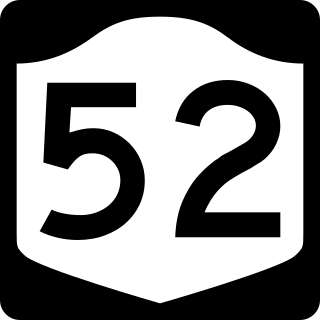
New York State Route 52 (NY 52) is a 108.72-mile-long (174.97 km) state highway in the southeastern part of the state. It generally runs from west to east through five counties, beginning at the Pennsylvania state line in the Delaware River near Narrowsburg, crossing the Hudson River on the Newburgh–Beacon Bridge, and ending in Carmel. NY 52 and NY 55, both major east–west routes of the Mid-Hudson Region, run parallel to each other, intersecting in downtown Liberty.

<span class="mw-page-title-main">New York State Route 55</span> State highway in southern New York, US

New York State Route 55 (NY 55) is a 122.45-mile-long (197.06 km) east-west state highway in southern New York, running from the Pennsylvania state line at the Delaware River in Barryville to the Connecticut state line at Wingdale. It is the only other state highway beside NY 7 to completely cross the state, from border to border, in an east–west direction, although NY 17 does so and is partially east–west. It also forms a concurrency when it joins US 44 for 33 miles (53 km).

<span class="mw-page-title-main">New York State Route 42</span> State highway in New York, US

New York State Route 42 (NY 42) is a north–south, discontinuous state highway in the Catskill Mountains region of New York in the United States. The southernmost of the highway's two segments begins at an intersection with U.S. Route 6 (US 6) and US 209 in Port Jervis and ends at a junction with NY 55 near the Rondout Reservoir in Neversink. NY 42's northern segment runs from NY 28 in Shandaken to NY 23A in Lexington. The 41-mile (66 km) southern segment is located in Orange County and Sullivan County, while the 11-mile (18 km) northern segment is in Ulster County and Greene County.

<span class="mw-page-title-main">New York State Route 17B</span> State highway in Sullivan County, New York, US

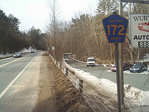
New York State Route 17B (NY 17B) is a state highway located entirely within Sullivan County, New York, in the United States. It connects the hamlet of Callicoon at its western end with the Monticello area in the east, ending at a junction with NY 17's exit 104, just northeast of Monticello.

<span class="mw-page-title-main">New York State Route 146</span> State highway in New York, US

New York State Route 146 (NY 146) is a state highway in the Capital District of New York in the United States. It extends for 43 miles (69 km) from Gallupville at NY 443 to near Mechanicville at U.S. Route 4 (US 4) and NY 32. NY 146 is a major thoroughfare in the city of Schenectady, just outside Albany. Most of the route follows an east–west alignment; however, the middle third of the route between Guilderland and Clifton Park runs in a more north–south manner in order to serve Schenectady. At one time, NY 146 had three spur routes; only one—NY 146A—still exists.

<span class="mw-page-title-main">New York State Route 353</span> State highway in Cattaraugus County, New York, US

New York State Route 353 (NY 353) is a north–south state highway located within Cattaraugus County, New York, in the United States. It extends for 23.97 miles (38.58 km) from an intersection with NY 417 in the city of Salamanca to a junction with U.S. Route 62 (US 62) in the hamlet of Dayton. In between, the route traverses isolated and undeveloped areas of the county, save for the villages of Little Valley and Cattaraugus. In the latter, NY 353 intersects and briefly overlaps with NY 242.

<span class="mw-page-title-main">New York State Route 91</span> State highway in central New York, US

New York State Route 91 (NY 91) is a north–south state highway in Central New York in the United States. The southern terminus of the route is located at an intersection with NY 13 in the Cortland County town of Truxton. Its northern terminus is located at a junction with NY 173 in the Onondaga County hamlet of Jamesville. In between, NY 91 serves the village of Fabius and the hamlet of Pompey, where it meets NY 80 and U.S. Route 20 (US 20), respectively.

<span class="mw-page-title-main">New York State Route 54</span> State highway in New York, US

New York State Route 54 (NY 54) is a state highway in the Finger Lakes region of New York in the United States. The southern terminus of the route is at an interchange with the Southern Tier Expressway in the village of Bath in Steuben County. Its northern terminus is at an intersection with NY 14 in the village of Dresden in Yates County. The section of NY 54 from Penn Yan to Dresden is signed as east–west. NY 54 serves as the eastern lakeside road along Keuka Lake. NY 54A, NY 54's alternate route between Hammondsport and Penn Yan, runs along the western and northern lakeshore.

<span class="mw-page-title-main">New York State Route 328</span> State highway in Chemung County, New York, US

New York State Route 328 (NY 328) is a northeast–southwest state highway located entirely within the town of Southport in Chemung County, New York, in the United States. The northeast end of NY 328 is at an intersection with NY 14 in the community of Southport, and the southwest terminus is at the Pennsylvania state line, where NY 328 continues on as Pennsylvania Route 328 (PA 328). NY 328 parallels Seeley Creek, a tributary of the Chemung River, for its entire length. The entirety of the 6.15-mile (9.90 km) route is part of Corridor U of the Appalachian Development Highway System.

<span class="mw-page-title-main">New York State Route 96B</span> State highway in New York, US

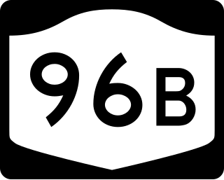
New York State Route 96B (NY 96B) is a north–south state highway in the Southern Tier of New York in the United States. It connects NY 96 in the village of Candor in Tioga County to NY 13, NY 34, and NY 96 in the city of Ithaca in Tompkins County. NY 96B approaches Ithaca from the south as Danby Road and then as South Aurora Street, before turning westward onto Clinton Street and proceeding to its northern terminus at a junction with NY 13, NY 34, and NY 96. The portion of NY 96B from the Ithaca city line to its northern terminus is maintained by the city.

The Newburgh and Cochecton Turnpike was a turnpike road in southern New York in the United States. It ran from Newburgh on the Hudson River west to Cochecton on the Delaware River, where travelers could continue west through Pennsylvania on the Cochecton and Great Bend Turnpike toward Binghamton. The road operated as a toll road from 1810 to 1872. It is now mostly maintained by the state, carrying New York State Route 17K (NY 17K) from Newburgh to Bloomingburg and NY 17B from Monticello to Fosterdale. Between Bloomingburg and Monticello, the turnpike has been bypassed by the Quickway (NY 17), and is now maintained by Sullivan County; similarly, the route west of Fosterdale to Cochecton is County Route 114 (CR 114). Across the Delaware River, Pennsylvania Route 371 (PA 371) leads west from the Cochecton–Damascus Bridge.

<span class="mw-page-title-main">New York State Route 402</span> Former highway in New York

New York State Route 402 (NY 402) was a state highway located within the village of Tivoli in Dutchess County, New York, in the United States. It was assigned in the early 1930s and served as a connector between NY 9G and what was once a ferry landing on the Hudson River west of the village. Although the ferry service linking Tivoli and the village of Saugerties was shut down in the 1940s, NY 402 continued to exist until 1980. On April 1 of that year, ownership and maintenance of the highway was transferred to Dutchess County as part of a highway maintenance swap between the county and the state of New York. The highway became part of an extended County Route 78 (CR 78), which had begun at the junction of NY 9G and NY 402 prior to the swap.

<span class="mw-page-title-main">New York State Route 393</span> Former highway in New York

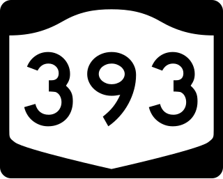
New York State Route 393 (NY 393) was an east–west state highway in Tompkins County, New York, in the United States. It was a spur route that connected the downtown district of the city of Ithaca to the Ithaca–Dryden town line. The western terminus of the route was at an intersection with NY 13 in East Ithaca. Its eastern terminus was at Game Farm Road, a local road that straddled the boundary between the towns of Ithaca and Dryden.

<span class="mw-page-title-main">Callicoon Bridge</span> Bridge in New York – Damascus Township, Pennsylvania

The Callicoon Bridge carries vehicles and pedestrians across the Delaware River between the unincorporated hamlet of Callicoon in the town of Delaware, part of Sullivan County, New York, and Damascus Township in Wayne County, Pennsylvania, both in the United States. It is a multi-girder structure of steel and concrete built in the early 1960s to replace an older bridge built in 1899.

<span class="mw-page-title-main">Cochecton–Damascus Bridge</span> Bridge in Damascus Twp., PA

The Cochecton–Damascus Bridge, sometimes called the Cochecton Dam Road Bridge, crosses the Delaware River in the United States between the unincorporated hamlet of Cochecton, in Sullivan County, New York, and Damascus Township, in Wayne County, Pennsylvania. On the Pennsylvania side it is the eastern terminus of State Route 371; in New York its approach road is County Route 114. It was built in 1950; bridges have crossed the river at that point since 1819.

<span class="mw-page-title-main">New York–Pennsylvania Joint Interstate Bridge Commission</span> American interstate bridge authority

The New York–Pennsylvania Joint Interstate Bridge Commission, or simply the Joint Interstate Bridge Commission, is an interstate agency jointly owned by the states of New York and Pennsylvania. The commission was formed in 1919 by the two states to manage the crossings of the Delaware River that connected them. It currently maintains and operates 10 toll-free bridges from the New Jersey–Pennsylvania state line to the end of Pennsylvania and New York's shared border along the Delaware River.

References

  1. "County Markers". New York Daily News . August 10, 1958. p. 16. Retrieved January 26, 2020 via Newspapers.com. Open Access logo PLoS transparent.svg
  2. 1 2 3 4 5 6 7 8 9 10 11 12 13 14 15 16 17 18 "County Roads Listing - Sullivan County" (PDF). New York State Department of Transportation. June 22, 2021. Retrieved August 13, 2021.
  3. 1 2 "New York's Main Highways Designated by Numbers". The New York Times . December 21, 1924. p. XX9.
  4. 1 2 Road Map & Historical Guide – New York (Map). Cartography by Rand McNally and Company. Sun Oil Company. 1935.
  5. 1 2 New York Road Map for 1938 (Map). Cartography by General Drafting. Esso. 1938.
  6. Rand McNally Road Atlas (eastern Pennsylvania) (Map). Rand McNally and Company. 1926. Retrieved June 18, 2009.
  7. Road Map of New York (Map). Cartography by General Drafting. Standard Oil Company of New York. 1930.
  8. New York (Map). Cartography by Rand McNally and Company. Sunoco. 1952.
  9. New York with Special Maps of Putnam–Rockland–Westchester Counties and Finger Lakes Region (Map) (1955–56 ed.). Cartography by General Drafting. Esso. 1954.
  10. New York and Metropolitan New York (Map). Cartography by Rand McNally and Company. Sinclair Oil Corporation. 1962.
  11. New York and Metropolitan New York (Map). Cartography by Rand McNally and Company. Sinclair Oil Corporation. 1964.
  12. New York (Map) (1969–70 ed.). Cartography by General Drafting. Esso. 1968.