List of county routes in Tompkins County, New York

Last updated

Tompkins CR 122 shield.jpg
CR 122 signage in Forest Home
Highway names
Interstates Interstate X (I-X)
US Highways U.S. Route X (US X)
State New York State Route X (NY X)
County:County Route X (CR X)
System links

County routes in Tompkins County, New York, are signed with the Manual on Uniform Traffic Control Devices-standard yellow-on-blue pentagon route marker.

Contents

Routes 100–150

Number [1] Length (mi) [1] Length (km)Southern or western terminusNorthern or eastern terminusLocal namesFormedRemovedNotes
CR 100 jct.svgCR 1006.4310.35 NY 34 in Lansing Spring Street Extension (CR 190) in Groton North Lansing School Road; West Groton Road
CR 101 jct.svgCR 1014.046.50Pleasant Valley Road (CR 153) in Groton Cayuga County line in Groton (becomes CR 50)Cobb Street
CR 101 jct.svgCR 1010.200.32 NY 34B in Dryden Groton town line in Dryden Cobb Road
CR 102 jct.svgCR 1024.036.49Stevens Road (CR 104) at Stevens Road in Groton Cayuga County line in Groton (becomes CR 102)Salt Road
CR 103 jct.svgCR 1031.692.72 NY 222 in Groton Champlin Road (CR 103A) in Groton Groton City Road
CR 103A jct.svgCR 103A2.053.30 NY 222 in Groton Cayuga County line in Groton (becomes CR 101)Champlin Road
CR 103B jct.svgCR 103B0.731.17Groton City Road (CR 103) in Groton Cayuga County line in Groton (becomes CR 163)Hinman Road
CR 104 jct.svgCR 1042.203.54Salt Road (CR 102) in Groton School Street (CR 105) in Groton Stevens Road
CR 105 jct.svgCR 1055.258.45 Freeville village line in Dryden Cortland County line in Groton (becomes CR 120)Fall Creek Road; School Street; and McLean–Cortland Road
CR 106 jct.svgCR 1062.003.22 NY 13 in Dryden School Street (CR 105) in Groton Gulf Hill Road
CR 107 jct.svgCR 1073.505.63 NY 34B  / NY 38 in Groton Fall Creek Road (CR 105) in Groton Peruville Road
CR 107A jct.svgCR 107A1.842.96 NY 34B in Groton Peruville Road (CR 107) in Groton Old Peruville Road
CR 108 jct.svgCR 1087.7912.54 NY 34 in Lansing NY 38 in Dryden Asbury Road; West Dryden Road
CR 108 jct.svgCR 1081.612.59Warren Road (CR 121) in Lansing Asbury Road in Dryden Farrell Road; West Dryden Road
CR 109 jct.svgCR 1096.6210.65 Cayuga Heights village line in Ithaca NY 13 in Dryden Hanshaw Road; Etna Road; Upper Creek Road; Etna Lane
CR 110 jct.svgCR 1104.937.93 Ithaca city line in Ithaca Ellis Hollow Creek Road (CR 164) in Dryden Mitchell Street Extension; Ellis Hollow RoadPart west of CR 173 was formerly part of NY 393
CR 113 jct.svgCR 1133.205.15Coddington Road (CR 119) in Caroline NY 79 in Caroline Caroline Depot Road; White Church Road, Lounsberry Road
CR 113A jct.svgCR 113A0.450.72Valley Road (CR 115) in Caroline Lounsberry Road (CR 113) in Caroline Old Brooktondale Road
CR 114 jct.svgCR 1140.580.93Valley Road (CR 115) in Caroline NY 79 in Caroline Boiceville Road
CR 115 jct.svg CR 115 12.9120.78 Tioga County line in Caroline (becomes CR 33) NY 79 in Dryden Old 76 Road; Central Chapel Road; Valley Road; Brooktondale RoadPart north of 76 Road was formerly NY 330
CR 115M jct.svg CR 115M 0.270.43Old 76 Road (CR 115) in Caroline Tioga County line in Caroline (becomes CR 33)Mill Road
CR 116 jct.svgCR 1161.111.79Coddington Road (CR 119) in Ithaca NY 79 in Ithaca Burns Road
CR 117 jct.svgCR 1174.38[ citation needed ]7.05 NY 79 in Caroline Cortland County line in Dryden (becomes CR 137)Harford RoadBriefly enters Tioga County as CR 29
CR 117A jct.svgCR 117A1.001.61 NY 79 in Caroline Harford Road (CR 117) in Caroline Flat Iron Road
CR 119 jct.svgCR 11910.6817.19 Tioga County line in Caroline (becomes CR 15) NY 96B in Ithaca Coddington Road
CR 121 jct.svgCR 1211.903.06Forest Home Drive in Ithaca Lansing village line in Ithaca Warren Road
CR 121 jct.svgCR 1212.974.78 NY 13 in Lansing village Asbury Road (CR 108) in Lansing Warren Road
CR 122 jct.svgCR 1220.600.97Forest Home Drive in Ithaca Cayuga Heights village line in Ithaca Pleasant Grove Road
CR 122 jct.svgCR 1222.584.15 Lansing village line in Lansing NY 34 in Lansing North Triphammer Road
CR 123 jct.svgCR 1235.879.45 NY 96B in Danby CR 119 in Ithaca Hornbrook Road; Nelson Road; Troy Road
CR 124 jct.svgCR 1240.861.38Warren Road (CR 121) in Lansing village NY 13 in Lansing village Brown Road
CR 125 jct.svgCR 1254.827.76 Tioga County line in Danby (becomes CR 5) NY 96B in Danby South Danby Road
CR 126 jct.svgCR 1262.123.41Comfort Road in Danby NY 96B in Danby Bald Hill Road
CR 127 jct.svgCR 1271.001.61Comfort Road (CR 128) in Danby NY 96B in Danby West Miller Road
CR 128 jct.svgCR 1286.069.75Comfort Road / Jersey Hill Road in Danby NY 96B in Danby Jersey Hill Road; Gunderman Road; Comfort Road [fn 1]
CR 129 jct.svgCR 1292.003.22Vankirk Road (CR 132) in Newfield Shaffer Road (CR 131) in Newfield Van Buskirk Gulf Road
CR 130 jct.svgCR 1301.923.09Main Street in Newfield NY 34  / NY 96 in Newfield Newfield Depot Road
CR 131 jct.svgCR 1316.6210.65 Chemung County line in Newfield (becomes CR 13)Main Street in Newfield Shaffer Road
CR 131A jct.svgCR 131A0.931.50Shaffer Road (CR 131) in Newfield Newfield Depot Road (CR 130) in Newfield Adams Road
CR 132 jct.svgCR 1325.669.11 Schuyler and Tioga county lines in Newfield [fn 2] Main Street in Newfield Van Kirk Road
CR 133 jct.svgCR 1336.079.77Main Street in Newfield NY 327 in Enfield Trumbulls Corners Road
CR 133A jct.svgCR 133A1.562.51 NY 13 in Newfield Test Road in Newfield Sebring Road
CR 134 jct.svgCR 1343.796.10Trumbulls Corners Road (CR 133) in Newfield NY 13 in Newfield Millard Hill Road
CR 135 jct.svgCR 1350.821.32 Schuyler County line in Newfield (becomes CR 12) NY 13 in Newfield Cayuta Road
CR 136 jct.svgCR 13610.9417.61Trumbulls Corners Road (CR 133) in Enfield Trumansburg village line in Ulysses Connecticut Hill Road; Black Oak Road; Waterburg Road; South Street Extension
CR 137 jct.svgCR 1374.206.76South Applegate Road (CR 143) in Enfield NY 13A in Ithaca Bostwick Road
CR 139 jct.svgCR 1394.607.40Halseyville Road (CR 170) in Enfield NY 96 in Ithaca Hayts Road
CR 140 jct.svgCR 1403.766.05 NY 96 in Ithaca Kraft Road (CR 145) in Ulysses Duboise Road
CR 141 jct.svgCR 1412.554.10Iradell Road (CR 177) / Sheffield Road (CR 172) in Ulysses Dubois Road (CR 140) in Ulysses Krums Corners Road
CR 142 jct.svgCR 1427.7512.47 Schuyler County line in Ulysses (becomes CR 3) NY 89 in Ulysses Perry City Road
CR 143 jct.svgCR 1437.7612.49Bostwick Road (CR 137) in Enfield Taughannock Park Road (CR 143A) in Ulysses South Applegate Road; North Applegate Road; Jacksonville Road
CR 143A jct.svgCR 143A1.141.83 NY 96 in Ulysses Falls Road in Ulysses Taughannock Park Road
CR 144 jct.svgCR 1440.681.09Willow Creek Road / Agard Road in Ulysses Kraft Road (CR 145) in Ulysses Willow Creek Road
CR 145 jct.svgCR 1452.584.15Jacksonville Road (CR 143) in Ulysses NY 89 in Ulysses Kraft Road
CR 146 jct.svgCR 1465.228.40 NY 79 in Enfield Waterburg Road (CR 136) in Ulysses Podunk Road
CR 147 jct.svgCR 1471.993.20Podunk Road (CR 146) in Ulysses NY 96 in Ulysses Swamp College Road
CR 149 jct.svgCR 1491.211.95 Schuyler County line in Ulysses (becomes CR 1) Trumansburg village line in Ulysses Searsburg Road
CR 150 jct.svgCR 1501.512.43Cement plant gate in Lansing NY 34B in Lansing Portland Point Road

Routes 151 and up

Number [1] Length (mi) [1] Length (km)Southern or western terminusNorthern or eastern terminusLocal namesFormedRemovedNotes
CR 151 jct.svgCR 1514.427.11 NY 34B in Lansing North Lansing School Road (CR 100) in Lansing Vanostrand Road
CR 153 jct.svgCR 1533.094.97 Lansing town line in Groton Smith Road (CR 178) in Groton Pleasant Valley Road
CR 154 jct.svgCR 1542.504.02 NY 34 in Lansing Cayuga County line in Lansing (becomes CR 48)Locke Road
CR 155 jct.svgCR 1554.717.58 NY 34B in Lansing Cayuga County line in Lansing (becomes CR 32)Lansingville Road
CR 156 jct.svgCR 1560.490.79Milliken Station Road in Lansing NY 34B in Lansing Cayuga Drive
CR 159 jct.svgCR 1591.522.45 NY 34B in Lansing NY 34B in Lansing Brickyard Road; Ludlowville Road
CR 161 jct.svgCR 1612.063.32Ellis Hollow Road (CR 110) in Dryden NY 366 in Dryden Turkey Hill Road
CR 162 jct.svgCR 1624.827.76 NY 79 in Caroline Ringwood Road (CR 164) in Dryden Midline Road
CR 162A jct.svgCR 162A5.238.42Midline Road (CR 162) in Dryden NY 13 in Dryden Irish Settlement Road
CR 163 jct.svgCR 1632.483.99 NY 13 in Dryden Fall Creek Road (CR 105) in Dryden North Road
CR 164 jct.svgCR 1647.4712.02 NY 79 in Caroline NY 13 in Dryden Ellis Hollow Road; Ellis Hollow Creek Road; Ringwood Road
CR 166 jct.svgCR 1662.053.30West Dryden Road (CR 108) in Dryden NY 34B in Dryden Caswell Road
CR 169 jct.svgCR 1692.504.02Peruville Road (CR 107) in Groton Groton village line in Groton Lick Street; South Main Street Extension
CR 170 jct.svgCR 1705.318.55 NY 79 in Enfield NY 96 in Ulysses Halseyville Road
CR 171 jct.svgCR 1711.452.33 NY 38 in Groton Cayuga County line in Groton (becomes CR 161)Chipman Corners
CR 172 jct.svgCR 1723.926.31Bostwick Road (CR 137) in Ithaca Iradell Road (CR 177) / Krums Corners Road (CR 141) in Ithaca Sheffield Road
CR 173 jct.svgCR 1731.231.98Ellis Hollow Road (CR 110) in Ithaca NY 366 in Ithaca Game Farm Road
CR 174 jct.svgCR 1741.602.57 NY 79 in Ithaca NY 366 in Ithaca Pine Tree Road
CR 175 jct.svgCR 1750.590.95Brooktondale Road (CR 115) in Caroline NY 79 in Caroline Besemer Road
CR 177 jct.svgCR 1775.809.33Waterburg Road (CR 136) in Enfield NY 96 in Ithaca Iradell Road
CR 177A jct.svgCR 177A0.220.35Iradell Road (CR 177) in Ulysses Krums Corners Road (CR 141) in Ulysses Iradell Road Extension
CR 178 jct.svgCR 1784.357.00Old Peruville Road (CR 107A) in Groton West Groton Road (CR 100) in Groton Pleasant Valley Road; Smith Road
CR 179 jct.svgCR 1792.053.30 NY 96B in Ithaca Coddington Road (CR 119) in Ithaca East King Road
CR 180 jct.svgCR 1802.984.80School Street (CR 105) in Groton NY 222 in Groton Church Street; Lafayette Road
CR 181 jct.svgCR 1811.692.72CR 154 in Lansing CR 101 in Groton West Groton Road; Talmadge Road
CR 182 jct.svgCR 1825.098.19Etna Road (CR 109) in Dryden NY 34B in Dryden Hanshaw Road; Neimi Road; Sheldon Road
CR 182H jct.svgCR 182H1.031.66Neimi Road (CR 182) in Dryden West Dryden Road (CR 108) in Dryden Hanshaw Road
CR 183 jct.svgCR 1830.991.59 Schuyler County line in Enfield Black Oak Road (CR 136) in Enfield Weatherby Road
CR 184 jct.svgCR 1842.233.59 NY 34B in Lansing Lansingville Road (CR 155) in Lansing Jerry Smith Road
CR 185 jct.svgCR 1851.602.57 NY 34B in Lansing Cayuga County line in Lansing (becomes CR 157)Lake Ridge Road
CR 186 jct.svgCR 1864.427.11 NY 34B in Lansing NY 34 in Lansing Conlon Road
CR 187 jct.svgCR 1872.103.38 NY 34  / NY 96 in Danby Tioga County line in Danby (becomes CR 1)Hillview Road; Michigan Hollow Road
CR 187 jct.svgCR 1870.060.097 NY 34  / NY 96 in Danby Hillview Road (CR 187) in Danby Hillview Road Spur
CR 188 jct.svgCR 1880.430.69 NY 34  / NY 96 in Danby Norfolk Southern Railway crossing in Danby Station Road
CR 189 jct.svgCR 1892.964.76 NY 34B in Lansing Lansingville Road (CR 155) in Lansing Fenner Road
CR 190 jct.svgCR 1903.415.49West Groton Road (CR 101) in Groton Groton village line in Groton Spring Street Extension

See also

Notes

  1. The southern portion is a loop comprising Jersey Hill, Gunderman, and Comfort roads. The route follows Comfort Road north of Jersey Hill Road to reach NY 96B.
  2. Road continues south along the Schuyler–Tioga county line, co-designated as CR 54 by Chemung County and CR 13 by Schuyler County.

Related Research Articles

<span class="mw-page-title-main">New Jersey Route 70</span> Highway in New Jersey

Route 70 is a state highway located in the U.S. state of New Jersey. It extends 59.84 mi (96.30 km) from an interchange with Route 38 in Pennsauken Township, Camden County, east to an intersection with Route 34 and Route 35 in Wall Township, Monmouth County. Route 70 cuts across the middle of the state as a two-lane highway through the Pine Barrens in Burlington and Ocean counties. A popular truck route, it provides access between Philadelphia and the surrounding Delaware Valley metropolitan area and the Jersey Shore resorts, particularly Long Beach Island by way of Route 72. It is also a congested commercial route within Philadelphia's New Jersey suburbs. The western section in Cherry Hill and Marlton is a four- to eight-lane divided highway that serves as a major suburban arterial and is locally known as Marlton Pike. The eastern section in Monmouth and Ocean counties is also a multilane divided highway that runs through suburban areas. Route 70 is officially known as the John Davison Rockefeller Memorial Highway its entire length in honor of John Davison Rockefeller.

<span class="mw-page-title-main">New Jersey Route 10</span> State highway in northern New Jersey, US

Route 10 is a 23.51 mi (37.84 km) state highway in the northern part of the U.S. state of New Jersey. It runs from an intersection with U.S. Route 46 in Roxbury Township, Morris County, east to County Route 577 /CR 677 in West Orange, Essex County. Route 10 is a major route through northern New Jersey that runs through Ledgewood, East Hanover, and Livingston. It is a four-lane highway for most of its length with the exception of the easternmost part of the route. Route 10 features intersections with many major roads including Route 53 and US 202 in Morris Plains and Interstate 287 (I-287) in Hanover Township.

<span class="mw-page-title-main">New Jersey Route 45</span> State highway in southern, New Jersey, US

Route 45 is a state highway in the southern part of New Jersey. It runs 28.51 mi (45.88 km) from Route 49 in Salem, Salem County, northeast to U.S. Route 130 in Westville, Gloucester County. The route is signed as a north-south highway. Much of the southern part of the route runs through rural areas of Salem and Gloucester counties, passing through the communities of Woodstown and Mullica Hill. North of Mullica Hill, Route 45 runs through suburban areas, with the portion of the route between the northern border of Mantua Township and the southern border of Woodbury a four-lane divided highway. The route intersects many highways, including US 40 in Woodstown, Route 77 and US 322 in Mullica Hill, and Interstate 295 (I-295) in West Deptford Township.

<span class="mw-page-title-main">New Jersey Route 77</span> State highway in southern, New Jersey, US

Route 77 is a state highway in the southern part of the U.S. state of New Jersey. It runs 22.55 mi (36.29 km) from an intersection with Route 49 in Bridgeton in Cumberland County north to a junction with Route 45 in Mullica Hill in Gloucester County. It is a mostly two-lane, undivided road traversing through farmland in Cumberland, Salem, and Gloucester Counties. Along the way, Route 77 intersects Route 56 in Upper Deerfield Township and U.S. Route 40 in Upper Pittsgrove Township.

<span class="mw-page-title-main">New Jersey Route 208</span> State highway in Bergen and Passaic counties in New Jersey, United States

Route 208 is an expressway in the northern part of New Jersey in the United States. It runs 10.07 miles (16.21 km) from an interchange with Route 4 and County Route 79 in Fair Lawn northwest to an interchange with Interstate 287 (I-287) in Oakland. The route runs through suburban areas of Bergen and Passaic counties as a four- to six-lane divided highway. It is an expressway, as intersections with cross roads are controlled by interchanges, but is not a freeway as several driveways exist. The route runs through the communities of Fair Lawn, Glen Rock, Hawthorne, Wyckoff, and Franklin Lakes along the way, interchanging with CR 507 in Fair Lawn and CR 502 in Franklin Lakes.

<span class="mw-page-title-main">Interstate 280 (New Jersey)</span> Highway in New Jersey

Interstate 280 (I-280) is a 17.85-mile (28.73 km) Interstate Highway in the US state of New Jersey. It provides a spur from I-80 in Parsippany–Troy Hills, Morris County, east to Newark and I-95 in Kearny, Hudson County. In Kearny, access is provided toward the Holland Tunnel and Lincoln Tunnel to New York City. The western part of the route runs through suburban areas of Morris and Essex counties, crossing the Watchung Mountains. Upon reaching The Oranges, the setting becomes more urbanized and I-280 runs along a depressed alignment before ascending again in Newark. I-280 includes a vertical-lift bridge, the William A. Stickel Memorial Bridge, over the Passaic River between Newark and East Newark/Harrison. The highway is sometimes called the Essex Freeway. I-280 interchanges with several roads, including the Garden State Parkway in East Orange and Route 21 in Newark.

<span class="mw-page-title-main">New York State Route 366</span> State highway in Tompkins County, New York, US

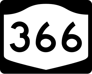
New York State Route 366 (NY 366) is an east–west state highway located entirely within Tompkins County in the Finger Lakes region of New York in the United States. It runs for 9.40 miles (15.13 km) from State Street (NY 79) just east of downtown Ithaca to NY 38 in Freeville. NY 366 parallels Fall Creek from Varna to Freeville and passes along the southern edge of the Cornell University campus. NY 366 was assigned as part of the 1930 renumbering of state highways in New York; however, it was initially nothing more than a connector between NY 13 in Etna and NY 38 in Freeville. In the 1960s, NY 13 was moved onto a new expressway bypassing Ithaca to the west and north. The former surface routing of NY 13 into downtown Ithaca became an extension of NY 366.

<span class="mw-page-title-main">New York State Route 222</span> State highway in central New York, US

New York State Route 222 (NY 222) is a 10.57-mile-long (17.01 km) east–west state highway in central New York in the United States. It runs from an intersection with NY 38 in the village of Groton in northeastern Tompkins County to a junction with the conjoined routes of U.S. Route 11, NY 13, and NY 41 in the city of Cortland in western Cortland County. NY 222 passes through the town of Cortlandville, where it intersects NY 281 and serves Cortland County–Chase Field Airport. The road was acquired by the state of New York in the early 20th century and designated NY 222 as part of the 1930 renumbering of state highways in New York.

<span class="mw-page-title-main">New York State Route 392</span> State highway in New York, US

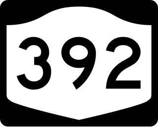
New York State Route 392 (NY 392) is an east–west state highway in the Southern Tier region of New York in the United States. The western terminus of the route is at an intersection with the concurrency of NY 13 and NY 38 in the village of Dryden in Tompkins County. Its eastern terminus is at a junction with U.S. Route 11 (US 11) in the hamlet of Messengerville within the Cortland County town of Virgil. NY 392 passes through the hamlet of Virgil, where it intersects NY 215.

<span class="mw-page-title-main">New York State Route 34B</span> State highway in central New York, US

New York State Route 34B (NY 34B) is a north–south state highway located within Tompkins and Cayuga counties in Central New York in the United States. Its northern terminus is located at a junction with NY 34 by the hamlet of Fleming within the town of the same name in Cayuga County. The southern terminus is located at a junction with NY 38 in the town of Dryden in Tompkins County.

In the U.S. state of New York, county routes exist in all 62 counties except those in the five boroughs of New York City. Most are maintained locally by county highway departments. County route designations are assigned at the county level; as a result, routes often change numbers as they cross from one county to the next due to the lack of a statewide numbering system and lack of coordination between counties. Some exceptions exist, such as County Route 36 (CR 36) in Ontario County and CR 36A in Livingston County. The assignment of routes by individual counties also results in varying system density and numbering and signage practices between the state's counties.

<span class="mw-page-title-main">New York State Route 228</span> State highway in Schuyler County, New York, US

New York State Route 228 (NY 228) is a state highway in Schuyler County, New York, in the United States. It runs for 12.47 miles (20.07 km) in a northeast to southwest direction from an intersection with NY 224 in the village of Odessa to a junction with NY 227 in the hamlet of Perry City within the town of Hector. NY 228 has a short overlap with NY 79 in the Hector community of Mecklenburg. The route was assigned as part of the 1930 renumbering of state highways in New York; however, it initially ended at NY 79 in Mecklenburg, from where NY 79 went north to Perry City. NY 79 was realigned to head west from Mecklenburg in the early 1960s, at which time the NY 228 designation was extended northward over NY 79's former routing.

<span class="mw-page-title-main">New York State Route 227</span> Highway in New York

New York State Route 227 (NY 227) is a state highway in the Finger Lakes region of New York in the United States. The highway extends for 9.84 miles (15.84 km) in a northeast–southwest direction from an intersection with NY 79 south of the hamlet of Reynoldsville in the town of Hector to a junction with NY 96 in the village of Trumansburg. In between, NY 227 intersects NY 228 in Perry City by the east town line of Hector and passes through the town of Ulysses. Part of NY 227 straddles the Schuyler–Tompkins county line.

<span class="mw-page-title-main">New York State Route 226</span> State highway in New York, United States

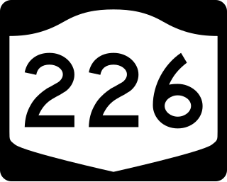
New York State Route 226 (NY 226) is a 19.03-mile-long (30.63 km) north–south state highway in the Finger Lakes region of New York in the United States. The southern terminus of the route is at an interchange with the Southern Tier Expressway just west of the Savona village line in the town of Bath. Its northern terminus is at an intersection with NY 14A in the town of Reading.

<span class="mw-page-title-main">County Route 508 (New Jersey)</span> County highway in New Jersey, U.S.

County Route 508 is a county highway in the U.S. state of New Jersey. The highway extends 16.14 miles (25.97 km) from Mount Pleasant Avenue in Livingston to Belleville Turnpike in Kearny.

<span class="mw-page-title-main">County Route 507 (New Jersey)</span> Highway in New Jersey

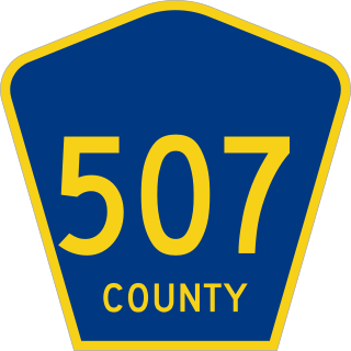
County Route 507 is a county highway in the U.S. state of New Jersey. The highway extends 28.37 mi (45.66 km) from Harrison Avenue on the Kearny-Harrison town line to the New York state line in Mahwah. Between Ho-Ho-Kus and Mahwah, this highway is known as Franklin Turnpike. At its northern terminus, County Route 507 continues north into New York as Orange Avenue, which is a portion of U.S. Route 202 (US 202).

<span class="mw-page-title-main">New York State Route 96B</span> State highway in New York, US

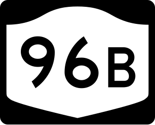
New York State Route 96B (NY 96B) is a north–south state highway in the Southern Tier of New York in the United States. It connects NY 96 in the village of Candor in Tioga County to NY 13, NY 34, and NY 96 in the city of Ithaca in Tompkins County. NY 96B approaches Ithaca from the south as Danby Road and then as South Aurora Street, before turning westward onto Clinton Street and proceeding to its northern terminus at a junction with NY 13, NY 34, and NY 96. The portion of NY 96B from the Ithaca city line to its northern terminus is maintained by the city.

<span class="mw-page-title-main">U.S. Route 322 in New Jersey</span> Highway in New Jersey

U.S. Route 322 is a spur of U.S. Route 22, running from Cleveland, Ohio, east to Atlantic City, New Jersey. The easternmost segment of the route in New Jersey runs 62.64 miles (100.81 km) from the Commodore Barry Bridge over the Delaware River in Logan Township, Gloucester County, where it continues southeast to Atlantic Avenue and Pacific Avenue in Atlantic City, Atlantic County. The portion of the route between the Commodore Barry Bridge and Route 42 in Williamstown is mostly a two-lane undivided road that is concurrently signed with County Route 536 (CR 536), passing through Mullica Hill and Glassboro. From Williamstown, US 322 follows the Black Horse Pike, a four-lane road, southeast to Atlantic City. In Hamilton Township, Atlantic County, US 322 forms a concurrency with U.S. Route 40, continuing with that route all the way to Atlantic City. US 322 intersects several major roads including U.S. Route 130 and Interstate 295 (I-295) in Logan Township, the New Jersey Turnpike in Woolwich Township, Route 55 in Harrison Township, Route 42 in Williamstown, Route 50 and U.S. Route 40 in Hamilton Township, the Garden State Parkway in Egg Harbor Township, and U.S. Route 9 in Pleasantville.

<span class="mw-page-title-main">County Route 115 (Tompkins County, New York)</span> County route in New York

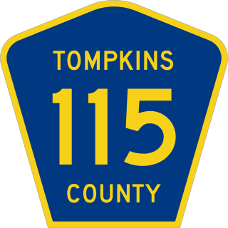
County Route 115 (CR 115) is a northwest–southeast county highway located mostly within the town of Caroline in Tompkins County, New York, in the United States. It extends for 12.8 miles (20.6 km) from the Tioga County line south of the hamlet of Speedsville to an intersection with New York State Route 79 (NY 79) just north of the Caroline town line in the town of Dryden. The highway continues into Tioga County as CR 33. The portion of CR 115 north of the hamlet of Guide Board Corners was originally designated as New York State Route 330 and maintained by the state of New York. NY 330 existed from the early 1930s to 1980, when ownership and maintenance of the highway was transferred to Tompkins County.

References

  1. 1 2 3 4 Office of Technical Services (August 11, 2015). "County Roads Listing, Tompkins County" (PDF). Engineering Division, New York State Department of Transportation . Retrieved April 9, 2016.