List of geological features on Rhea

Last updated

This is a list of named geological features on Rhea, the second largest moon of Saturn. [1] Planetary features are approved by the International Astronomical Union's (IAU) Working Group for Planetary System Nomenclature (WGPSN). [2]

Contents

Catenae

A catena /kəˈtnə/ is a crater chain.

CatenaNamed afterNotes
Koykamou Catena Koykamou, a mountain in Nganasan mythology
Mouru Catena Merv, holy land in Persian mythology
Onokoro Catenae Onokoro, mythical island in Japanese mythology
Puchou Catenae Pu Chou Mountain in Chinese mythology Formerly classified as a chasma
Thebeksan Catena Thebeksan, holy mountain in Korean mythology
Wungaran Catenae Wungaran, sacred place in Kakadu, Australia

Chasmata

Rhean chasms are called chasmata. They are named after sacred places in world mythologies.

ChasmaNamed after
Avaiki Chasmata Avaiki, the underworld in Cook Islands mythology
Galunlati Chasmata ᎦᎸᎳᏗ galvladi (galvv́ládii) "the above": the land above the sky in Cherokee mythology
Kun Lun Chasma was reclassified as a linea in 2010 (see below)
Pu Chou Chasma was reclassified as a catena in 2010 (see above)
Pulag Chasma Pulag, sacred mountain in Igorot mythology
Vaupas Chasma Vaupas, a river in the mythology of the Cuebo of Colombia
Yamsi Chasmata Yamsi, lodge of the North Wind in Klamath mythology

Craters

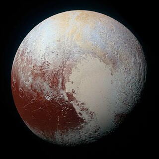
Rhean craters are named after figures from the mythologies of mostly non-European cultures. As of 2017, there are 128 named craters. [3]

CraterCoordinateNamed after
Aananin 34°54′N339°54′W / 34.9°N 339.9°W / 34.9; -339.9 Aananin (Korean)
Abassi 21°18′S146°30′W / 21.3°S 146.5°W / -21.3; -146.5 Abassi (Efik)
Adjua 40°12′N118°54′W / 40.2°N 118.9°W / 40.2; -118.9 Adjua (Ulch people of Siberia)
Agunua 63°18′N66°12′W / 63.3°N 66.2°W / 63.3; -66.2 Agunua (Solomon Islands)
Ameta 53°18′N21°54′W / 53.3°N 21.9°W / 53.3; -21.9 Ameta (Seram, Indonesia)
Anguta 25°42′N190°00′W / 25.7°N 190.0°W / 25.7; -190.0 Anguta (Inuit)
Arunaka 15°18′S22°06′W / 15.3°S 22.1°W / -15.3; -22.1 Arunaka (Incan)
Atum 47°06′S1°06′W / 47.1°S 1.1°W / -47.1; -1.1 Atum (Egyptian)
Awonawilona 37°18′S150°18′W / 37.3°S 150.3°W / -37.3; -150.3 Awonawilona (Zuni)
Bulagat 38°12′S15°12′W / 38.2°S 15.2°W / -38.2; -15.2 Bulagat (Buryat people of Siberia)
Bumba 63°06′N50°24′W / 63.1°N 50.4°W / 63.1; -50.4 Bumba (Bushongo people of the Congo)
Burkhan 66°48′N310°36′W / 66.8°N 310.6°W / 66.8; -310.6 Burkhan (Buryat people of Siberia)
Chingaso 17°06′S106°00′W / 17.1°S 106.0°W / -17.1; -106.0 Chingaso (Jivaro)
Con 25°48′S12°42′W / 25.8°S 12.7°W / -25.8; -12.7 Kon (Incan)
Dangun 7°12′N208°00′W / 7.2°N 208.0°W / 7.2; -208.0 Dangun (Korean)
Djuli 31°12′S46°42′W / 31.2°S 46.7°W / -31.2; -46.7 Djuli (Neghidahan people of Ukraine)
Dohitt 18°00′S74°06′W / 18.0°S 74.1°W / -18.0; -74.1 Dohitt (Mosetene, people of north Bolivia)
Ellyay 71°24′N91°48′W / 71.4°N 91.8°W / 71.4; -91.8 Ellyay (Yakut people of Siberia)
Faro 45°18′N114°00′W / 45.3°N 114.0°W / 45.3; -114.0 Faro (Mandé peoples of West Africa)
Fatu 7°42′N176°06′W / 7.7°N 176.1°W / 7.7; -176.1 Fatu (Samoan)
Gborogboro 12°42′S162°12′W / 12.7°S 162.2°W / -12.7; -162.2 Gborogboro (Lugbara)
Gmerti 52°00′S192°36′W / 52.0°S 192.6°W / -52.0; -192.6 Gmerti (Georgian)
Gucumatz 37°00′N175°48′W / 37.0°N 175.8°W / 37.0; -175.8 Gukumatz (Maya)
Haik 36°36′S29°18′W / 36.6°S 29.3°W / -36.6; -29.3 Haik (Armenian)
Haoso 8°18′N12°30′W / 8.3°N 12.5°W / 8.3; -12.5 Haoso (Manchuria)
Heller 10°06′N315°06′W / 10.1°N 315.1°W / 10.1; -315.1 Heller (Auracanin)
Huracan 53°12′N188°30′W / 53.2°N 188.5°W / 53.2; -188.5 Huracan (Kiche)
Imberombera 33°18′S216°42′W / 33.3°S 216.7°W / -33.3; -216.7 Imberombera (Kakadu)
Inktomi 14°06′S112°06′W / 14.1°S 112.1°W / -14.1; -112.1 Iktomi (Lakota)
Inmar 2°18′S301°36′W / 2.3°S 301.6°W / -2.3; -301.6 Inmar (Udmurtian)
Iraca 39°24′N112°06′W / 39.4°N 112.1°W / 39.4; -112.1 Iraca (Incan)
Izanagi 49°24′S310°12′W / 49.4°S 310.2°W / -49.4; -310.2 Izanagi (Japanese)
Izanami 46°18′S313°24′W / 46.3°S 313.4°W / -46.3; -313.4 Izanami (Japanese)
Jumo 52°48′N66°30′W / 52.8°N 66.5°W / 52.8; -66.5 Jumo (Marijan people of the Volga)
Karora 5°54′N20°06′W / 5.9°N 20.1°W / 5.9; -20.1 Karora (Aranda people of Australia)
Khado 41°36′N359°06′W / 41.6°N 359.1°W / 41.6; -359.1 Khado (Nganasan)
Kiho 11°06′S358°42′W / 11.1°S 358.7°W / -11.1; -358.7 Kiho (Polynesian)
Kuksu 25°18′N288°42′W / 25.3°N 288.7°W / 25.3; -288.7 Kuksu (Pomo)
Kuma 10°00′N277°12′W / 10.0°N 277.2°W / 10.0; -277.2 Kuma (Yaruro)
Kumpara 9°36′N327°06′W / 9.6°N 327.1°W / 9.6; -327.1 Kumpara (Jivaro people of Ecuador)
Leza 21°48′S309°12′W / 21.8°S 309.2°W / -21.8; -309.2 Leza (Tongan)
Lowa 40°54′N16°36′W / 40.9°N 16.6°W / 40.9; -16.6 Lowa (Marshall Islands)
Luli 46°30′N243°06′W / 46.5°N 243.1°W / 46.5; -243.1 Luli (Mansi)
Madumda 36°54′S64°48′W / 36.9°S 64.8°W / -36.9; -64.8 Madumda (Pomo)
Maheo 31°36′N281°42′W / 31.6°N 281.7°W / 31.6; -281.7 Maheo (Cheyenne)
Malunga 65°06′N56°12′W / 65.1°N 56.2°W / 65.1; -56.2 Malunga (Bantu)
Mamaldi 14°N184°W / 14°N 184°W / 14; -184 Mamaldi (Nanai) (Tungusic people of the Amur River area)
Manoid 29°30′N8°30′W / 29.5°N 8.5°W / 29.5; -8.5 Manoid (Negrito people of the Malay Peninsula)
Melo 53°12′S7°06′W / 53.2°S 7.1°W / -53.2; -7.1 Melo (Minyong people of India)
Mubai 55°48′N20°12′W / 55.8°N 20.2°W / 55.8; -20.2 Mubai (Tibetan)
Napi 26°54′N174°48′W / 26.9°N 174.8°W / 26.9; -174.8 Napi (Blackfoot)
Nishanu 9°00′S129°00′W / 9.0°S 129.0°W / -9.0; -129.0 Nishanu (Arikara)
Num 24°00′N92°42′W / 24.0°N 92.7°W / 24.0; -92.7 Num (Samoyed)
Nzame 9°00′N24°54′W / 9.0°N 24.9°W / 9.0; -24.9 Nzame (Fang)
Obatala 1°06′S269°42′W / 1.1°S 269.7°W / -1.1; -269.7 Obatala (Yoruba)
Olorun 24°42′N155°24′W / 24.7°N 155.4°W / 24.7; -155.4 Olorun (Yoruba)
Ormazd 52°30′N58°30′W / 52.5°N 58.5°W / 52.5; -58.5 Ormazd (Zoroastrian)
Pachacamac 23°24′S83°42′W / 23.4°S 83.7°W / -23.4; -83.7 Pachacamac (Inca)
Pan Ku 65°42′N107°42′W / 65.7°N 107.7°W / 65.7; -107.7 Pan Ku (Hmong)
Pedn 46°00′N351°42′W / 46.0°N 351.7°W / 46.0; -351.7 Pedn (Negrito people of the Malay Peninsula)
Pokoh 71°42′S326°24′W / 71.7°S 326.4°W / -71.7; -326.4 Pokoh (Pallawonaps)
Pouliuli 16°54′S284°24′W / 16.9°S 284.4°W / -16.9; -284.4 Pouliuli (Hawaiian)
Powehiwehi 8°12′S280°24′W / 8.2°S 280.4°W / -8.2; -280.4 Powehiwehi (Hawaiian)
Puntan 33°54′N292°24′W / 33.9°N 292.4°W / 33.9; -292.4 Puntan (Chamorro)
Qat 23°48′S351°36′W / 23.8°S 351.6°W / -23.8; -351.6 Qat (New Hebrides)
Samni 47°42′S90°42′W / 47.7°S 90.7°W / -47.7; -90.7 Samni (Kachins)
Seveki 12°54′N164°42′W / 12.9°N 164.7°W / 12.9; -164.7 Seveki (Evenki)
Shedi 53°30′S346°48′W / 53.5°S 346.8°W / -53.5; -346.8 Shedi (Minyong)
Sholmo 12°00′N346°24′W / 12.0°N 346.4°W / 12.0; -346.4 Sholmo (Buryat people of Siberia)
Taaroa 16°30′N95°30′W / 16.5°N 95.5°W / 16.5; -95.5 Ta'aroa (Hawaiian)
Tane 12°30′S57°24′W / 12.5°S 57.4°W / -12.5; -57.4 Tāne (Māori)
Tawa 17°54′N175°12′W / 17.9°N 175.2°W / 17.9; -175.2 Tawa (Hopi)
Thunupa 45°36′N21°18′W / 45.6°N 21.3°W / 45.6; -21.3 Thunpa (Incan)
Tika 25°06′N84°06′W / 25.1°N 84.1°W / 25.1; -84.1 Tika (Abkhazia)
Tirawa 34°12′N151°42′W / 34.2°N 151.7°W / 34.2; -151.7 Tirawa (Pawnee)
Tore 0°00′N335°36′W / 0.0°N 335.6°W / 0.0; -335.6 Tore (Pygmy people of Africa)
Torom 68°06′S343°30′W / 68.1°S 343.5°W / -68.1; -343.5 Torom (Ostiak people of Siberia)
Tsuki-Yomi 35°00′N43°48′W / 35.0°N 43.8°W / 35.0; -43.8 Tsukuyomi-no-Mikoto (Japanese)
Tuwale 78°00′S242°24′W / 78.0°S 242.4°W / -78.0; -242.4 Tuwale (Ceram)
Uku 78°42′N95°30′W / 78.7°N 95.5°W / 78.7; -95.5 Uku (Estonian)
Wakonda 48°36′N269°42′W / 48.6°N 269.7°W / 48.6; -269.7 Wakonda (Sioux)
Wende 56°18′S226°24′W / 56.3°S 226.4°W / -56.3; -226.4 Wende (Mossi)
Whanin 66°54′N115°00′W / 66.9°N 115.0°W / 66.9; -115.0 Hwanin (Korean)
Wuraka 25°06′N4°00′W / 25.1°N 4.0°W / 25.1; -4.0 Wuraka (Kakadu people of Australia)
Woyengi 13°42′N294°30′W / 13.7°N 294.5°W / 13.7; -294.5 Woyengi (Ijaw)
Wulbari 67°00′N88°54′W / 67.0°N 88.9°W / 67.0; -88.9 Wulbari (Krachi  [ fr ])
Xamba 2°06′N349°42′W / 2.1°N 349.7°W / 2.1; -349.7 Xamba (unidentified, purportedly "Bushman")
Xowalaci 2°24′N56°18′W / 2.4°N 56.3°W / 2.4; -56.3 Xowalaci (Joshua)
Xu 55°00′N71°54′W / 55.0°N 71.9°W / 55.0; -71.9 !Xu (various San peoples, a loanword to translate "Lord" in the Bible)
Yu-Ti 50°06′N81°30′W / 50.1°N 81.5°W / 50.1; -81.5 Yu-Ti (Chinese), i.e. the Jade Emperor
Zicum 50°54′S111°12′W / 50.9°S 111.2°W / -50.9; -111.2 Zicum (Babylonian)
back to top WWC arrow up.png

Fossae

A fossa is a long, narrow depression.

FossaNamed afterNotes
Harahvaiti Fossa Beautiful land created by Persian god Ahura Mazda; modern Kandahar, Afghanistan
Parun Fossa Parun River, Nuristan (NE Afghanistan), in which the mother goddess Disani gave birth to Bagisht, the creator of people

Lineae

A linea is a long marking on a planet or moon's surface.

NameCoordinatesDiameter (km)Approval DateNamed AfterNotesRef
Kirinyaga Linea 1°48′S128°48′W / 1.8°S 128.8°W / -1.8; -128.8 (Kirinyaga) 40017 June 2010 Mount Kenya (Kirinyaga), a holy mountain in Kikuyu mythology. WGPSN
Kunlun Linea 45°N308°W / 45°N 308°W / 45; -308 (Kunlun) 1806 August 2010 Kunlun Mountains, home of the gods in Chinese mythology Formerly classified as a chasma WGPSN

See also

Related Research Articles

<span class="mw-page-title-main">Planetary nomenclature</span> System of uniquely identifying features on the surface of a planet or natural satellite

Planetary nomenclature, like terrestrial nomenclature, is a system of uniquely identifying features on the surface of a planet or natural satellite so that the features can be easily located, described, and discussed. Since the invention of the telescope, astronomers have given names to the surface features they have discerned, especially on the Moon and Mars. To found an authority on planetary nomenclature, the International Astronomical Union (IAU) was organized in 1919 to designate and standardize names for features on Solar System bodies.

<span class="mw-page-title-main">Von Kármán (lunar crater)</span> Lunar impact crater

Von Kármán is a large lunar impact crater that is located in the southern hemisphere on the far side of the Moon. The crater is about 186 km (116 mi) in diameter and lies within an immense impact crater known as the South Pole–Aitken basin of roughly 2,500 km (1,600 mi) in diameter and 13 km (8.1 mi) deep. Von Kármán is the site of the first soft-landing on the lunar far side by the Chinese Chang'e 4 spacecraft on 3 January 2019.

<span class="mw-page-title-main">Patsaev</span> Lunar impact crater

Patsaev is a lunar impact crater that lies on the far side of the Moon, to the northeast of the prominent crater Tsiolkovskiy. To the northwest is the smaller crater Lander.

Stokes is an impact crater on Mars, located on the Martian Northern plains at 55.9°N latitude and 188.8°W longitude. It measures approximately 62.74 kilometres (38.98 mi) in diameter and was named after Irish-born physicist George Gabriel Stokes (1819–1903). The crater's name was officially adopted by IAU's Working Group for Planetary System Nomenclature in 1973.

The Mindolluin Montes are a range of mountains on Titan, the largest moon of the planet Saturn. The range is located near Titan's equator, between 1-4° south and 205-213° east. It is located within the Adiri region, just west of the landing site of the Huygens probe.

The Taniquetil Montes are a range of mountains on Titan, the largest moon of the planet Saturn. The range is located near Titan's equator, between 2-4° south and 211-214° west. It is located within the Adiri region, just west of the landing site of the Huygens probe.

<span class="mw-page-title-main">Mons (planetary nomenclature)</span>

Mons is a mountain on a celestial body. The term is used in planetary nomenclature: it is a part of the international names of such features. It is capitalized and usually stands after the proper given name, but stands before it in the case of lunar mountains.

Agnesi is a crater on the planet Venus. It was named after Maria Gaetana Agnesi, an Italian mathematician; Venusian craters are named after notable women. The crater was named by the International Astronomical Union's Working Group on Planetary System Nomenclature in 1991. It is located at 39.4 degrees south and 37.7 degrees east. The crater is 42.4 kilometers in diameter.

<span class="mw-page-title-main">Patera (planetary nomenclature)</span> Irregular type of crater

PateraPAT-ər-ə is an irregular crater, or a complex crater with scalloped edges on a celestial body. Paterae can have any origin, although the majority of them were created by volcanism. The term comes from Latin, where it refers to a shallow bowl used in antique cultures.

References

  1. "IAU – Gazetteer of Planetary Nomenclature – Rhea". US Geological Survey. Retrieved 14 August 2017.
  2. "Categories for Naming Features on Planets and Satellites". US Geological Survey. Gazetteer of Planetary Nomenclature – International Astronomical Union (IAU) Working Group for Planetary System Nomenclature (WGPSN). Retrieved 14 August 2017.
  3. "Nomenclature Search Results: Rhea > Crater, Craters". US Geological Survey. Gazetteer of Planetary Nomenclature – International Astronomical Union (IAU) Working Group for Planetary System Nomenclature (WGPSN). Retrieved 14 August 2017.