This is a list of mayors of municipalities in the Canadian province of Newfoundland and Labrador.

Portugal was the leading country in the European exploration of the world in the 15th century. The Treaty of Tordesillas in 1494 divided the Earth outside Europe into Castilian and Portuguese global territorial hemispheres for exclusive conquest and colonization. Portugal colonized parts of South America, but also made some unsuccessful attempts to colonize North America.

Division 1, Newfoundland and Labrador is a census division covering the entire Avalon Peninsula including the Isthmus of Avalon of the Canadian province of Newfoundland and Labrador. Like all census divisions in Newfoundland and Labrador, but unlike the census divisions of some other provinces, the division exists only as a statistical division for census data, and is not a political entity.

Upper Island Cove, Newfoundland and Labrador is a town in Newfoundland and Labrador. It is located in Division 1, Newfoundland and Labrador census division. It is north east of Bay Roberts. The Way office was established in 1864. The population was 942 in 1940; 1,346 in 1951, 1,563 in 1956, and 1762 in 1966. As of 2001, the population is 1,774.

St. John's East is a federal electoral district in Newfoundland and Labrador, Canada, that has been represented in the House of Commons of Canada since 1949.

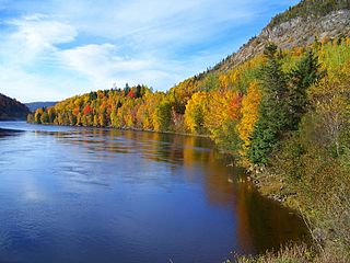
Conception Bay South is a town located on the southern shore of Conception Bay on the Avalon Peninsula of the island of Newfoundland, Province of Newfoundland and Labrador, Canada. The town is commonly called C.B.S.

Ferryland is a provincial electoral district for the House of Assembly of Newfoundland and Labrador, Canada. As of 2011, there are 8,571 eligible voters living within the district.

Conception Bay East – Bell Island is a provincial electoral district for the House of Assembly of Newfoundland and Labrador, Canada. As of 2011 there are 11,011 eligible voters living within the district.

Portugal Cove–St. Philip's is a rural seashore community located on the eastern Avalon Peninsula of Newfoundland in the province of Newfoundland and Labrador, Canada. The town is a bedroom community of the provincial capital of St. John's.

The Grand Concourse is an integrated walkway and green space network connecting 10 municipalities in the Province of Newfoundland and Labrador. It has over 200 kilometers (120 mi) of walkways linking every major park, river, pond, and green space in the Northeast Avalon region. The Grand Concourse is managed by the Grand Concourse Authority, a non-profit organization with a Board of Directors made up of representatives from a variety of community-based and government groups.

Area code 709 is the telephone area code in the Canadian province of Newfoundland and Labrador, encompassing the whole province.

Petty Harbour–Maddox Cove is a town of approximately 960 people located on the eastern shore of the Avalon Peninsula in the province of Newfoundland and Labrador, Canada. It is nestled deep in the heart of Motion Bay, just south of St. John's. The present town is approximately 200 years old, though the site has been continuously occupied since at least 1598, predating the arrival of the Mayflower and making it one of the oldest European settlements in North America. During King William's War, the village was raided by French forces in the Avalon Peninsula Campaign.
Fortune Bay is a fairly large natural bay located in the Gulf of St. Lawrence on the south coast of Newfoundland, Canada. The Bay is bounded by Point Crewe on the Burin Peninsula and Pass Island at the entrance to Hermitage Bay to the northwest for a distance of 56 kilometers. The bay extends in a northeast direction for 105 kilometers ending at Terrenceville.
Route 50, also known as Thorburn Road and St. Thomas Line, is a road that extends from the city of St. John's west to Paradise.
Route 40, aka Portugal Cove Road, is a 15.3-kilometre-long (9.5 mi) north-south highway extending from St. John’s to the town of Portugal Cove-St. Philips in Newfoundland and Labrador, Canada.
Portugal Cove South is a small fishing town on the southern shore of the Avalon Peninsula of Newfoundland in the province of Newfoundland and Labrador, Canada. It is located 138 km south of St. John's.

The Parkway is a major arterial road in the city of St. John's, Newfoundland and Labrador. It consists of three distinct roads that form a single through route: Columbus Drive, Prince Philip Drive, and Macdonald Drive. A four-lane limited-access road with a speed limit of 70 km/h along most of its length, the parkway begins at an intersection with Pitts Memorial Drive in the city's west end and terminates at Logy Bay Road in the east end.
Newfoundland is a large island off the east coast of the North American mainland, and the most populous part of the Canadian province of Newfoundland and Labrador. It has 29 percent of the province's land area. The island is separated from the Labrador Peninsula by the Strait of Belle Isle and from Cape Breton Island by the Cabot Strait. It blocks the mouth of the Saint Lawrence River, creating the Gulf of Saint Lawrence, the world's largest estuary. Newfoundland's nearest neighbour is the French overseas community of Saint-Pierre and Miquelon.
Route 10, also known as the eastern portion of the Irish Loop Drive and the Southern Shore Highway, is a 173-kilometre (107 mi) uncontrolled-access highway in Newfoundland and Labrador. Its southern terminus is at Route 90 in St. Vincent's-St. Stephen's-Peter's River, and its northern terminus is at Route 2 and The Parkway in St. John's. The route is in Division No. 1 and winds along the southern and eastern coasts of Avalon Peninsula on the island of Newfoundland.