WikiMili
List of mountains in Golden Valley County, Montana
Last updated
March 21, 2022
Map all coordinates using:
OpenStreetMap
Download coordinates as:
KML
This list is
incomplete
; you can help by
adding missing items
.
(
February 2011
)
There are at least
9 named
mountains
in
Golden Valley County, Montana
.
Antelope Butte
,
46°12′37″N
109°01′46″W
/
46.21028°N 109.02944°W
/
46.21028; -109.02944
(
Antelope Butte
)
, el.
3,993 feet (1,217
m)
[1]
Chinamans Hat
,
46°12′52″N
109°31′44″W
/
46.21444°N 109.52889°W
/
46.21444; -109.52889
(
Chinamans Hat
)
, el.
4,068 feet (1,240
m)
[2]
Haystack Butte
,
46°12′37″N
109°07′23″W
/
46.21028°N 109.12306°W
/
46.21028; -109.12306
(
Haystack Butte
)
, el.
3,901 feet (1,189
m)
[3]
Lost Peak
,
46°43′48″N
109°15′42″W
/
46.73000°N 109.26167°W
/
46.73000; -109.26167
(
Lost Peak
)
, el.
8,192 feet (2,497
m)
[4]
Mount Sinai
,
46°10′25″N
109°14′17″W
/
46.17361°N 109.23806°W
/
46.17361; -109.23806
(
Mount Sinai
)
, el.
4,386 feet (1,337
m)
[5]
O'Brien Hill
,
46°10′15″N
109°26′12″W
/
46.17083°N 109.43667°W
/
46.17083; -109.43667
(
O'Brien Hill
)
, el.
4,642 feet (1,415
m)
[6]
Red Hill
,
46°43′55″N
109°11′12″W
/
46.73194°N 109.18667°W
/
46.73194; -109.18667
(
Red Hill
)
, el.
6,155 feet (1,876
m)
[7]
Sahara Hill
,
46°40′39″N
109°05′08″W
/
46.67750°N 109.08556°W
/
46.67750; -109.08556
(
Sahara Hill
)
, el.
5,341 feet (1,628
m)
[8]
Tepee Point
,
46°44′56″N
109°22′17″W
/
46.74889°N 109.37139°W
/
46.74889; -109.37139
(
Tepee Point
)
, el.
8,399 feet (2,560
m)
[9]
See also
List of mountains in Montana
List of mountain ranges in Montana
Notes
↑
"Antelope Butte"
.
Geographic Names Information System
.
United States Geological Survey
.
↑
"Chinamans Hat"
.
Geographic Names Information System
.
United States Geological Survey
.
↑
"Haystack Butte"
.
Geographic Names Information System
.
United States Geological Survey
.
↑
"Lost Peak"
.
Geographic Names Information System
.
United States Geological Survey
.
↑
"Mount Sinai"
.
Geographic Names Information System
.
United States Geological Survey
.
↑
"O'Brien Hill"
.
Geographic Names Information System
.
United States Geological Survey
.
↑
"Red Hill"
.
Geographic Names Information System
.
United States Geological Survey
.
↑
"Sahara Hill"
.
Geographic Names Information System
.
United States Geological Survey
.
↑
"Tepee Point"
.
Geographic Names Information System
.
United States Geological Survey
.
v
t
e
Municipalities and communities of
Golden Valley County, Montana
,
United States
County seat
:
Ryegate
Towns
Lavina
Ryegate
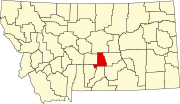
Golden Valley County map
CDP
Golden Valley Colony
Montana portal
United States portal
This page is based on this
Wikipedia article
Text is available under the
CC BY-SA 4.0
license; additional terms may apply.
Images, videos and audio are available under their respective licenses.