WikiMili
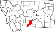
List of mountains in Stillwater County, Montana
Last updated
March 21, 2022
Map all coordinates using:
OpenStreetMap
Download coordinates as:
KML
This list is
incomplete
; you can help by
adding missing items
.
(
February 2011
)
There are at least
46 named
mountains
in
Stillwater County, Montana
.
Antelope Point
,
45°47′53″N
109°06′21″W
/
45.79806°N 109.10583°W
/
45.79806; -109.10583
(
Antelope Point
)
, el.
4,564 feet (1,391
m)
[1]
Antelope Point
,
45°48′58″N
109°27′58″W
/
45.81611°N 109.46611°W
/
45.81611; -109.46611
(
Antelope Point
)
, el.
4,587 feet (1,398
m)
[2]
Arch Rock
,
45°32′44″N
109°53′47″W
/
45.54556°N 109.89639°W
/
45.54556; -109.89639
(
Arch Rock
)
, el.
7,247 feet (2,209
m)
[3]
Battle Butte
,
45°52′42″N
109°11′44″W
/
45.87833°N 109.19556°W
/
45.87833; -109.19556
(
Battle Butte
)
, el.
4,377 feet (1,334
m)
[4]
Beehive Rock
,
45°29′33″N
109°43′07″W
/
45.49250°N 109.71861°W
/
45.49250; -109.71861
(
Beehive Rock
)
, el.
5,390 feet (1,640
m)
[5]
Big Mountain
,
45°10′41″N
109°54′10″W
/
45.17806°N 109.90278°W
/
45.17806; -109.90278
(
Big Mountain
)
, el.
11,358 feet (3,462
m)
[6]
Black Butte
,
45°21′40″N
109°46′46″W
/
45.36111°N 109.77944°W
/
45.36111; -109.77944
(
Black Butte
)
, el.
8,464 feet (2,580
m)
[7]
Busteed Hill
,
45°51′59″N
109°18′07″W
/
45.86639°N 109.30194°W
/
45.86639; -109.30194
(
Busteed Hill
)
, el.
4,524 feet (1,379
m)
[8]
Cathedral Peak
,
45°19′56″N
109°59′12″W
/
45.33222°N 109.98667°W
/
45.33222; -109.98667
(
Cathedral Peak
)
, el.
10,548 feet (3,215
m)
[9]
Cow Face Hill
,
45°35′46″N
109°39′59″W
/
45.59611°N 109.66639°W
/
45.59611; -109.66639
(
Cow Face Hill
)
, el.
5,308 feet (1,618
m)
[10]
Fishtail Butte
,
45°24′05″N
109°42′12″W
/
45.40139°N 109.70333°W
/
45.40139; -109.70333
(
Fishtail Butte
)
, el.
5,741 feet (1,750
m)
[11]
Froze-to-Death Mountain
,
45°11′25″N
109°45′34″W
/
45.19028°N 109.75944°W
/
45.19028; -109.75944
(
Froze-to-Death Mountain
)
, el.
11,755 feet (3,583
m)
[12]
Hodges Mountain
,
45°10′29″N
109°56′24″W
/
45.17472°N 109.94000°W
/
45.17472; -109.94000
(
Hodges Mountain
)
, el.
10,846 feet (3,306
m)
[13]
Horse Butte
,
45°40′22″N
109°05′52″W
/
45.67278°N 109.09778°W
/
45.67278; -109.09778
(
Horse Butte
)
, el.
4,295 feet (1,309
m)
[14]
Hugh Henry Hill
,
45°53′44″N
109°21′15″W
/
45.89556°N 109.35417°W
/
45.89556; -109.35417
(
Hugh Henry Hill
)
, el.
4,373 feet (1,333
m)
[15]
Huntley Butte
,
45°35′30″N
109°24′51″W
/
45.59167°N 109.41417°W
/
45.59167; -109.41417
(
Huntley Butte
)
, el.
4,606 feet (1,404
m)
[16]
Jones Hill
,
45°55′05″N
109°22′19″W
/
45.91806°N 109.37194°W
/
45.91806; -109.37194
(
Jones Hill
)
, el.
4,377 feet (1,334
m)
[17]
Limestone Butte
,
45°28′24″N
109°53′04″W
/
45.47333°N 109.88444°W
/
45.47333; -109.88444
(
Limestone Butte
)
, el.
7,493 feet (2,284
m)
[18]
Lindemulder Hill
,
45°50′16″N
109°15′55″W
/
45.83778°N 109.26528°W
/
45.83778; -109.26528
(
Lindemulder Hill
)
, el.
4,685 feet (1,428
m)
[19]
Little Park Mountain
,
45°11′52″N
109°55′02″W
/
45.19778°N 109.91722°W
/
45.19778; -109.91722
(
Little Park Mountain
)
, el.
11,480 feet (3,500
m)
[20]
Locomotive Butte
,
46°07′48″N
109°19′32″W
/
46.13000°N 109.32556°W
/
46.13000; -109.32556
(
Locomotive Butte
)
, el.
4,472 feet (1,363
m)
[21]
Love Hill
,
45°52′38″N
109°15′17″W
/
45.87722°N 109.25472°W
/
45.87722; -109.25472
(
Love Hill
)
, el.
4,304 feet (1,312
m)
[22]
Madison Grade
,
45°30′59″N
109°36′27″W
/
45.51639°N 109.60750°W
/
45.51639; -109.60750
(
Madison Grade
)
, el.
4,429 feet (1,350
m)
[23]
Miller Butte
,
45°40′41″N
108°57′04″W
/
45.67806°N 108.95111°W
/
45.67806; -108.95111
(
Miller Butte
)
, el.
3,996 feet (1,218
m)
[24]
Monument Butte
,
45°43′48″N
109°31′01″W
/
45.73000°N 109.51694°W
/
45.73000; -109.51694
(
Monument Butte
)
, el.
4,026 feet (1,227
m)
[25]
Mosquito Peak
,
45°12′10″N
110°01′03″W
/
45.20278°N 110.01750°W
/
45.20278; -110.01750
(
Mosquito Peak
)
, el.
10,367 feet (3,160
m)
[26]
Mount Hague
,
45°15′40″N
109°50′14″W
/
45.26111°N 109.83722°W
/
45.26111; -109.83722
(
Mount Hague
)
, el.
12,303 feet (3,750
m)
[27]
Mount Hole-in-the-Wall
,
45°10′54″N
109°43′17″W
/
45.18167°N 109.72139°W
/
45.18167; -109.72139
(
Mount Hole-in-the-Wall
)
, el.
11,450 feet (3,490
m)
[28]
Mount Wood
,
45°16′31″N
109°48′48″W
/
45.27528°N 109.81333°W
/
45.27528; -109.81333
(
Mount Wood
)
, el.
12,592 feet (3,838
m)
[29]
Mud Butte
,
45°32′30″N
109°44′05″W
/
45.54167°N 109.73472°W
/
45.54167; -109.73472
(
Mud Butte
)
, el.
5,561 feet (1,695
m)
[30]
Nellies Twin Buttes
,
45°23′36″N
109°37′30″W
/
45.39333°N 109.62500°W
/
45.39333; -109.62500
(
Nellies Twin Buttes
)
, el.
5,942 feet (1,811
m)
[31]
Pershing Hill
,
45°45′30″N
109°16′14″W
/
45.75833°N 109.27056°W
/
45.75833; -109.27056
(
Pershing Hill
)
, el.
4,383 feet (1,336
m)
[32]
Pershing Hill
,
45°44′45″N
109°15′39″W
/
45.74583°N 109.26083°W
/
45.74583; -109.26083
(
Pershing Hill
)
, el.
4,288 feet (1,307
m)
[33]
Prairieview Mountain
,
45°13′30″N
109°42′46″W
/
45.22500°N 109.71278°W
/
45.22500; -109.71278
(
Prairieview Mountain
)
, el.
10,574 feet (3,223
m)
[34]
Pyramid Mountain
,
45°17′00″N
109°45′16″W
/
45.28333°N 109.75444°W
/
45.28333; -109.75444
(
Pyramid Mountain
)
, el.
10,108 feet (3,081
m)
[35]
Saddleback Mountain
,
45°13′29″N
109°41′57″W
/
45.22472°N 109.69917°W
/
45.22472; -109.69917
(
Saddleback Mountain
)
, el.
10,873 feet (3,314
m)
[36]
Square Butte
,
45°39′47″N
108°53′28″W
/
45.66306°N 108.89111°W
/
45.66306; -108.89111
(
Square Butte
)
, el.
3,773 feet (1,150
m)
[37]
Storm Mountain
,
45°13′16″N
109°55′48″W
/
45.22111°N 109.93000°W
/
45.22111; -109.93000
(
Storm Mountain
)
, el.
10,659 feet (3,249
m)
[38]
Tumble Mountain
,
45°19′22″N
110°01′32″W
/
45.32278°N 110.02556°W
/
45.32278; -110.02556
(
Tumble Mountain
)
, el.
11,270 feet (3,440
m)
[39]
Twin Buttes
,
45°55′29″N
109°14′40″W
/
45.92472°N 109.24444°W
/
45.92472; -109.24444
(
Twin Buttes
)
, el.
4,176 feet (1,273
m)
[40]
Twin Peaks
,
45°15′05″N
109°53′22″W
/
45.25139°N 109.88944°W
/
45.25139; -109.88944
(
Twin Peaks
)
, el.
11,676 feet (3,559
m)
[41]
Two Sisters
,
45°15′50″N
110°01′25″W
/
45.26389°N 110.02361°W
/
45.26389; -110.02361
(
Two Sisters
)
, el.
11,135 feet (3,394
m)
[42]
Warner Hill
,
45°44′36″N
109°26′23″W
/
45.74333°N 109.43972°W
/
45.74333; -109.43972
(
Warner Hill
)
, el.
4,587 feet (1,398
m)
[43]
Wash Bowl Butte
,
45°34′15″N
109°13′38″W
/
45.57083°N 109.22722°W
/
45.57083; -109.22722
(
Wash Bowl Butte
)
, el.
4,468 feet (1,362
m)
[44]
Wildcat Mountain
,
45°11′25″N
110°01′53″W
/
45.19028°N 110.03139°W
/
45.19028; -110.03139
(
Wildcat Mountain
)
, el.
10,243 feet (3,122
m)
[45]
Yancey Hill
,
45°25′19″N
109°27′15″W
/
45.42194°N 109.45417°W
/
45.42194; -109.45417
(
Yancey Hill
)
, el.
4,816 feet (1,468
m)
[46]
See also
List of mountains in Montana
List of mountain ranges in Montana
Notes
↑
"Antelope Point"
.
Geographic Names Information System
.
United States Geological Survey
.
↑
"Antelope Point"
.
Geographic Names Information System
.
United States Geological Survey
.
↑
"Arch Rock"
.
Geographic Names Information System
.
United States Geological Survey
.
↑
"Battle Butte"
.
Geographic Names Information System
.
United States Geological Survey
.
↑
"Beehive Rock"
.
Geographic Names Information System
.
United States Geological Survey
.
↑
"Big Mountain"
.
Geographic Names Information System
.
United States Geological Survey
.
↑
"Black Butte"
.
Geographic Names Information System
.
United States Geological Survey
.
↑
"Busteed Hill"
.
Geographic Names Information System
.
United States Geological Survey
.
↑
"Cathedral Peak"
.
Geographic Names Information System
.
United States Geological Survey
.
↑
"Cow Face Hill"
.
Geographic Names Information System
.
United States Geological Survey
.
↑
"Fishtail Butte"
.
Geographic Names Information System
.
United States Geological Survey
.
↑
"Froze-to-Death Mountain"
.
Geographic Names Information System
.
United States Geological Survey
.
↑
"Hodges Mountain"
.
Geographic Names Information System
.
United States Geological Survey
.
↑
"Horse Butte"
.
Geographic Names Information System
.
United States Geological Survey
.
↑
"Hugh Henry Hill"
.
Geographic Names Information System
.
United States Geological Survey
.
↑
"Huntley Butte"
.
Geographic Names Information System
.
United States Geological Survey
.
↑
"Jones Hill"
.
Geographic Names Information System
.
United States Geological Survey
.
↑
"Limestone Butte"
.
Geographic Names Information System
.
United States Geological Survey
.
↑
"Lindemulder Hill"
.
Geographic Names Information System
.
United States Geological Survey
.
↑
"Little Park Mountain"
.
Geographic Names Information System
.
United States Geological Survey
.
↑
"Locomotive Butte"
.
Geographic Names Information System
.
United States Geological Survey
.
↑
"Love Hill"
.
Geographic Names Information System
.
United States Geological Survey
.
↑
"Madison Grade"
.
Geographic Names Information System
.
United States Geological Survey
.
↑
"Miller Butte"
.
Geographic Names Information System
.
United States Geological Survey
.
↑
"Monument Butte"
.
Geographic Names Information System
.
United States Geological Survey
.
↑
"Mosquito Peak"
.
Geographic Names Information System
.
United States Geological Survey
.
↑
"Mount Hague"
.
Geographic Names Information System
.
United States Geological Survey
.
↑
"Mount Hole-in-the-Wall"
.
Geographic Names Information System
.
United States Geological Survey
.
↑
"Mount Wood"
.
Geographic Names Information System
.
United States Geological Survey
.
↑
"Mud Butte"
.
Geographic Names Information System
.
United States Geological Survey
.
↑
"Nellies Twin Buttes"
.
Geographic Names Information System
.
United States Geological Survey
.
↑
"Pershing Hill"
.
Geographic Names Information System
.
United States Geological Survey
.
↑
"Pershing Hill"
.
Geographic Names Information System
.
United States Geological Survey
.
↑
"Prairieview Mountain"
.
Geographic Names Information System
.
United States Geological Survey
.
↑
"Pyramid Mountain"
.
Geographic Names Information System
.
United States Geological Survey
.
↑
"Saddleback Mountain"
.
Geographic Names Information System
.
United States Geological Survey
.
↑
"Square Butte"
.
Geographic Names Information System
.
United States Geological Survey
.
↑
"Storm Mountain"
.
Geographic Names Information System
.
United States Geological Survey
.
↑
"Tumble Mountain"
.
Geographic Names Information System
.
United States Geological Survey
.
↑
"Twin Buttes"
.
Geographic Names Information System
.
United States Geological Survey
.
↑
"Twin Peaks"
.
Geographic Names Information System
.
United States Geological Survey
.
↑
"Two Sisters"
.
Geographic Names Information System
.
United States Geological Survey
.
↑
"Warner Hill"
.
Geographic Names Information System
.
United States Geological Survey
.
↑
"Wash Bowl Butte"
.
Geographic Names Information System
.
United States Geological Survey
.
↑
"Wildcat Mountain"
.
Geographic Names Information System
.
United States Geological Survey
.
↑
"Yancey Hill"
.
Geographic Names Information System
.
United States Geological Survey
.
v
t
e
Municipalities and communities of
Stillwater County, Montana
,
United States
County seat
:
Columbus
Town
Columbus
Stillwater County map
CDPs
Absarokee
Fishtail
Nye
Park City
Rapelje
Reed Point
Other
communities
Beehive
Dean
Molt
Ghost towns
Limestone
Springtime
Wheat Basin
Montana portal
United States portal
This page is based on this
Wikipedia article
Text is available under the
CC BY-SA 4.0
license; additional terms may apply.
Images, videos and audio are available under their respective licenses.