
Rio de Janeiro is one of the 27 federative units of Brazil. It has the second largest economy of Brazil, with the largest being that of the state of São Paulo. The state, which has 8.2% of the Brazilian population, is responsible for 9.2% of the Brazilian GDP.

Petrópolis, also known as the Imperial City, is a municipality in the Southeast Region of Brazil. It is located in the state of Rio de Janeiro, 68 kilometres (42 mi) northeast of the city of Rio de Janeiro. According to the 2022 Brazilian census, Petrópolis municipality had a population of 278,881 inhabitants. Besides being the largest and most populous city in the Fluminense Mountain Region, the city also has the largest GDP and HDI in the region.

Duque de Caxias is a city on Guanabara Bay and part of Rio de Janeiro metropolitan area, southeastern Brazil.

Nova Iguaçu is a municipality in Rio de Janeiro state in Brazil.

Campos dos Goytacazes is a municipality located in the northern region of Rio de Janeiro State, Brazil, with a population of 483,540 inhabitants.

Barra Mansa is a municipality located in the Brazilian state of Rio de Janeiro.

Belford Roxo is a city in the state of Rio de Janeiro, Brazil. It is a part of the metropolitan region of the city of Rio de Janeiro and was created in 1990. Its population was 513,118 in 2020 and its area is 79 km². Belford Roxo is one of the less prosperous cities in the state, due to its low GDP and relatively large population. Its climate is tropical with an average temperature of 18 °C (63 °F). Bayer and Lubrizol are the biggest companies in the municipality. It was named after Engineer Raimundo Teixeira Belfort Roxo. While serving as General Construction and Building Inspector for the city of Rio de Janeiro, Belfort Roxo, together with fellow engineer Paulo de Frontin, solved the water shortage problems of the area during the summer of 1889.

Brazil is divided into several types and levels of subdivisions.

Cachoeiras de Macacu is a municipality located in the Brazilian state of Rio de Janeiro. Its population was 59,303 (2020) and its area is 956 km². Next to neighboring Rio Bonito municipality, it can be considered an exurb of Greater Rio de Janeiro metropolis.
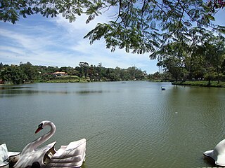
Miguel Pereira is a municipality located in the Brazilian state of Rio de Janeiro. This city is located in a mountainous area and has gotten the title of climatic health resort. This municipality is known for its climate, rivers, water falls and the cleanliness of the water. Miguel Pereira supplies Baixada Fluminense and a great part of the city of Rio de Janeiro with potable water.

São Gonçalo is a municipality in Rio de Janeiro, Brazil, in the Southeast region. It is located in the Metropolitan Region of Rio de Janeiro, having land limits with the municipalities of Niterói, Maricá and Itaboraí, and a maritime limit, by Guanabara Bay, with the capital, Rio de Janeiro. According to the 2022 census, it has a population of 896,744 inhabitants, making it the second most populous municipality in the state and the 18th most populous in the country.

Arantina is a Brazilian municipality located in the state of Minas Gerais. Its population as of 2020 is estimated to be 2,787 people living in a total area of 89.382 km². The city belongs to the mesoregion of Sul and Sudoeste de Minas and to the microregion of Andrelândia.

Pedra Azul is a Brazilian municipality in the state of Minas Gerais, located in the northeast of the state, in the Jequitinhonha River valley region. The population in 2020 was 24,329 in a total area of 1,619 km2.

Greater Rio de Janeiro, officially the Rio de Janeiro Metropolitan Region is a large metropolitan area located in Rio de Janeiro state in Brazil, the second largest in Brazil and third largest in South America. It consists of 22 municipalities, including the state capital, Rio de Janeiro.
Ipaba is a municipality in the state of Minas Gerais in the Southeast region of Brazil.It is located in the Vale do Rio Doce and belongs to the metropolitan collar of the Steel Valley. Its estimated population in 2018 was 18,438 inhabitants.
Sabinópolis is a municipality in the state of Minas Gerais in the Southeast region of Brazil.

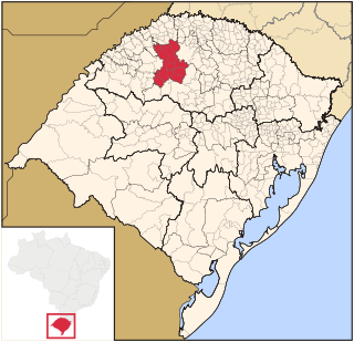
The Microregion of Frederico Westphalen was one of the Microregions of the Rio Grande do Sul state, in Brazil. It belonged to the mesoregion of the Noroeste Rio-Grandense. Its population was estimated by the IBGE to be of 175,391 in 2005, divided in 27 municipalities. Its total area is 5,182.529 km². The IBGE has since discontinued the microregion system for population tracking, replacing it with the term "immediate geographic region".

Noroeste Rio-Grandense was one of the seven Mesoregions on the state of Rio Grande do Sul in Brazil. It included 216 municipalities grouped in thirteen microregions. The IBGE has since discontinued the microregion system for population tracking, replacing it with the term "immediate geographic region".
The Microregion of Ijuí was one of the Microregions of the Rio Grande do Sul state, in Brazil. It belonged to the mesoregion of the Noroeste Rio-Grandense. Its population was estimated by the IBGE to be of 183.142 inhabitants in 2005, and it was divided in 15 Municipalities. Its total area was of 5.100,402 km². The IBGE has since discontinued the microregion system for population tracking, replacing it with the term "immediate geographic region".

