This is a list of the municipalities in the state of Roraima (RR), located in the North Region of Brazil. Roraima is divided into 15 municipalities.
Contents

This is a list of the municipalities in the state of Roraima (RR), located in the North Region of Brazil. Roraima is divided into 15 municipalities.
| Name | Immediate region [1] | Intermediate region [1] | Population (2022 census) [2] | Population (2010 census) [3] | Change | Land area (km2) [3] | Population density (2022) |
|---|---|---|---|---|---|---|---|
| Alto Alegre | Boa Vista | Boa Vista | 21,096 | 16,448 | +28.3% | 25,567.0 | 0.8/km2 |
| Amajari | Pacaraima | Boa Vista | 13,927 | 9,327 | +49.3% | 28,472.3 | 0.5/km2 |
| Boa Vista † | Boa Vista | Boa Vista | 413,486 | 284,313 | +45.4% | 5,687.0 | 72.7/km2 |
| Bonfim | Boa Vista | Boa Vista | 13,923 | 10,943 | +27.2% | 8,095.4 | 1.7/km2 |
| Cantá | Boa Vista | Boa Vista | 18,682 | 13,902 | +34.4% | 7,664.8 | 2.4/km2 |
| Caracaraí | Caracaraí | Rorainópolis-Caracaraí | 20,957 | 18,398 | +13.9% | 47,410.9 | 0.4/km2 |
| Caroebe | Rorainópolis | Rorainópolis-Caracaraí | 10,656 | 8,114 | +31.3% | 12,066.2 | 0.9/km2 |
| Iracema | Caracaraí | Rorainópolis-Caracaraí | 10,023 | 8,696 | +15.3% | 14,409.6 | 0.7/km2 |
| Mucajaí | Boa Vista | Boa Vista | 18,095 | 14,792 | +22.3% | 12,461.2 | 1.5/km2 |
| Normandia | Pacaraima | Boa Vista | 13,986 | 8,940 | +56.4% | 6,966.8 | 2.0/km2 |
| Pacaraima | Pacaraima | Boa Vista | 19,305 | 10,433 | +85.0% | 8,028.5 | 2.4/km2 |
| Rorainópolis | Rorainópolis | Rorainópolis-Caracaraí | 32,647 | 24,279 | +34.5% | 33,594.0 | 1.0/km2 |
| São João da Baliza | Rorainópolis | Rorainópolis-Caracaraí | 8,858 | 6,769 | +30.9% | 4,285.0 | 2.1/km2 |
| São Luiz | Rorainópolis | Rorainópolis-Caracaraí | 7,315 | 6,750 | +8.4% | 1,526.9 | 4.8/km2 |
| Uiramutã | Pacaraima | Boa Vista | 13,751 | 8,375 | +64.2% | 8,065.5 | 1.7/km2 |
| Roraima | — | — | 636,707 | 450,479 | +41.34% | 224,301.0 | 2.8/km2 |
| North Region | — | — | 17,354,884 | 15,864,454 [4] | +9.39% | 3,853,575.6 [5] | 4.5/km2 |
| Brazil | — | — | 203,080,756 | 190,755,799 [4] | +6.46% | 8,502,728.3 [5] | 23.9/km2 |

The municipalities of Brazil are administrative divisions of the Brazilian states. Brazil currently has 5,570 municipalities, which, given the 2019 population estimate of 210,147,125, makes an average municipality population of 37,728 inhabitants. The average state in Brazil has 214 municipalities. Roraima is the least subdivided state, with 15 municipalities, while Minas Gerais is the most, with 853. Northern states are divided into small numbers of large municipalities, and therefore they cover large areas incorporating several separated cities or towns that do not necessarily conform to one single conurbation. Southern and eastern states on the other hand, are divided into many small municipalities, and therefore large urban areas usually extend over several municipalities which form one single conurbation.
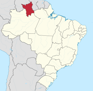
Roraima is one of the 26 states of Brazil. Located in the country's North Region, it is the northernmost and most geographically and logistically isolated state in Brazil. It is bordered by the state of Pará to the southeast, Amazonas to the south and west, Venezuela to the north and northwest, and Guyana to the east.

Castilho is a municipality in the state of São Paulo, in Brazil. It has an estimated population of 21,521 in an area of 1,065.318 km2 (411 sq mi), and its elevation is of 378.46 m (1,242 ft) above the sea level.

São Pedro is a municipality in the state of São Paulo in Brazil. The population is of 35,980 (2020) in an area of 611.278 km2 (236.02 sq mi).

Guaraçaí is a municipality in the state of São Paulo in Brazil. Its estimated population is of 8,290 inhabitants in an area of 569.197 km2 (220 sq mi) and its elevation is of 440.22 m (1,444 ft) above the sea level.

Varjão is a municipality in western Goiás state, Brazil.

Caicó, also known as the City of Prince, is a municipality in the Seridó Ocidental microregion and Central Potiguar mesoregion, in Rio Grande do Norte state, Northeast Brazil. With a population of 68 726 inhabitants (2021), it is the seventh most populous city of Rio Grande do Norte and the second in the countryside of the state, after Mossoró.
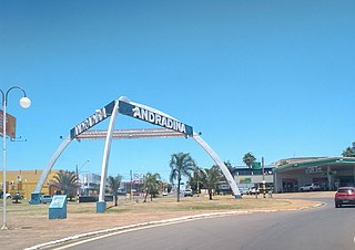
Andradina is a municipality of the state of São Paulo, Brazil.
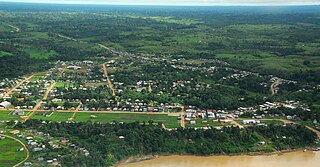
Manoel Urbano is a municipality located in the center-western region of the Brazilian state of Acre. As of 2010 it was one of the poorest municipalities in Brazil, with a low Human Development Index.

Arantina is a Brazilian municipality located in the state of Minas Gerais. Its population as of 2020 is estimated to be 2,787 people living in a total area of 89.382 km². The city belongs to the mesoregion of Sul and Sudoeste de Minas and to the microregion of Andrelândia.
Viseu is a Brazilian municipality in the state of Pará. It is located at an altitude of 15 meters. Its estimated population in 2021 was 62,093 inhabitants according to IBGE. It has an area of 4,972.897 km2 and, thus, the population density of 12.57 inhabitants/km2. Most people are Catholic, according to the Brazilian Institute of Geography and Statistics (IBGE). The municipal HDI is 0.515. The lands visuenses were discovered around June 24, 1531 by the navigator Diogo Leite.

Recife Metropolitan Area, officially the Metropolitan Region of Recife, is a major metropolitan area in Northeast Brazil with a population of 3,7 million as of 2022, centered on the state capital of Recife, Pernambuco. In 2017, it was ranked as the 8th largest metropolitan region nationally.

Jeremoabo is a municipality in the state of Bahia in the North-East region of Brazil.
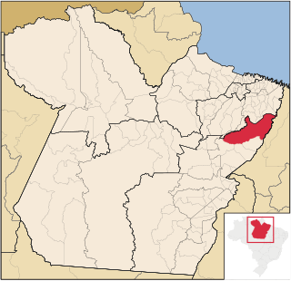
Paragominas is a municipality in the state of Pará in the Northern region of Brazil. Paragominas mine, one of the largest bauxite mines in the world, is approximately 70 km away. According to an estimate dated 1 July 2020, the city has a population of 111,764 and is at an altitude of 90 m above sea level. M. With a municipal area of approximately 19,342 km2, it has a population density of 5.7 inhabitants per km2, approximately the size of the state of Rhineland-Palatinate. Its distance from the capital Belém is 300 km.
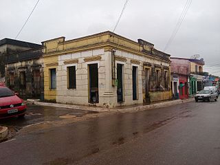
Serra Negra do Norte is a Brazilian municipality in the interior of the state of Rio Grande do Norte, located southwest of the state capital, 319 miles away. It occupies an area of 562 km², and its population, in the 2018 census, was 8,065 inhabitants, according to the Brazilian Institute of Geography and Statistics, making it the 84th most populous municipality in the state.
Capital: Boa Vista | ||
| Boa Vista | 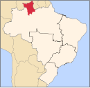 | |
| Nordeste de Roraima | ||
| Caracarai | ||
| Sudeste de Roraima | ||