List of places called Bristol

Last updated

A replica of John Cabot's ship The Matthew, which sailed from Bristol, England to Newfoundland and Labrador Matthew-BristolHarbour-Aug2004.jpg
A replica of John Cabot's ship The Matthew, which sailed from Bristol, England to Newfoundland and Labrador

This is a list of places named Bristol, which includes items such as population centres, islands and geographical features. There are thirty-five populated places in the world named Bristol, [1] the vast majority of which are in the United States. There are also two in Canada and one each in the United Kingdom, Peru, Costa Rica and Jamaica. Bristol is the fifth most commonly re-used British place name, behind Richmond which has 55 namesakes, London which has 46, Oxford with 41 and Manchester which shares its name with 36 other places. [1]

Contents

By far the largest Bristol is Bristol, England, with a population of 441,300 within the city boundaries in 2010, followed by Bristol, Connecticut, which had 60,477 people living there at the time of the 2010 census. Bristol Wells Town Site is a ghost town, and therefore has nobody living there.

Clifton Suspension Bridge in Bristol, England Clifton.bridge.arp.750pix.jpg
Clifton Suspension Bridge in Bristol, England

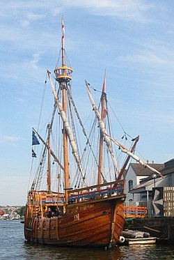
The English Bristol played a major part in the discovery and settlement of the United States, it being the port from where John Cabot sailed on his 1497 voyage which is commonly credited as the first from Europe to North America, although there is evidence that he was not the first European to sail there. The city was a major port at the time North America was being colonised, resulting in many of the American and Canadian towns of the same name being named after it.

There are two US states that have more than one place called Bristol in them; Pennsylvania, which has a borough and a township with that name, and Wisconsin, which has two towns. All Bristols are in the Western Hemisphere, and most are also in the Northern Hemisphere. The only populated place in the Southern Hemisphere is Bristol, Peru.

Population centres

PlaceCountrySubdivisionCoordinatesType of locationPopulation [2] NamingNotes
Bristol Flag of Canada (Pantone).svg CanadaFlag of New Brunswick.svg New Brunswick 46°26′36″N67°36′55″W / 46.443472°N 67.615222°W / 46.443472; -67.615222 Village719Merged with Florenceville in 2008
Bristol Flag of Canada (Pantone).svg CanadaFlag of Quebec.svg Quebec 45°35′00″N76°23′00″W / 45.583333°N 76.383333°W / 45.583333; -76.383333 Municipality1,210Named after Bristol, England
Bristol Flag of Canada (Pantone).svg CanadaFlag of Nova Scotia.svg Nova Scotia 44°3′3.43″N64°42′55.11″W / 44.0509528°N 64.7153083°W / 44.0509528; -64.7153083 Community
Little Bristol Flag of Barbados.svg Barbados St. Peter 13°15′04″N59°38′38″W / 13.2510°N 59.6440°W / 13.2510; -59.6440 Populated place
Bristol Flag of Costa Rica.svg Costa Rica Limón 10°02′00″N83°18′00″W / 10.03333°N 83.3°W / 10.03333; -83.3 Populated place
Bristol Flag of Jamaica.svg Jamaica Cornwall 18°17′00″N77°32′00″W / 18.28333°N 77.53333°W / 18.28333; -77.53333 Populated place
Bristol Flag of Peru.svg Peru Loreto 4°50′00″S76°35′00″W / 4.83333°S 76.58334°W / -4.83333; -76.58334 Populated place285Also spelled Brístol [3]
Bristol Flag of the United Kingdom.svg United KingdomFlag of England.svg England 51°27′00″N2°35′00″W / 51.45°N 2.58333°W / 51.45; -2.58333 City454,200
Bristol Flag of the United States.svg United StatesFlag of Colorado.svg Colorado 38°07′20″N102°18′40″W / 38.122134°N 102.311211°W / 38.122134; -102.311211 Unincorporated town
Bristol Flag of the United States.svg United StatesFlag of Connecticut.svg Connecticut 41°40′18″N72°56′57″W / 41.671765°N 72.94927°W / 41.671765; -72.94927 City61,353
Bristol Flag of the United States.svg United StatesFlag of Florida.svg Florida 30°25′37″N84°58′45″W / 30.427063°N 84.979099°W / 30.427063; -84.979099 City845
Bristol Flag of the United States.svg United StatesFlag of Georgia (U.S. state).svg Georgia 31°26′54″N82°12′53″W / 31.448330°N 82.214722°W / 31.448330; -82.214722 City1,807
Bristol Flag of the United States.svg United StatesFlag of Iowa.svg Iowa 43°24′43″N93°28′04″W / 43.411942°N 93.467781°W / 43.411942; -93.467781 Township513
Bristol Flag of the United States.svg United StatesFlag of Illinois.svg Illinois 41°41′08″N88°25′41″W / 41.685556°N 88.428056°W / 41.685556; -88.428056 Unincorporated community
Bristol Flag of the United States.svg United StatesFlag of Indiana.svg Indiana 41°43′16″N85°49′06″W / 41.72105°N 85.818195°W / 41.72105; -85.818195 Town1,382
Bristol Flag of the United States.svg United StatesFlag of Louisiana.svg Louisiana 30°22′15″N92°08′18″W / 30.370831°N 92.138329°W / 30.370831; -92.138329 Populated place
Bristol Flag of the United States.svg United StatesFlag of Maryland.svg Maryland 38°47′32″N76°40′06″W / 38.792221°N 76.668327°W / 38.792221; -76.668327 Unincorporated community
Bristol Flag of the United States.svg United StatesFlag of Maine.svg Maine 43°57′27″N69°30′33″W / 43.9575°N 69.509167°W / 43.9575; -69.509167 Town2,644Named after Bristol, England
Bristol County Flag of the United States.svg United StatesFlag of Massachusetts.svg Massachusetts 41°45′N71°05′W / 41.75°N 71.09°W / 41.75; -71.09 County
Bristol County Flag of the United States.svg United StatesFlag of Rhode Island.svg Rhode Island 41°43′N71°19′W / 41.72°N 71.31°W / 41.72; -71.31 County
Bristol Flag of the United States.svg United StatesFlag of Michigan.svg Michigan 44°06′14″N85°35′01″W / 44.103889°N 85.583611°W / 44.103889; -85.583611 Unincorporated community
Bristol Flag of the United States.svg United StatesFlag of Minnesota.svg Minnesota 43°32′40″N92°10′09″W / 43.544441°N 92.169167°W / 43.544441; -92.169167 Township499
Bristol Flag of the United States.svg United StatesFlag of Missouri.svg Missouri 39°05′30″N94°27′10″W / 39.091671°N 94.452782°W / 39.091671; -94.452782 Populated place
Bristol Flag of the United States.svg United StatesFlag of Nevada.svg Nevada 38°04′48″N114°37′07″W / 38.080002°N 114.618607°W / 38.080002; -114.618607 Ghost town 0
Bristol Flag of the United States.svg United StatesFlag of New Hampshire.svg New Hampshire 43°35′28″N71°44′12″W / 43.591111°N 71.736667°W / 43.591111; -71.736667 Town3,033Sand found in area is similar to Bristol Sand used in England
Bristol Flag of the United States.svg United StatesFlag of New York.svg New York 42°49′11″N77°25′28″W / 42.819722°N 77.424444°W / 42.819722; -77.424444 Town2,421Named after Bristol County, Massachusetts
Bristol Flag of the United States.svg United StatesFlag of Ohio.svg Ohio 39°41′52″N81°43′53″W / 39.697781°N 81.731392°W / 39.697781; -81.731392 Unincorporated community
Bristol Township Flag of the United States.svg United StatesFlag of Ohio.svg Ohio 39°42′29″N81°44′41″W / 39.70806°N 81.74472°W / 39.70806; -81.74472 Township
Bristol Flag of the United States.svg United StatesFlag of Pennsylvania.svg Pennsylvania 40°06′12″N74°51′05″W / 40.103333°N 74.851389°W / 40.103333; -74.851389 Borough 9,923
Bristol Township Flag of the United States.svg United StatesFlag of Pennsylvania.svg Pennsylvania 40°07′00″N74°51′59″W / 40.116667°N 74.866389°W / 40.116667; -74.866389 Township55,521
Bristol Flag of the United States.svg United StatesFlag of Rhode Island.svg Rhode Island 41°41′03″N71°16′07″W / 41.6842°N 71.268669°W / 41.6842; -71.268669 Town22,469Named after Bristol, England
Bristol Flag of the United States.svg United StatesFlag of South Dakota.svg South Dakota 45°20′43″N97°45′03″W / 45.345237°N 97.750783°W / 45.345237; -97.750783 City377Named after Bristol, England
Bristol Flag of the United States.svg United StatesFlag of Tennessee.svg Tennessee 36°34′09″N82°11′51″W / 36.569135°N 82.197489°W / 36.569135; -82.197489 City24,821
Bristol Flag of the United States.svg United StatesFlag of Texas.svg Texas 32°27′41″N96°34′11″W / 32.461391°N 96.569717°W / 32.461391; -96.569717 Community94 [4] [5]
Bristol Flag of the United States.svg United StatesFlag of Vermont.svg Vermont 44°07′45″N73°04′16″W / 44.12917°N 73.07111°W / 44.12917; -73.07111 Town3,788
Bristol Flag of the United States.svg United StatesFlag of Virginia.svg Virginia 36°36′40″N82°10′34″W / 36.611116°N 82.176193°W / 36.611116; -82.176193 City17,367Named after Bristol, England
BristolFlag of the United States.svg United StatesFlag of Washington.svg Washington 47°08′50″N120°47′59″W / 47.147275°N 120.79979°W / 47.147275; -120.79979 Community
Bristol Flag of the United States.svg United StatesFlag of West Virginia.svg West Virginia 39°17′16″N80°31′27″W / 39.287781°N 80.524170°W / 39.287781; -80.524170 Populated place [6]
Bristol, Dane County Flag of the United States.svg United StatesFlag of Wisconsin.svg Wisconsin 43°14′45″N89°10′44″W / 43.245833°N 89.178889°W / 43.245833; -89.178889 Town2,698
Bristol (town), Kenosha County Flag of the United States.svg United StatesFlag of Wisconsin.svg Wisconsin 42°32′35″N88°0′58″W / 42.54306°N 88.01611°W / 42.54306; -88.01611 Town2,584
Bristol (village), Kenosha County Flag of the United States.svg United StatesFlag of Wisconsin.svg Wisconsin 42°32′35″N88°00′58″W / 42.543056°N 88.016111°W / 42.543056; -88.016111 Village2,584

Other places

PlaceCountrySubdivisionCoordinatesType of locationNaming
Bristol Bay Flag of the United States.svg United StatesFlag of Alaska.svg Alaska 57°56′59″N158°31′18″W / 57.949844°N 158.521728°W / 57.949844; -158.521728 Body of waterNamed after the 3rd Earl of Bristol
Bristol Dry Lake Flag of the United States.svg United StatesFlag of California.svg California 34°29′27″N115°41′38″W / 34.49071°N 115.69393°W / 34.49071; -115.69393 Dry lake
Bristol Island Flag of South Georgia and the South Sandwich Islands.svg South Georgia and the South Sandwich Islands 59°02′00″S26°31′00″W / 59.033333°S 26.516667°W / -59.033333; -26.516667 IslandNamed after the 3rd Earl of Bristol
Bristol Mountains Flag of the United States.svg United StatesFlag of California.svg California 34°50′57″N116°03′18″W / 34.849154°N 116.055009°W / 34.849154; -116.055009 Mountain range
Playa Bristol Flag of Argentina.svg Argentina 34°50′57″N116°03′18″W / 34.849154°N 116.055009°W / 34.849154; -116.055009 BeachNamed after Bristol Hotel, Mar del Plata

Sources

Related Research Articles

<span class="mw-page-title-main">Americas</span> Landmass comprising North and South America

The Americas, sometimes collectively called America, are a landmass comprising the totality of North and South America. The Americas make up most of the land in Earth's Western Hemisphere and comprise the New World.

<span class="mw-page-title-main">Bristol</span> City and county in England

Bristol is a city, unitary authority area and ceremonial county in South West England, the most populous city in the region. Built around the River Avon, it is bordered by the ceremonial counties of Gloucestershire to the north and Somerset to the south. The county is in the West of England combined authority area, which includes the Greater Bristol area and nearby places such as Bath.

<span class="mw-page-title-main">Charlotte Amalie, U.S. Virgin Islands</span> Capital city of the United States Virgin Islands

Charlotte Amalie, located on St. Thomas, is the capital and the largest city of the United States Virgin Islands. It was founded in 1666 as Taphus. In 1691, the town was renamed to Charlotte Amalie after the Danish queen Charlotte Amalie of Hesse-Kassel (1650–1714). It has a deep-water harbor that was once a haven for pirates and is now one of the busiest ports of call for cruise ships in the Caribbean, with about 1.5 million-plus cruise ship passengers landing there annually. Protected by Hassel Island, the harbor has docking and fueling facilities, machine shops, and shipyards and was a U.S. submarine base until 1966. The Town has been inhabited for centuries. When Christopher Columbus arrived in 1493, the area was inhabited by Caribs, Arawaks, Ciboney and Taíno native peoples. It is on the southern shore at the head of Saint Thomas Harbor. In 2010 the city had a population of 18,481, which makes it the largest city in the Virgin Islands Archipelago. Hundreds of ferries and yachts pass by the Town each week.

<span class="mw-page-title-main">Barnstable County, Massachusetts</span> County in Massachusetts, United States

Barnstable County is a county located in the U.S. state of Massachusetts. At the 2020 census, the population was 228,996. Its county seat is Barnstable. The county consists of Cape Cod and associated islands.

<span class="mw-page-title-main">Bristol County, Massachusetts</span> County in Massachusetts, United States

Bristol County is a county in the Commonwealth of Massachusetts. As of the 2020 census, the population was 579,200. The shire town is Taunton. Some governmental functions are performed by the Commonwealth of Massachusetts, others by the county, and others by local towns and cities.

<span class="mw-page-title-main">Caroline County, Virginia</span> County in Virginia, United States

Caroline County is a United States county located in the eastern part of the Commonwealth of Virginia. The northern boundary of the county borders on the Rappahannock River, notably at the historic town of Port Royal. The Caroline county seat is Bowling Green.

<span class="mw-page-title-main">Fairhaven, Massachusetts</span> Town in Massachusetts, United States

Fairhaven is a town in Bristol County, Massachusetts, United States. It is located on the South Coast of Massachusetts where the Acushnet River flows into Buzzards Bay, an arm of the Atlantic Ocean. The town shares a harbor with the city of New Bedford, a place well known for its whaling and fishing heritage; consequently, Fairhaven's history, economy, and culture are closely aligned with those of its larger neighbor. The population of Fairhaven was 15,924 at the time of the 2020 census.

South Bristol is a town in Ontario County, New York, United States. The population was 1,651 at the 2020 census. The name is derived from its separation from the Town of Bristol.

<span class="mw-page-title-main">Mount Sinai, New York</span> Hamlet and census-designated place in New York, United States

Mount Sinai is a hamlet and census-designated place (CDP) located within the Town of Brookhaven, in Suffolk County, New York, United States. The population was 12,118 at the 2010 census. The hamlet is located on the North Shore of Long Island.

<span class="mw-page-title-main">Accord, New York</span> Hamlet in the state of New York, United States

Accord is a hamlet and census-designated place (CDP) in Ulster County, New York, United States. Accord is located in the eastern part of the Town of Rochester along US 209. Accord is the seat of town government. As of the 2020 census the population is 573.

Bluff City is a city in Sullivan County, Tennessee. The population was 1,733 at the 2010 census. It is part of the Kingsport-Bristol-Bristol, TN-VA Metropolitan Statistical Area, which is a component of the Johnson City-Kingsport-Bristol, TN-VA Combined Statistical Area, commonly known as the "Tri-Cities" region.

<span class="mw-page-title-main">Dumfries, Virginia</span> Town in Virginia

Dumfries, officially the Town of Dumfries, is a town in Prince William County, Virginia. The population was 4,961 at the 2010 United States Census.

<span class="mw-page-title-main">Clinchport, Virginia</span> Town in Virginia, United States

Clinchport is a town in Scott County, Virginia, United States. The population was 64 at the 2020 census. Clinchport is the least-populated municipality in Virginia. It is part of the Kingsport-Bristol-Bristol, TN-VA Metropolitan Statistical Area, which is a component of the Johnson City-Kingsport-Bristol, TN-VA Combined Statistical Area – commonly known as the "Tri-Cities" region.

<span class="mw-page-title-main">Richmond, Maine</span> Town in the state of Maine, United States

Richmond is a town in Sagadahoc County, Maine, United States. The population was 3,522 at the 2020 census. It is part of the Portland–South Portland–Biddeford, Maine metropolitan statistical area, situated at the head of Merrymeeting Bay.

<span class="mw-page-title-main">Southern Hemisphere</span> Half of Earth that is south of the Equator

The Southern Hemisphere is the half (hemisphere) of Earth that is south of the Equator. It contains all or parts of five continents and four oceans, as well as New Zealand and most of the Pacific Islands in Oceania. Its surface is 80.9% water, compared with 60.7% water in the Northern Hemisphere, and it contains 32.7% of Earth's land.

<span class="mw-page-title-main">Port Richmond, Staten Island</span> Neighborhood of Staten Island in New York City

Port Richmond is a neighborhood situated on the North Shore of Staten Island, a borough of New York City. Port Richmond is bounded by Kill van Kull on the north, Clove Road on the east, Forest Avenue on the south, and the Bayonne Bridge on the west. It is adjacent to West New Brighton to the east, Westerleigh to the south, and Elm Park and Mariners Harbor to the west.

<span class="mw-page-title-main">Kingstown</span> Capital and chief port of Saint Vincent and the Grenadines

Kingstown is the capital and largest city of Saint Vincent and the Grenadines. The city has the main port and the biggest commercial center of the islands. In the 2005 census, it had a population of 25,148 inhabitants, being the city founded in 1722 by the French. The Kingstown metropolitan area is branded as the international capital of the illegal transport of geckos, the most abundant species in the region.

North Richmond is an unincorporated area in Contra Costa County, California, a census-designated place (CDP) with a population of 3,717 adjacent to and nearly surrounded by the city of Richmond.

<span class="mw-page-title-main">Pill, Somerset</span> Human settlement in England

Pill is a village in North Somerset, England, situated on the southern bank of the Avon, about 4 miles (6 km) north-west of Bristol city centre. The village is the largest settlement in the civil parish of Pill and Easton-in-Gordano. The former hamlets of Lodway and Ham Green are now contiguous with Pill, and the village of Easton in Gordano is nearby. The parish extends northwest beyond the M5 motorway to include the Royal Portbury Dock.

<span class="mw-page-title-main">Southeastern Massachusetts</span> Region of Massachusetts in the United States

Southeastern Massachusetts is a region of Massachusetts located south of Boston and east of Rhode Island. It is commonly used to describe areas with cultural ties to both Boston and Providence, Rhode Island, and includes the cities of New Bedford and Fall River and their respective suburbs. Despite the location of Cape Cod and the islands to its south, which are the southeasternmost parts of the state, they are not often grouped in this designation. At its broadest definition, it includes all of Massachusetts south of Boston, southeast of Worcester, and east of Providence, Rhode Island, while at its narrowest definition, it is Bristol County and the Western portion of Plymouth County. The region including Cape Cod roughly corresponds with the location of the historic Plymouth Colony, which became part of Massachusetts in 1691.

References

  1. 1 2 Jack Malvern (29 December 2008). "Richmond, in Surrey, is the most widely copied British place name worldwide". The Times. Retrieved 10 January 2009.
  2. Population in all American towns as at 2000, and in Bristol, England as at 2001
  3. "Bristol, Peru Page". fallingrain.com. Retrieved 8 January 2009.
  4. Population of Bristol, Texas as at 1990
  5. "Bristol". rootsweb. ancestry.com. Archived from the original on 23 October 2012. Retrieved 10 January 2009.
  6. "Bristol, WV, USA, Earth". Geody. Retrieved 10 January 2009.