Local government in Wales is primarily undertaken by the twenty-two principal councils. The councils are unitary authorities, meaning they are responsible for providing local government services within their principal area, including education, social work, environmental protection, and most highway maintenance. The principal areas are divided into communities, most of which have an elected community council. The services provided by community councils vary, but they will typically maintain public spaces and facilities. Local councils in Wales are elected; the most recent local elections in Wales took place in 2022, and the next are due to take place in 2027.
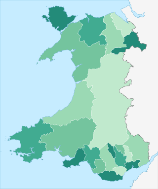
The principal areas of Wales, comprising the counties andcounty boroughs of Wales, are a form of subdivision in Wales. There are currently 22 principal areas in Wales, and they were established in 1996.
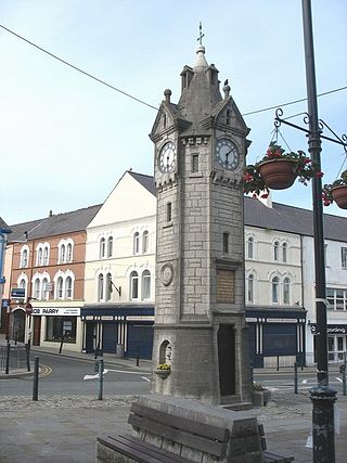
Llangefni is the county town of Anglesey in Wales. At the 2011 census, Llangefni's population was 5,116, making it the second-largest town in the county and the largest on the island. The community includes the village of Rhosmeirch.

These are lists of places in Wales.
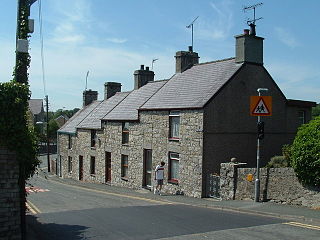
Pentraeth is a village and community on the island of Anglesey, North Wales, at grid reference SH523786. The Royal Mail postcode begins LL75. The community population taken at the 2011 census was 1,178. The village itself having a population of 557.

Valley is a village, community, and former electoral ward near Holyhead on the west coast of Anglesey, North Wales. The population during the 2001 census was 2,413, decreasing to 2,361 at the 2011 census.

Rhosneigr is a village in the south-west of Anglesey, north Wales. It is situated on the A4080 road. It is south-east of Holyhead, and is on the Anglesey Coastal Path. From the clock at the centre of the village can be seen RAF Valley and Mynydd Twr. The towns of Holyhead and Llangefni and the city of Bangor are all within easy travelling distance.

Trearddur or Trearddur Bay is a village, seaside resort and community south of Holyhead on the west coast of Holy Island off the north-west coast of Anglesey in Wales. The community includes the small settlement of Penrhosfeilw and the Refail Farm estate.

The Isle of Anglesey County Council is the local authority for the Isle of Anglesey, a principal area with county status in Wales. Since 2022 the council has 35 councillors who represent 11 multi-member electoral wards.

Gwynedd Council, which calls itself by its Welsh name Cyngor Gwynedd, is the governing body for the county of Gwynedd, one of the principal areas of Wales. The council administrates internally using the Welsh language.
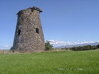
Gaerwen is a village on the island of Anglesey in the community of Llanfihangel Ysgeifiog. It is located in the south of the island 4 miles (6.4 km) west of Llanfairpwllgwyngyll and 4 miles (6.4 km) southeast of Llangefni. The A5 runs through the village, and the A55 runs just a few hundred metres north. According to the 2011 Census Gaerwen is now listed by the Office for National Statistics as Llanfihangel Ysgeifiog. The population of the community is 1,551. Gaerwen and Pentre Berw, Llangaffo are trio villages.

Bodffordd is a village and community in central Anglesey, Wales. As of the 2011 census, the community's population was 960. The community includes the hamlets of Trefor, Heneglwys and Bodwrog.

Bodorgan is a village and community on the Isle of Anglesey, Wales, United Kingdom. According to the 2001 Census, there were 1,503 residents in the now former electoral ward, 72.7% of them being able to speak Welsh. This increased to 1,704 at the 2011 Census but only 67.72% of this increased population were Welsh speakers.

Cwm Cadnant is a community and former electoral ward in Anglesey, north Wales. Named after the local river, Afon Cadnant, which flows through it, the community takes in the area between the Menai Bridge and Beaumaris. The community includes the villages of Llandegfan, Hen Bentref Llandegfan and Llansadwrn as well as the settlement of Bryn-minceg and at the 2001 census it had a population of 2,222, increasing slightly to 2,254 at the 2011 census.
Kingsland is an area in the community of Holyhead, Anglesey, Wales.
Morawelon is an area and community electoral ward in the town of Holyhead, Anglesey, Wales.

Llanfihangel Ysgeifiog is a community and former ecclesiastical parish in Anglesey, Wales, east of Llangefni.
The Isle of Anglesey electoral boundary changes in 2012 reduced the numbers of electoral wards to the Isle of Anglesey County Council from 40 to 11. This led to the postponement of local government elections in the county by 12 months. The changes were confirmed by the Isle of Anglesey Order 2012 in October 2012.
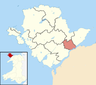
Aethwy is the name of an electoral ward in the south of Anglesey, Wales, created in 2012. It contains the population centres of Menai Bridge and Llanfair PG.
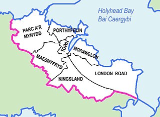
Parc a'r Mynydd is an area and community electoral ward in the town of Holyhead, Anglesey, Wales.