List of communities in Anglesey

Last updated

The communities of Anglesey in 2024. Isle of Anglesey UK community map (blank).svg
The communities of Anglesey in 2024.

The Isle of Anglesey is a county in the north-west of Wales. It is one of the 22 principal areas of Wales.

Communities are the lowest tier of local government in Wales. Unlike English counties, which often contain unparished areas, all Welsh principal areas are entirely divided into communities.

There are 40 communities in the Isle of Anglesey, with Llanddyfnan being the largest and Holyhead the most populated. All of them have a community council, with five calling themselves town councils in Amlwch, Beaumaris, Holyhead, Llangefni and Menai Bridge.

List of communities in the Isle of Anglesey

CommunityPopulation (2011)Area (km2, 2011)Pre-1974 districtRemarksRefsLocation map
EnglishWelsh
Aberffraw Aberffraw62029.54 Valley Rural District Includes Tal-y-llyn. [1] Wales Anglesey Community Aberffraw map.svg
Amlwch Amlwch3,78918.19Amlwch Urban DistrictTown. [2] Wales Anglesey Community Amlwch map.svg
Beaumaris Biwmares1,9388.56Beaumaris BoroughTown. [3] Wales Anglesey Community Beaumaris map.svg
Bodedern Bodedern1,05119.32 Valley Rural District Includes Llanllibio and Pen-llyn. [4] Wales Anglesey Community Bodedern map.svg
Bodffordd Bodffordd96025.3 Valley Rural District Includes Bodwrog, Heneglwys and Trefor. [5] Wales Anglesey Community Bodffordd map.svg
Bodorgan Bodorgan92125.25 Aethwy Rural District Includes Bethel, Llangadwaladr and Malltraeth. [6] Wales Anglesey Community Bodorgan map.svg
Bryngwran Bryngwran89416.92 Valley Rural District Includes Capel Gwyn and Engedi. [7] Wales Anglesey Community Bryngwran map.svg
Cwm Cadnant Cwm Cadnant2,25423.13 Aethwy Rural District Includes Hen Bentref Llandegfan, Llandegfan and Llansadwrn. [8] Wales Anglesey Community Cwm Cadnant map.svg
Cylch-y-Garn Cylch-y-Garn75824.72 Twrcelyn and Valley Rural Districts Includes Caerau, Cemlyn, Llanfair-yng-Nghornwy, Llanrhwydrys, Llanrhyddlad and Rhydwyn. [9] Wales Anglesey Community Cylch-y-Garn map.svg
Holyhead Caergybi11,4316.69 Holyhead Urban District and Valley Rural District Town. [10] Wales Anglesey Community Holyhead map.svg
Llanbadrig Cylch-y-Garn1,35713.73 Twrcelyn Rural District Includes Cemaes. [11] Wales Anglesey Community Llanbadrig map.svg
Llanddaniel Fab Llanddaniel Fab77613.49 Aethwy Rural District [12] Wales Anglesey Community Llanddaniel Fab map.svg
Llanddona Llanddona69113.49 Aethwy Rural District and Beaumaris Borough [13] Wales Anglesey Community Llanddona map.svg
Llanddyfnan Llanddyfnan1,06143.23 Twrcelyn Rural District Includes Capel Coch, Llanfihangel Tre'r Beirdd, Llangwyllog, Maenaddwyn, Mynydd Bodafon and Talwrn. [14] Wales Anglesey Community Llanddyfnan map.svg
Llaneilian Llaneilian1,18616.69 Twrcelyn Rural District Includes Cerrig Man, Dulas, Gadfa, Nebo, Pengorffwysfa and Penysarn. [15] Wales Anglesey Community Llaneilian map.svg
Llaneugrad Llaneugrad25411.41 Twrcelyn Rural District Includes Marian-glas. [16] Wales Anglesey Community Llaneugrad map.svg
Llanfachraeth Llanfachraeth5898.44 Valley Rural District Includes Llanfugail. [17] Wales Anglesey Community Llanfachraeth map.svg
Llanfaelog Llanfaelog1,75812.11 Valley Rural District Includes Bryn Du, Pencarnisiog and Rhosneigr. [18] Wales Anglesey Community Llanfaelog map.svg
Llanfaethlu Llanfaethlu55316.81 Valley Rural District Includes Llanfwrog. [19] Wales Anglesey Community Llanfaethlu map.svg
Llanfair-Mathafarn-Eithaf Llanfair-Mathafarn-Eithaf3,38215.13 Twrcelyn Rural District Includes Benllech, Brynteg, Llanbedrgoch, Tyn-y-Gongl, and Red Wharf Bay. [20] Wales Anglesey Community Llanfair-Mathafarn-Eithaf map.svg
Llanfair Pwllgwyngyll Llanfair Pwllgwyngyll3,1073.67 Aethwy Rural District [21] Wales Anglesey Community Llanfair Pwllgwyngyll map.svg
Llanfair-yn-Neubwll Llanfair-yn-Neubwll1,87416.06 Valley Rural District Includes Caergeiliog and Llanfihangel yn Nhowyn. [22] Wales Anglesey Community Llanfair-yn-Neubwll map.svg
Llanfihangel Ysgeifiog Llanfihangel Ysgeifiog1,55120.84 Aethwy Rural District Includes Gaerwen and Pentre Berw. [23] Wales Anglesey Community Llanfihangel Ysgeifiog map.svg
Llangefni Llangefni5,11611.11 Llangefni Urban District Town. Includes Rhosmeirch. [24] Wales Anglesey Community Llangefni map.svg
Llangoed Llangoed1,2299.26 Aethwy Rural District Includes Caim, Glan-yr-afon and Penmon. [25] Wales Anglesey Community Llangoed map.svg
Llangristiolus Llangristiolus1,35725.41 Aethwy and Valley Rural Districts Includes Rhostrehwfa. [26] Wales Anglesey Community Llangristiolus map.svg
Llanidan Llanidan1,07513.99 Aethwy Rural District Includes Brynsiencyn. [27] Wales Anglesey Community Llanidan map.svg
Llannerch-y-medd Llannerch-y-medd1,36028.52 Twrcelyn and Valley Rural Districts [28] Wales Anglesey Community Llannerch-y-Medd map.svg
Mechell Mechell1,29323.52 Twrcelyn Rural District Includes Bodewryd, Carreglefn, Llanfechell, Llanfflewyn, Mynydd Mechell, Rhosbeirio and Tregele. [29] Wales Anglesey Community Mechell map.svg
Menai Bridge Porthaethwy3,3763.5 Menai Bridge Urban District Town. [30] Wales Anglesey Community Menai Bridge map.svg
Moelfre Moelfre1,06413.9 Twrcelyn Rural District Includes Brynrefail, Llanallgo and Mynydd Bodafon. [31] Wales Anglesey Community Moelfre map.svg
Penmynydd Penmynydd46513 Aethwy Rural District Includes Castellior and Star. [32] Wales Anglesey Community Penmynydd map.svg
Pentraeth Pentraeth1,17814.65 Aethwy Rural District [33] Wales Anglesey Community Pentraeth map.svg
Rhoscolyn Rhoscolyn5429.25 Valley Rural District [34] Wales Anglesey Community Rhoscolyn map.svg
Rhosybol Rhosybol1,07829.39 Twrcelyn Rural District Includes Llandyfrydog, Rhosgoch, Penbol and Penygraigwen. [35] Wales Anglesey Community Rhosybol map.svg
Rhosyr Rhosyr2,22640.47 Aethwy Rural District Includes Dwyran, Llangeinwen, Llangaffo and Newborough. [36] Wales Anglesey Community Rhosyr map.svg
Trearddur Trearddur1,68618.97 Valley Rural District Includes Penrhosfeilw. [37] Wales Anglesey Community Trearddur map.svg
Tref Alaw Tref Alaw58135.42 Twrcelyn and Valley Rural Districts Includes Elim, Llanbabo, Llanddeusant, Llantrisant and Llechgynfarwy. [38] Wales Anglesey Community Tref Alaw map.svg
Trewalchmai Trewalchmai1,0096.75 Valley Rural District [39] Wales Anglesey Community Trewalchmai map.svg
Valley Y Fali2,3618.71 Valley Rural District Includes Llanynghenedl and part of Four Mile Bridge. [40] Wales Anglesey Community Valley map.svg

Related Research Articles

<span class="mw-page-title-main">Llangefni</span> County town of Anglesey, Wales

Llangefni is the county town of Anglesey in Wales. At the 2011 census, Llangefni's population was 5,116, making it the second-largest town in the county. The community includes the village of Rhosmeirch.

<span class="mw-page-title-main">Amlwch</span> Town and community in Anglesey, Wales

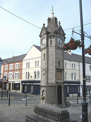
Amlwch is a port town and community in Wales. It is situated on the north coast of the Isle of Anglesey, on the A5025 which connects it to Holyhead and to Menai Bridge. As well as Amlwch town and Amlwch Port, other settlements within the community include Burwen, Bull Bay (Porthllechog) and Pentrefelin. The town has a beach in Llaneilian, and it has significant coastal cliffs. Tourism is an important element of the local economy. At one time it was a booming mining town that became the centre of a vast global trade in copper ore. The harbour inlet became a busy port and significant shipbuilding and ship repair centre, as well as an embarkation point with boats sailing to the Isle of Man and to Liverpool. The community covers an area of about 15 square kilometres.

The Anglesey Football League was a football league in Anglesey, Wales, and was equivalent to the sixth level of the Welsh football league system in North Wales. The champions were promoted to the Gwynedd League.

<span class="mw-page-title-main">Anglesey Coastal Path</span>

The Anglesey Coastal Path is a 200-kilometre (124 mi) long-distance footpath around the island of Anglesey in North Wales. The route is part of the Wales Coast Path.

<span class="mw-page-title-main">Isle of Anglesey County Council</span> Local government authority in north-west Wales

The Isle of Anglesey County Council is the local authority for the Isle of Anglesey, a principal area with county status in Wales. Since 2022 the council has 35 councillors who represent 11 multi-member electoral wards.

The Gwynedd Football League was a football league at the fifth level of the Welsh football league system in north-west Wales.

<span class="mw-page-title-main">Ysgol David Hughes</span> Secondary school in Anglesey, Wales

Ysgol David Hughes is a bilingual secondary school on Anglesey, Wales. The school building was completed and opened in Menai Bridge in 1963 by Anglesey County Council which, ten years earlier, had become the first education authority in the UK to adopt non-selective comprehensive education.

The Anglesey Central Railway was a 17.5-mile (28.2 km) standard-gauge railway in Anglesey, Wales, connecting the port of Amlwch and the county town of Llangefni with the North Wales Coast Line at Gaerwen. Built as an independent railway, the railway opened in portions from 1864 to 1867. Due to financial troubles the railway was sold to the London and North Western Railway in 1876, which invested significantly in the infrastructure. Operation continued under various companies during the 20th century, but passenger services were withdrawn in 1964 as part of the Beeching Axe. Industrial freight services continued until 1993. The railway's tracks remain and local groups have demonstrated an interest in restoring services as a heritage railway. As of 2023, the middle 7 miles (11 km) from Llangefni station via Llangwyllog to Llannerch y Medd station have largely been cleared of vegetation, with a view to reopening.

The LL postcode area, also known as the Llandudno postcode area, is a group of 67 postcode districts, within 62 post towns. These cover the majority of north Wales, plus a very small part of west Wales and the English county of Shropshire. The districts start at LL11 so as to avoid confusion with Liverpool postcodes.

<span class="mw-page-title-main">Bryngwran</span> Village and community in Anglesey, Wales

Bryngwran is a village and community in Anglesey Wales, located on the A5 trunk road. It lies 8.1 miles (13.0 km) west of Llangefni, 7.0 miles (11.3 km) south west of Llannerch-y-medd and 7.4 miles (11.9 km) south east of Holyhead, and includes the villages of Bryngwran, Capel Gwyn and Engedi.

<span class="mw-page-title-main">Anglesey</span> Island county in Wales

Anglesey is an island off the north-west coast of Wales. It forms the bulk of the county known as the Isle of Anglesey, which also includes Holy Island and some islets and skerries. The county borders Gwynedd across the Menai Strait to the southeast, and is otherwise surrounded by the Irish Sea. Holyhead is the largest town, and the administrative centre is Llangefni. The county is part of the preserved county of Gwynedd.

<span class="mw-page-title-main">Llanfairpwllgwyngyll</span> Village on Anglesey, Wales

Llanfairpwllgwyngyll or Llanfair Pwllgwyngyll, sometimes shortened to Llanfair PG, is a village and community on the Isle of Anglesey, Wales. It is located on the Menai Strait, next to the Britannia Bridge. At the 2011 Census the population was 3,107, of whom 71% could speak Welsh. In 2021, the population decreased to 2,900. It is the sixth largest settlement in the county by population.

<span class="mw-page-title-main">Cylch-y-Garn</span> Community in Anglesey, Wales

Cylch-y-Garn is a community in Anglesey, Wales, located on the north west coast of the county, 9.0 miles (14.5 km) west of Amlwch, 12.5 miles (20.1 km) north east of Holyhead and 15.0 miles (24.1 km) north west of Llangefni. It includes the villages of Llanfair-yng-Nghornwy, Llanrhyddlad and Rhydwyn, plus Llanrhwydrys, Caerau and Cemlyn. the north west tip of the island at Carmel Head, and the offshore islands of the Skerries and West Mouse. At the 2001 census the community had a population of 675, increasing to 758 at the 2011 census.

<span class="mw-page-title-main">Llanddyfnan</span> Village and community in Anglesey, Wales

Llanddyfnan is a village and community in Anglesey, Wales, located 3.5 miles (5.6 km) north east of Llangefni, 6.6 miles (10.6 km) north west of Menai Bridge and 7.1 miles (11.4 km) west of Beaumaris.

<span class="mw-page-title-main">Llaneugrad</span> Community in Anglesey, Wales

Llaneugrad is a community in Anglesey, Wales. It is located on the east coast of the island, 7.2 miles (11.6 km) south east of Amlwch, 9.8 miles (15.8 km) north west of Menai Bridge and 6.7 miles (10.8 km) north east of Llangefni, and includes the village of Marian-glas. At the 2001 census the community had a population of 273.

The Isle of Anglesey electoral boundary changes in 2012 reduced the numbers of electoral wards to the Isle of Anglesey County Council from 40 to 11. This led to the postponement of local government elections in the county by 12 months. The changes were confirmed by the Isle of Anglesey Order 2012 in October 2012.

References

  1. "Aberffraw Parish". Nomis. Office for National Statistics. Retrieved 17 May 2024.
  2. "Amlwch Parish". Nomis. Office for National Statistics. Retrieved 17 May 2024.
  3. "Beaumaris Parish". Nomis. Office for National Statistics. Retrieved 17 May 2024.
  4. "Bodedern Parish". Nomis. Office for National Statistics. Retrieved 17 May 2024.
  5. "Bodffordd Parish". Nomis. Office for National Statistics. Retrieved 17 May 2024.
  6. "Bodorgan Parish". Nomis. Office for National Statistics. Retrieved 17 May 2024.
  7. "Bryngwran Parish". Nomis. Office for National Statistics. Retrieved 17 May 2024.
  8. "Cwm Cadnant Parish". Nomis. Office for National Statistics. Retrieved 17 May 2024.
  9. "Cylch-y-Garn Parish". Nomis. Office for National Statistics. Retrieved 17 May 2024.
  10. "Holyhead Parish". Nomis. Office for National Statistics. Retrieved 17 May 2024.
  11. "Llanbadrig Parish". Nomis. Office for National Statistics. Retrieved 17 May 2024.
  12. "Llanddaniel Fab Parish". Nomis. Office for National Statistics. Retrieved 17 May 2024.
  13. "Llanddona Parish". Nomis. Office for National Statistics. Retrieved 17 May 2024.
  14. "Llanddyfnan Parish". Nomis. Office for National Statistics. Retrieved 17 May 2024.
  15. "Llaneilian Parish". Nomis. Office for National Statistics. Retrieved 17 May 2024.
  16. "Llaneugrad Parish". Nomis. Office for National Statistics. Retrieved 17 May 2024.
  17. "Llanfachraeth Parish". Nomis. Office for National Statistics. Retrieved 17 May 2024.
  18. "Llanfaelog Parish". Nomis. Office for National Statistics. Retrieved 17 May 2024.
  19. "Llanfaethlu Parish". Nomis. Office for National Statistics. Retrieved 17 May 2024.
  20. "Llanfair-Mathafarn-Eithaf Parish". Nomis. Office for National Statistics. Retrieved 17 May 2024.
  21. "Llanfair Pwllgwyngyll Parish". Nomis. Office for National Statistics. Retrieved 17 May 2024.
  22. "Llanfair-yn-Neubwll Parish". Nomis. Office for National Statistics. Retrieved 17 May 2024.
  23. "Llanfihangel Ysgeifiog Parish". Nomis. Office for National Statistics. Retrieved 17 May 2024.
  24. "Llangefni Parish". Nomis. Office for National Statistics. Retrieved 17 May 2024.
  25. "Llangoed Parish". Nomis. Office for National Statistics. Retrieved 17 May 2024.
  26. "Llangristiolus Parish". Nomis. Office for National Statistics. Retrieved 17 May 2024.
  27. "Llanidan Parish". Nomis. Office for National Statistics. Retrieved 17 May 2024.
  28. "Llannerch-y-medd Parish". Nomis. Office for National Statistics. Retrieved 17 May 2024.
  29. "Mechell Parish". Nomis. Office for National Statistics. Retrieved 17 May 2024.
  30. "Menai Bridge Parish". Nomis. Office for National Statistics. Retrieved 17 May 2024.
  31. "Moelfre Parish". Nomis. Office for National Statistics. Retrieved 17 May 2024.
  32. "Penmynydd Parish". Nomis. Office for National Statistics. Retrieved 17 May 2024.
  33. "Pentraeth Parish". Nomis. Office for National Statistics. Retrieved 17 May 2024.
  34. "Rhoscolyn Parish". Nomis. Office for National Statistics. Retrieved 17 May 2024.
  35. "Rhosybol Parish". Nomis. Office for National Statistics. Retrieved 17 May 2024.
  36. "Rhosyr Parish". Nomis. Office for National Statistics. Retrieved 17 May 2024.
  37. "Trearddur Parish". Nomis. Office for National Statistics. Retrieved 17 May 2024.
  38. "Tref Alaw Parish". Nomis. Office for National Statistics. Retrieved 17 May 2024.
  39. "Trewalchmai Parish". Nomis. Office for National Statistics. Retrieved 17 May 2024.
  40. "Valley Parish". Nomis. Office for National Statistics. Retrieved 17 May 2024.