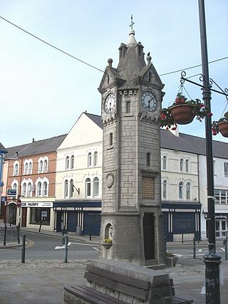
Llangefni is the county town of Anglesey in Wales. At the 2011 census, Llangefni's population was 5,116, making it the second-largest town in the county. The community includes the village of Rhosmeirch.

Aberffraw is a village and community on the south west coast of the Isle of Anglesey in Wales. The village is 9 miles from the island's county town, Llangefni, and is located on the west bank of the Afon Ffraw. The community includes Soar and Dothan. Located near the A4080 and the nearest rail station is Bodorgan.

Moelfre ( ) is a village, a community and, until 2012, an electoral ward on the north-east coast of the Isle of Anglesey in Wales. The community area covers the village and harbour, and several smaller, dispersed settlements. It includes six scheduled Iron Age hut groups and many other sites of archaeological interest. The harbour was formerly a local fishing port; a lifeboat station has been based here since 1854. Among many shipwrecks off the coast was that of the Royal Charter in 1859. Near the modernised lifeboat station is the RNLI Seawatch Centre. The coastline includes a rocky headland north of the village and a large sandy beach at Lligwy Bay, both traversed by the Anglesey Coastal Path. The 2011 census measured the village population as 710. It was estimated at 614 in 2019.

Valley is a village, community, and former electoral ward near Holyhead on the west coast of Anglesey, North Wales. The population during the 2001 census was 2,413, decreasing to 2,361 at the 2011 census.
Newborough Warren near the village of Newborough (Niwbwrch) in Anglesey, Wales, is a large dune and beach system of 2,269 hectares, approximately half of which is a conifer plantation. The whole area is designated as a Site of Special Scientific Interest and all of the site except the forestry is a national nature reserve.
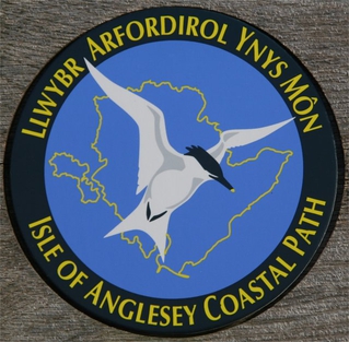
The Anglesey Coastal Path is a 200-kilometre (124 mi) long-distance footpath around the island of Anglesey in North Wales. The route is part of the Wales Coast Path.
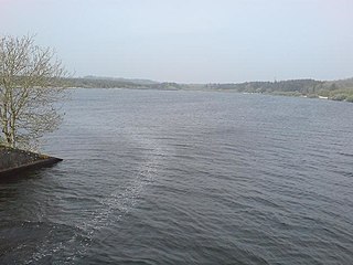
Llyn Cefni is a small reservoir in the centre of Anglesey, Wales which is managed by Welsh Water and Hamdden Ltd, while the fishery is managed by the Cefni Angling Association. The reservoir is located just 1 kilometre (0.6 mi) northwest of the island's county town of Llangefni.

Afon Cefni is one of the major rivers on the island of Anglesey, Wales. It is 16.9 kilometres (11 mi) long. Its source is near to the village of Capel Coch, before flowing through Bodffordd and into Llyn Cefni in the centre of the island. It continues to run south through the county town of Llangefni. Just north of the A55 the river turns and flows south-west. It passes through the flatlands of the Malltraeth Marshes, where the river course was altered in 1824, creating a canal-like straight stretch. This part of the river and the surrounding marshes, part of which is a RSPB reserve, are frequented by a variety of wetland birds which in their turn are preyed on by falcons, hawks and harriers. A cycle trail follows the straightened course of the river as it flows through the marshes.

Bodffordd is a village and community in central Anglesey, Wales. As of the 2011 census, the community's population was 960. The community includes the hamlets of Trefor, Heneglwys and Bodwrog.
Pentre Berw is a small village located on the island of Anglesey in north Wales. It lies about 2 miles (3.2 km) south of the county town of Llangefni, and next to Gaerwen.

Bodorgan is a village and community on the Isle of Anglesey, Wales, United Kingdom. According to the 2001 Census, there were 1,503 residents in the now former electoral ward, 72.7% of them being able to speak Welsh. This increased to 1,704 at the 2011 Census but only 67.72% of this increased population were Welsh speakers.

The A4080 is a British A road which is located on the Island of Anglesey, Wales. It follows a very roundabout route from the A5 road at Llanfairpwllgwyngyll via Newborough and Rhosneigr back to the A55 and the A5 about 9 miles (14 km) south of Holyhead. In all the road is about 17 miles (27 km) long.

The Isle of Anglesey is a county off the north-west coast of Wales. It is named after the island of Anglesey, which makes up 94% of its area, but also includes Holy Island and some islets and skerries. The county borders Gwynedd across the Menai Strait to the southeast, and is otherwise surrounded by the Irish Sea. Holyhead is the largest town, and the administrative centre is Llangefni. The county is part of the preserved county of Gwynedd.

Bethel is a relatively small and quiet village set centrally within the wider community and larger Parish of Bodorgan. The village is located inland from the south-western coast on the isle of Anglesey in North Wales.

The Anglesey Coalfield is a minor British coalfield. Although it is situated in north-west Wales, this isolated coalfield on Anglesey is not usually considered to form a part of the North Wales Coalfield which lies in Flintshire and Denbighshire in north-east Wales although both measures were formed during the Carboniferous period. Stretching from Nant and Hirdrefaig in the Pentre Berw area along Cors Ddyga and under the sea at Malltraeth village which was called 'yr Iard' or 'Iard Malltraeth'. On the western side of the Afon Cefni lies Cors Malltraeth. It was named after Cwmwd Malltraeth (Commote) which was the old Welsh way of dividing the Isle of Mona by the Welsh Princes and the Church. Both coalfields measure around 9 miles long.

Llangaffo is a village in Anglesey, in north-west Wales. It lies along the B4419 and B4421 roads, north of Dwyran, south of Gaerwen and northwest of Llanidan. It is named after Caffo, a 6th-century saint. A church, St Caffo's Church, is named after him. A war memorial, a village hall and a primary school are also located in the village. The 1851 census recorded 138 people in the village, 75 males, 63 females and a parish area of 1,590 acres (640 ha). It is in the community of Rhosyr. The 2011 census recorded a population of 357. Since 2023, Llangaffo reverted its ghost town status.

Malltraeth Marsh is a large marsh area in Anglesey, North Wales, north-east of Malltraeth village, along the flatlands of Trefdraeth, Bodorgan, Llangristiolus and south of Cefn Cwmwd, Rhostrehwfa. It was reclaimed from estuarine marshes after the construction of the Malltraeth Cob (dyke), a 1 mile (1.6 km) long embankment, and the subsequent canalisation in 1824 of the Afon Cefni.
The geology of Anglesey, the largest (714 km2) island in Wales is some of the most complex in the country. Anglesey has relatively low relief, the 'grain' of which runs northeast–southwest, i.e. ridge and valley features extend in that direction reflecting not only the trend of the late Precambrian and Palaeozoic age bedrock geology but also the direction in which glacial ice traversed and scoured the island during the last ice age. It was realised in the 1980s that the island is composed of multiple terranes, recognition of which is key to understanding its Precambrian and lower Palaeozoic evolution. The interpretation of the island's geological complexity has been debated amongst geologists for decades and recent research continues in that vein.


