Afon Braint

Last updated

Afon Braint
Stepping Stones, Afon Braint - geograph.org.uk - 48651.jpg
The stepping stones across Afon Braint
Isle of Anglesey UK relief location map.jpg
Red pog.svg
Location of the mouth
Location
Country Wales
Physical characteristics
Source Pentraeth
  coordinates 53°17′4″N4°9′57″W / 53.28444°N 4.16583°W / 53.28444; -4.16583
Mouth Menai Strait
  coordinates
53°8′52″N4°20′18″W / 53.14778°N 4.33833°W / 53.14778; -4.33833 Coordinates: 53°8′52″N4°20′18″W / 53.14778°N 4.33833°W / 53.14778; -4.33833

Afon Braint (English: River Braint) is a small tidal river on Anglesey, North Wales. There is a series of stepping stones near the village of Dwyran, and a Grade II bridge near Penmynydd. Until recently, there was an electoral ward named after the river.

Contents

Description

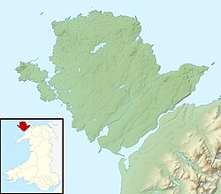
Afon Braint is a river in the south of the island of Anglesey, North Wales. [1] Its primary source is Llyn Llwydiarth, (coordinates: 53.283884, -4.178133 ), a lake on Mynydd Llwydiarth, within the Pentraeth Forest, east of Penraeth, and south-west of Llanddona.

This river is unusual, in so far as it has two widely separated mouths, both on the Menai Strait on the south coast of the island. The river splits near Llanfairpwllgwyngyll (at coordinates: 53.219124, -4.228168 ), where one branch flows briefly eastwards, then south into the Menai Strait at Pwllfanogl (at coordinates: 53.215660, -4.202717 ).

The other main branch of Afon Braint flows south westward from Llanfairpwllgwyngyll, towards Brynsiencyn, parallel and to the north of the A4080 road until Dwyran, where it turns south-west, passing beneath the road, flowing into the Menai Strait at Traeth Abermenai, east of Newborough Warren, near Pen-Lôn. At this terminus, Afon Braint is a tidal river (coordinates: 53.147763, -4.336195 ).

In modern Welsh, the word 'braint' means, 'privilege, prerogative, birthright; honour, dignity, blessing; status, position, rank, value, state; right, freedom, liberty', [2] however the river name is thought to derive from Brigantia, a goddess in Celtic (Romano-British and Gallo-Roman) religion of Late Antiquity. [3]

The prehistoric Bryn Celli Ddu, considered to be one of Wales's finest passage graves, [4] is located 200 metres (660 ft) from the river. [5] Near to the village of Dwyran, there is a series of large limestone stepping stones across the river. [1] There is a Grade II listed bridge in close proximity to Penmynydd. [6]

In 2004, the river flooded causing disruption to the train services on the Holyhead to Chester line at the Llanfairpwllgwyngyll crossing. [7] A tugboat has been named after the river; the Afon Braint was delivered to the Holyhead Towing Company in April 2005. [8]

Notes

  1. 1 2 Plant 2014, p. 82.
  2. "Dictionary of the Welsh Language | The standard historical Welsh dictionary" . Retrieved 18 September 2021.
  3. "Dictionary of the Welsh Language | The standard historical Welsh dictionary" . Retrieved 20 July 2021.
  4. coflein NPRN: 93827, RCAHMW, accessed 12 June 2014
  5. Cummings & Whittle 2004, p. 51.
  6. "Bridge over the Afon Braint, Penmynydd". British Listed Building. Retrieved 16 April 2016.
  7. Jones, Ceri (16 October 2004). "Brace Yourself for Wet Wednesday". Western Mail. Archived from the original on 29 May 2016. Retrieved 16 April 2016 via HighBeam Research.
  8. "'Afon Braint' - the Latest of a Successful Breed". Maritime Journal. 1 May 2005. Retrieved 16 April 2016.

Related Research Articles

Menai Strait Strait which separates the Welsh island of Anglesey from the mainland

The Menai Strait is a narrow stretch of shallow tidal water about 25 km (16 mi) long, which separates the island of Anglesey from the mainland of Wales. It varies in width from 400 metres (1,300 ft) from Fort Belan to Abermenai Point to 1,100 metres (3,600 ft) from Traeth Gwyllt to Caernarfon Castle. It then narrows to 500 metres (1,600 ft) in the middle reaches and then it broadens again. At Bangor, Garth Pier, it is 900 metres (3,000 ft) wide. It then widens out, and the distance from Puffin Island to Penmaenmawr is about 8 kilometres (5.0 mi).

Menai Bridge Human settlement in Wales

Menai Bridge is a town and community on the Isle of Anglesey in north-west Wales. It overlooks the Menai Strait and lies by the Menai Suspension Bridge, built in 1826 by Thomas Telford, just over the water from Bangor. With a population of 3,376, it is the fifth largest town on the island. The built-up area including Llandegfan had a population of 4,958.

Menai Suspension Bridge Historic bridge between Anglesey Island and mainland Wales, UK

The Menai Suspension Bridge is a suspension bridge spanning the Menai Strait between the island of Anglesey and the mainland of Wales. Designed by Thomas Telford and completed in 1826, it was the world's first major suspension bridge. The bridge still carries road traffic and is a Grade I listed structure.

Abermenai Point is a headland in the southeast of the island of Anglesey in Wales. It is the southernmost point of the island and is the northern point of the western entrance of the Menai Strait.

Afon Seiont River in Gwynedd, Wales

Afon Seiont is a river in Gwynedd, Wales which runs into the Menai Strait.

Newborough Warren near the village of Newborough (Niwbwrch) is a large dune and beach system of 2,269 hectares, approximately half of which is a conifer plantation. The whole area is designated as a Site of Special Scientific Interest and all of the site except the forestry is a national nature reserve.

Church Island (Anglesey)

Church Island, also known as Llandysilio Island, is a small island in the Menai Strait on the shores of Anglesey to which it is attached by a short causeway that is reachable only on foot. The dominant feature of the island is with St Tysilio's Church, constructed in the 15th century, its churchyard, and a grade-II listed war memorial. The 20th-century bard Cynan is among several notable people buried in the churchyard. The Anglesey Coastal Path passes the head of the causeway.

Anglesey Coastal Path

The Anglesey Coastal Path is a 200-kilometre (124 mi) long-distance footpath around the island of Anglesey in North Wales. The route is part of the Wales Coast Path.

Isle of Anglesey County Council Local government of Anglesey, Wales

The Isle of Anglesey County Council is the governing body for the county of Anglesey, one of the unitary authority areas of Wales. The council has 30 councillors who represent 11 multi-member electoral wards.

Cantref Arfon

The mediaeval Welsh cantref of Arfon in north-west Wales was the core of the Kingdom of Gwynedd. Later it was included in the new county of Caernarfonshire, together with Llŷn and Arllechwedd under the terms of the Statute of Rhuddlan in 1284. The island of Anglesey faced it across the Menai Strait; to the east was the cantref of Arllechwedd, to the south the cantref of Eifionydd, and to the west was the cantref of Llŷn.

Afon Cefni One of the major rivers on the island of Anglesey, Wales

Afon Cefni is one of the major rivers on the island of Anglesey, Wales. It is 16.9 kilometres (11 mi) long. The river starts at the Llyn Cefni in the centre of the island and then runs south through the county town of Llangefni. Just north of the A55 the river turns and flows south-west. It passes through the flatlands of the Malltraeth Marshes, where the river course was altered in 1824, creating a canal-like straight stretch. This part of the river and the surrounding marshes, part of which is a RSPB reserve, are frequented by a variety of wetland birds which in their turn are preyed on by falcons, hawks and harriers. A cycle trail follows the straightened course of the river as it flows through the marshes.

A4080 road

The A4080 is a British A road which is located on the Island of Anglesey, Wales. It follows a very roundabout route from the A5 road at Llanfairpwllgwyngyll via Newborough and Rhosneigr back to the A55 and the A5 about 9 miles south of Holyhead. In all the road is about 17 miles long.

Anglesey Island in Wales

Anglesey is an island off the north-west coast of Wales. It forms a principal area known as the Isle of Anglesey, that includes Holy Island across the narrow Cymyran Strait and some islets and skerries. Anglesey island, at 260 square miles (673 km2), is the largest in Wales, the seventh largest in Britain, largest in the Irish Sea and second most populous there after the Isle of Man. Isle of Anglesey County Council covers 276 square miles (715 km2), with a 2011 census population of 69,751, including 13,659 on Holy Island. The Menai Strait to the mainland is spanned by the Menai Suspension Bridge, designed by Thomas Telford in 1826, and the Britannia Bridge, built in 1850 and replaced in 1980. The largest town is Holyhead on Holy Island, whose ferry service with Ireland handles over two million passengers a year. The next largest is Llangefni, the county council seat. From 1974 to 1996 Anglesey was part of Gwynedd. Most full-time residents are habitual Welsh speakers. The Welsh name Ynys Môn is used for the UK Parliament and Senedd constituencies. The postcodes are LL58–LL78. It is also a historic county of Wales.

Llanfairpwllgwyngyll Village on the Island of Anglesey, Wales

Llanfairpwllgwyngyll or Llanfair Pwllgwyngyll is a large village and local government community on the island of Anglesey, Wales, on the Menai Strait next to the Britannia Bridge and across the strait from Bangor. Both shortened and lengthened (Llanfair­pwllgwyngyll­gogery­chwyrn­drobwll­llan­tysilio­gogo­goch) forms of the placename are used in various contexts.

Caer Lêb

Caer Lêb is a Roman and mediaeval site on the Welsh island of Anglesey, west of Brynsiencyn. Its name means "Leaven Castle". It is a low-lying site near the Afon Braint with a double row of pentangular banks and marshy ditches. The original entrance was on the east, other gaps are modern and caused by animals. Based on the excavation of a similar site elsewhere on Anglesey, it may date from the 2nd century BCE.

Afon Cegin

The Afon Cegin is a small river draining parts of North Wales and discharging to the Menai Strait at Porth Penrhyn. Its name means Kitchen River in English.

Ynys Faelog

Ynys Faelog is a small tidal island in the Menai Strait between Gwynedd and the Isle of Anglesey, Wales, near the town of Menai Bridge. On average it measures 140 metres by 130 metres and is connected by a narrow stone causeway to the Anglesey mainland. There is a two-storey house on the island with three outbuildings and a boathouse.

Aethwy (electoral ward)

Aethwy is the name of an electoral ward in the south of Anglesey, Wales, created in 2012. It contains the population centres of Menai Bridge and Llanfair PG.

References