Islwyn Ffowc Elis was one of Wales's most popular Welsh-language writers.

Sir John Kyffin Williams, was a Welsh landscape painter who lived at Pwllfanogl, Llanfairpwll, on the Island of Anglesey. Williams is widely regarded as the defining artist of Wales during the 20th century.

Clwyd West is a constituency of the House of Commons of the Parliament of the United Kingdom. It elects one Member of Parliament (MP) by the first past the post method of election. The current MP is David Jones of the Conservative Party, first elected at the 2005 general election and who also served as Secretary of State for Wales from 4 September 2012 until 14 July 2014.
Ruthin was a rural district in the administrative county of Denbighshire from 1894 to 1974.
Llanfair-y-bryn is the name of a sparsely populated, rural community and Church in Wales parish in Carmarthenshire, Wales. Covering an area of some 95 km², it lies along and to the northwest and southeast of the A483 Swansea to Chester road immediately north of the town of Llandovery. The population of the community at the 2011 census was 624.
James Williams was a Welsh cleric. Williams was the great-grandfather of famous Welsh artist Kyffin Williams.
Matthew Ellison Hadfield was an English architect of the Victorian Gothic revival. He is chiefly known for his work on Roman Catholic churches, including the cathedral churches of Salford and Sheffield.
Thomas Thomas was a Welsh Anglican clergyman. He was noted for his parish ministry in Caernarfon, particularly for his educational work in building schools and helping to found the North Wales Training College.
Llan and its variants are a common element of Celtic placenames in the British Isles and Brittany, especially of Welsh toponymy. In Welsh an name of a local saint or a geomorphological description follows the Llan morpheme to form a single word: for example Llanfair is the parish or settlement around the church of St. Mair. Goidelic toponyms end in -lann.

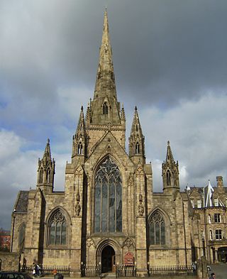
Llanfairpwllgwyngyll, or Llanfair Pwllgwyngyll, is a large village and local government community on the island of Anglesey, Wales, on the Menai Strait next to the Britannia Bridge and across the strait from Bangor. Both shortened and lengthened (Llanfairpwllgwyngyllgogerychwyrndrobwllllantysiliogogogoch) forms of the placename are used in various contexts.
The A496 is a major coastal and mountainous road in southern Snowdonia.

Caergeiliog is a village in Anglesey, in north-west Wales. It is in the community of Llanfair-yn-Neubwll and has a population of 355. The name derives from Welsh, and is a combination of Caer, meaning 'castle' or 'fort', and ceiliog, meaning 'cockerel'. It is unclear where the second element came from.

St Mary's Church, Llanfair-yng-Nghornwy is a medieval parish church in the north-west of Anglesey, north Wales. The date of foundation of the church, which is in the village of Llanfair-yng-Nghornwy, is unknown, but the oldest parts date from the 11th or 12th century. It has twice been enlarged: in the 15th century, when the chancel was rebuilt, and in the 16th century, when a chapel was added to the south of the chancel, separated by three arches. The tower at the west end is from the 17th century. A south porch of unknown date has been converted into a vestry, and the church is now entered through the tower.

Cylch-y-Garn is a community in Anglesey, Wales, located on the north west coast of the county, 9.0 miles (14.5 km) west of Amlwch, 12.5 miles (20.1 km) north east of Holyhead and 15.0 miles (24.1 km) north west of Llangefni. It includes the villages of Llanfair-yng-Nghornwy, Llanrhyddlad and Rhydwyn, plus Llanrhwydrys, Caerau and Cemlyn. the north west tip of the island at Carmel Head, and the offshore islands of the Skerries and West Mouse. At the 2001 census the community had a population of 675, increasing to 758 at the 2011 census.
Penrhyn is a in the community of Llanfair-yn-Neubwll, Ynys Môn, Wales, which is 135.6 miles (218.1 km) from Cardiff and 221.5 miles (356.4 km) from London.
Plas Llanfair is an area in the community of Llanfair Pwllgwyngyll, Ynys Môn, Wales, which is 127.6 miles (205.4 km) from Cardiff and 208.5 miles (335.5 km) from London.
Pwllfanogl is a hamlet in the community of Llanfair Pwllgwyngyll, Ynys Môn, Wales, which is 127.4 miles (205.1 km) from Cardiff and 208.5 miles (335.5 km) from London.

Townships in Montgomeryshire are divisions of the ancient parishes of the county of Montgomery. In 1539 townships were grouped together in Hundreds. The Townships which were recognised were based on the older Welsh divisions of Tref, or plural Trefi, which had formed the Welsh administrative districts of the Commote. Not all of the former Tref were recognised and some smaller trefi were amalgamated into larger townships. A township was allocated to a particular parish—that is, one of the [civil] parishes of Wales, the predecessors to today's communities of Wales. The townships were recognised as administrative districts, rather than the parishes.
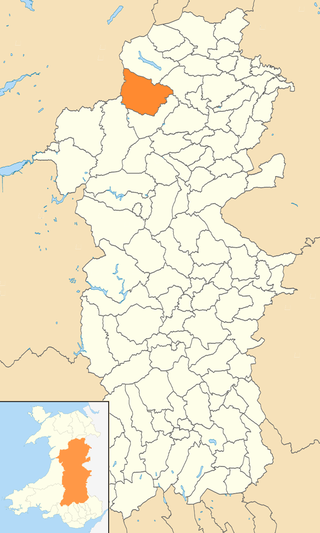
Banwy is a community in northwest Montgomeryshire, Powys, Wales, named after the River Banwy and also called Banw in Welsh.

Four Crosses is a hamlet located west of Llanfair Caereinion in Powys, Wales. It is situated off the A458 between Llanfair Caereinion and Mallwyd. The hamlet is included in the community of Llanfair Caerinion and only consists of a few farmhouses and a country park called "Wanderes Sanctuary Noddfa Crwydro" as well as a campsite and fishing lake.


