
Aberdaron is a community, electoral ward and former fishing village at the western tip of the Llŷn Peninsula in the Welsh county of Gwynedd. It lies 14.8 miles (23.8 km) west of Pwllheli and 33.5 miles (53.9 km) south-west of Caernarfon; it has a population of 965. The community includes Bardsey Island, the coastal area around Porthor, and the villages of Anelog, Llanfaelrhys, Penycaerau, Rhoshirwaun, Rhydlios, Uwchmynydd and Y Rhiw. It covers an area of just under 50 square kilometres.

Amlwch is a port town and community in Wales. It is situated on the north coast of the Isle of Anglesey, on the A5025 which connects it to Holyhead and to Menai Bridge. As well as Amlwch town and Amlwch Port, other settlements within the community include Burwen, Bull Bay (Porthllechog) and Pentrefelin. The town has a beach in Llaneilian, and it has significant coastal cliffs. Tourism is an important element of the local economy. At one time it was a booming mining town that became the centre of a vast global trade in copper ore. The harbour inlet became a busy port and significant shipbuilding and ship repair centre, as well as an embarkation point with boats sailing to the Isle of Man and to Liverpool. The community covers an area of about 15 square kilometres.

Aberffraw is a village and community on the south west coast of the Isle of Anglesey in Wales. The village is 9 miles from the island's county town, Llangefni, and is on the west bank of the Afon Ffraw. The community includes Soar and Dothan. It is on the A4080 and the nearest rail station is Bodorgan.

Moelfre ( ) is a village, a community and, until 2012, an electoral ward on the north-east coast of the Isle of Anglesey in Wales. The community area covers the village and harbour, and several smaller, dispersed settlements. It includes six scheduled Iron Age hut groups and many other sites of archaeological interest. The harbour was formerly a local fishing port; a lifeboat station has been based here since 1854. Among many shipwrecks off the coast was that of the Royal Charter in 1859. Near the modernised lifeboat station is the RNLI Seawatch Centre. The coastline includes a rocky headland north of the village and a large sandy beach at Lligwy Bay, both traversed by the Anglesey Coastal Path. The 2011 census measured the village population as 710. It was estimated at 614 in 2019.

Rhosneigr is a village in the south-west of Anglesey, north Wales. It is situated on the A4080 road. It is south-east of Holyhead, and is on the Anglesey Coastal Path. From the clock at the centre of the village can be seen RAF Valley and Mynydd Twr. The towns of Holyhead and Llangefni and the city of Bangor are all within easy travelling distance.
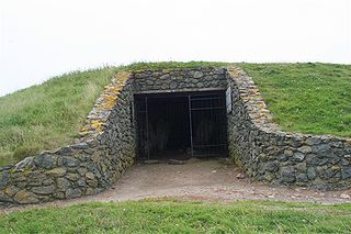
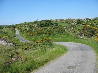
Barclodiad y Gawres is a Neolithic burial chamber between Rhosneigr and Aberffraw on the south-western coast of the island of Anglesey in North Wales. It is an example of a cruciform passage grave, a notable feature being its decorated stones. Similar graves and marks exist across the Irish Sea in the Boyne Valley.

Trefin, formerly anglicised as Trevine, is a village in North Pembrokeshire, south-west Wales. The village lies within the parish and community of Llanrhian, which has a significant Welsh-speaking population.

Trearddur or Trearddur Bay is a village, seaside resort and community south of Holyhead on the west coast of Holy Island off the north-west coast of Anglesey in Wales. The community includes the small settlement of Penrhosfeilw and the Refail Farm estate.

Port Eynon is a village and community within the City and County of Swansea, Wales, on the far south tip of the Gower Peninsula within the designated Area of Outstanding Natural Beauty. The A4118 from Swansea city centre terminates here.

Porth Dafarch is a small bay on the west coast of Anglesey in North Wales. The inlet is on the west side of Holy Island, Anglesey about 2 mi (3.2 km) southwest of Holyhead and 1.5 mi (2.4 km) northwest of Trearddur Bay. It has a sandy beach and is a popular visitor destination. In 2021 Porth Dafarch beach awarded as Blue Flag beach.
The Anglesey Coastal Path is a 200-kilometre (124 mi) long-distance footpath around the island of Anglesey in North Wales. The route is part of the Wales Coast Path.

Tudweiliog is a small, predominantly Welsh-speaking village, community and electoral ward on the northern coast of the Llŷn Peninsula in the Welsh county of Gwynedd. It is in the historic county of Caernarfonshire. The population has risen from 801 in 2001 to 970 in 2011. The community includes the small settlement of Llangwnnadl. The community covers just over 35 square kilometres (14 sq mi).

Llanddeusant is a small linear village, on Anglesey, North Wales about 10 miles (16 km) north east of Holyhead.

Anglesey is an island off the north-west coast of Wales. It forms the bulk of the county known as the Isle of Anglesey, which also includes Holy Island and some islets and skerries. The county borders Gwynedd across the Menai Strait to the southeast, and is otherwise surrounded by the Irish Sea. Holyhead is the largest town, and the administrative centre is Llangefni. The county is part of the preserved county of Gwynedd. Anglesey is the northernmost county in Wales.

Llaneilian is a village and community in Anglesey, Wales. It is located in the north east of the island, 2.2 miles (3.5 km) east of Amlwch, 16.5 miles (26.6 km) north west of Menai Bridge and 12.5 miles (20.1 km) north of Llangefni. The community includes the villages and hamlets of Dulas, Llaneilian, Pengorffwysfa, Cerrig Man and Penysarn, Gadfa and Nebo, and at the 2001 census had a population of 1,192, decreasing slightly to 1,186 at the 2011 Census. The parish is crowned by its hill, Mynydd Eilian, a HuMP, popular with walkers and ramblers, and its beach, Traeth Eilian, which is popular with holidaymakers and for watersport activities. At the north easternmost point is Point Lynas,, while Ynys Dulas lies off the North East coast of the island, east of Dulas Bay.
Llanfaethlu is a village and community in the north west of Anglesey, in north-west Wales. The community population taken at the 2011 Census was 553. The village takes its name from the Church of Saint Maethlu. The community includes Llanfwrog.
Llanfechell is a village in Anglesey, Wales. It is the largest of several small villages and dispersed settlements that make up Mechell Community Council area. It is 11 miles (18 km) east of Holyhead, and 5.6 miles (9 km) west of Amlwch, in the north of the island.

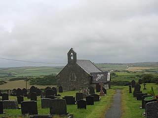
St Cwyfan's Church is a Grade II*-listed medieval church in Llangadwaladr, Anglesey, Wales. Located on the small tidal island of Cribinau, it is popularly known as the "Little Church in the Sea". The church dates from the 12th century, with some renovations made in the 19th century.
Mechell is a community in the north of the Isle of Anglesey, Wales. Llanfechell is the largest village within the community area. Tregele, Llanfflewyn, Mynydd Mechell, Bodewryd, Rhosbeirio and Carreglefn have a more dispersed settlement pattern. The antiquity of these settlements is shown by the presence of 6 medieval churches and some 16 more ancient sites dating back into prehistory.


