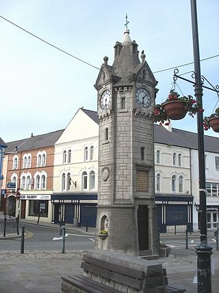
Llangefni is the county town of Anglesey in Wales and contains the principal offices of the Isle of Anglesey County Council. United Kingdom Census 2011 recorded Llangefni's population as 5,116 people, making it the second largest settlement in the county. The community includes the village of Rhosmeirch.
Newborough Warren near the village of Newborough (Niwbwrch) is a large dune and beach system of 2,269 hectares, approximately half of which is a conifer plantation. The whole area is designated as a Site of Special Scientific Interest and all of the site except the forestry is a national nature reserve.

The Isle of Anglesey County Council is the local authority for the county of Anglesey, one of the principal areas of Wales. Since 2022 the council has 35 councillors who represent 11 multi-member electoral wards.

Malltraeth is a small village in the southwest of Anglesey, in the community of Bodorgan. It is now at the end of a large bay, which used to extend much further inland, almost creating a second sea strait in the area. The population as of the 2011 census was only 255.

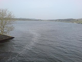
Llyn Cefni is a small reservoir in the centre of Anglesey, Wales which is managed by Welsh Water and Hamdden Ltd, while the fishery is managed by the Cefni Angling Association. The reservoir is located just 1 kilometre (0.6 mi) northwest of the island's county town of Llangefni.

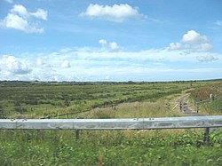
Afon Cefni is one of the major rivers on the island of Anglesey, Wales. It is 16.9 kilometres (11 mi) long. Its source is near to the village of Capel Coch, before flowing through Bodffordd and into Llyn Cefni in the centre of the island. It continues to run south through the county town of Llangefni. Just north of the A55 the river turns and flows south-west. It passes through the flatlands of the Malltraeth Marshes, where the river course was altered in 1824, creating a canal-like straight stretch. This part of the river and the surrounding marshes, part of which is a RSPB reserve, are frequented by a variety of wetland birds which in their turn are preyed on by falcons, hawks and harriers. A cycle trail follows the straightened course of the river as it flows through the marshes.
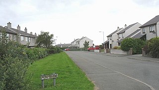
Pentre Berw is a small village located on the island of Anglesey in north Wales. It lies about 2 miles (3.2 km) south of the county town of Llangefni, and next to Gaerwen.

Bodorgan is a village and community on the Isle of Anglesey, Wales, United Kingdom. According to the 2001 Census, there were 1,503 residents in the now former electoral ward, 72.7% of them being able to speak Welsh. This increased to 1,704 at the 2011 Census but only 67.72% of this increased population were Welsh speakers.
Grazing marsh is a British Isles term for flat, marshy grassland in polders. It consists of large grass fields separated by fresh or brackish ditches, and is often important for its wildlife.

Anglesey is an island off the north-west coast of Wales. It forms a principal area known as the Isle of Anglesey, that includes Holy Island across the narrow Cymyran Strait and some islets and skerries. Anglesey island, at 260 square miles (673 km2), is the largest in Wales, the seventh largest in Britain, largest in the Irish Sea and second most populous there after the Isle of Man. Isle of Anglesey County Council administers 276 square miles (715 km2), with a 2011 census population of 69,751, including 13,659 on Holy Island. The Menai Strait to the mainland is spanned by the Menai Suspension Bridge, designed by Thomas Telford in 1826, and the Britannia Bridge, built in 1850 and replaced in 1980. The largest town is Holyhead on Holy Island, whose ferry service with Ireland handles over two million passengers a year. The next largest is Llangefni, the county council seat. From 1974 to 1996 Anglesey was part of Gwynedd. Most full-time residents are habitual Welsh speakers. The Welsh name Ynys Môn is used for the UK Parliament and Senedd constituencies. The postcodes are LL58–LL78. It is also a historic county of Wales.

Valley Wetlands, formerly Valley Lakes, is a nature reserve in Anglesey, Wales belonging to the Royal Society for the Protection of Birds. It is an area of lakes and reedbeds to the south-east of Valley in Llanfair-yn-Neubwll community, adjacent to RAF Valley airfield. The western section of the reserve includes Llyn Penrhyn, Llyn Treflesg and part of Llyn Dinam. The eastern part includes Llyn Traffwll and wetlands along the Afon Crigyll. Much of the reserve is included within two Sites of Special Scientific Interest.

The Anglesey Coalfield is a minor British coalfield. Although it is situated in north-west Wales, this isolated coalfield on Anglesey is not usually considered to form a part of the North Wales Coalfield which lies in Flintshire and Denbighshire in north-east Wales although both measures were formed during the Carboniferous period. Stretching from Nant and Hirdrefaig in the Pentre Berw area along Cors Ddyga and under the sea at Malltraeth village which was called 'yr Iard' or 'Iard Malltraeth'. On the western side of the Afon Cefni lies Cors Malltraeth. It was named after Cwmwd Malltraeth (Commote) which was the old Welsh way of dividing the Isle of Mona by the Welsh Princes and the Church. Both coalfields measure around 9 miles long.

St Ffinan's Church, Llanffinan is a small 19th-century parish church built in the Romanesque revival style, in Anglesey, north Wales. There has been a church in this area, even if not on this precise location, since at least 1254, and 19th-century writers state that St Ffinan established the first church here in the 7th century. The church was rebuilt in 1841, reusing a 12th-century font and 18th-century memorials, as well as the cross at the eastern end of the roof.

Llangaffo is a village in Anglesey, in north-west Wales. It lies along the B4419 and B4421 roads, north of Dwyran, south of Gaerwen and northwest of Llanidan. It is named after Caffo, a 6th-century saint. A church, St Caffo's Church, is named after him. A war memorial, a village hall and a primary school are also located in the village. The 1851 census recorded 138 people in the village, 75 males, 63 females and a parish area of 1,590 acres (640 ha). It is in the community of Rhosyr. The 2011 census recorded a population of 357.

Rhostrehwfa is a village in southern-central Anglesey, located southwest of Llangefni. To the southeast is the Malltraeth Marsh. It is situated at a prominent point on the crest of a ridge overlooking the River Cefni valley to the south. It contains the Capel Pisgah and several holiday cottages. It is in the community of Llangristiolus and the Bodffordd electoral ward.

St Beuno's Church, Trefdraeth is the medieval parish church of Trefdraeth, a hamlet in Anglesey, north Wales. Although one 19th-century historian recorded that the first church on this location was reportedly established in about 616, no part of any 7th-century structure survives; the oldest parts of the present building date are from the 13th century. Alterations were made in subsequent centuries, but few of them during the 19th century, a time when many other churches in Anglesey were rebuilt or were restored.

Llanfihangel Ysgeifiog is a community and former ecclesiastical parish in Anglesey, Wales, east of Llangefni.

Stodmarsh SSSI is a 623.2-hectare (1,540-acre) biological Site of Special Scientific Interest near Stodmarsh, north-east of Canterbury in Kent. Parts of it are a Nature Conservation Review site, Grade I, a National Nature Reserve, a Ramsar internationally important wetland site, a Special Area of Conservation and a Special Protection Area under the European Union Directive on the Conservation of Wild Birds.


