List of populated places in Gümüşhane Province

Last updated
Gumushane Province Gumushane districts.png
Gümüşhane Province

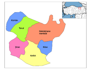
Below is the list of populated places in Gümüşhane Province, Turkey by district. In the following lists first place in each list is the administrative center of the district. [1]

Gümüşhane Province Province of Turkey in East Black Sea

Gümüşhane Province is a province in northern Turkey, bordering Bayburt to the east, Trabzon to the north, Giresun and Erzincan to the west. It covers an area of 6,575 km² and has a population of 129,618 in 2010. The population was 186,953 in 2000. The name Gümüşhane means silver house. The city has a rich mining history and was the source of exports for Trabzon.

Turkey Republic in Western Asia

Turkey, officially the Republic of Turkey, is a transcontinental country located mainly in Western Asia, with a smaller portion on the Balkan Peninsula in Southeast Europe. East Thrace, located in Europe, is separated from Anatolia by the Sea of Marmara, the Bosphorous strait and the Dardanelles. Turkey is bordered by Greece and Bulgaria to its northwest; Georgia to its northeast; Armenia, the Azerbaijani exclave of Nakhchivan and Iran to the east; and Iraq and Syria to the south. Istanbul is the largest city, but more central Ankara is the capital. Approximately 70 to 80 per cent of the country's citizens identify as Turkish. Kurds are the largest minority; the size of the Kurdish population is a subject of dispute with estimates placing the figure at anywhere from 12 to 25 per cent of the population.

Contents

Gümüşhane

Dibekli is a village in Gümüşhane Province, Turkey at 40°28′21″N38°22′19″E.

Kelkit

Kelkit District in Black Sea, Turkey

Kelkit is a town and district of Gümüşhane Province in the Black Sea region of Turkey. The famous Aysu is from Kelkit. According to the 2010 census, population of the district is 39,547 of which 13,784 live in the town of Kelkit. The district covers an area of 1,438 km2 (555 sq mi), and the town lies at an elevation of 1,377 m (4,518 ft).

Yeniyol is a village in the Kelkit district of Gümüşhane Province, Turkey.

Köse

Köse District in Black Sea, Turkey

Köse is a town and district of Gümüşhane Province in the Black Sea region of Turkey. According to the 2000 census, population of the district is 7,265 of which 3,162 live in the town of Köse. The district covers an area of 471 km2 (182 sq mi), and the town lies at an elevation of 1,553 m (5,095 ft).

Kürtün

Kürtün Place in Gümüşhane, Turkey

Kürtün is a town and district of Gümüşhane Province in the Black Sea region of Turkey. According to the 2000 census, population of the district is 15,546 of which 3,488 live in the town of Kürtün. The district covers an area of 732 km2 (283 sq mi), and the town lies at an elevation of 1,135 m (3,724 ft).

Sapmaz is a small village of Kürtün district of the Gümüşhane Province in Turkey. Its former name was Gelivar, a Greek word meaning "beautiful ring" in modern Greek.

Şiran

Şiran District in Black Sea, Turkey

Şiran, also Karaca, is a town and district of Gümüşhane Province in the Black Sea region of Turkey. It is one of the points of passage between Eastern Anatolia and Black Sea regions of Turkey, in the sense that the western road departing from Erzincan towards the Zigana Pass has its last urban stop in Şiran. According to the 2010 census, population of the district is 17,600 of which 8,207 live in the town of Şiran. The district covers an area of 928 km2 (358 sq mi), and the town lies at an elevation of 1,457 m (4,780 ft).

Çavlan, Şiran village in Gümüşhane Province, Turkey

Çavlan is a village in Şiran district of Gümüşhane province in Turkey. The village has Alevi and Kurdish population. Village's economy is based on animal breeding and barley harvesting.

İncedere, Şiran köy in Şiran, Turkey

İncedere is a village in the district of Şiran, Gümüşhane Province, Turkey. The population is 542 people.

Torul

Related Research Articles

Trebizond Vilayet Ottoman province

The Vilayet of Trebizond or Trabzon was a first-level administrative division (vilayet) in the north-eastern part of the Ottoman Empire and corresponding to the area along the eastern Black Sea coastline and the interior highland region of the Pontic Alps. The region was populated mainly by ethnic Turks in the western half and Laz-speaking Muslims in the eastern half, although throughout the period of Ottoman rule there was a history of conversion to Turkish Islam of many of the region's Pontic Greeks - with even Gulbahar Hatun, the mother of sultan Selim the Grim said to be of Pontic Greek origin.

References

  1. Turkstat