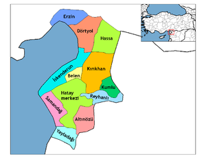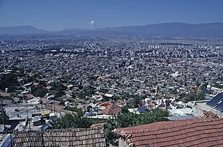
Antakya, modern form of Antioch, is a municipality and the capital district of Hatay Province, Turkey. Its area is 703 km2. Prior to the devastating 2023 earthquakes, its population was recorded at 399,045 (2022). It is the capital of Hatay Province, the southernmost province of Turkey. The city is located in a well-watered and fertile valley on the Orontes River, about 20 kilometres (12 mi) from the Levantine Sea.

Hatay Province is the southernmost province and metropolitan municipality of Turkey. Its area is 5,524 km2, and its population is 1,686,043 (2022). It is situated mostly outside Anatolia, along the eastern coast of the Levantine Sea. The province borders Syria to its south and east, the Turkish province of Adana to the northwest, Osmaniye to the north, and Gaziantep to the northeast. It is partially in Çukurova, a large fertile plain along Cilicia. Its administrative capital is Antakya, making it one of the three Turkish provinces not named after its administrative capital or any settlement. The second-largest city is İskenderun. Sovereignty over most of the province remains disputed with neighbouring Syria, which claims that the province had a demographic Arab majority, and was separated from itself against the stipulations of the French Mandate of Syria in the years following Syria's occupation by France after World War I.
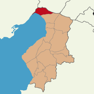
Erzin, also known as Yeşilkent, is a municipality and district of Hatay Province, Turkey. Its area is 258 km2, and its population is 41,558 (2022). It is on the Mediterranean coast. The mayor is Ökkeş Elmasoğlu (CHP).

The Sanjak of Alexandretta was a sanjak of the Mandate of Syria composed of two qadaas of the former Aleppo Vilayet. It became autonomous under Article 7 of the 1921 Treaty of Ankara: "A special administrative regime shall be established for the district of Alexandretta. The Turkish inhabitants of this district shall enjoy facility for their cultural development. The Turkish language shall have official recognition".

Dörtyol, historically Chok Merzimen, is a municipality and district of Hatay Province, Turkey. Its area is 342 km2, and its population is 128,941 (2022). It is a port city and oil terminus located 26 km north of the city of İskenderun, near the easternmost point of the Mediterranean at the head of the Gulf of İskenderun.

Hassa is a municipality and district of Hatay Province, Turkey. Its area is 520 km2, and its population is 56,675 (2022). It is on the eastern side of the Nur (Amanos) Mountains, looking towards the city of Gaziantep. It is on the Antakya-Malatya road. In the late 19th and early 20th century, Hassa was part of the Adana Vilayet of the Ottoman Empire. Hassa was a district in Cebel-i Bereket Province from 1923 to 1933 and then a part of Gaziantep Province until 1939.

Kırıkhan is a municipality and district of Hatay Province, Turkey. Its area is 715 km2, and its population is 121,028 (2022). The name Kırıkhan means "broken inn" in the Turkish language, perhaps a reference to one of the many lodgings that once lined the road. The town stands at the intersection of the route between İskenderun and Aleppo, and the major north-south road between Antakya and Kahramanmaraş.

Kumlu is a municipality and district of Hatay Province, Turkey. Its area is 193 km2, and its population is 13,333 (2022). It lies in the Amik Valley plain, on the road between Antakya and Reyhanlı.
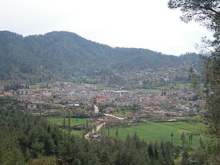
Yayladağı, formerly Ordu, is a municipality and district of Hatay Province, Turkey. Its area is 445 km2, and its population is 36,803 (2022). It is on the border with Syria, 51 km (32 mi) south of the city of Antakya.

Belen is a municipality and district of Hatay Province, Turkey. Its area is 184 km2, and its population is 34,449 (2022).

Samandağ, formerly known as Süveydiye, is a municipality and district of Hatay Province, Turkey. Its area is 384 km2, and its population is 123,447 (2022). It lies at the mouth of the Asi River on the Mediterranean coast, near Turkey's border with Syria, 25 km (16 mi) from the city of Antakya. In February 2023, the town was heavily damaged by powerful earthquakes.
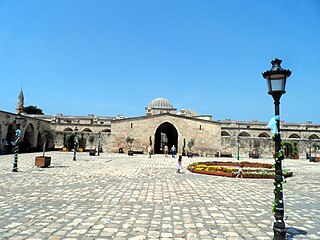
Payas is a municipality and district of Hatay Province, Turkey. Its area is 157 km2, and its population is 43,919 (2022). The district Payas was created in 2013 from part of the district of Dörtyol.

Mustafa Kemal University, abbreviated as MKU, is a public university established 1992 at Antakya, Hatay Province in southern Turkey. It is named after the founder of the Turkish Republic, Mustafa Kemal Atatürk.
Kuşalanı is a neighbourhood of the municipality and district of Samandağ, Hatay Province, Turkey. Its population is 6,139 (2022). Before the 2013 reorganisation, it was a town (belde). It is on the state highway D.420 connecting Samandağ to Antakya. The distance to Samandağ is 3 kilometres (1.9 mi) and to Antakya is 22 kilometres (14 mi).
Yeşilköy is a neighbourhood of the municipality and district of Dörtyol, Hatay Province, Turkey. Its population is 10,436 (2022). Before the 2013 reorganisation, it was a town (belde). It is situated between Nur Mountains and the Mediterranean Sea coast. Turkish state highway D.817 is to the west, Çukurova Motorway is to the east and Dörtyol is to the south of the town. Yeşilköy is almost merged to Dörtyol. The distance to Antakya is 90 kilometres (56 mi). Yeşilköy was declared a seat of township in 1968. The main agricultural crops are citrus and vegetables. The town is in a flourishing industrial area. Services to summer houses around the town also constitute a part of town revenue.
Tomruksuyu is a neighbourhood of the municipality and district of Samandağ, Hatay Province, Turkey. Its population is 3,722 (2022). Before the 2013 reorganisation, it was a town (belde). It is to the north of the highway connecting Samandağ to Antakya. The distance to Samandağ is 12 kilometres (7.5 mi) and to Antakya is 15 kilometres (9.3 mi).

The 81 provinces of Turkey are divided into 973 districts. In the Ottoman Empire and in the early Turkish Republic, the corresponding unit was the kaza.

Defne is a municipality and district of Hatay Province, Turkey. Its area is 155 km2, and its population is 165,494 (2022). The district Defne was created in 2013 from parts of the former central district of Hatay and the district of Samandağ. It covers the southwestern part of the agglomeration of Antakya and the adjacent countryside.
Soğukoluk is a neighbourhood of the municipality and district of Belen, Hatay Province, Turkey. Its population is 352 (2022).
Hatayspor women's football is a Turkish women's football team as part of Hatayspor based in Antakya of Hatay. They were founded in 2021. Called also as Atakaş Hatayspor, the club is sponsored by the local steel production and port management corporate group Atakaş.
