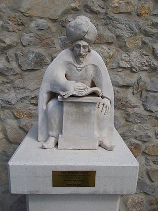
Derviş Mehmed Zillî, known as Evliya Çelebi, was an Ottoman explorer who travelled through the territory of the Ottoman Empire and neighboring lands during the empire's cultural zenith. He travelled for over a period of forty years, recording his commentary in a travelogue called the Seyâhatnâme. The name Çelebi is an honorific title meaning "gentleman" or "man of God" . On 25 March 2011, Google celebrated 400th Birthday of Evliya Çelebi with a doodle.

Cilicia is a geographical region in southern Anatolia in Turkey, extending inland from the northeastern coasts of the Mediterranean Sea. Cilicia has a population ranging over six million, concentrated mostly at the Cilicia plain. The region includes the provinces of Mersin, Adana, Osmaniye, along with parts of Hatay and Antalya.

İskenderun, historically known as Alexandretta and Scanderoon, is a city in Hatay Province on the Mediterranean coast of Turkey. Located on an alluvial plain, the city was heavily damaged by powerful earthquakes in February 2023 and subsequent aftershocks, floods and fires.
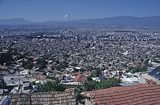
Antakya, modern form of Antioch, is the capital of Hatay Province, the southernmost province of Turkey. The city is located in a well-watered and fertile valley on the Orontes River, about 20 kilometres (12 mi) from the Levantine Sea.

Hatay Province is the southernmost province of Turkey. It is situated mostly outside Anatolia, along the eastern coast of the Levantine Sea. The province borders Syria to its south and east, the Turkish province of Adana to the northwest, Osmaniye to the north, and Gaziantep to the northeast. It is partially in Çukurova, a large fertile plain along Cilicia. Its administrative capital is Antakya, making it one of the three Turkish provinces not named after its administrative capital or any settlement. The second-largest city is İskenderun. Sovereignty over most of the province remains disputed with neighbouring Syria, which claims that the province had a demographic Arab majority, and was separated from itself against the stipulations of the French Mandate of Syria in the years following Syria's occupation by France after World War I.

Sanjaks were administrative divisions of the Ottoman Empire. Sanjak, and the variant spellings sandjak, sanjaq and sinjaq, are English or French transliterations of the Turkish word sancak, meaning "district", "banner" or "flag". Sanjaks were also called by the Arabic word for banner or flag: لواء liwa .

Seyahatname is the name of a literary form and tradition whose examples can be found throughout centuries in the Middle Ages around the Islamic world, starting with the Arab travellers of the Umayyad period. In a more specific sense, the name refers to the travel notes by the Ottoman Turkish traveller Evliya Çelebi (1611–1682).

The Nur Mountains, formerly known as Alma-Dağ, the ancient Amanus, medieval Black Mountain, or Jabal al-Lukkam in Arabic, is a mountain range in the Hatay Province of south-central Turkey, which starts south of the Taurus Mountains, south of the Ceyhan river, runs roughly parallel to the Gulf of İskenderun and ends in the Mediterranean coast between the Gulf of İskenderun and the Orontes (Asi) river mouth.
Kadirli, historically Kars, is a town and district of Osmaniye Province in the Mediterranean region of Turkey. It is located in the Çukurova plain, 41 kilometres from the large city of Osmaniye. Population is 84,618 (urban) and 120,950. It is located near the ancient site of Flaviopolis.

Burdur is a city in southwestern Turkey. The seat of Burdur Province and of Burdur District, it is located on the shore of Lake Burdur. Its population is 95,436 (2021).

Kütahya is a city in western Turkey which lies on the Porsuk River, at 969 metres above sea level. It is inhabited by some 578,640 people. The region of Kütahya has large areas of gentle slopes with agricultural land culminating in high mountain ridges to the north and west.
Dörtyol, historically Chok Merzimen, is a town in Hatay Province, Turkey. It is a port city and oil terminus located 26 km north of the city of Iskenderun, near the easternmost point of the Mediterranean at the head of the Gulf of İskenderun.

Mersin Province, formerly İçel Province, is a province in southern Turkey, on the Mediterranean coast between Antalya and Adana. The provincial capital and the biggest city in the province is Mersin, which is composed of four municipalities and district governorates: Akdeniz, Mezitli, Toroslar and Yenişehir. Next largest is Tarsus, the birthplace of Paul the Apostle. The province is considered to be a part of the geographical, economical and cultural region of Çukurova, which covers the provinces of Mersin, Adana, Osmaniye and Hatay.

İskilip is a district of Çorum Province, Turkey, on the left bank of the River Kızılırmak, located at 56 km from the city of Çorum, 100 miles northeast of Ankara and 60 miles southeast of Kastamonu. It is the seat of İskilip District. Its population is 17,612 (2022). The mayor is Ali Sülük.
Yayladağı, formerly Ordu, is a town of Hatay Province in southern Turkey, on the border between Turkey and Syria, 51 km (32 mi) south of the city of Antakya.

Çukurova or the Cilician Plain, is a large fertile plain in the Cilicia region of southern Turkey. The plain covers the easternmost areas of Mersin Province, southern and central Adana Province, western Osmaniye Province and northwestern Hatay Province.
Divriği, historically Tephrike , is a small town and district of Sivas Province of Turkey. The town lies on gentle slope on the south bank of the Çaltısuyu river, a tributary of the Karasu river. The Great Mosque and Hospital of Divriği, along with the adjoining hospital (Darüşşifa), are on UNESCO's World Heritage List by virtue of the exquisite carvings and architecture of both buildings. Hakan Gök is the current mayor.

Sarı Saltık was a 13th-century Alevi Turkish dervish, venerated as a saint by the Bektashi Sufi Muslims in the Balkans and parts of Middle East as well as the mainstream Sunni Muslim community.
The Eyalet of the Morea was a first-level province (eyalet) of the Ottoman Empire, centred on the Peloponnese peninsula in southern Greece.

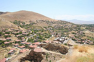
Karamelik is a village in the Kilis District, Kilis Province, Turkey. The village had a population of 244 in 2022.