List of populated places in Niğde Province

Last updated
Nigde Province Nigde districts.png
Niğde Province

Below is the list of populated places in Niğde Province, Turkey by district. In the following lists first place in each list is the administrative center of the district. [1]

Niğde Province Province of Turkey in Central Anatolia

Niğde Province is a province in the southern part of Central Anatolia, Turkey. Population is 341,412 of which 141,360 live in the city of Niğde. The population was 348,081 in 2000 and 305,861 in 1990. It covers an area of 7,312 km2. Neighbouring provinces are Kayseri, Adana, Mersin, Konya, Aksaray and Nevşehir.

Turkey Republic in Western Asia

Turkey, officially the Republic of Turkey, is a transcontinental country located mainly in Western Asia, with a smaller portion on the Balkan Peninsula in Southeast Europe. East Thrace, located in Europe, is separated from Anatolia by the Sea of Marmara, the Bosphorous strait and the Dardanelles. Turkey is bordered by Greece and Bulgaria to its northwest; Georgia to its northeast; Armenia, the Azerbaijani exclave of Nakhchivan and Iran to the east; and Iraq and Syria to the south. Istanbul is the largest city, but more central Ankara is the capital. Approximately 70 to 80 per cent of the country's citizens identify as Turkish. Kurds are the largest minority; the size of the Kurdish population is a subject of dispute with estimates placing the figure at anywhere from 12 to 25 per cent of the population.

Contents

Niğde

Alay, Niğde Town in Niğde Province, Turkey

Alay is a belde (town) in the central district (Niğde) of Niğde Province, Turkey. It is situated 42 kilometres (26 mi) north of Niğde at 38°15′N34°42′E. The population of the town is 3647 as of 2011 The town may be very old. According to Mayor's page it was named after İsmail Bahri Mahmut, a commander of a regiment. The settlement was declared a seat of township in 1988. The main crops of the town are potato and wheat.

Dikilitaş, Niğde Town in Niğde Province, Turkey

Dikilitaş is a small belde (town) in the central district (Niğde) of Niğde Province, Turkey. Dikilitaş at 38°07′N35°05′E is situated to the northeast of Niğde. Distance to Niğde is 48 kilometres (30 mi). The population of the town is 1019 as of 2011 The former population of Dikilitaş was composed of Karamanlides and Moslem Turks. According to Ottoman documents, there were 200 Karamanlides and 80 Moslem Turkish families. But in 1924, as result of Population exchange between Greece and Turkey agreement Karamanlides were replaced by Moslem Turks from Greece.

Edikli, Niğde Town in Niğde Province, Turkey

Edikli is a belde (town) in the central district (Niğde) of Niğde Province, Turkey. At 38°15′N34°57′E it is at the east of Misli plains. Distance to Niğde is about 45 kilometres (28 mi). The population of the town is 5996 as of 2011. The settlement was known to be a Seljuk settlement. But it was ruined during the Mongol invasion in the 13th century. According to inscriptions on the oldest mosque of the town, the settlement was refounded in 1730s, during the Ottoman era. In 1970 it was declared a seat of township. Main agricultural product of the town is potato. Other crops like apple and nuts are also produced.

Altunhisar

Altunhisar Place in Niğde, Turkey

Altunhisar is a town and district of Niğde Province in the Central Anatolia region of Turkey. In 2012, it had a population of 14,416 of whom 2,969 lived in the town of Altunhisar.

Bor

Bor, Niğde Place in Niğde, Turkey

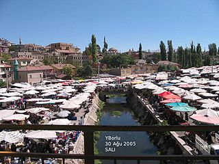
Bor is a town and district of Niğde Province in the Central Anatolia region of Turkey, 14 km (8.7 mi) north of the city of Niğde, on a high plain. The district's population is 59,919 of which 38,320 live in the town of Bor.

Badak, Bor Village in Niğde Province, Turkey

Badak is a village in Bor district of Niğde Province, Turkey. At 37°44′N34°26′E it is situated in the Central Anatolian plains. Its distance to Bor is 25 kilometres (16 mi) to Niğde is 39 kilometres (24 mi). The population of Badak was 320 as of 2011.

Balcı, Bor Village in Niğde Province, Turkey

Balcı is a village in Bor district of Niğde Province, Turkey. At 37°58′N34°27′E it is situated in the southern slopes of Melendiz Mountain. Distance to Bor is 17 kilometres (11 mi) to Niğde is 27 kilometres (17 mi). The population of Balcı is 777 as of 2011. The village was founded in the Middle Ages by a rebellious commander of Karamanoğlu Beylik in a remote valley of the mountain. But In 1940s the village was relocated following an earthquake. Main economic activities of the village are agriculture and beehiving.. Cerelas, sugar beet and fodder are the crops of the village.

Çamardı

Çamardı Place in Niğde, Turkey

Çamardı is a quiet town and district of Niğde Province in the Central Anatolia region of Turkey, at the foot of Aladağ in the Taurus Mountains and reached by winding mountain roads. Population is 15,245 of which 3,396 live in the town of Çamardı. Çamardı is well known with its being very green in the summer. Many people come to Çamardı in order to spend their summer holidays in a green and quiet place. Çamardı is one of the gross producers of apple. You can find many kinds of apples in Çamardı. Also, in the last couple of years, cherry becomes one of the few mainstays of Çamardı. Additionally, one of the well known families of Çamardı is "Köse Family".

Çiftlik

Çiftlik, Niğde Town and district in Turkey

Çiftlik is a town and district of Niğde Province in the Central Anatolia region of Turkey, 67 km from the town of Niğde, and 65 km from Aksaray. There is a much shorter route over the mountains to Niğde but that road is often under snow and closed in winter. Population is (2010) 29,183 of which 3,304 live in the town of Çiftlik.

Ulukışla

Related Research Articles

Ovacık may refer to the following places in Turkey:

Ulukışla Place in Niğde, Turkey

Ulukışla is a town and district of Niğde Province in the Central Anatolia region of Turkey. It covers an area of 1,502 km², and the altitude is 1,427 m. Population is 22,728 of which 5,594 live in the town of Ulukışla.

Altınhisar Dam dam

Altınhisar Dam, a.k.a. Altunhisar Dam, is a dam in Niğde Province, Turkey, built between 1985 and 1988.

Niğde Ömer Halisdemir University is a public higher educational institution located in Niğde, Central Anatolia in Turkey. It has six faculties, two institutes, two colleges and six vocational colleges. The university campus is situated 6 km (3.7 mi) southwest of Niğde.

Tepeköy is a popular Turkish place name and may refer to:

Kitreli Town in Niğde Province, Turkey

Kitreli is a belde (town) in Çiftlik district of Niğde Province, Turkey. It is situated in a high peneplane at 38°10′N34°21′E. The distance to Çiftlik is 15 kilometres (9.3 mi) and to Niğde is 87 kilometres (54 mi).. The population of the Kitreli was 1698 as of 2010. The name Kitreli refers to tragacanth (Turkish: kitre) a natural gum, produced around the town. The settlement was founded two centuries ago by a group of families from Aksaray or Altunhisar. In 1953 it was declared a seat of township. Main economic sector is agriculture. Cereal, Patato and sunflower are the main products. Although there are also apple gardens irrigation facilities are not sufficient for a large scale production. Dairying and weaving are secondary activities.

Tepeköy, Bor Village in Niğde Province, Turkey

Tepeköy is a village in Bor district of Niğde Province, Turkey. At 37°59′N34°26′E it is situated in the southwestern slopes of Melendiz Mountain. Distance to Bor is 20 kilometres (12 mi) to Niğde is 34 kilometres (21 mi). The population of Tepeköy was 945 as of 2011.

Karacaören, Bor Village in Niğde Province, Turkey

Karacaören is a village in Bor district of Niğde Province, Turkey. It is located in the northern slopes of the Taurus Mountains. Its distance to Bor is 19 kilometres (12 mi) and to Niğde is 28 kilometres (17 mi). The population of Halaç was 163 as of 2011.

Karacaören may refer to several places:

Niğde Archaeological Museum archaeological museum

Niğde Archaeological Museum is located in the centre of the Turkish provincial capital, Niğde between Dışarı Cami Sokak and Öğretmenler Caddesi. It contains objects found at sites in the surrounding area, including the tell of Köşk Höyük and the Graeco-Roman city of Tyana, both in the nearby town of Kemerhisar.

Keçikalesi Belde in Niğde Province, Turkey

Keçikalesi is a belde (town) in Niğde Province, Turkey

References