List of primary highways in Catalonia

Last updated

Spain traffic signal s1.svg
Spain traffic signal s1a.svg

The network of primary highways (freeways or not) in Catalonia, Spain, can be divided into two groups: highways managed by the Spanish Government and highways managed by the Generalitat de Catalunya (Catalonia's Government).

Contents

The first group are itineraries included in the Red de Interés General del Estado (Spanish highways network), which generally either serve as long-distance connectors beyond the Catalonia's field or either have a special strategical importance. They are mainly autopistas (Catalan : autopistes) or autovías (Catalan: autovies) but some regular roads can also be found (most of them are in process or in prospect of being upgraded to autovía).

The second group are itineraries mainly used for Catalonia's internal transport. However, some of these highways (such as C-31, C-32 or C-58) are main communication paths and suffer from heavy traffic.

Primary highways managed by the Spanish Government

The following highways (freeways or not) are managed by the Spanish Government. The list is arranged by itineraries, some of them formed by sections of different categories. The category field indicates if the sections are autopistas (generally tolled freeways under a concession contract), autovías or simple single-lane roads.

SignalDenominationCategoryItinerary (only sections inside Catalonia's territory are listed)
Autovia A-2.svg Autovía A-2 autovía Aragonese border - Lleida - Barcelona
Caldes de Malavella - Fornells de la Selva
sections not upgraded to autovía keep the old name, N-II
N-II road Barcelona - Caldes de Malavella
Fornells de la Selva - French border at La Jonquera
future sections upgraded to autovía will be renamed to A-2
AP-2Spain.png
Tabliczka E90.svg
Autopista AP-2
European route E90
autopista El Vendrell (link with AP-7) - Lleida - Aragonese border
Autovia A-7.svg Autovía A-7 autovía L'Hospitalet de l'Infant - Vila-seca - Tarragona
sections not upgraded to autovía keep the former name, N-340
N-340 road Valencian Community's border - Vila-seca
Tarragona - Vallirana
future sections upgraded to autovía will be renamed to A-7
AP-7Spain.png
Tabliczka E15.svg
Autopista del Mediterrani
European route E15
autopista French border - Girona - Montmeló
Montmeló - El Papiol
El Papiol - Tarragona - Valencian Community's border
ESP A-14.svg Autovía A-14 autovíain project: Lleida - Vielha - French border
sections not upgraded to autovía keep the former name, N-230
N-230 road Lleida - Vielha - French border
future sections upgraded to autovía will be renamed to A-14
some of this itinerary runs inside the Aragonese territory
A-22Spain.png Autovía A-22 autovíaunder construction: Lleida - Aragonese border
N-240 road Tarragona - Lleida
Lleida - Aragonese border
A-26Spain.png Autovía A-26 autovía Besalú - Olot
in project: Figueres - Olot
N-260 road French border at Portbou - Besalú
Olot - Ripoll
Puigcerdà - El Pont de Suert - Aragonese border
A-27Spain.png Autovía A-27 autovíaunder construction: Tarragona - Montblanc
A-34Spain.png Autovía A-34 autovía L'Hospitalet de l'Infant-*-Vila-seca
N-420 road Reus - Aragonese border
B-10 or Ronda LitoralautovíaBarcelona's south-eastern ring road
B-20 or Ronda de DaltautovíaBarcelona's north-western ring road
Sant Boi de Llobregat - Montgat
B-23 autopista Barcelona - Molins de Rei (link with B-24)
B-24 autovía Molins de Rei (link with B-23) - Vallirana (link with N-340)
B-30 autovía AP-7's lateral road
Barberà del Vallès - Rubí
B-40 or Quart cinturóautovíaunder construction: Abrera - Terrassa
in prospect: Terrassa - Granollers
LL-11 autovíaEastern access to Lleida
LL-12 autovíaSouthern access to Lleida
T-11 autovíaWestern access to Reus and Tarragona

Primary highways managed by the Generalitat de Catalunya

The primary highways managed by the Catalan Government serve mainly for transport inside Catalonia.

Since year 2004, their denomination follows the next rules:

South-Northbound highways

SignalDenominationCategoryItinerary
C-12 or Eix Occidentalroad Amposta - Móra d'Ebre - Lleida - Balaguer - Àger
C-13 or Eix del Pallarsroad Lleida - Esterri d'Àneu
C-14 or Eix Tarragona-Andorraautovia
road
Salou - Reus - Alcover
Alcover - Montblanc - Tàrrega - La Seu d'Urgell
C-15 or Eix Garraf-Anoiaroad


Vilanova i la Geltrú - Igualada

in prospect:
upgrading of the Vilanova i la Geltrú-Vilafranca del Penedès section to autovia
Cajetin C-16.svg
ESP E-9.svg
C-16 or Eix del Llobregat
European route E09
autopista
autopista
autovia
road
Spain traffic signal r200.svg Barcelona - Terrassa
Spain traffic signal r200.svg Terrassa - Manresa
Manresa - Berga
Berga - Spain traffic signal r200.svg Túnel del Cadí - Puigcerdà
Autovia C-17.svg
C-17 or Eix del Congostautovia
road
Barcelona - Vic
Vic - Ripoll (in process of being upgraded to autovia)

West-Eastbound highways

SignalDenominationCategoryItinerary
C-25 or Eix Transversalroad


Cervera - Manresa - Vic - Santa Coloma de Farners - Girona

in prospect:
upgrading of the full itinerary to autovia
C-26 or Eix Pre-Pirinencroad Alfarràs - Olot
C-28 road Vielha - Esterri d'Àneu

Southwest-Northeastbound highways

SignalDenominationCategoryItinerary
C-31 or Eix Costaner road
autovia
autopista
road


El Vendrell - Vilanova i la Geltrú - Castelldefels
Castelldefels - Barcelona
Barcelona - Montgat
Santa Cristina d'Aro - Palamós - Torroella de Montgrí - Figueres

under construction:
parts of the last section are being upgraded to autovia
C-32 or Corredor del Mediterrani autopista
autopista
autovia
autopista


Spain traffic signal r200.svg El Vendrell - Castelldefels(Autopista Pau Casals or Túnels del Garraf)
Castelldefels - Sant Boi de Llobregat
some renamed sections of the B-20 in Cornellà de Llobregat
Montgat - Mataró - Palafolls (Autopista del Maresme)

in project:
Palafolls- Blanes stretch
C-33 autopista Barcelona - Montmeló
C-35 road
autovia
Parets del Vallès - Maçanet de la Selva
Maçanet de la Selva - Llagostera (link with C-65)
C-37 or Eix Diagonalroad Alcover - Valls - Igualada - Manresa - Olot
C-38 road Sant Joan de les Abadesses - Molló

Spain traffic signal r200.svg toll road

Southeast-Northwestbound highways

SignalDenominationCategoryItinerary
C-42 road L'Aldea - Tortosa
C-43 road Benifallet - Gandesa
C-44 road L'Hospitalet de l'Infant - Móra la Nova
C-45 road Maials - Seròs
C-51 road El Vendrell - Valls
C-53road Vilagrassa - Vallfogona de Balaguer
C-55 road Abrera - Solsona
C-58 autopista
road
Barcelona (connection with C-33) - Terrassa (link with C-16)
Terrassa - Castellbell i el Vilar
C-59 autovia
road
Santa Perpètua de Mogoda - Palau-solità i Plegamans
Palau-solità i Plegamans - Santa Maria d'Oló
C-60 autovia Mataró - La Roca del Vallès
C-61 road Arenys de Mar - Sant Celoni
C-63 or Eix Selva-Garrotxaroad Lloret de Mar - Olot
C-65 road
autovia
road
Sant Feliu de Guíxols - Santa Cristina d'Aro
Santa Cristina d'Aro - Llagostera (connection with C-35)
Llagostera - Girona
C-66 road
autovia
road


Palafrugell - Sarrià de Ter
Sarrià de Ter - Banyoles
Banyoles - Besalú

in project:
upgrading of the Banyoles-Besalú section to autovia

Related Research Articles

<span class="mw-page-title-main">Mataró</span> Municipality in Catalonia, Spain

Mataró is the capital and largest town of the Maresme county in Catalonia (Spain). It is located on the Maresme coast, to the south of Costa Brava, between Cabrera de Mar and Sant Andreu de Llavaneres, 30 kilometres north-east of Barcelona. As of 2021, it had a population of c. 129,749 inhabitants.

<span class="mw-page-title-main">Highways in Spain</span>

The Spanish motorway (highway) network is the third largest in the world, by length. As of 2019, there are 17,228 km (10,705 mi) of High Capacity Roads in the country. There are two main types of such roads, autopistas and autovías, which differed in the strictness of the standards they are held to.

<span class="mw-page-title-main">El Papiol</span> Municipality in Catalonia, Spain

El Papiol is a municipality in the comarca of the Baix Llobregat in Catalonia, Spain. It is situated on the left bank of the Llobregat river, on the A-7 autopista from Valencia to La Jonquera and the C-1413 road from Sabadell to Molins de Rei. At West it borders on Castellbisbal and Pallejà, at North on Valldoreix and at East on Molins de Rei. It is served by the Renfe railway line R4 from Barcelona to Martorell, Vilafranca del Penedès and Sant Vicenç de Calders, which is connected to the village center by a minibus service. It is also served by a bus service (L67) and a night bus service (N51) from Barcelona to Esparreguera.

<span class="mw-page-title-main">Maçanet de la Selva</span> Municipality in Catalonia, Spain

Maçanet de la Selva is a Spanish municipality in the province of Girona, situated in the comarca of the Selva, Catalonia. It is an important communications junction, where the routes from the coast meet those from the Prelittoral Depression to form a single axis north towards Girona and the French border. RENFE railway lines run both south-east towards Blanes and the coasts of the Maresme and south-west towards Granollers: the station is shared with the neighbouring municipality of Massanes.

<span class="mw-page-title-main">Massanes, Catalonia</span> Municipality in Catalonia, Spain

Massanes, also called Maçanes, is a municipality of the province of Girona, in the comarca of the Selva in Catalonia, Spain. It is situated on the left bank of the Tordera river. Local roads link the town with the A-7 autopista, the C-251 road and the RENFE railway station shared with Maçanet de la Selva.

<span class="mw-page-title-main">Montgat</span> Municipality in Spain

Montgat is a municipality in the comarca of the Maresme in Catalonia, Spain. It is situated on the coast between Badalona (Barcelonès) and El Masnou, to the north-east of Barcelona. The town is both a tourist centre and a dormitory town for Barcelona. The C-31 autopista, B-20 autopista, the main N-II road and a Renfe railway line run through the town.

<span class="mw-page-title-main">Premià de Mar</span> Municipality in Catalonia, Spain

Premià de Mar is a municipality in the comarca of the Maresme in Catalonia, Spain. It is situated on the coast between El Masnou and Vilassar de Mar, to the north-east of Barcelona. The town is both a tourist centre and a dormitory town for Barcelona.
<span class="mw-page-title-main">Vilassar de Mar</span> Municipality in Catalonia, Spain

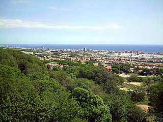
Vilassar de Mar is a municipality in the comarca of the Maresme in Catalonia, Spain. It is situated on the coast between Premià de Mar and Cabrera de Mar, to the north-east of Barcelona. The town is both a tourist centre and a dormitory town for Barcelona, and is also known for its horticulture. The main N-II road and a RENFE railway line run through the town, while a local road connects the municipality with the C-32 autopista at Vilassar de Dalt and Mataró and Barcelona. The famous canned food company DANI is based in Vilassar de Mar coming from a Vilassar family.
<span class="mw-page-title-main">Cabrera de Mar</span> Municipality in Catalonia, Spain

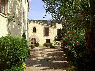
Cabrera de Mar is a municipality of the comarca of Maresme in Catalonia, Spain.

<span class="mw-page-title-main">L'Aldea</span> Municipality in Catalonia, Spain

L'Aldea is a municipality in the comarca of the Baix Ebre in Catalonia, Spain. It was created in 1983 from parts of the municipality of Tortosa. It is situated on the left bank of the Ebre at the start of the delta. The town is served by the A-7 autopista and the N-340 road, and has a station on the RENFE railway line between Tarragona and Valencia.

An autovía is one of two classes of major highway in the Spanish road system similar to a British motorway or an American freeway. It is akin to the autopista, the other major highway class, but has fewer features and is never a toll road. Some distinguishing features of an autovía are that it must be divided by a median, it must have restricted access, and it cannot be crossed by other roads. While autopistas are generally new routes, autovías are normally improvements to existing roads, so they may have tighter curves and less safe accesses, often with shorter acceleration lanes. However, both have nominal speed limits of 120 kilometres per hour (75 mph). Rest areas are usually 300 kilometres (190 mi) or 2 hours apart. There is usually a safety lane along the median.

<span class="mw-page-title-main">C-32 highway (Spain)</span> Highway in Catalonia, Spain

C-32 is a primary highway in Catalonia, Spain. It was created in 2004 by merging three sections of existing autopistas and autovías. This re-organisation was part of a renaming of primary highways managed by the Generalitat de Catalunya. According to this new denomination, the first number (C-32) indicates that is a southwest-northeast highway, while the second number (C-32) indicates that is the second-closest to the Mediterranean Sea.

<span class="mw-page-title-main">C-16 highway (Spain)</span>

C-16 or Eix del Llobregat is a primary highway in Catalonia, Spain. It is also part of the European route E9, from Orléans (France) to Barcelona.

<span class="mw-page-title-main">Eix Transversal</span>

Eix Transversal, labelled C-25, is a primary highway in Catalonia, Spain. It crosses the Catalan Transversal Range mountainous region, connecting the northern end of the Catalan Coastal Depression with the Catalan Central Depression.

<span class="mw-page-title-main">Autovía A-26</span> Motorway from Olot to Figueras (Spain)

Autovía A-26 is a long-term project of the Spanish government to upgrade the N-260 national road, also known as Eje Pirenaico or Eix Pirenenc.

<span class="mw-page-title-main">C-31 highway (Spain)</span>

C-31 or Eix Costaner is one of Catalonia's primary highways. It is the result of merging several sections of previously existing roads, autopistas and autovías after the 2004's renaming of primary highways managed by the Generalitat de Catalunya. According to this new denomination, the first number (C-31) indicates that is a southwest-northeast highway, while the second number (C-31) indicates that is the closest to the Mediterranean Sea.

<span class="mw-page-title-main">Autovia C-35</span>

The C-35 is a highway in Catalonia, Spain. It connects the Costa Brava with the Autopista AP-7 to Barcelona.
<span class="mw-page-title-main">C-17 highway (Spain)</span>

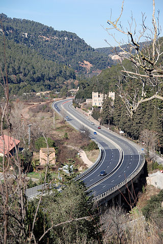
C-17 or Eix del Congost is a primary highway in Catalonia, Spain. According to the 2004's new coding for primary highways managed by the Generalitat de Catalunya, the first number (C-17) indicates that is a south-northbound highway, whereas the second number (C-17) indicates that is the seventh westernmost.

<span class="mw-page-title-main">Autovía B-10</span>

The B-10, also known as Ronda Litoral, is a 20-kilometre (12.43 mi) freeway in Catalonia, Spain partially encircling Barcelona passing through the eastern side of the city. It starts at Nus de la Trinitat interchange in northern Barcelona and runs along the entire length of the Besòs River and the city's coastline south to Nus del Llobregat interchange in Barcelona's southern suburbs, where it becomes the Autovía A-2. Both north and south end interchanges link the freeway to the B-20 or Ronda de Dalt, which encircles Barcelona passing through the western side, jointly forming a beltway commonly referred to as the rondes that surrounds the city.

<span class="mw-page-title-main">Autovía CV-10</span>

The Autovía CV-10, also called Autovía de la Plana, is a Spanish motorway in the Valencian Community. It runs through the province of Castellón from south to north, connecting the A-7 in La Vilavella with the N-232 in La Jana.
References

  1. "New coding for primary highways managed by the Generalitat de Catalunya (in Catalan)". Generalitat de Catalunya. 2005-01-04.
  2. "New coding for primary highways managed by the Generalitat de Catalunya (in Spanish)". Generalitat de Catalunya. 2005-01-04.