List of protected areas of Ethiopia

Last updated

Map of National park and Sanctuaries located in Ethiopia Ethiopia Protected Areas map - National Parks and Sanctuaries.svg
Map of National park and Sanctuaries located in Ethiopia

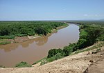
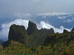
National parks and other protected areas cover 17% of Ethiopia's land area. [1] They include: [2] [3]

Contents

National parks

National ParkRegionEstablishedAreaImageCoordinatesAdministered by
Abijatta-Shalla National Park Oromia 1963887 square kilometres (342 sq mi) Lake Shalla Landscape.jpg 7°31′46″N38°31′07″E / 7.529554°N 38.518681°E / 7.529554; 38.518681 (Abijata Lakes National Park) Federal Government
Alitash National Park Amhara 20062,666 square kilometres (1,029 sq mi) 12°06′32″N35°33′13″E / 12.108911°N 35.553571°E / 12.108911; 35.553571 (Alatish National Park) Federal Government
Arsi Mountains National Park Oromia 201110,876 square kilometres (4,199 sq mi) Regional Government
Awash National Park Oromia and Afar 1958850 square kilometres (330 sq mi) Parc national d'Awash-Ethiopie-Chutes d'eau (3).jpg 9°04′42″N39°59′36″E / 9.078332°N 39.993255°E / 9.078332; 39.993255 (Awash National Park) Federal Government
Bejimiz National Park Benishangul-Gumuz and Amhara 2015not reported Regional Government
Borana National Park Oromia and Somali 201745,366 square kilometres (17,516 sq mi)
El Sod (11606130484).jpg
04°07′N38°34′E / 4.117°N 38.567°E / 4.117; 38.567 Regional Government
Bale Mountains National Park Oromia 19622,200 square kilometres (850 sq mi) Bale Mountns.jpg 6°53′09″N39°44′05″E / 6.885713°N 39.734817°E / 6.885713; 39.734817 (Bale Mountains National Park) Federal Government
Chebera Churchura National Park SNNPR 19971,190 square kilometres (460 sq mi) A picture of Chebera Churchura National Park landscape.jpg 6°53′14″N36°38′11″E / 6.887221°N 36.636336°E / 6.887221; 36.636336 (Chebera Churchura National Park) Regional Government
Dati Wolel National Park Oromia 1998431 square kilometres (166 sq mi) Regional Government
Didessa National Park Benishangul-Gumuz 2017Not reported Regional Government
Gambela National Park Gambela 19665,061 square kilometres (1,954 sq mi) 8°00′17″N34°03′51″E / 8.004614°N 34.064153°E / 8.004614; 34.064153 (Gambela National Park) Federal Government
Geralle National Park Somali 19983,558 square kilometres (1,374 sq mi) 4°21′56″N40°57′44″E / 4.365541°N 40.962177°E / 4.365541; 40.962177 (Geraille National Park) Regional Government
Gibe Sheleko National Park SNNPR 2001360 square kilometres (140 sq mi) Regional Government
Kafta Sheraro National Park Tigray 19995,000 square kilometres (1,900 sq mi) 14°14′47″N36°43′58″E / 14.24641°N 36.73279°E / 14.24641; 36.73279 (Kafeto Shiraro National Park) Federal Government
Loka-Abaya National Park SNNPR 2001500 square kilometres (190 sq mi) Regional Government
Mao-Komo National Park Benishangul-Gumuz and Oromia 2016not reported Regional Government
Mago National Park SNNPR 19741,942 square kilometres (750 sq mi) Mago Park.JPG 5°31′08″N36°20′38″E / 5.518792°N 36.343935°E / 5.518792; 36.343935 (Mago National Park) Regional Government
Maze National Park SNNPR 1997202 square kilometres (78 sq mi) 6°26′29″N37°11′19″E / 6.441527°N 37.188633°E / 6.441527; 37.188633 (Maze National Park) Regional Government
Nech Sar National Park SNNPR 1966750 square kilometres (290 sq mi) Nechisar National Park.JPG 5°56′01″N37°40′53″E / 5.933518°N 37.681282°E / 5.933518; 37.681282 (Nech Sar National Park) Federal Government
Omo National Park SNNPR 19804,068 km2 (1,571 sq mi) Omo River 02.jpg 6°0′N35°50′E / 6.000°N 35.833°E / 6.000; 35.833 Federal Government
Simien Mountains National Park Amhara 1959412 square kilometres (159 sq mi) Semien Mountains 02.jpg 13°18′23″N38°15′51″E / 13.306512°N 38.264118°E / 13.306512; 38.264118 (Simien Mountains National Park) Federal Government
Yangudi Rassa National Park Afar 19694,731 square kilometres (1,827 sq mi) Parc national de Yangudi Rassa-Gazelle de Soemmerring (3).jpg 10°32′16″N40°52′40″E / 10.537726°N 40.877762°E / 10.537726; 40.877762 (Yangudi Rassa National Park) Federal Government

Proposed national parks

Wildlife reserves

The Locations of Wildlife Reserves of Ethiopia Ethiopia Protected Areas map - Wildlife Reserves.svg
The Locations of Wildlife Reserves of Ethiopia

Sanctuaries

Proposed sanctuaries

Controlled hunting areas

National forest priority areas

International designations

UNESCO-MAB Biosphere Reserves

World Heritage Sites

See also

Related Research Articles

<span class="mw-page-title-main">Protected areas of South Australia</span> Areas protected by legislation in South Australia

Protected areas of South Australia consists of protected areas located within South Australia and its immediate onshore waters and which are managed by South Australian Government agencies. As of March 2018, South Australia contains 359 separate protected areas declared under the National Parks and Wildlife Act 1972, the Crown Land Management Act 2009 and the Wilderness Protection Act 1992 which have a total land area of 211,387.48 km2 (81,617.16 sq mi) or 21.5% of the state's area.

<span class="mw-page-title-main">Nature reserve</span> Protected area for flora, fauna or features of geological interest

A nature reserve is a protected area of importance for flora, fauna, funga, or features of geological or other special interest, which is reserved and managed for purposes of conservation and to provide special opportunities for study or research. They may be designated by government institutions in some countries, or by private landowners, such as charities and research institutions. Nature reserves fall into different IUCN categories depending on the level of protection afforded by local laws. Normally it is more strictly protected than a nature park. Various jurisdictions may use other terminology, such as ecological protection area or private protected area in legislation and in official titles of the reserves.

<span class="mw-page-title-main">Awash National Park</span> National park in Ethiopia

Awash National Park is a national park in Ethiopia. Located at the border of Oromia state and Afar state, the park covers an area of 827 square kilometers, most of it lies at an altitude of 900 meters. Spanning across the southern tip of the Afar Region and the northeastern corner of the East Shewa Zone of Oromia, this park is 225 kilometers east of Addis Ababa.

<span class="mw-page-title-main">Yangudi Rassa National Park</span> National park in Ethiopia

Yangudi Rassa National Park is a national park in Ethiopia located in Afar Region.

<span class="mw-page-title-main">Protected areas of Canada</span> Areas protected for conservation or historical reasons

Protected areas of Canada consist of approximately 12.1 percent of the nation's landmass and freshwater are considered conservation areas, including 11.4 percent designated as protected areas. Approximately 13.8 percent of Canada's territorial waters are conserved, including 8.9 percent designated as protected areas. Terrestrial areas conserved have increased by 65 percent in the 21st century, while marine areas conserved have increased by more than 3,800 percent.

There are four categories of protected areas in India, constituted under the Wildlife Protection Act, 1972. Tiger reserves consist of areas under national parks and wildlife sanctuaries. There are 53 tiger reserves in India. As of January 2023, the protected areas of India cover 173,629.52 square kilometres (67,038.73 sq mi), roughly 5.28% of the total geographical area of the country.

Private protected areas of India refer to protected areas inside India whose land rights are owned by an individual or a corporation / organization, and where the habitat and resident species are offered some kind of protection from exploitative activities like hunting, logging, etc. The Government of India did not provide any legal or physical protection to such entities, but in an important amendment introduced by the Wildlife (Protection) Amendment Act of 2002, has agreed to protect communally owned areas of ecological value.

<span class="mw-page-title-main">Eastern Himalayan alpine shrub and meadows</span> Ecoregion in the Eastern Himalayas

The Eastern Himalayan alpine shrub and meadows is a montane grasslands and shrublands ecoregion of Bhutan, China, India, Myanmar, and Nepal, which lies between the tree line and snow line in the eastern portion of the Himalaya Range.

Chelbi Wildlife Reserve or Stephanie Wildlife Reserve is a protected area in Ethiopia's Southern Nations, Nationalities, and Peoples' Region.

<span class="mw-page-title-main">Yabelo Wildlife Sanctuary</span> Wildlife sanctuary in Oromia Region of Ethiopia

Yabelo Wildlife Sanctuary is a protected area and wildlife sanctuary in southern Ethiopia. It is located in the Borena Zone of the Oromia Region west of the town of Yabelo, having an area of 2,500 square kilometers and elevations ranging from 1430 to 2000 meters above sea level. The wildlife sanctuary borders on Borana National Park to the south.

Under UNESCO’s Man and the Biosphere Programme (MAB), there are 70 biosphere reserves recognized as part of the World Network of Biosphere Reserves in African states as of 2016. These are distributed across 28 countries. While biosphere reserves in West African, East African, Central African and Southern African countries are organised in the AfriMAB regional network, biosphere reserves in Northern African countries are organised in the ArabMAB, UNESCO's regional MAB network.

<span class="mw-page-title-main">Sigur Plateau</span> Reserve forest in Tamil Nadu, India

Sigur Plateau is a plateau in the north and east of Nilgiri District in the Nilgiri Hills of Tamil Nadu, South India. It covers the 778.8 square kilometres (300.7 sq mi) portion of the Moyar River drainage basin on the northern slopes of the Nilgiri Hills, south of the Moyar River.

<span class="mw-page-title-main">Ethiopian montane forests</span> Tropical moist broadleaf forest ecoregion in Ethiopia

The Ethiopian montane forests is a tropical moist broadleaf forest ecoregion in eastern Africa. It covers the middle elevations of the Ethiopian Highlands in Ethiopia and extends into neighboring Eritrea, Sudan, Djibouti, and Somaliland. The ecoregion includes distinctive Afromontane forests, woodlands, grasslands, and shrublands. The ecoregion's biodiversity is threatened by deforestation, conversion to agriculture, and overgrazing.

The Yayu Coffee Forest Biosphere Reserve is situated in Illubabor Zone of the Oromia Regional State, southwestern Ethiopia.

Last Mountain Lake Bird Sanctuary is a National Historic Site of Canada, located in the rural municipality of Last Mountain Valley No. 250 in Saskatchewan. The migratory bird sanctuary was the first established in North America. The 47.36 km2 (18.29 sq mi) area is within the Last Mountain Lake National Wildlife Area, an International Biological Program site, and includes adjacent uplands.

Somali <i>Acacia</i>–<i>Commiphora</i> bushlands and thickets

The Somali AcaciaCommiphora bushlands and thickets is a semi-arid tropical grasslands, savannas, and shrublands ecoregion in the Horn of Africa. It is home to diverse communities of plants and animals, including several endemic species.

<span class="mw-page-title-main">Borana National Park</span> National park in Ethiopia

Borana National Park is a wildlife sanctuary located in the Borana Zone of the Oromia Regional State in Ethiopia.

References

  1. UNEP-WCMC (2022). Protected Area Profile for Ethiopia from the World Database of Protected Areas. Accessed 27 February 2022.
  2. "Protected Wildlife Areas of Ethiopia". Ethiopian Wildlife Conservation Authority. 7 October 2016. Archived from the original on 9 October 2016. Retrieved 7 October 2016.
  3. Kebbede, Girma (2016-10-04). Environment and Society in Ethiopia. Taylor & Francis. ISBN   978-1-315-46428-2.