There are at least 22 named trails in Park County, Montana according to the U.S. Geological Survey, Board of Geographic Names. A trail is defined as: "Route for passage from one point to another; does not include roads or highways (jeep trail, path, ski trail)." [1]

Park County is a county located in the U.S. state of Montana. At the 2010 census, the population was 15,636. Its county seat is Livingston. A small part of Yellowstone National Park is located in the extreme southern part of the county.
Contents
- Ash Mountain Trail, 45°05′33″N110°31′01″W / 45.09250°N 110.51694°W , el. 9,472 feet (2,887 m) [2]
- Beaver Lakes Loop Trail, 44°59′48″N110°42′44″W / 44.99667°N 110.71222°W , el. 6,532 feet (1,991 m) [3]
- Beaver Lakes Loop Trail, 44°59′12″N110°42′12″W / 44.98667°N 110.70333°W , el. 6,388 feet (1,947 m) [4]
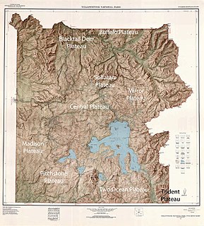
- Buffalo Plateau Trail, 44°59′49″N110°24′26″W / 44.99694°N 110.40722°W , el. 7,405 feet (2,257 m) [5]
- Buffalo Plateau Trail, 44°59′43″N110°17′27″W / 44.99528°N 110.29083°W , el. 7,654 feet (2,333 m) [6]
- Coyote Creek Trail, 45°01′38″N110°24′14″W / 45.02722°N 110.40389°W , el. 7,451 feet (2,271 m) [7]
- Coyote Creek Trail, 44°59′03″N110°25′31″W / 44.98417°N 110.42528°W , el. 6,440 feet (1,960 m) [8]
- Fawn Pass Trail, 44°55′45″N110°55′07″W / 44.92917°N 110.91861°W , el. 9,009 feet (2,746 m) [9]
- Highland Trail, 45°18′11″N110°31′31″W / 45.30306°N 110.52528°W , el. 7,192 feet (2,192 m) [10]
- Jardine-Hellroaring Trail, 45°04′37″N110°31′43″W / 45.07694°N 110.52861°W , el. 8,980 feet (2,740 m) [11]
- Lower Blacktail Trail, 44°59′37″N110°34′44″W / 44.99361°N 110.57889°W , el. 5,961 feet (1,817 m) [12]
- Poacher Trail, 45°02′21″N110°20′45″W / 45.03917°N 110.34583°W , el. 9,354 feet (2,851 m) [13]
- Pole Gulch Trail, 45°22′42″N110°49′43″W / 45.37833°N 110.82861°W , el. 6,424 feet (1,958 m) [14]
- Pole Gulch Trail, 45°21′23″N110°53′53″W / 45.35639°N 110.89806°W , el. 7,228 feet (2,203 m) [15]
- Pyramid Trail, 45°16′54″N110°29′35″W / 45.28167°N 110.49306°W , el. 7,369 feet (2,246 m) [16]
- Republic Trail, 44°59′35″N109°56′23″W / 44.99306°N 109.93972°W , el. 8,291 feet (2,527 m) [17]
- Rescue Creek Trail, 45°00′54″N110°38′48″W / 45.01500°N 110.64667°W , el. 6,243 feet (1,903 m) [18]
- Sidehill Trail, 45°18′03″N110°29′13″W / 45.30083°N 110.48694°W , el. 7,851 feet (2,393 m) [19]
- Snowbank Trail, 45°12′54″N110°34′05″W / 45.21500°N 110.56806°W , el. 6,909 feet (2,106 m) [20]
- Sportsman Lake Trail, 45°01′03″N110°57′23″W / 45.01750°N 110.95639°W , el. 8,005 feet (2,440 m) [21]
- Wallace Creek Trail, 45°15′05″N110°29′59″W / 45.25139°N 110.49972°W , el. 6,289 feet (1,917 m) [22]
- Yellowstone River Trail, 44°59′17″N110°28′30″W / 44.98806°N 110.47500°W , el. 6,286 feet (1,916 m) [23]

The Snowbank Trail is a hiking trail in the Boundary Waters Canoe Area Wilderness (BWCAW) in northern Minnesota. The trail runs the perimeter of Snowbank Lake and crosses the Kekekabic Trail at the south side of Snowbank Lake. The entire trail comprises a 24-mile (39 km) loop, numerous campsites are available. During the BWCAW Visitor' Distribution Program, permits are required for overnight use of the trail. It is located in Fall Lake Township in northernmost Lake County.