Cooke City-Silver Gate, Montana

Last updated

Cooke City-Silver Gate, Montana
Former CDP
Park County Montana Incorporated and Unincorporated areas Cooke City-Silver Gate Highlighted.svg
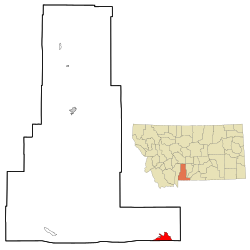
Location of Cooke City-Silver Gate, Montana
Coordinates: 45°1′3″N109°56′19″W / 45.01750°N 109.93861°W / 45.01750; -109.93861
Country United States
State Montana
County Park
Area
  Total10.0 sq mi (25.9 km2)
  Land10.0 sq mi (25.9 km2)
  Water0.0 sq mi (0.0 km2)
Elevation
7,608 ft (2,318.9 m)
Population
 (2000)
  Total140
  Density14.0/sq mi (5.4/km2)
Time zone UTC-7 (Mountain (MST))
  Summer (DST) UTC-6 (MDT)
Area code 406
FIPS code 30-17359
Regional Flag (unofficial) Cooke City Silver-Gate Flag.jpg
Regional Flag (unofficial)

Cooke City-Silver Gate was a census-designated place (CDP) in Park County, Montana, United States, corresponding to the unincorporated communities of Cooke City and Silver Gate. The population was 140 at the 2000 census. Starting with the 2010 census, the two communities were listed as separate CDPs. The communities sit toward the northeast of Yellowstone National Park on the Beartooth Highway.

Contents

Geography

The Cooke City-Silver Gate CDP was located at 45°1′3″N109°56′19″W / 45.01750°N 109.93861°W / 45.01750; -109.93861 (45.017378, −109.938599), [1] at an elevation of 7,608 feet (2,318 m). [2]

According to the United States Census Bureau, the CDP had a total area of 10.0 square miles (26 km2), all land.

Demographics

As of the census [3] of 2000, there were 140 people, 79 households, and 27 families residing in the CDP. The population density was 14.0 inhabitants per square mile (5.4/km2). There were 247 housing units at an average density of 24.7 per square mile (9.5/km2). The racial makeup of the CDP was 97.86% White, 0.71% African American, 0.71% Native American, and 0.71% from two or more races.

There were 79 households, out of which 11.4% had children under the age of 18 living with them, 29.1% were married couples living together, 5.1% had a female householder with no husband present, and 65.8% were non-families. 40.5% of all households were made up of individuals, and 11.4% had someone living alone who was 65 years of age or older. The average household size was 1.77 and the average family size was 2.44.

In the CDP, the population was spread out, with 8.6% under the age of 18, 4.3% from 18 to 24, 42.1% from 25 to 44, 35.0% from 45 to 64, and 10.0% who were 65 years of age or older. The median age was 43 years. For every 100 females, there were 122.2 males. For every 100 females age 18 and over, there were 113.3 males.

The median income for a household in the CDP was $25,000, and the median income for a family was $50,625. Males had a median income of $38,125 versus $17,813 for females. The per capita income for the CDP was $31,618. There were 7.4% of families and 15.8% of the population living below the poverty line, including 18.2% of under eighteens and 10.5% of those over 64.

Related Research Articles

<span class="mw-page-title-main">Belfry, Montana</span> Census-designated place in Montana, United States

Belfry is a census-designated place (CDP) in Carbon County, Montana, United States. It is part of the Billings, Montana Metropolitan Statistical Area. The population was 218 at the 2010 census. It is located approximately 11 miles (18 km) from the Wyoming border, roughly halfway between Billings, Montana and Cody, Wyoming.

<span class="mw-page-title-main">Boneau, Montana</span> Census-designated place in Montana, United States

Boneau is a census-designated place (CDP) in Chouteau County, Montana, United States. The population was 380 at the 2010 census, up from 190 in 2000.

<span class="mw-page-title-main">Loma, Montana</span> Census-designated place in Montana, United States

Loma is a census-designated place (CDP) in Chouteau County, Montana, United States. The population was 85 at the 2010 census.

<span class="mw-page-title-main">Willow Creek, Montana</span> Census-designated place in Gallatin County, Montana, United States.

Willow Creek is a census-designated place (CDP) in Gallatin County, Montana, United States. The population was 210 at the 2010 census. It is part of the Bozeman, MT Micropolitan Statistical Area.

<span class="mw-page-title-main">Rocky Boy's Agency, Montana</span> CDP in Montana, United States

Rocky Boy's Agency is a census-designated place (CDP) in Hill County, Montana, United States. The population was 355 at the 2010 census. The settlement developed around the US Indian agency for the Rocky Boy's Indian Reservation.

<span class="mw-page-title-main">Beaver Creek, Montana</span> Census-designated place in Montana, United States

Beaver Creek is a census-designated place (CDP) in Hill County, Montana, United States. The population was 271 at the 2010 census.

<span class="mw-page-title-main">Havre North, Montana</span> Census-designated place in Montana, United States

Havre North is a census-designated place (CDP) in Hill County, Montana, United States. The population was 716 at the 2010 census, down from 973 in 2000.

<span class="mw-page-title-main">Herron, Montana</span> Census-designated place in Montana, United States

Herron is a census-designated place (CDP) in Hill County, Montana, United States. The population was 43 at the 2010 census.

<span class="mw-page-title-main">Saddle Butte, Montana</span> Census-designated place in Montana, United States

Saddle Butte is a census-designated place (CDP) in Hill County, Montana, United States. The population was 128 at the 2010 census.

<span class="mw-page-title-main">Sangrey, Montana</span> Census-designated place in Montana, United States

Sangrey is a census-designated place (CDP) in Hill County, Montana, United States. The population was 306 at the 2010 census, up from 263 in 2000.

<span class="mw-page-title-main">St. Pierre, Montana</span> Census-designated place in Montana, United States

St. Pierre is a census-designated place (CDP) in Hill County, Montana, United States, within the Rocky Boy Indian Reservation. The population of St. Pierre was 350 at the 2010 census, up from 289 in 2000.

<span class="mw-page-title-main">West Havre, Montana</span> Census-designated place in Montana, United States

West Havre is a census-designated place (CDP) in Hill County, Montana, United States. The population was 316 at the 2010 census, up from 284 in 2000.

<span class="mw-page-title-main">De Borgia, Montana</span> CDP in Montana, United States

De Borgia is a census-designated place (CDP) in Mineral County, Montana, United States. The population was 69 at the 2000 census.

<span class="mw-page-title-main">Clinton, Montana</span> CDP in Montana, United States

Clinton is a census-designated place (CDP) in Missoula County, Montana, United States. It is part of the 'Missoula, Montana Metropolitan Statistical Area'. The CDP was named for General Sir Henry Clinton. The population was 1,052 at the 2010 census, an increase from its population of 549 in 2000.

<span class="mw-page-title-main">Musselshell, Montana</span> CDP in Montana, United States

Musselshell is an unincorporated village in Musselshell County, Montana, United States. It is also the namesake of a census designated place (CDP) which incorporates the village. The population of the village is unknown, but the population of the entire CDP was 60 at the 2010 census and 2000 census. The village is located near the Musselshell River.

<span class="mw-page-title-main">Greycliff, Montana</span> CDP in Montana, United States

Greycliff is a census-designated place (CDP) in Sweet Grass County, Montana, United States. The population was 56 at the 2000 census.

<span class="mw-page-title-main">Shepherd, Montana</span> CDP in Montana, United States

Shepherd is a census-designated place (CDP) in Yellowstone County, Montana, United States. The population was 193 at the 2000 census. Shepherd is a Billings suburb located to the northeast. The unincorporated town was named after R.E. Shepherd, a prominent early settler and owner of the Billings Land and Irrigation Company and the Merchants National Bank. The post office opened in 1915.

<span class="mw-page-title-main">Azure, Montana</span> Census-designated place in Montana, United States

Azure is a census-designated place (CDP) in Hill County, Montana, United States. The population was 286 at the 2010 census.

<span class="mw-page-title-main">Cuartelez, New Mexico</span> Census-designated place in New Mexico, United States

Cuartelez is a census-designated place (CDP) in Santa Fe County, New Mexico, United States. It is part of the Santa Fe, New Mexico Metropolitan Statistical Area. The population was 469 at the 2010 census.

<span class="mw-page-title-main">Parker School, Montana</span> Census-designated place in Montana, United States

Parker School is a census-designated place (CDP) in Hill and Chouteau counties in the U.S. state of Montana. The population was 340 at the 2010 census.

References

  1. "US Gazetteer files: 2010, 2000, and 1990". United States Census Bureau. February 12, 2011. Retrieved April 23, 2011.
  2. "Elevation of Montana Cities and Towns". geoinfo.msl.mt.gov. Retrieved November 27, 2016.
  3. "U.S. Census website". United States Census Bureau . Retrieved January 31, 2008.