List of waterbodies in Saxony-Anhalt

Last updated

The Arendsee Arendsee (vom Westufer durchs Ufergehoelz).jpg
The Arendsee

Waterbodies

Waterbody; Length in km; in Saxony-Anhalt flowing through; (confluence of ...); Remarks

Contents

Elbe

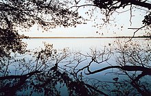
Elbe; 1.091 km; rises in the Giant Mountains of the Czech Republic at a height of ca. 1,386 m, flows through or touches the Czech Republic, Saxony, Saxony-Anhalt, Brandenburg, Lower Saxony, Mecklenburg-Western Pomerania, Hamburg, Schleswig-Holstein

Elbe tributaries and water bodies with their confluence in Saxony-Anhalt

The Ohre near Calvorde Ohre bei Calvoerde.JPG
The Ohre near Calvörde

Sautal (left)

Elbe tributaries and waterbodies with their confluence outside Saxony-Anhalt

Special rivers

(via Oker, Aller to the Weser)

Canals

Standing waterbodies

Waterbody; Waterbody system; Area in ha; location of the nearest significant settlement; Remarks

The standing waterbodies are sorted by type. Their boundaries are however, somewhat fluid.

Reservoirs and forebays

  1. Kelbra Reservoir; Helme, Unstrut, Saale, Elbe; 600 ha; near Kelbra; bathing lake
  2. Rappbode Reservoir; Bode, Saale, Elbe; 395 ha; near Hasselfelde
  3. Wendefurth Reservoir; Bode, Hassel, Saale, Elbe; 78.0 ha; near Wendefurth
  4. Wippra Reservoir; Wipper, Saale, Elbe; 38.5 ha; near Wippra
  5. Königshütte Reservoir; Bode, Saale, Elbe; 32.0 ha; Königshütte near Wernigerode
  6. Hassel Forebay; Hassel, Bode, Saale, Elbe; 25.0 ha; near Hasselfelde
  7. Rappbode Forebay; Bode, Saale, Elbe; 24.3 ha; near Hasselfelde
  8. Zillierbach Reservoir; Zillierbach, Bode, Saale, Elbe; 23.0 ha; near Wernigerode
  9. Frankenteich; Rödelbachgraben, Selke (river), Bode, Saale, Elbe; 11.0 ha; near Straßberg in the Harz
  10. Kiliansteich Reservoir; Büschengraben, Rödelbachgraben, Selke, Bode, Saale, Elbe; 17.3 ha; near Straßberg in the Harz
  11. Upper Kiliansteich; Büschengraben, Rödelbachgraben, Selke, Bode, Saale, Elbe; 17.3 ha; near Straßberg in the Harz
  12. Teufelsteich; Teufelsgrundbach, Selke, Bode, Saale, Elbe; 19.9 ha; near Harzgerode
  13. Birnbaumteich; Birnbaumbach; 4.5 ha; near Neudorf (Harz)
  14. Gondelteich; Uhlenbach; 4.2 ha; near Friedrichsbrunn
  15. Großer Siebersteinteich; Siebersteinbach; 4.2 ha; near Ballenstedt
  16. Bremer Teich; Bach vom Bremer Teich; 3.7 ha; near Gernrode
  17. Kunstteich Neudorf; unnamed, tributary of the schmalen Wipper, schmale Wipper, Wipper, Saale, Elbe, 4.2 ha; near Neudorf
  18. Kunstteich Ballenstedt; Garnwinde, Sauerbach; 3 ha; near Ballenstedt
  19. Fürstenteich; Teufelsbach; 2.5 ha; near Silberhütte
  20. Neuer Teich; Hagentalsbach; 2.4 ha; near Gernrode
  21. Kleiner Siebersteinteich; Siebersteinbach; 1.8 ha; near Ballenstedt
  22. Bergrat-Müller-Teich; Friedenstalbach; 1.3 ha; near Friedrichsbrunn
  23. Erichsburger Teich; Friedenstalbach; 1.1 ha; near Harzgerode

Open cast mine lakes

  1. Goitzsche; near the Mulde, Elbe; 2500 ha; southeast of Bitterfeld
  2. Geiseltalsee; Saale, Elbe; 1842 to 1900 ha; south of Halle (Saale); former brown coal open cast mine to 2011 flooded, [1] Original smaller lakes merged: August 2008
  3. Muldestausee; Mulde, Elbe; 605 ha; east of Bitterfeld
  4. Concordiasee; flooded until 2015. 600 ha; between Nachterstedt and Schadeleben; bank collapse of 2 million cubic metres on 19 Juli 2009. 3 dead
  5. Raßnitzer See; White Elster, Saale, Elbe; 310 ha; east of Merseburg; former brown coal open cast mine flooded until 2000,
  6. Wallendorfer See; White Elster, Saale, Elbe; 338 ha; east of Merseburg; former brown coal open cast mine flooded until 2000
  7. Gremminer See; Elbe; 543 ha; west of Gräfenhainichen; former brown coal open cast mine (still flooded) Golpa-Nord, Ferropolis museum and event location
  8. Gröberner See; Elbe; 366 ha; east of Gräfenhainichen; former brown coal open cast mine (still flooded) Gröbern
  9. Barleber See; Elbe; 105 ha; near Magdeburg and Barleben; bathing lake
  10. Paupitzscher See; Mulde, Elbe; 100 ha; between Bitterfeld and Delitzsch; largest part in Saxony
  11. Hufeisensee; ca. 70 ha; former brown coal open cast mine and gravel pit in the borough of Halle (Saale)
  12. Neustädter See; Elbe; 60 ha; near Magdeburg
  13. Posthornteiche; 2 Teiche; 20 ha and 5 ha; former Braunkohlentiefbau, near Halle (Saale)
  14. Heidesee; 12.5 ha; former brown coal open cast mine, near Halle (Saale)
  15. Rattmannsdorfer See; 76 ha; former gravel pit, near Halle (Saale)
  16. Hohenweidener See; 13 ha; former gravel pit, near Halle (Saale)
  17. Osendorfer See; 22 ha; former brown coal open cast mine in Halle (Saale)
  18. Angersdorfer Teiche; 2 Teiche 6 ha and 3 ha; former clay pit, near Halle (Saale)
  19. Runstedter See; 23 ha former brown coal open cast mine near Braunsbedra
  20. Bergwitzsee; Elbe; 180 ha; south of Wittenberg near Bergwitz; former brown coal open cast mine, bathing lake
  21. Adria Gravel Pit; Mulde, Elbe; 12 ha; near Dessau; former gravel pit for motorway construction, bathing lake
  22. Gerwisch Gravel Lake
  23. Salbker See 1 and 2 in Magdeburg Southeast (remains of former gravel pits originally several hectares in area )
  24. Mondsee; ca. 38 ha; near Hohenmölsen; flooded 1989 to 1991

Water management storage

  1. Wettelrode Storage Reservoir; Erlbach; 4 ha; west of Wettelrode
  2. Schmon Storage Reservoir; Schmoner Bach; 2.2 ha; west of Schmon

Retention basins

Partially impounded retention basins

  1. Kalte Bode flood retention basin; Bode, Saale, Elbe; 58.9 ha; near Königshütte in the Harz

Normally non-impounded retention basins

  1. Stöbnitz Retention Basin; Saale, Elbe; 21.5 ha; northeast of Öchlitz in Merseburg-Querfurt
  2. Schrote Retention Basin; Elbe; 10.0 ha; west of Magdeburg
  3. Gleinaer Grund Retention Basin; Geisel; 6.3 ha; southwest of Mücheln

Natural lakes and bogs

Schonitzer See aerial photo Riesigk.jpg
Schönitzer See aerial photo
  1. Arendsee; Elbe; 514 ha; near Arendsee (Altmark); bathing lake
  2. Süßer See; Saale, Elbe, Böse Sieben, Salza; 247 ha; Seeburg
  3. Schönitzer See; Elbe; 145 ha; near Riesigk; Altarm der Elbe
  4. Bindersee; Saale, Elbe; 25 ha; east of Seeburg
  5. Kernersee; Saale, Elbe; 17 ha; east of Seeburg
  6. Schönfeld-Kamerner See; Elbe; ?? ha; near Schönfeld, Saxony-Anhalt and Kamern in the Landkreis Stendal
  7. Lake Niegripp; Elbe; ?? ha; near Niegripp in the Landkreis Jerichower Land
  8. Salziger See  ; Salza; Weida; trockengelegt, near Röblingen am See

Ponds and others

  1. Gotthardteich; Geisel; 6.8 ha; near Merseburg
  2. Grenzteich; schmale Wipper, Wipper, Saale, Elbe; 70 are; near Neudorf
  3. Lausiger Teiche; Elbe; ?? ha; near Bad Schmiedeberg
  4. Maliniusteich; Rödelbachgraben, Selke, Bode, Saale, Elbe; near Straßberg in the Harz
  5. Mensingteich; Hagenbach; 1.1 ha; near Gernrode
  6. Möllerteich, Graben vom Möllerteich, Büschengraben, Rödelbachgraben, Selke, Bode, Saale, Elbe; between Straßberg and Breitenstein in the Harz
  7. Mühlenteich; Selke; 7.1 ha; near Güntersberge
  8. Neudorfer Gemeindeteich; unnamed, tributary of the schmalen Wipper, schmale Wipper, Wipper, Saale, Elbe; 50 a; in Neudorf
  9. Neudorfer kleiner Teich 1; unnamed, tributary of the schmalen Wipper, schmale Wipper, Wipper, Saale, Elbe; 3 a; near Neudorf
  10. Neudorfer kleiner Teich 2; unnamed, tributary of the schmalen Wipper, schmale Wipper, Wipper, Saale, Elbe; 22 a; near Neudorf

Canals and ditches

  1. Elbe-Havel Canal
  2. Gnevsdorfer Vorfluter
  3. Mittelland Canal
  4. Niegripper Link Canal
  5. Pareyer Link Canal
  6. Rothenseer Link Canal
  7. Schindelbrücher Kunstgraben
  8. Siebengründer Graben

See also

Related Research Articles

<span class="mw-page-title-main">Saxony-Anhalt</span> State in Germany

Saxony-Anhalt is a state of Germany, bordering the states of Brandenburg, Saxony, Thuringia and Lower Saxony. It covers an area of 20,451.7 square kilometres (7,896.4 sq mi) and has a population of 2.17 million inhabitants, making it the 8th-largest state in Germany by area and the 11th-largest by population. Its capital is Magdeburg and its largest city is Halle (Saale).

<span class="mw-page-title-main">Duchy of Anhalt</span> German duchy (1806–1918)

The Duchy of Anhalt was a historical German duchy. The duchy was located between the Harz Mountains in the west and the River Elbe and beyond to the Fläming Heath in the east. The territory was once ruled by the House of Ascania, and is now part of the federal state of Saxony-Anhalt.

<span class="mw-page-title-main">Saale</span> River in Germany

The Saale, also known as the Saxon Saale and Thuringian Saale, is a river in Germany and a left-bank tributary of the Elbe. It is not to be confused with the smaller Franconian Saale, a right-bank tributary of the Main, or the Saale in Lower Saxony, a tributary of the Leine.

<span class="mw-page-title-main">Aschersleben-Staßfurt</span> District in Saxony-Anhalt, Germany

Aschersleben-Staßfurt was a district in Saxony-Anhalt, Germany until 2007. It was bounded by the districts of Schönebeck, Bernburg, Mansfelder Land, Quedlinburg and Bördekreis.

<span class="mw-page-title-main">Harzgerode</span> Town in Saxony-Anhalt, Germany

Harzgerode is a town in the district of Harz in Saxony-Anhalt, Germany.

<span class="mw-page-title-main">Bode (river)</span> River in Germany

The Bode is a river in the German state of Saxony-Anhalt, a left tributary of the Saale. It rises in the Harz mountains and drains them in a northerly direction. After 169 kilometres (105 mi) it discharges into the Saale at Nienburg. The river is named after a legendary giant, the wild, rampaging, Bohemian, Prince Bodo, who, according to the Rosstrappe legend, changed into a marauding dog that guarded the crown of Princess Brunhilde in the Kronensumpf in the present-day Bode Gorge. The gorge is the narrow section of the Bode valley between Treseburg and Thale.

<span class="mw-page-title-main">Wipper (Saale)</span> River in Germany

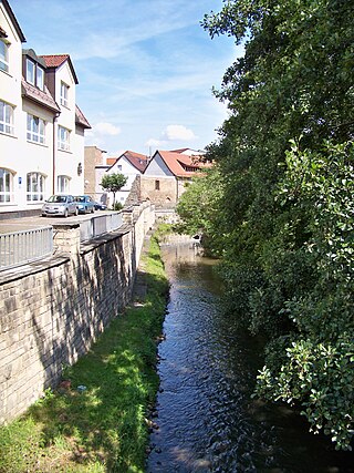
The Wipper is a river in Saxony-Anhalt, Germany. A left tributary of the Saale, the Wipper is 85 kilometres (53 mi) long. Its name comes from the old German word Uipparaha, which means "singing, bouncing river".

<span class="mw-page-title-main">Principality of Anhalt</span> State of the Holy Roman Empire

The Principality of Anhalt was a State of the Holy Roman Empire, located in Central Germany, in what is today part of the federal state of Saxony-Anhalt.

<span class="mw-page-title-main">Magdeburg Börde</span>

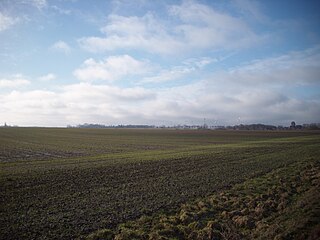
The Magdeburg Börde is the central landscape unit of the state of Saxony-Anhalt and lies to the west and south of the eponymous state capital Magdeburg. Part of a loess belt stretching along the southeastern rim of the North German Plain, it is noted for its very fertile Chernozem soils.

<span class="mw-page-title-main">Bundesstraße 242</span> Federal highway in Germany

The B 242 is a federal highway in Germany. It runs from Seesen to Mansfeld.

<span class="mw-page-title-main">Lower Harz Pond and Ditch System</span>

Within the Lower Harz region are still many traces of the historical water management facilities used by the mining industry. In addition to water-carrying ditches and ponds, there are also long-abandoned ditches and dry pond beds. The Lower Harz Pond and Ditch System, which forms the major part of these old water management facilities, lies in the central Lower Harz, almost entirely within the borough of the present-day town of Harzgerode.

<span class="mw-page-title-main">Kunstteich Neudorf</span> Water reservoir in Germany

Kunstteich Neudorf is a reservoir near Neudorf in the Harz Mountains, Saxony-Anhalt, Germany. It is fed and drained by a small tributary of the Schmale Wipper, itself a tributary of the Wipper.

<i>Mitteldeutsche Zeitung</i> German regional daily newspaper

The Mitteldeutsche Zeitung is a regional daily newspaper for southern Saxony-Anhalt, Germany. Published in Halle with several local versions, the paper is owned by M. DuMont Schauberg, Cologne.

<span class="mw-page-title-main">Bremer Teich</span> Dam in Landkreis Harz

The Bremer Teich is an historic reservoir that lies south of the two villages of Bad Suderode and Gernrode in the Harz Mountains of Germany, and is used as a recreation area. It impounds the Bremer Graben, an artificial channel fed by water from the Bode and the Saale. The water reservoir was built in the 18th century in the Lower Harz (Saxony-Anhalt). It has an area of ca. 4 ha. The pond is located on the Romanesque Road and the North Harz Cycleway.

<span class="mw-page-title-main">Transdev Sachsen-Anhalt</span>

Transdev Sachsen-Anhalt is a regional railway company, a subsidiary of Transdev Germany. It provided passenger services on the North Harz network from 2005 to 2018 under the name HEX (HarzElbeExpress).

<span class="mw-page-title-main">Elster-Saale Canal</span>

The Elster-Saale Canal, renamed in 1999 by the Federal Waterways and Shipping Administration to Saale-Leipzig Canal or SLK and on the Halle side also called Saale-Elster Canal, was a canal project started in 1933 and aborted in 1943. It was intended to link the White Elster river with the Saale near Leuna and thus enable the city of Leipzig to be joined to Germany's inland waterway network. The 11 kilometre long water-filled channel is one of the "special federal waterways".

<span class="mw-page-title-main">Bergrat Müller Pond</span> Dam in Harz county, Saxony-Anhalt

The Bergrat Müller Pond, named after a former mining director, Müller, in the Harz mountains of central Germany is a storage pond laid out from 1737 to 1738. It has an area of about 1.3 ha and lies in the forested southern part of the borough of Quedlinburg in the county of Harz in Saxony-Anhalt.

References

  1. Ein Trio feiert das Flutungsende, Mitteldeutsche Zeitung vom 30. April 2011. Accessed on 1 September 2011 (digitalised)