List of waterfalls in West Virginia

Last updated

Blackwater Falls in Tucker County Blackwater Falls.jpg
Blackwater Falls in Tucker County
Falls of Hills Creek (Lower) in Pocahontas County Falls-of-hills-creek-wv.jpg
Falls of Hills Creek (Lower) in Pocahontas County
Cathedral Falls in Fayette County. Cathedral-Falls-27527.jpg
Cathedral Falls in Fayette County.
Elakala Falls in Tucker County Elakala Waterfalls Swirling Pool Mossy Rocks.jpg
Elakala Falls in Tucker County
Douglas Falls in Tucker County DouglasFallsWV.JPG
Douglas Falls in Tucker County

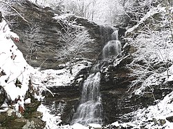
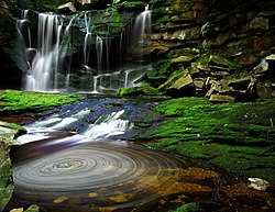
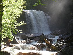
There are about 275 waterfalls in the U.S. state of West Virginia .

Contents

Surface waterfalls

NameHeightCoordinatesUSGS Map GNIS ID
Black Fork Falls 20 ft (6.1 m) ????? ????? ?????
Blackwater Falls 57 to 63 ft (17 to 19 m) 39°06′50″N79°29′00″W / 39.113889°N 79.483333°W / 39.113889; -79.483333 (Blackwater Falls (Tucker County, West Virginia)) Blackwater Falls 1550380
Brush Creek Falls 25 ft (7.6 m) ????? ????? ?????
Cathedral Falls 60 ft (18 m)38.15444 N 81.1788 W ????? ?????
Douglas Falls35 ft (11 m) ????? ????? ?????
Elakala Falls (3rd fall)40 ft (12 m) ????? ????? ?????
Falling Spring Run Falls40 ft (12 m) ????? ????? ?????
High Falls of Cheat 15 to 18 ft (4.6 to 5.5 m) 38°46′21″N79°46′38″W / 38.772500°N 79.777222°W / 38.772500; -79.777222 (High Falls (Randolph County, West Virginia)) Beverly East 1551426
Jordan Run Falls 25 to 30 ft (7.6 to 9.1 m) 38°59′39″N79°15′58″W / 38.994131°N 79.266189°W / 38.994131; -79.266189 (Jordan Run Falls (Grant County, West Virginia)) Hopeville 1551612
Kanawha Falls 15 to 21 ft (4.6 to 6.4 m) 38°09′04″N81°12′44″W / 38.151111°N 81.212222°W / 38.151111; -81.212222 (Kanawha Falls (Fayette County, West Virginia)) Gauley Bridge 1556129
Hills Creek Falls (Lower) 63 to 65 ft (19 to 20 m) 38°10′25″N80°20′06″W / 38.173611°N 80.335000°W / 38.173611; -80.335000 (Falls of Hills Creek (Pocahontas County, West Virginia)) Lobelia 1551095
Mill Creek Falls 20 ft (6.1 m) ????? ????? ?????
Pendleton Falls20 ft (6.1 m) [fall]
150 ft (46 m) [cascade]
 ????? ????? ?????
Pipestem Falls 15 ft (4.6 m) ????? ????? ?????
Sandstone Falls 15 to 25 ft (4.6 to 7.6 m) ????? ????? ?????
Valley Falls 20 ft (6.1 m) 39°23′12″N80°05′16″W / 39.386735°N 80.087832°W / 39.386735; -80.087832  ????? ?????
Wonder Falls 15 ft (4.6 m) 39°29′47″N79°38′40″W / 39.496331°N 79.644476°W / 39.496331; -79.644476  ????? ?????

Underground waterfalls

Many of the state's subterranean waterfalls far exceed the surface falls in height.

NameHeightCoordinatesUSGS Map GNIS ID
Suicide Falls (Cass Cave) [1] [2] 139 ft (42 m) ????? ????? ?????
Monster Falls (Friars Hole Cave) [3] 103 to 105 ft (31 to 32 m) ????? ????? ?????

See also

Related Research Articles

A fall line is the area where an upland region and a coastal plain meet and is noticeable especially where rivers cross it, with resulting rapids or waterfalls. The uplands are relatively hard crystalline basement rock, and the coastal plain is softer sedimentary rock. A fall line often will recede upstream as a river cuts out the uphill dense material, forming "c"-shaped waterfalls and exposing bedrock shoals. Because of these features, riverboats typically cannot travel any farther inland without portaging, unless locks are built. The rapid change of elevation of the water and resulting energy release make the fall line a good location for water mills, grist mills, and sawmills. Seeking a head of navigation with a ready supply of water power, people have long made settlements where rivers cross a fall line.

<span class="mw-page-title-main">Yarlung Tsangpo Grand Canyon</span> Canyon in Tibet, China

The Yarlung Tsangpo Grand Canyon, also known as the Yarlung Zangbo Grand Canyon, the Tsangpo Canyon, the Brahmaputra Canyon or the Tsangpo Gorge, is a canyon along the Yarlung Tsangpo River in Tibet Autonomous Region, China. It is the deepest canyon in the world, and at 504.6 kilometres (313.5 mi) is slightly longer than the Grand Canyon in the United States, making it one of the world's largest. The Yarlung Tsangpo originates near Mount Kailash and runs east for about 1,700 kilometres (1,100 mi), draining a northern section of the Himalayas before it enters the gorge just downstream of Pei, Tibet, near the settlement of Zhibe. The canyon has a length of about 240 kilometres (150 mi) as the gorge bends around Mount Namcha Barwa and cuts its way through the eastern Himalayas. Its waters drop from about 2,900 metres (9,500 ft) near Pei to about 1,500 metres (4,900 ft) at the end of the Upper Gorge where the Po Tsangpo River enters. The river continues through the Lower Gorge to the Indian border at an elevation of 660 metres (2,170 ft). The river then enters Arunachal Pradesh and eventually becomes the Brahmaputra.

<span class="mw-page-title-main">Oneonta Gorge</span> Waterfall in Oregon, United States

Oneonta Gorge is a scenic gorge located in the Columbia River Gorge area of the American state of Oregon. The U.S. Forest Service has designated it as a botanical area because of the unique aquatic and woodland plants that grow there. Exposed walls of 25-million-year-old basalt are home to a wide variety of ferns, mosses, hepatics, and lichens, many of which grow only in the Columbia River Gorge. Oneonta Gorge with its 50 species of wildflowers, flowering shrubs and trees has been described as "one of the true dramatic chasms in the state." The Oneonta Gorge Creek Bridge is listed on the National Register of Historic Places.

<span class="mw-page-title-main">National Register of Historic Places listings in West Virginia</span>

This is a list of properties and historic districts in West Virginia that are listed on the National Register of Historic Places. There are listings in every one of West Virginia's 55 counties.

<span class="mw-page-title-main">Great Falls and Old Dominion Railroad</span> Former trolley line in Virginia

The Great Falls and Old Dominion Railroad (GF&OD) was an interurban trolley line that ran in Northern Virginia during the early 20th century.

<span class="mw-page-title-main">Clearwater River (Oregon)</span> River in Douglas County, Oregon, United States

The Clearwater River is a river in Douglas County of the U.S. state of Oregon. It is a roughly 15-mile (24 km) long tributary of the North Umpqua River, located about 50 miles (80 km) east of Roseburg in the Cascade Range.

<span class="mw-page-title-main">National Register of Historic Places listings in Accomack County, Virginia</span>

This is a list of the National Register of Historic Places listings in Accomack County, Virginia.

<span class="mw-page-title-main">McWay Creek</span> River in California, United States

McWay Creek is a 2.5-mile-long (4.0 km) coastal stream in Monterey County in the U.S. state of California. It flows steeply west and south from McWay Canyon, high in California's Central Coast Range, and spills into the Pacific Ocean at Waterfall Cove after flowing over scenic McWay Falls. Most of the creek and its watershed are contained within Julia Pfeiffer Burns State Park, 12 miles (19 km) south of Pfeiffer Big Sur State Park. The creek is named after Christopher McWay from New York, a pioneer who homesteaded the property.

<span class="mw-page-title-main">Atlantic Seaboard Fall Line</span> Escarpment in the Eastern United States

The Atlantic Seaboard Fall Line, or Fall Zone, is a 900-mile (1,400 km) escarpment where the Piedmont and Atlantic coastal plain meet in the eastern United States. Much of the Atlantic Seaboard fall line passes through areas where no evidence of faulting is present.

<span class="mw-page-title-main">National Register of Historic Places listings in Falls Church, Virginia</span>

This list of the National Register of Historic Places listings in Falls Church, Virginia, includes six properties and districts on the National Register of Historic Places, including one National Historic Landmark, in the independent city of Falls Church, Virginia, United States.
     This National Park Service list is complete through NPS recent listings posted April 26, 2024.

<span class="mw-page-title-main">Kiamba, Queensland</span> Suburb of Sunshine Coast Region, Queensland, Australia

Kiamba is a rural locality in the Sunshine Coast Region, Queensland, Australia. In the 2021 census, Kiamba had a population of 191 people.

Coorumba is a rural locality in the Cassowary Coast Region, Queensland, Australia. In the 2016 census, Coorumba had a population of 121 people.

<span class="mw-page-title-main">Middlebrook, Queensland</span> Suburb of Tablelands Region, Queensland, Australia

Middlebrook is a rural locality in the Tablelands Region, Queensland, Australia. In the 2021 census, Middlebrook had a population of 62 people.

References

Citations

  1. Dasher, George R., Editor (2000), The Caves of East-Central West Virginia: The Guidebook of the National Speleological Society's 2000 Convention; West Virginia Speleological Survey, Bulletin #14, pg 171.
  2. Mohr, Charles E. (1964), “Exploring America Underground”, National Geographic Magazine ; Vol. 125, No. 6 (June issue), pp 803–837. (Includes photo [2-page spread] of the falls).
  3. Dasher, Op. cit. , pg 169.

Further reading

Kanawha Falls on the Kanawha River at Glen Ferris, West Virginia Kanawha Falls Pano-27527.jpg
Kanawha Falls on the Kanawha River at Glen Ferris, West Virginia