Listed buildings in Burton (near Neston)

Last updated

Village Street, Burton, with Bishop Wilson's House on the left Burton village.jpg
Village Street, Burton, with Bishop Wilson's House on the left

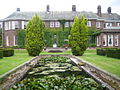
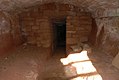
Burton is an unparished district in the Wirral Peninsula, Cheshire West and Chester, England. It contains 33 buildings that are recorded in the National Heritage List for England as designated listed buildings. The district contains the village of Burton and surrounding farmland and marsh. Most of the listed buildings are houses and cottages in the village, and many of these date from the 17th century, although most have been altered or extended. Only one of the buildings is listed at Grade II*, the middle of the three grades; this is St Nicholas' Church. All the other buildings are listed at Grade II, the lowest grade. The major house in the village is Burton Manor, which was later converted into an adult education college, although this closed in 2011. There are separate listed structures associated with the church and the manor. The other buildings include farmhouses and farm buildings, a former school and schoolmaster's cottage, the ruins of a windmill, a peace memorial, and a telephone kiosk.

Contents

Key

GradeCriteria [1]
II*Particularly important buildings of more than special interest.
IIBuildings of national importance and special interest.

Buildings

Name and locationPhotographDateNotesGrade
Barn End
53°15′38″N3°01′40″W / 53.2605°N 3.0279°W / 53.2605; -3.0279 (Barn End)
Barn End at Burton - geograph.org.uk - 907364.jpg
17th century
(or earlier)
Originating as two cottages, the building has been altered and converted into one house. It is built partly in timber framing with brick nogging and crucks, and partly in sandstone, all of which is rendered. The house stands on an outcrop of sandstone, and is approached by ten steps. Its roof is thatched. The house is in a single storey and extends for five bays. The windows are horizontal sliding sashes. [2] [3] II
Bishop Wilson's House
53°15′38″N3°01′46″W / 53.2605°N 3.0295°W / 53.2605; -3.0295 (Bishop Wilson's House)
Bishop Wilsons cottage at Burton - geograph.org.uk - 907373.jpg
Early 17th centuryThis originated as a cottage, dairy and cheese room; it was altered in the 19th and 20th centuries and is used as a house with an outbuilding. It is built in sandstone. The house has a thatched roof, and the roof of the outbuilding is slated. The house is in a single storey with an attic and has a four-bay front. Above the entrance is a gabled half-dormer, and the attic window is a dormer. Inside the house are the remains of three crucks. The house was the birthplace of Bishop Wilson. [2] [4] II
Barn Farmhouse and outbuildings
53°15′21″N3°01′22″W / 53.2557°N 3.0229°W / 53.2557; -3.0229 (Barn Farmhouse)
17th centuryThe farmhouse and outbuildings are in stone and brick with slate roofs, the front of the farmhouse being stuccoed. The farmhouse is in two storeys with a two-bay front on a stone plinth and the outbuildings are in a single storey with a loft. The windows are a mix of sashes and casements. [5] II
Burton Point Farmhouse
53°15′35″N3°02′37″W / 53.2597°N 3.0435°W / 53.2597; -3.0435 (Burton Point Farmhouse)
17th centuryThere have been alterations and additions, and the farmhouse is used as a house. It is built in sandstone with some rendering, and has a slate roof with stone copings and ridges. The house is in two storeys and has two bays. The windows are later casements. [6] II
Church Cottage
53°15′41″N3°01′27″W / 53.2613°N 3.0243°W / 53.2613; -3.0243 (Church Cottage)
17th centuryOriginally two cottages, this has been converted into a single dwelling. It is built in sandstone and brick with a slate roof. The house is in two storeys and has a five-bay front, with the left (brick) part standing on a stone plinth. The windows are casements. [7] II
Elm Farmhouse
53°15′38″N3°01′32″W / 53.2606°N 3.0256°W / 53.2606; -3.0256 (Elm Farmhouse)
17th centuryThe farmhouse was remodelled in the 19th century and extended in the 20th century, and is used as a private house. It is built in stone and brick on a stone plinth and has a slate roof. The house is in two storeys with an attic, and has a three-bay front with an added bay to the right. The windows are casements. Inside the house is an inglenook. [8] II
Farm building,
Village Street
53°15′39″N3°01′36″W / 53.2607°N 3.0268°W / 53.2607; -3.0268 (Farm building)
17th centuryThe farm building has subsequently been altered. It is in sandstone with a slate roof. The building has one storey and a loft and extends for two bays. Its features include two large circular pitch holes. [9] II
Greenwood
53°15′37″N3°01′47″W / 53.2603°N 3.0298°W / 53.2603; -3.0298 (Greenwood)
17th centuryThis originated as a house and a farm building, and was later combined into a single dwelling. It was damaged by fire in the 20th century. The building is timber-framed and encased in brick, and has a red tiled roof. It has an L-shaped plan, is in a single storey, and in two bays. The windows are replacement casements. [10] II
Plessington Cottage
53°15′40″N3°01′32″W / 53.2610°N 3.0255°W / 53.2610; -3.0255 (Plessington Cottage)
Plessington Cottage, Burton - geograph.org.uk - 180516.jpg
17th centuryThe house has been altered and extended. It is built in roughcast brick with a slate roof. The original part is in a single storey with attics and two dormers, and has a three-bay front. The extension to the left has two storeys and a single bay. The windows are replacement casements. The house stands on a sandstone outcrop, and steps lead up to the entrance. [11] II
Rake Farm Cottage
53°15′37″N3°01′43″W / 53.26034°N 3.02865°W / 53.26034; -3.02865 (Rake Farm Cottage)
Rake Farm cottage at Burton - geograph.org.uk - 907384.jpg
17th centuryThe house has been altered, and it was restored in about 1975. It is basically timber-framed on a sandstone plinth, and was later encased in brick. The house is in two storeys and has a two-bay front. In the plinth is a blocked mullioned window. Four steps lead up to the door. The windows are replacement casements. [12] II
Rose Cottage
53°15′37″N3°01′38″W / 53.26028°N 3.02726°W / 53.26028; -3.02726 (Rose Cottage)
17th centuryA house that was altered in the 19th and 20th centuries. It is partly timber-framed with brick nogging, and partly in stone. The house has a single storey with an attic and a two-bay front. The left part projects slightly forward and contains a door. The windows are 20th-century casements; those in the attic are in gabled half-dormers. [13] II
The Croft
53°15′37″N3°01′44″W / 53.26037°N 3.02880°W / 53.26037; -3.02880 (The Croft)
17th centuryThe end cottage in a row of three. It is built in roughcast sandstone with a slate roof and a tile ridge. It is in a single storey with an attic, and has a front with one window and a door. The door is approached by six steps. The windows are replacement casements; that in the attic is in a gabled half-dormer. [14] II
Church House
53°15′37″N3°01′38″W / 53.2604°N 3.0273°W / 53.2604; -3.0273 (Church House)
Late 17th centuryOriginating as two cottages, there have been alterations in the 19th and 20th centuries, and it is now a single dwelling with an L-shaped plan. The building is timber-framed with crucks and brick nogging on a stone plinth. It is roofed in red tiles, with gables, one coped, the other with bargeboards. The building is in one storey with attics. The windows are later casements. [15] II
Delamere House
53°15′38″N3°01′37″W / 53.2605°N 3.0269°W / 53.2605; -3.0269 (Delamere House)
Late 17th centuryThis is basically a timber-framed house with crucks, which was later altered and encased in rendered sandstone. The house has a stone plinth and a red tiled roof. It is in a single storey with an attic, and has a two-bay front. The windows are casements; that in the attic being in a half-dormer. [16] II
Pickerton Cottage
53°15′38″N3°01′37″W / 53.2606°N 3.0270°W / 53.2606; -3.0270 (Pickerton Cottage)
Late 17th centuryA sandstone house with a slate roof and stone copings. It is in two storeys, and has a three-bay front. The windows are mainly replacement casements. [17] II
Stanley House
53°15′38″N3°01′38″W / 53.2606°N 3.0272°W / 53.2606; -3.0272 (Stanley House)
Late 17th centuryThe house was extended in the late 18th century, and altered in the 20th century. The original house is timber-framed with brick nogging on a sandstone plinth, and has a red tile roof. The extension to the left is in stone and has a slate roof. The original part has a single storey with an attic, and is in two bays. The extension has two storeys and one bay. The windows in the original part are 20th-century casements, those in the attic being in gabled dormers; the windows in the extension are sashes. [18] II
The White House
53°15′38″N3°01′35″W / 53.2605°N 3.0263°W / 53.2605; -3.0263 (The White House)
Late 17th centuryThis originated as a farmhouse, later altered into a house with a shop, then into a private house. It is built in painted brick on a stone plinth with a slate roof. It is in two storeys with a four-bay front. Most of the windows are 19th-century casements. [19] II
Church Farmhouse
53°15′39″N3°01′31″W / 53.2608°N 3.0253°W / 53.2608; -3.0253 (Church Farmhouse)
1678This originated as a farmhouse with an attached cottage, and was later converted into a single dwelling. The house is in brick with stone quoins on a stone plinth. The former cottage is rendered. Both have slate roofs. Both parts are in two storeys, the house having two bays, and the cottage having one. The windows are sashes. [20] II
Peartree Cottage
53°15′40″N3°01′33″W / 53.2610°N 3.0258°W / 53.2610; -3.0258 (Peartree Cottage)
1682The cottage is built in sandstone and brick, and has a slate roof with red ridge tiles. It is in a single storey with a three-bay front, and a single-bay lean-to extension to the left. The windows are casements. [21] II
St Nicholas House
53°15′37″N3°01′39″W / 53.2603°N 3.0275°W / 53.2603; -3.0275 (St Nicholas House)
1711The house has been altered and extended. It is built in roughcast brick and has slate roofs. The main part has three storeys and a four-bay front, and the extension to the right has two storeys and one bay. The windows in the main part of the house are sashes, and in the extension and the porch they are casements. [22] II
St Nicholas' Church
53°15′42″N3°01′30″W / 53.2617°N 3.0250°W / 53.2617; -3.0250 (St Nicholas' Church)
St Nicholas' Church, Burton.jpg
1721The church incorporates a chapel dating from 1380, and the chancel was rebuilt in 1870. It is built in sandstone and has a slate roof. The church consists of a continuous nave and chancel, a north aisle, a north vestry and a west tower. The tower is in four stages and has a plain parapet and a clock face, the clock having only one hand. [23] [24] [25] II*
The Old School
53°15′41″N3°01′56″W / 53.2614°N 3.0323°W / 53.2614; -3.0323 (Old School)
1724This originated as a school with an attached schoolmaster's cottage. A rear extension was added in 1890, and the building has been converted into a residence. It is built in brick with a slate roof and coped gables. The School is in a single storey with a five-bay front, the end bays being gabled and projecting forwards, The cottage is in one storey and an attic, and has one bay. [26] II
Chest tombs
53°15′41″N3°01′29″W / 53.2615°N 3.0248°W / 53.2615; -3.0248 (Chest tombs)
Gravestones at St Nicholas', Burton-in-Wirral - geograph.org.uk - 1495721.jpg
1740–83A group of 18 chest tombs in the churchyard of St Nicholas. They are in sandstone and have various inscriptions. Many of these consist of indecipherable dates and names, but skull and crossbones and hourglass motifs can be identified. [2] [27] II
Barn, Burton Marsh Farm
53°15′41″N3°02′50″W / 53.2615°N 3.0471°W / 53.2615; -3.0471 (Barn, Burton Marsh Farm)
Mid 18th centuryThe barn is built in sandstone with a slate roof and coped gables. It is in two storeys, including lofts, and has a four-bay front. Its features include round pitch holes and vertical slit ventilators. [28] II
Sundial
53°15′42″N3°01′30″W / 53.26154°N 3.02500°W / 53.26154; -3.02500 (Sundial)
18th centuryThe sundial is in the churchyard of St Nicholas. It is constructed in red sandstone and consists of a vase-shaped pillar on a square pedestal, standing on square base. The dial and gnomon are missing. [2] [29] II
Windmill (remains)
53°15′46″N3°01′53″W / 53.26284°N 3.03132°W / 53.26284; -3.03132 (Windmill)
1771This was a tower windmill with a circular plan. It is built in sandstone, but only the lower eight courses and a date stone have survived. [30] II
Grave slabs
53°15′42″N3°01′29″W / 53.2616°N 3.0248°W / 53.2616; -3.0248 (Grave slabs)
1783–1879A group of eight grave slabs in the churchyard of St Nicholas. They are in sandstone and have various inscriptions, many of which consist of indecipherable dates and names. [31] II
Burton Manor
53°15′35″N3°01′43″W / 53.2597°N 3.0285°W / 53.2597; -3.0285 (Burton Manor)
Burton Manor.jpg
c. 1805A house that was remodelled in 1902–05 by Sir Charles Nicholson, with an orangery added in 1910. In 1948 it became an adult education college, but this closed in 2011. The house is built in sandstone with a green slate roof, and has a quadrilateral plan with a central courtyard. The entrance front is in two and three storeys and five bays, the central bay having an open pediment. The windows in the house and the orangery are sashes, and there is also a high-level Diocletian window in the orangery. [2] [32] [33] [34] II
Ice House,
Burton Manor
53°15′33″N3°01′47″W / 53.25906°N 3.02984°W / 53.25906; -3.02984 (Ice house, Burton Manor)
Ice House, Burton Manor.jpg
c. 1805The ice house is constructed in sandstone. It consists of two underground chambers linked by a passage, each chamber being approached by a separate flight of steps. [35] II
Coach House,
Burton Manor
53°15′36″N3°01′44″W / 53.2601°N 3.0288°W / 53.2601; -3.0288 (Coach House, Burton Manor)
1904The coach house was designed by Sir Charles Nicholson and converted into a house in 1948. It is built in sandstone and has a roof of Westmorland slate. The house is in a single storey with attics, and has a front of three bays. On the roof are weatherboarded dormers, and a slate-clad clock tower with a pyramidal roof, and a weathervane in the form of a bird. [2] [36] II
Wall, gate piers and library, Burton Manor
53°15′37″N3°01′44″W / 53.26026°N 3.02896°W / 53.26026; -3.02896 (Wall, gate piers and library, Burton Manor)
1904Designed by Sir Charles Nicholson, parts of the sandstone wall probably pre-date his design. The library is in sandstone with a hipped slate roof. It is in a single storey with three bays, and a flat-roofed extension to the right. The gate piers are in brick, standing in pairs on each side of the entrance. They have ball finials, and the pairs of piers are joined by stone lintels. [37] II
Burton in Wirral Peace Cross
53°15′45″N3°01′21″W / 53.26257°N 3.02263°W / 53.26257; -3.02263 (Burton in Wirral Peace Cross)
1917The memorial stands near a road junction. It is in stone, and consists of a wheel-head cross on a tall four-sided plinth on a base of three steps. There are inscriptions on the three steps including a plea for peace. [38] II
Telephone kiosk
53°15′38″N3°01′39″W / 53.26043°N 3.02740°W / 53.26043; -3.02740 (Telephone kiosk)
1935A K6 type telephone kiosk, designed by Giles Gilbert Scott. It is constructed in cast iron, with a square plan and domed roof. In the panels around the top are three unperforated crowns. [39] II

Related Research Articles

Kingsley is a civil parish in Cheshire West and Chester, England. Other than the village of Kingsley, the parish is entirely rural. It contains 13 buildings that are recorded in the National Heritage List for England as designated listed buildings. Other than the church and its lychgate, and the wall of a former Quaker burial ground, the structures are all related to domestic buildings or farms.

Weaverham is a civil parish in Cheshire West and Chester, England. Apart from the village of Weaverham, the parish is entirely rural, and contains 22 buildings that are recorded in the National Heritage List for England as designated listed buildings. Most of the buildings are related to houses or farming, and many of the cottages originating in the 17th century are basically timber-framed. Buildings in other categories are two churches, a public house, and the former grammar school.

Davenham is a civil parish in Cheshire West and Chester, England. It contains 28 buildings that are recorded in the National Heritage List for England as designated listed buildings. Other than the village of Davenham, the parish is rural, and most of the buildings in the list are domestic or related to farming. Running through the parish are the Trent and Mersey Canal, the River Weaver and the Weaver Navigation, and the West Coast Main Line; there are structures relating to all these in the list. The other listed buildings are the village church and associated structures, two public houses, and a memorial drinking fountain.

Tarporley is a civil parish in Cheshire West and Chester, England. It contains 39 buildings that are recorded in the National Heritage List for England as designated listed buildings. It includes the large village of Tarporley; otherwise the parish is rural. Of the listed buildings, five are at Grade II*, the others are at Grade II. The Grade II* listed buildings are the church, a hotel in the village, the former market hall, a large house on the outskirts of the village, and a farmhouse just outside the village. Many of the listed buildings are in the village, and a high proportion of these are in its High Street. Outside the village, they are houses and associated buildings.

<span class="mw-page-title-main">Listed buildings in Christleton</span>

Christleton is a civil parish in Cheshire West and Chester, England. It contains 32 buildings that are recorded in the National Heritage List for England as designated listed buildings. Of these, three are listed at Grade II*, and the others at Grade II. The largest settlement in the parish is the village of Christleton, and most of the listed buildings are in the village. These include houses with related structures, the church and items in the churchyard, almshouses, a memorial shelter, and a telephone kiosk. The Shropshire Union Canal passes through the parish, and three of its bridges are listed. Also listed is a former hydraulic sewage lift.

There are over 20,000 Grade II* listed buildings in England. This page is a list of these buildings in the unitary authority of Cheshire West and Chester.

There are over 9,000 Grade I listed buildings in England. This page is a list of these buildings in the unitary authority of Cheshire West and Chester.

<span class="mw-page-title-main">Listed buildings in Saughall</span>

Saughall is a former civil parish now in the parishes of Saughall and Shotwick Park, Puddington and the unparished area of Chester, in Cheshire West and Chester, England. It contains eleven buildings that are recorded in the National Heritage List for England as designated listed buildings, all of which are listed at Grade II. This grade is the lowest of the three gradings given to listed buildings and is applied to "buildings of national importance and special interest". The parish contains the village of Saughall, and is otherwise rural. Most of the listed buildings are houses and associated structures. The others include a former inn, a former windmill, a church, and two guideposts.

Shotwick is a former civil parish, now in the parish of Puddington, in Cheshire West and Chester, England. It contains 23 buildings that are recorded in the National Heritage List for England as designated listed buildings. Of these, one is listed at Grade I, the highest grade, two are listed at Grade II*, the middle grade, and the others are at Grade II. Apart from the village of Shotwick, the parish is entirely rural. Most of the listed buildings are in the village, and include houses, St Michael's Church and structures in the churchyard, and Shotwick Hall with associated structures. Outside the village, the listed buildings are domestic or related to farming.

Tattenhall is a former civil parish, now in the parish of Tattenhall and District, in Cheshire West and Chester, England. It contains 27 buildings that are recorded in the National Heritage List for England as designated listed buildings. Of these, three are listed at Grade II*, the middle grade, and the others are at Grade II, the lowest grade. Apart from the village of Tattenhall, the parish is rural. In the village the listed buildings include the church and its sundial, the war memorial, and houses and cottages, some dating from the 17th century and with a timber-framed core. Outside the village, the listed buildings include country houses and associated structures, other houses and cottages, farmhouses, and a boundary stone.

Acton is a former civil parish in Cheshire East, England. It contained 24 buildings that are recorded in the National Heritage List for England as designated listed buildings. Of these, two are listed at Grade I, the highest grade, four are listed at Grade II*, the middle grade, and the others are at Grade II. Apart from the village of Acton, the parish was rural. Listed buildings in the village include the church and associated structures, houses, a public house and a telephone kiosk. The major structure is the parish is Dorfold Hall; this and associated structures are listed. The other items include an aqueduct carrying the Shropshire Union Canal across a road, farmhouses and cottages.

Audlem is a civil parish in Cheshire East, England. It contains 25 buildings that are recorded in the National Heritage List for England as designated listed buildings. Of these, two are listed at Grade I, the highest grade, one is listed at Grade II*, the middle grade, and the others are at Grade II. The major settlement in the parish is the village of Audlem. In the village the listed buildings include churches and cemetery chapels, a former grammar school, a hotel, houses, and a memorial lamp standard. In the surrounding countryside the listed buildings include country houses, farmhouses, farm buildings, and a road bridge. Running through the parish is the Shropshire Union Canal, and the listed structures associated with this are bridges, mileposts and a lock keeper's cottage.

Brereton is a civil parish in Cheshire East, England. It contains 21 buildings that are recorded in the National Heritage List for England as designated listed buildings. Of these, one is listed at Grade I, the highest grade, three are listed at Grade II*, the middle grade, and the others are at Grade II. The parish is almost entirely rural. The major building in the parish is Brereton Hall. The listed buildings consist of the hall and associated buildings, the church and a sundial in its churchyard, a public house, a former mill, farmhouses and farm buildings, houses or cottages, and three mileposts.

Chelford is a civil parish in Cheshire East, England. It contains nine buildings that are recorded in the National Heritage List for England as designated listed buildings. Of these, three are listed at Grade II*, the middle grade, and the other six are at Grade II. Apart from the village of Chelford, which is in the western part of the parish, to the west of the railway, and well to the west of the Chelford Roundabout, where the A535 road meets the A537. The listed buildings are to the south and east of the roundabout. Most of them are houses and cottages, the other listed buildings being farm buildings, a church and a bridge.

Church Minshull is a civil parish in Cheshire East, England. It contains 22 buildings that are recorded in the National Heritage List for England as designated listed buildings. Of these, four are listed at Grade II*, the middle grade, and the others are at Grade II. Apart from the village of Church Minshull the parish is rural. A high proportion of the listed buildings are houses or cottages, many of which are timber-framed, and date back to the 17th century. The Middlewich Branch of the Shropshire Union Canal and the River Weaver pass through the parish. Three structures associated with the canal are listed, a bridge, an aqueduct, and a former warehouse. The other listed buildings are farmhouses, farm buildings, the village church and its gates, a public house, and two bridges.

Cranage is a civil parish in Cheshire East, England. It contains 12 buildings that are recorded in the National Heritage List for England as designated listed buildings. Of these, one is listed at Grade II*, the middle grade, and the others are at Grade II. Apart from the village of Cranage, and some residential areas, the parish is rural. Most of the listed buildings are houses and cottages, or farmhouses and farm buildings. The other listed buildings are a former country house, a former vicarage, a school, a bridge, and a milepost.

Goostrey is a civil parish in Cheshire East, England. It contains 19 buildings that are recorded in the National Heritage List for England as designated listed buildings. Of these, one is listed at Grade I, the highest grade, three are listed at Grade II*, the middle grade, and the others are at Grade II. Apart from the village of Goostrey, the parish is mainly rural. It contains the Jodrell Bank Observatory, with its Grade I listed Lovell Telescope and its control building. In the village, the listed buildings include the church and associated structures, the former schoolmaster's house, and a row of cottages. Outside the village they include country houses, farmhouses, and farm buildings, some of which date back to the 16th century and are timber-framed.

Great Warford is a civil parish in Cheshire East, England. It contains six buildings that are recorded in the National Heritage List for England as designated listed buildings. Of these, one is listed at Grade II*, the middle grade, and the others are at Grade II. Apart from the village of Great Warford, the parish is almost entirely rural. The listed buildings consist of a house, a cottage, a farmhouse, a Chapel, the most spectacular is Highgrove built in 1903 as a Convalescent home for Ancoats Hospital in Manchester and its lodge after which the road is named.

Haslington is a civil parish in Cheshire East, England. It contains 12 buildings that are recorded in the National Heritage List for England as designated listed buildings. Of these, one is listed at Grade I, the highest grade, and the others are at Grade II. The parish contains the villages of Haslington, Oakhanger and Winterley, but is otherwise rural. The listed buildings consist of two churches, two former manor houses, a former vicarage with its lodge, other houses and cottages, and a public house.

Siddington is a civil parish in Cheshire East, England. It contains 23 buildings that are recorded in the National Heritage List for England as designated listed buildings. Of these, three are listed at Grade II*, the middle grade, and the others are at Grade II. The major building in the parish is Capesthorne Hall; the hall, its chapel and chapel gates, and three other structures in the grounds are listed. Otherwise, apart from the village of Siddington, the parish is rural, and most of the listed buildings are farms, farm buildings, houses, cottages, and associated structures. The other listed buildings are a church with a cross base in the churchyard, a mill, and a bridge.

References

Citations

  1. Listed Buildings, Historic England , retrieved 30 March 2015
  2. 1 2 3 4 5 6 Hartwell et al. (2011), p. 197
  3. Historic England, "Barn End, Burton Village (1387800)", National Heritage List for England , retrieved 16 August 2013
  4. Historic England, "Bishop Wilson's Cottage, Burton Village (1387801)", National Heritage List for England, retrieved 16 August 2013
  5. Historic England, "Barn Farmhouse and attached range of outbuildings, Burton (1387718)", National Heritage List for England, retrieved 16 August 2013
  6. Historic England, "Burton Point Farmhouse, Burton (1387727)", National Heritage List for England, retrieved 16 August 2013
  7. Historic England, "Church Cottage, Burton Village (1387807)", National Heritage List for England, retrieved 16 August 2013
  8. Historic England, "Elm Farmhouse, Burton Village (1387719)", National Heritage List for England, retrieved 16 August 2013
  9. Historic England, "Farm building immediately to east of Pickerton Cottage, Burton Village (1387834)", National Heritage List for England, retrieved 17 August 2013
  10. Historic England, "Greenwood, Burton Village (1387822)", National Heritage List for England, retrieved 16 August 2013
  11. Historic England, "Plessington Cottage, Burton Village (1387835)", National Heritage List for England, retrieved 17 August 2013
  12. Historic England, "Rake Farm Cottage, Burton Village (1387836)", National Heritage List for England, retrieved 17 August 2013
  13. Historic England, "Rose Cottage, Burton Village (1387837)", National Heritage List for England, retrieved 17 August 2013
  14. Historic England, "The Croft, Burton Village (1387840)", National Heritage List for England, retrieved 17 August 2013
  15. Historic England, "Church House, Burton Village (1387809)", National Heritage List for England, retrieved 16 August 2013
  16. Historic England, "Delamere House, Burton Village (1387820)", National Heritage List for England, retrieved 16 August 2013
  17. Historic England, "Pickerton Cottage, Burton Village (1387833)", National Heritage List for England, retrieved 17 August 2013
  18. Historic England, "Stanley House, Burton Village (1387839)", National Heritage List for England, retrieved 17 August 2013
  19. Historic England, "The White House, Burton Village (1387841)", National Heritage List for England, retrieved 17 August 2013
  20. Historic England, "Church Farmhouse, Burton Village (1387808)", National Heritage List for England, retrieved 16 August 2013
  21. Historic England, "Peartree Cottage, Burton Village (1387832)", National Heritage List for England, retrieved 16 August 2013
  22. Historic England, "St Nicholas House, Burton Village (1387838)", National Heritage List for England, retrieved 17 August 2013
  23. Hartwell et al. (2011), pp. 196–197
  24. Richards (1947), pp. 83–87
  25. Historic England, "Church of St Nicholas, Burton Village (1387811)", National Heritage List for England, retrieved 16 August 2013
  26. Historic England, "The Old School, Burton Village (1387693)", National Heritage List for England, retrieved 16 August 2013
  27. Historic England, "Group of 18 Chest tombs, approximately 2 metres from the southeast corner of Church of St Nicholas, Burton Village (1387812)", National Heritage List for England, retrieved 16 August 2013
  28. Historic England, "Barn to south of Burton Marsh Farmhouse, Burton (1387725)", National Heritage List for England, retrieved 16 August 2013
  29. Historic England, "Sundial in Churchyard of St Nicholas Church, Burton Village (1387815)", National Heritage List for England, retrieved 16 August 2013
  30. Historic England, "Remains of Windmill, Burton Wood (1387679)", National Heritage List for England, retrieved 16 August 2013
  31. Historic England, "Group of 8 raised grave slabs approximately 2 metres from east gable of Church of St Nicholas, Burton Village (1387814)", National Heritage List for England, retrieved 16 August 2013
  32. de Figueiredo & Treuherz (1988), pp. 220–222
  33. Historic England, "Burton Manor and attached Orangery, Burton Village (1387802)", National Heritage List for England, retrieved 16 August 2013
  34. Burton Manor College, Neston Town Council, retrieved 16 August 2013
  35. Historic England, "Ice House approximately 75m south west of Burton Manor, Burton Village (1387806)", National Heritage List for England, retrieved 16 August 2013
  36. Historic England, "Former Coach House of Burton Manor, Burton Village (1387804)", National Heritage List for England, retrieved 16 August 2013
  37. Historic England, "Front Boundary Wall, Gate Piers and Library at Burton Manor, Burton Village (1387805)", National Heritage List for England, retrieved 16 August 2013
  38. Historic England, "Burton in Wirral Peace Cross, Burton Village (1450305)", National Heritage List for England, retrieved 10 November 2017
  39. Historic England, "K6 Telephone Kiosk to front of Church House, Burton Village (1387810)", National Heritage List for England, retrieved 16 August 2013

Sources