Brigham is a civil parish in the borough of Allerdale in Cumbria, England. It contains 16 listed buildings that are recorded in the National Heritage List for England. Of these, one is listed at Grade I, the highest of the three grades, one is at Grade II*, the middle grade, and the others are at Grade II, the lowest grade. The parish contains the village of Brigham and surrounding countryside. The listed buildings include a church and a sundial in the churchyard, houses and associated structures, farmhouses and farm buildings, milestones, a bridge, a war memorial, and a cattle pound.
Crosscanonby is a civil parish in the Borough of Allerdale in Cumbria, England. It contains 16 listed buildings that are recorded in the National Heritage List for England. Of these, one is listed at Grade I, the highest of the three grades, and the others are at Grade II, the lowest grade. The parish contains the villages of Crosscanonby, Crosby and Birkby, and the surrounding countryside. The listed buildings consist of houses and cottages, and associated buildings, a church and a war memorial.
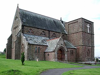
Plumbland is a civil parish in the Borough of Allerdale in Cumbria, England. It contains eleven listed buildings that are recorded in the National Heritage List for England. Of these, one is listed at Grade II*, the middle of the three grades, and the others are at Grade II, the lowest grade. The parish contains the village of Plumbland and the settlements of Threapland, Parsonby and Arkleby, and is otherwise rural. The listed buildings include houses and associated structures, a church, a dovecote, a bridge, a farmhouse, and a school later used as a village hall.
Hayton is a civil parish in the Carlisle district of Cumbria, England. It contains 33 listed buildings that are recorded in the National Heritage List for England. Of these, two are listed at Grade II*, the middle of the three grades, and the others are at Grade II, the lowest grade. The parish contains the villages of Hayton and Talkin, and the smaller settlements of Heads Nook, Corby Hill, Faugh, Fenton, and Greenwell, and is otherwise rural. The listed buildings include houses and associated structures, farmhouses, farm buildings, churches and associated structures, bridges, milestones, public houses, a war memorial, and a school.
Nicholforest is a civil parish in the Carlisle district of Cumbria, England. It contains seven listed buildings that are recorded in the National Heritage List for England. Of these, one is listed at Grade II*, the middle of the three grades, and the others are at Grade II, the lowest grade. The parish is almost entirely rural, and the listed buildings consist of a country house that originated as a tower house, an outbuilding associated with it, a farmhouse and a barn, a milestone, a church, and a monument.
Rockcliffe is a civil parish in the Carlisle district of Cumbria, England. It contains 16 buildings that are recorded in the National Heritage List for England. Of these, one is listed at Grade I, the highest of the three grades, two are at Grade II*, the middle grade, and the others are at Grade II, the lowest grade. The parish contains the villages of Rockcliffe and Harker, and the surrounding countryside. The listed buildings include houses and associated structures, farmhouses and farm buildings, a church with a mediaeval cross in the churchyard, a public house, and a milestone.
Scaleby is a civil parish in the Carlisle district of Cumbria, England. It contains 16 buildings that are recorded in the National Heritage List for England. Of these, one is listed at Grade I, the highest of the three grades, and the others are at Grade II, the lowest grade. The parish contains the village of Scaleby, and is otherwise rural. The most important building in the parish is Scaleby Castle; this and associated structures are listed. The other listed buildings include houses, farmhouses and farm buildings, a church, a former chapel, a church hall, a war memorial, and a milestone.
Westlinton is a civil parish in the Carlisle district of Cumbria, England. It contains eight listed buildings that are recorded in the National Heritage List for England. All the listed buildings are designated at Grade II, the lowest of the three grades, which is applied to "buildings of national importance and special interest". The parish include the villages of Westlinton and Blackford, and is otherwise rural. The listed buildings include farmhouses, a house with outbuildings, two milestones, a bridge, and a church.
Egremont is a civil parish in the Borough of Copeland, Cumbria, England. It contains 26 buildings that are recorded in the National Heritage List for England. Of these, one is listed at Grade I, the highest of the three grades, and the others are at Grade II, the lowest grade. The parish contains the town of Egremont and the surrounding countryside. The oldest listed building is Egremont Castle; this and associated structures are listed. Most of the other listed buildings are houses and associated structures, farmhouses and farm buildings. The other listed buildings include churches, cemetery buildings, shops, two former toll houses, a milestone, a monument, a town hall, a drinking fountain, and two war memorials.
Muncaster is a civil parish in the Borough of Copeland, Cumbria, England. It contains 14 buildings that are recorded in the National Heritage List for England. Of these, two are listed at Grade I, the highest of the three grades, one is at Grade II*, the middle grade, and the others are at Grade II, the lowest grade. The parish contains the coastal village of Ravenglass and countryside to the east. The most important building in the parish is Muncaster Castle; this and buildings associated with it, including St Michael's Church and associated structures, are listed. The other listed buildings are houses, farmhouses, farm buildings, and a war memorial.
Parton is a civil parish in the Borough of Copeland, Cumbria, England. It contains eight buildings that are recorded in the National Heritage List for England. Of these, one is listed at Grade I, the highest of the three grades, and the others are at Grade II, the lowest grade. The parish contains the village of Parton, and is largely residential. The listed buildings comprise a country house and associated structures, a church and items in the churchyard, a former toll house, and a milestone.
Bolton is a civil parish in the Eden District, Cumbria, England. It contains 14 buildings that are recorded in the National Heritage List for England. Of these, one is listed at Grade I, the highest of the three grades, two are at Grade II*, the middle grade, and the others are at Grade II, the lowest grade. The parish contains the village of Bolton, and is otherwise rural. The listed buildings comprise the former residence of the Bishops of Carlisle, now in ruins, a church and structures in the churchyard, houses in the village, a farmhouse and barn, a bridge, and a country house with associated structures.
Brougham is a civil parish in the Eden District, Cumbria, England. It contains 17 buildings that are recorded in the National Heritage List for England. Of these, one is listed at Grade I, the highest of the three grades, six are at Grade II*, the middle grade, and the others are at Grade II, the lowest grade. The parish is to the southeast of the town of Penrith, and is almost completely rural. Two people are largely responsible for the more important buildings in the parish, Lady Anne Clifford in the 17th century, and Lord Brougham in the 19th century. The listed buildings include parts of a castle, later converted into a country house, a church, a chapel and its churchyard walls, a memorial pillar with an alms table, a house, farmhouses and farm buildings, two bridges, a milestone, and a parish boundary stone.
Hartley is a civil parish in the Eden District, Cumbria, England. It contains 16 listed buildings that are recorded in the National Heritage List for England. All the listed buildings are designated at Grade II, the lowest of the three grades, which is applied to "buildings of national importance and special interest". The parish is to the east of the town of Kirkby Stephen. The South Durham and Lancashire Union Railway ran through it until the line closed in 1965, but two viaducts have survived and are listed. Many of the other listed buildings are houses and associated structures, farmhouses and farm buildings. The rest of the listed buildings comprise the ruins of a castle, two bridges, a boundary stone, a row of nine cairns, and a pinfold.
Lowther is a civil parish in the Eden District, Cumbria, England. It contains 42 listed buildings that are recorded in the National Heritage List for England. Of these, 13 are listed at Grade II*, the middle of the three grades, and the others are at Grade II, the lowest grade. The parish contains the villages of Lowther, Newtown, Hackthorpe, Melkinthorpe, and Whale. The largest building in the parish is Lowther Castle, a country house in the form of a sham castle. which is now in ruins; this and associated structures are listed. In the 1760s a model village was created, the buildings designed by Robert Adam, but was never completed; the existing buildings are all listed. Most of the other listed buildings are houses and associated structures, farmhouses and farm buildings. The other listed buildings include a church an item in the churchyard, a public house, two bridges, and a milestone.
Mallerstang is a civil parish in the Eden District, Cumbria, England. It contains eight listed buildings that are recorded in the National Heritage List for England. Of these, one is listed at Grade I, the highest of the three grades, and the others are at Grade II, the lowest grade. The parish is mainly rural; it contains the village of Outhgill and the surrounding countryside and moorland. The listed buildings comprise a ruined tower house, a church, a group of three farmhouses with farm buildings, a house and its forecourt wall, and a bridge.
Milburn is a civil parish in the Eden District, Cumbria, England. It contains 15 listed buildings that are recorded in the National Heritage List for England. Of these, one is listed at Grade I, the highest of the three grades, and the others are at Grade II, the lowest grade. The parish contains the village of Milburn and the surrounding countryside. The largest building in the parish is Howgill House, originally a fortified house, and later a country house; this and structures associated with it are listed. Apart from a church, all the other listed buildings are located in the village and are centred round The Green.
Skelton is a civil parish in the Eden District, Cumbria, England. It contains 56 listed buildings that are recorded in the National Heritage List for England. Of these, three are listed at Grade I, the highest of the three grades, three are at Grade II*, the middle grade, and the others are at Grade II, the lowest grade. The parish is mainly rural, and contains a number of villages and smaller settlements, including Skelton, Ellonby, Lamonby, Unthank, Unthank End, Laithes, and Ivegill. Most of the listed buildings are country houses and smaller houses with associated structures, farmhouses and farm buildings. The other listed buildings include churches and structures in the churchyards, a chapel, a bridge, a boundary stone, and a war memorial lych gate.
Stainmore, for administrative purposes, is a civil parish in the Eden District, Cumbria, England. The parish contains ten listed buildings that are recorded in the National Heritage List for England. All the listed buildings are designated at Grade II, the lowest of the three grades, which is applied to "buildings of national importance and special interest". The parish is almost completely rural, containing only a few small settlements. The listed buildings consist of a farmhouse and outbuildings, a former country house and its coach house, a public house, three boundary stones, and three milestones.
Helsington is a civil parish in the South Lakeland District of Cumbria, England. It contains 21 listed buildings that are recorded in the National Heritage List for England. Of these, one is listed at Grade I, the highest of the three grades, one is at Grade II*, the middle grade, and the others are at Grade II, the lowest grade. The parish includes the village of Brigsteer, and is otherwise rural. The major listed buildings in the parish are Sizergh Castle and associated structures. The other listed buildings include farmhouses, farm buildings, houses, bridges, a church, a snuff mill, and buildings associated with a former gunpowder works.