Lindal and Marton is a civil parish in the Borough of Barrow-in-Furness in Cumbria, England. It contains 14 listed buildings that are recorded in the National Heritage List for England. All the listed buildings are designated at Grade II, the lowest of the three grades, which is applied to "buildings of national importance and special interest". The parish contains the villages of Lindal-in-Furness and Marton, and the surrounding countryside. The listed buildings are all in the villages, and consist of two farmhouses with farm buildings in Marton, and houses, farmhouses and farm buildings, the village hall, and the church in Lindal-in-Furness.
Cumrew is a civil parish in the Carlisle district of Cumbria, England. It contains eleven listed buildings that are recorded in the National Heritage List for England. All the listed buildings are designated at Grade II, the lowest of the three grades, which is applied to "buildings of national importance and special interest". The parish contains the village of Cumrew and is otherwise rural. Its listed buildings consist of houses, farmhouses, farm buildings, and a church.
Orton is a civil parish in the Carlisle district of Cumbria, England. It contains twelve listed buildings that are recorded in the National Heritage List for England. Of these, one is listed at Grade II*, the middle of the three grades, and the others are at Grade II, the lowest grade. The parish contains the village of Great Orton, and the smaller settlements of Little Orton and Baldwinholme, and is otherwise rural. The listed buildings consist of farmhouses, farm buildings, houses and associated structures, a church, and a war memorial in the churchyard.
Whicham is a civil parish in the Borough of Copeland, Cumbria, England. It contains eleven listed buildings that are recorded in the National Heritage List for England. All the listed buildings are designated at Grade II, the lowest of the three grades, which is applied to "buildings of national importance and special interest". The parish contains the villages or hamlets of Silecroft, Kirksanton, Whicham and Whitbeck and is otherwise rural. The listed buildings comprise houses, farmhouses and farm buildings, two churches, a former brewery, a former mill, and a limekiln.
Hutton is a civil parish in the Eden District, Cumbria, England. It contains 13 listed buildings that are recorded in the National Heritage List for England. Of these, one is listed at Grade I, the highest of the three grades, and the others are at Grade II, the lowest grade. The parish contains the villages of Hutton and Penruddock and the surrounding countryside. The most important building in the parish is Hutton John, originally a fortified tower house and later a country house; this and associated structures are listed. Apart from a church, all the other listed buildings are houses, farmhouses and farm buildings.
Claife is a civil parish in the South Lakeland District of Cumbria, England. It contains 45 listed buildings that are recorded in the National Heritage List for England. Of these, four are listed at Grade II*, the middle of the three grades, and the others are at Grade II, the lowest grade. The parish is in the Lake District National Park to the west of Windermere. It contains the villages and settlements of Far Sawrey, Near Sawrey, Colthouse, Loanthwaite, High Wray and Low Wray, and the surrounding countryside. Most of the listed buildings are farmhouses, farm buildings, and houses with associated structures. The other listed buildings include churches, a public house, and a bridge.
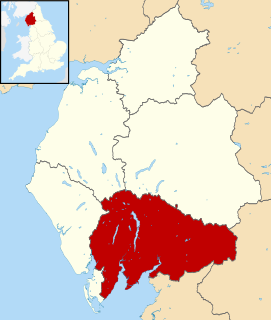
Coniston is a civil parish in the South Lakeland District of Cumbria, England. It contains 53 listed buildings that are recorded in the National Heritage List for England. Of these, four are listed at Grade II*, the middle of the three grades, and the others are at Grade II, the lowest grade. The parish is in the Lake District National Park and is located to the west, north and east of Coniston Water. Most of the listed buildings are houses and associated structures, farmhouses and farm buildings. The other listed buildings include bridges, a limekiln, a folly, a boundary stone, a church, a drinking fountain, and a memorial.
Crook is a civil parish in the South Lakeland District of Cumbria, England. It contains 18 listed buildings that are recorded in the National Heritage List for England. All the listed buildings are designated at Grade II, the lowest of the three grades, which is applied to "buildings of national importance and special interest". The parish is in the Lake District National Park to the east of the southern part of Windermere. It contains the villages of Crook and Winster, and is otherwise rural. Most of the listed buildings are houses with associated structures, farmhouses, and farm buildings. The other listed buildings are the tower of a disused church, a packhorse bridge, a public house, and a school.
Firbank is a civil parish in the South Lakeland District of Cumbria, England. It contains 15 listed buildings that are recorded in the National Heritage List for England. Of these, one is listed at Grade II*, the middle of the three grades, and the others are at Grade II, the lowest grade. The parish is almost completely rural, with no settlements of significant size. The listed buildings consist of farmhouses, farm buildings, houses, bridges, mileposts, a burial ground, and a church.
Grayrigg is a civil parish in the South Lakeland District of Cumbria, England. It contains eleven listed buildings that are recorded in the National Heritage List for England. Of these, one is listed at Grade II*, the middle of the three grades, and the others are at Grade II, the lowest grade. The parish is almost entirely rural, the only significant settlement being the village of Grayrigg. The listed buildings include houses, farmhouses, farm buildings, bridges, milestones, a church, and a disused railway viaduct.
Helsington is a civil parish in the South Lakeland District of Cumbria, England. It contains 21 listed buildings that are recorded in the National Heritage List for England. Of these, one is listed at Grade I, the highest of the three grades, one is at Grade II*, the middle grade, and the others are at Grade II, the lowest grade. The parish includes the village of Brigsteer, and is otherwise rural. The major listed buildings in the parish are Sizergh Castle and associated structures. The other listed buildings include farmhouses, farm buildings, houses, bridges, a church, a snuff mill, and buildings associated with a former gunpowder works.
Hugill is a civil parish in the South Lakeland District of Cumbria, England. It contains nine listed buildings that are recorded in the National Heritage List for England. Of these, two are listed at Grade II*, the middle of the three grades, and the others are at Grade II, the lowest grade. The parish is in the Lake District National Park and is almost completely rural, the only settlement being the village of Ings. Most of the listed buildings are farmhouses and farm buildings, the others being a country house, a monument, a church, and a school later used as a parish hall.
Kirkby Ireleth is a civil parish in the South Lakeland District of Cumbria, England. It contains six listed buildings that are recorded in the National Heritage List for England. Of these, one is listed at Grade I, the highest of the three grades, two are at Grade II*, the middle grade, and the others are at Grade II, the lowest grade. The parish contains the village of Kirkby-in-Furness and smaller settlements including Beck Side and Grizebeck, but is almost completely rural. The former Furness Railway runs through the parish and a footbridge crossing the line at Kirkby-in-Furness railway station is listed. The other listed buildings are a former manor house now a farmhouse, a country house and its garden wall, a church, and a barn.
Levens is a civil parish in the South Lakeland District of Cumbria, England. It contains 21 listed buildings that are recorded in the National Heritage List for England. Of these, one is listed at Grade I, the highest of the three grades, two are at Grade II*, the middle grade, and the others are at Grade II, the lowest grade. The parish contains the village of Levens and the surrounding countryside. The major building in the parish is Levens Hall; this and associated structures are listed. The other listed buildings include houses, farmhouses, farm buildings, a bridge, a church, and a limekiln.
Natland is a civil parish in the South Lakeland District of Cumbria, England. It contains 14 listed buildings that are recorded in the National Heritage List for England. Of these, one is listed at Grade II*, the middle of the three grades, and the others are at Grade II, the lowest grade. The parish contains the village of Natland, and is otherwise rural. The listed buildings include houses, farmhouses, farm buildings, bridges, a church, a milestone, and a boundary post.
New Hutton is a civil parish in the South Lakeland District of Cumbria, England. It contains 12 listed buildings that are recorded in the National Heritage List for England. All the listed buildings are designated at Grade II, the lowest of the three grades, which is applied to "buildings of national importance and special interest". The parish contains the village of New Hutton, and is otherwise rural. The listed buildings include farmhouses, farm buildings, houses, one of which is used as a school, a monument, a church and associated structures, and a dam and machinery house.
Skelwith is a civil parish in the South Lakeland District of Cumbria, England. It contains 17 listed buildings that are recorded in the National Heritage List for England. Of these, one is listed at Grade II*, the middle of the three grades, and the others are at Grade II, the lowest grade. The parish is in the Lake District National Park. The only settlement of significant size is the village of Skelwith Bridge, the rest of the parish being rural. Most of the listed buildings are houses with associated structures, and farmhouses and farm buildings. The other listed buildings are a church and a bridge.
Staveley-in-Cartmel is a civil parish in the South Lakeland District of Cumbria, England. It contains 22 listed buildings that are recorded in the National Heritage List for England. Of these, one is listed at Grade II*, the middle of the three grades, and the others are at Grade II, the lowest grade. The parish is in the Lake District National Park. It contains the villages of Staveley-in-Cartmel and Newby Bridge, and smaller settlements, but is mainly rural. In the parish is Fell Foot Park, a country park on the shore of Windermere; four buildings in this park have been listed. The other listed buildings include farmhouses, farm buildings, other houses, a milestone, a bridge, a church, and a sundial in the churchyard.
Strickland Roger is a civil parish in the South Lakeland District of Cumbria, England. It contains nine listed buildings that are recorded in the National Heritage List for England. Of these, one is listed at Grade II*, the middle of the three grades, and the others are at Grade II, the lowest grade. The parish is almost completely rural, and the listed buildings consist of houses, a gatehouse, farmhouses and farm buildings, a bridge, and a cottage associated with a mill.
Whitwell and Selside is a civil parish in the South Lakeland District of Cumbria, England. It contains eleven listed buildings that are recorded in the National Heritage List for England. Of these, one is listed at Grade II*, the middle of the three grades, and the others are at Grade II, the lowest grade. The parish contains the village of Selside and smaller settlements, and is otherwise rural. The listed buildings consist of houses, farm buildings, bridges, mileposts, and a church.