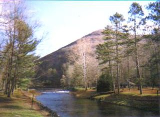
The Allegheny River is a 325-mile (523 km) long headwater stream of the Ohio River in western Pennsylvania and New York, United States. The Allegheny River runs from its headwaters just below the middle of Pennsylvania's northern border northwesterly into New York then in a zigzag southwesterly across the border and through Western Pennsylvania to join the Monongahela River at the Forks of the Ohio on the "Point" of Point State Park in Downtown Pittsburgh, Pennsylvania. The Allegheny River is, by volume, the main headstream of both the Ohio and Mississippi Rivers. Historically, the Allegheny was considered to be the upper Ohio River by both Native Americans and European settlers.

The Little Kanawha River is a tributary of the Ohio River, 169 mi (269 km) long, in western West Virginia in the United States. Via the Ohio, it is part of the watershed of the Mississippi River, draining an area of 2,320 mi² (6,009 km²) on the unglaciated portion of the Allegheny Plateau. It served as an important commercial water route in the early history of West Virginia, particularly in the logging and petroleum industries.

Tulpehocken Creek is a 39.5-mile-long (63.6 km) tributary of the Schuylkill River in southeastern Pennsylvania in the United States, and during the American Canal Age, once provided nearly half the length of the Union Canal linking the port of Philadelphia, the largest American city and the other communities of Delaware Valley with the Susquehanna basin and the Pennsylvania Canal System connecting the Eastern seaboard to Lake Erie and the new settlements of the Northwest Territory via the Allegheny}, Monongahela. and Ohio Rivers at Pittsburgh.
Brokenstraw Creek is a 37.1-mile (59.7 km) tributary of the Allegheny River in Warren County, Pennsylvania in the United States.

Kettle Creek is a tributary of the West Branch Susquehanna River running through Tioga, Potter, and Clinton counties, in Pennsylvania. It is slightly less than 43 miles (69 km) long. Although many streams in the Kettle Creek watershed are considered "Class A Wild Trout streams" by the Pennsylvania Fish and Boat Commission, the lower reaches of the stream experience acid mine drainage. The upper reaches of the creek are considered to be very high-quality.
Little Wills Creek is a 16.3-mile-long (26.2 km) tributary of Wills Creek in Bedford County, Pennsylvania, in the United States.

Oil Creek is a 46.7-mile (75.2 km) tributary of the Allegheny River in Venango and Crawford counties in the U.S. state of Pennsylvania. It has a drainage area of 319 square miles (830 km2) and joins the Allegheny at Oil City. Attractions along the river include the Drake Well Museum and Oil Creek State Park. The stream was named after the oil that was found along its banks before the historic oil strike by Edwin Drake in Titusville, which Oil Creek flows through. Oil Creek is popular with canoeists and fishers. The creek is rated as a beginners creek for those interested in learning how to safely use canoes and kayaks. Oil Creek is a cold water fishery with bass and trout living in its waters.
Little River is a 23.4-mile-long (37.7 km) tributary stream of Goose Creek in Fauquier and Loudoun counties in northern Virginia. Via Goose Creek, it is a tributary of the Potomac River.
Buffalo Creek is a tributary of the Allegheny River in Armstrong and Butler counties, Pennsylvania in the United States.

Kinzua Creek is a 26.5-mile (42.6 km) tributary of the Allegheny River in McKean County, Pennsylvania in the United States.
Bull Creek is a tributary of the Allegheny River in Allegheny and Butler counties, Pennsylvania in the United States.
Lardintown Run is a tributary of Bull Creek and a sub-tributary of the Allegheny River located in both Allegheny and Butler counties in the U.S. state of Pennsylvania.
Pucketa Creek is a tributary of the Allegheny River located in both Allegheny and Westmoreland counties in the U.S. state of Pennsylvania.
Little Pucketa Creek is a tributary of Pucketa Creek and a sub-tributary of the Allegheny River located in both Allegheny and Westmoreland counties in the U.S. state of Pennsylvania.
McDowell Run is a tributary of Bull Creek in Allegheny and Butler counties in the U.S. state of Pennsylvania.
Rocky Run is a tributary of Bull Creek in Butler County in the U.S. state of Pennsylvania.

Pine Creek is a tributary of the Allegheny River located in Allegheny County in the U.S. state of Pennsylvania.
Deer Creek is a tributary of the Allegheny River located in both Allegheny and Butler counties in the U.S. state of Pennsylvania.
Plum Creek is a tributary of the Allegheny River located in Allegheny County in the U.S. state of Pennsylvania. The stream was named for the plum trees lining its banks.


