
Snowdon or Yr Wyddfa is the highest mountain in Wales, at an elevation of 1,085 metres (3,560 ft) above sea level, and the highest point in the British Isles outside the Scottish Highlands. It is located in Snowdonia National Park in Gwynedd.

Kinder Scout is a moorland plateau and national nature reserve in the Dark Peak of the Derbyshire Peak District in England. Part of the moor, at 636 metres (2,087 ft) above sea level, is the highest point in the Peak District, in Derbyshire and the East Midlands; in an early text this summit was identified as the Peak, and the whole area is often referred to locally as The Peak or The Peaks. In excellent weather conditions, the city of Manchester and the Greater Manchester conurbation can be seen from the western edges, as well as Winter Hill near Bolton and the mountains of Snowdonia in North Wales.
The Fond du Lac River is one of the upper branches of the Mackenzie River system, draining into the Arctic Ocean, located in northern Saskatchewan, Canada. The river is 277 kilometres (172 mi) long, has a watershed of 66,800 km2 (25,800 sq mi), and its mean discharge is 300 m3/s (11,000 cu ft/s).
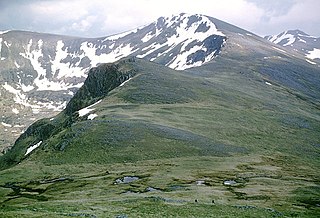
Carn Eige is a mountain in the Northwest Highlands of Scotland. Rising to 1,183 metres (3,881 ft) above sea level, it is the highest mountain in Scotland north of the Great Glen, the twelfth-highest in the British Isles, and, in terms of relative height, it is the second-tallest mountain in the British Isles after Ben Nevis. Carn Eige lies between Glen Affric and Loch Mullardoch, and is at the heart of a massif along with its twin peak, the 1,181-metre (3,875 ft) Mam Sodhail.
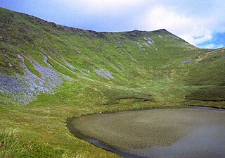
Cadair Berwyn or Cader Berwyn is a mountain summit in north-east Wales with a height of 832 metres (2,730 ft) above sea level. It is the highest point in the Berwyn range, the highest in North East Wales and the highest significant summit in Wales outside the National Parks. Cadair Berwyn and Foel Cedig to the west are the two Marilyns that form the Berwyn range. The undulating plateau of the range also includes a large number of other summits above 2,000 feet (610 m), including satellite summits of Cadair Berwyn and many which are classed as Nuttalls.

Grayrigg Forest is a hill in Cumbria, England, located on the eastern edge of what might be considered the Lake District, and in August 2016 becoming part of the national park. Reaching 494 metres (1,621 ft) above sea level, it is attainable from the less well-known Borrowdale valley.

Binsey is a hill on the northern edge of the Lake District in Cumbria, England. It is detached from the rest of the Lakeland hills, and thus provides a good spot to look out at the Northern and North Western Fells of the Lake District, as well as the coastal plain and, across the Solway Firth, Scotland. Snaefell on the Isle of Man is also visible on a clear day. It is the northernmost of the Wainwrights.

Galtymore or Galteemore is a mountain in the province of Munster, Ireland. At 917.9 metres, it is one of Ireland's highest mountains, being the 12th-highest on the Arderin list, and 14th-highest on the Vandeleur-Lynam list. Galtymore has the 4th-highest topographic prominence of any peak in Ireland, which classifies Galtymore as a P600, or "major mountain". It is one of the 13 Irish Munros.

Devoke Water is a small lake in the south west of the Lake District in North West England. It is the largest tarn in the Lake District, a tarn being a specific type of glacial lake formed when a hollow is created on a mountain. The lake is 1.17 kilometres (0.73 mi) long, has an area of 0.34 square kilometres (0.13 sq mi) and lies at an altitude of 236 metres (774 ft) on Birker Fell. Its outflow, to the north west, is Linbeck Gill, which joins the River Esk before flowing into the Irish Sea at Ravenglass. The lake is in the unitary authority of Cumberland and the ceremonial county of Cumbria. Its south-western shore forms part of the south-western boundary of Eskdale parish, in which it is situated.

Longlands Fell is a small fell in the northern part of the English Lake District. It is situated in the high ground known as the Uldale Fells, 5.5 kilometres south west of the village of Caldbeck. It reaches a height of 483 m (1,585 ft) and it is the most northerly fell in the Lake District.

Great Sca Fell is a fell in the English Lake District, seven kilometres southwest of the village of Caldbeck. It is the highest of the four Uldale Fells, the other three being Longlands Fell, Meal Fell and Great Cockup. It is a Wainwright, and the lowest of the lakeland ‘Sca fells’, the other two being Scafell and Scafell Pike.

Great Cockup is a fell in the northern region of the English Lake District, one of the four Uldale Fells.

Meal Fell is a small fell in the northern region of the English Lake District, it is situated seven kilometres south-west of the village of Caldbeck and is one of the four main Uldale Fells.
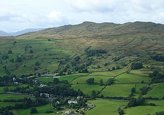
Wansfell is a fell in English Lake District situated 1+1⁄2 miles east of the town of Ambleside. The fell is part of the long southern ridge of Caudale Moor and occupies the swath of territory between Ambleside and the Troutbeck valley.

Mangerton or Mangerton Mountain, at 838 metres (2,749 ft), is the 19th-highest peak in Ireland on the Arderin list, and the 26th–highest mountain according to the Vandeleur-Lynam list. Mangerton is the tallest mountain in the Mangerton Mountain Group, also called the Mangerton Mountains or the Mountains of East Kerry, a range that includes five other major mountains that have a height above 2,000 feet (610 m). Mangerton's western slopes lie within the Killarney National Park. On Mangerton's north-western face lies a deep corrie lake called the Devil's Punchbowl, which is a popular scenic destination for hill walkers; although the mountain is often overlooked by walkers due to the proximity of its more scenic and accessible neighbour, Torc Mountain. The far northern slopes of Mangerton was the site of an important 13th-century battle between the Mac Cárthaigh, and the FitzGeralds, known as the "Tooreencormick battle site".
Moore Creek is a creek in South Algonquin, Nipissing District in Northeastern Ontario, Canada. It is in the Saint Lawrence River drainage basin and is a left tributary of the Madawaska River.
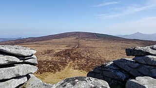
Prince William's Seat at 555 metres (1,821 ft), is the 296th–highest peak in Ireland on the Arderin scale, however, it does not have the elevation to quality as a Vandeleur-Lynam. Prince William's Seat is on the border of the Wicklow Mountains and Dublin Mountains in Ireland, and lies on the northern side of the Glencree valley, positioned at its entrance. Prince William's Seat is separated by a small col from neighbouring Knocknagun, which is also 555 metres (1,821 ft) in height. Prince William's Seat and Knocknagun are popular peaks with hill-walkers.

Winterscleugh is a hill of 464 metres (1,522 ft) in Cumbria, England, to the east of the Lake District. It is in the far east of the Lake District National Park since the national park's expansion in 2019. It is east of the A6 road and west of the M6 motorway, on the northern side of Borrowdale, Westmorland.

Whinfell Beacon is a hill of 472 metres (1,549 ft) in South Lakeland, Cumbria, England, to the east of the Lake District. It is in the far east of the Lake District National Park since the national park's expansion in 2019. It is east of the A6 road and west of the M6 motorway, south of Borrowdale, Westmorland and east of the upper reaches of the River Mint.
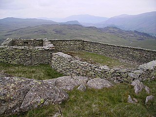
Bell Crags is a hill of 559.1 metres (1,834 ft) in the Lake District, England. It lies between Borrowdale to its west and Thirlmere to its east, and is north of Ullscarf. Below it to the west is one of several Lake District tarns named Blea Tarn, this one flowing out via Bleatarn Gill to Watendlath Tarn.


