Little Woods, Louisiana

Last updated

Little Woods, Louisiana
Nickname: 
Lake Pontchartrain Camps
Eastern New Orleans Louisiana Map Little Woods 1935.jpg
1935 map of portion of eastern New Orleans lakefront around Little Woods. [2]
Coordinates: 30°07′31″N89°57′36″W / 30.12528°N 89.96000°W / 30.12528; -89.96000
Country United States
State Louisiana
Parish Orleans
Elevation
−3 ft (−0.9 m)
Time zone UTC-6 (Central (CST))
  Summer (DST) UTC-5 (CDT)
Area code 504
GNIS, 1980 feature ID543401 [3]

Little Woods (French : La Petite Bois) was historically an unincorporated community on the shoreline of Lake Pontchartrain. The name in French, "La Petite Bois" or The Little Woods can be found on the 1883 Lafon-Alphonse Michoud Map drafted by civil-engineer George N. Grandjean. [4] "Little Woods", as a place designation that continues in local use. Little Woods also directly relates to the treed hammocks that were high Chénier ridges bordered by water and wetlands.

Contents

Geological formation

During the late Pleistocene or early Post-Pleistocene age, deltaic processes formed the beaches on the southshore of Lake Pontchartrain. Due to restricted flow resulting from the Pine Island trend, a series of 4600-year old barrier islands were formed. The discoveries of the Pine Island Beach Trend were compiled by Saucier (1963). [5] Previously, Rowett (1957) identified 87 species of mollusks here. He also established that there was a molluscan assemblage indicative of the conditions of deposition found on the shallow continental shelf described by Parker (1956).

Archaeological remains

Archaeological exploration of the Little Woods Middens led to discoveries of pot sherds and pumice, while burial sites uncovered quartz crystals and bones, no C14 data was collected. Cultural and geologic evidence collected from shell middens indicate this area was inhabited from 500 BCE to 1 CE during the Tchula period. The Tchefuncte Culture existed in the Early Woodland Period and were the first commonly making pottery from the native clay. Major excavations of shell deposits were directed by Maurice Weil in 1934 as part of a CWA project, followed by J. Richard Czajcowski as part of a large LSU New Deal Project. The sites at Little Woods are 16OR1-5, near to the site are two other sites Paris Road 16OR15 and Haughs Canal 16OR28. [6] Of these sites only a few remain today. [7]

Early exploration and development

René-Robert Cavelier, Sieur de La Salle, or Robert de La Salle (1643 – 1687) noted among his discoveries that the natives in Louisiana lived on pier like structures. [8] Later, Pierre Le Moyne d'Iberville, Sieur d'Iberville, or Sieur d'Iberville et d'Ardillières (1661 –1706) explored the area for trade, [9] from this time, King Louis XIV of France had a trading agreement with the local natives. [10] A road was planned by Pierre Denis de la Ronde (1762 - 1824), the planned road went from Little Woods to the town of Versailles, Louisiana in St. Bernard Parish he envisioned a canal linking Lake Pontchartrain to the Mississippi River along what is now Paris Road. In 1803 Napoleon Bonaparte sold the Louisiana territories to the Spain. [11]

alphonse michoud plantation map Alphonse michoud map.tif
alphonse michoud plantation map

Early development

By 1882, Little Woods was part of the Lafon-Alphonse Michaud Plantation and a railroad was being constructed to link New Orleans as part of New Orleans & Northeastern Railroad. The longest train trestle bridge in the world was constructed. [12] Railroad workers built section houses along the track and switched the passing trains onto the single track trestle, therefore, Little Woods became a whistle stop where trains would wait to cross the bridge. The train route leaving New Orleans to Little Woods is described in a newspaper article from 1887. [13] A large wooden dancing platform on piers is noted, also camps had thatched Palmetto roofs, people fished and sold their seafood in the city.

In 1908 a train wreck occurred, one evening at the Little Woods Station two trains collided in the fog killing prominent figures of the community. One of the twelve victims was Jacob Salmen [14] of The Salmen Brothers Brick and Lumber Company who later succumbed to his injuries. [15]

The Roaring Twenties

Louis Armstrong recalled, on page 47 of his autobiography, Satchmo: My Life in New Orleans, in 1913 at 13 years old, he was made a band leader and was sent to play at Milneberg and Little Woods. [16] By the 1920s hundreds of camps ranged from Milneberg at West End to Little Woods in the East. [17] Little Woods had become a vacation resort. Ragtime and early Jazz, called Ragajazz, was the music of the day. [18] Heard in the area were bands like Kid Stevenson Jazz Hounds, [19] Alcide yellow Nunez of the Original Dixieland Jazz Band, and Froggy's Moonlight Serenaders. During the 1920s plans for construction at Milneberg led to a few of those camps at that location to be moved to Little Woods. [20] Little Woods.jpg

Related Research Articles

<span class="mw-page-title-main">Interstate 12</span> Interstate in Louisiana

Interstate 12 (I-12) is an intrastate Interstate Highway located entirely within the US state of Louisiana. It spans a total of 85.59 miles (137.74 km) in an east–west direction from I-10 in Baton Rouge to an interchange with both I-10 and I-59 in Slidell. Along the way, it passes through the city of Hammond, where it intersects I-55 and US Route 51 (US 51). It also serves the cities of Ponchatoula and Denham Springs, as well as the St. Tammany Parish cities of Covington and Mandeville.

<span class="mw-page-title-main">St. Tammany Parish, Louisiana</span> Parish in Louisiana, United States

St. Tammany Parish is a parish located in the U.S. state of Louisiana named after Tamanend, the legendary Lenape Chief of Chiefs and the "Patron Saint of America." At the 2020 census, the population was 264,570, making it the fourth-most populous parish in Louisiana. The parish seat is Covington. The parish was founded in 1810.

<span class="mw-page-title-main">Kenner, Louisiana</span> City in Louisiana, United States

Kenner is a city in the U.S. state of Louisiana. It is the most populous city in Jefferson Parish, and is the largest incorporated suburban city of New Orleans. The population was 66,448 at the 2020 census, making it the sixth-most populous city in Louisiana.

<span class="mw-page-title-main">LaPlace, Louisiana</span> Census-designated place in Louisiana, United States

LaPlace is a census-designated place (CDP) in St. John the Baptist Parish, Louisiana, United States, situated along the east bank of the Mississippi River, in the New Orleans metropolitan area. In 2020, it had a population of 28,841.

Eden Isle is a census-designated place (CDP) in St. Tammany Parish, Louisiana, United States, on the northeast shore of Lake Pontchartrain. The population was 7,041 at the 2010 census. It is part of the New Orleans–Metairie–Kenner Metropolitan Statistical Area. The area is a residential community with homes built on a system of canals connecting to eastern Lake Pontchartrain, which also includes businesses along the Interstate-10 corridor as well as restaurants and marina services within the residential section.

<span class="mw-page-title-main">Slidell, Louisiana</span> City in Louisiana, United States

Slidell is a city on the northeast shore of Lake Pontchartrain in St. Tammany Parish, Louisiana, United States. The population was 28,781 at the 2020 census. It is part of the New Orleans−Metairie−Kenner metropolitan statistical area.

<span class="mw-page-title-main">St. Charles Parish, Louisiana</span> Parish in Louisiana, United States

St. Charles Parish is a parish located in the U.S. state of Louisiana. At the 2020 census, its population was 52,549. The parish seat is Hahnville and the most populous community is Luling.

<span class="mw-page-title-main">Lake Pontchartrain</span> Estuary located in southeastern Louisiana, United States

Lake Pontchartrain is an estuary located in southeastern Louisiana in the United States. It covers an area of 630 square miles (1,600 km2) with an average depth of 12 to 14 feet. Some shipping channels are kept deeper through dredging. It is roughly oval in shape, about 40 miles (64 km) from west to east and 24 miles (39 km) from south to north.

<span class="mw-page-title-main">Pierre Le Moyne d'Iberville</span> French soldier (1661–1706)

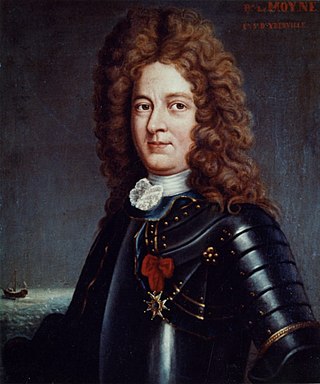
Pierre Le Moyne d'Iberville or Sieur d'Iberville was a French soldier, explorer, colonial administrator, and trader. He is noted for founding the colony of Louisiana in New France. He was born in Montreal to French colonist parents.

<span class="mw-page-title-main">Lake Pontchartrain Causeway</span> Parallel bridges in Louisiana, United States

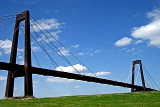
The Lake Pontchartrain Causeway, also known simply as The Causeway, is a fixed link composed of two parallel bridges crossing Lake Pontchartrain in southeastern Louisiana, United States. The longer of the two bridges is 23.83 miles (38.35 km) long. The southern terminus of the causeway is in Metairie, Louisiana, and the northern terminus is in Mandeville, Louisiana. Both are in the New Orleans metropolitan area.

<span class="mw-page-title-main">9th Ward of New Orleans</span>

The Ninth Ward or 9th Ward is a distinctive region of New Orleans, Louisiana, which is located in the easternmost downriver portion of the city. It is geographically the largest of the 17 Wards of New Orleans. On the south, the Ninth Ward is bounded by the Mississippi River. On the western or "upriver" side, the Ninth Ward is bounded by Franklin Avenue, then Almonaster Avenue, then People's Avenue. From the north end of People's Avenue the boundary continues on a straight line north to Lake Pontchartrain; this line is the boundary between the Ninth and the city's Eighth Ward. The Lake forms the north and northeastern end of the ward. St. Bernard Parish is the boundary to the southeast, Lake Borgne farther southeast and east, and the end of Orleans Parish to the east at the Rigolets.

<span class="mw-page-title-main">Gentilly, New Orleans</span> New Orleans neighborhood in Louisiana, United States

Gentilly is a broad, predominantly middle-class and racially diverse section of New Orleans, Louisiana. The Gentilly neighborhood is bounded by Lake Pontchartrain to the north, France Road to the east, Bayou St. John to the west, and CSX Transportation railroad tracks to the south.

<span class="mw-page-title-main">New Orleans East</span> Eastern section of New Orleans

New Orleans East is the eastern section of New Orleans, Louisiana, the newest section of the city. This collection neighborhood sub divisions represents 65% of the city's total land area, but it is geographically isolated from the rest of the city by the Inner Harbor Navigational Canal. It is surrounded by water on all sides, bounded by the Industrial Canal, Gulf Intracoastal Waterway, Lake Pontchartrain, Lake Borgne, and the Rigolets, a long deep-water strait connecting the two lakes. Interstate 10 (I-10) splits the area nearly in half, and Chef Menteur Hwy, Downman Rd, Crowder Blvd, Dwyer Rd, Lake Forest Blvd, Read Blvd, Bullard Ave, Michoud Blvd, Hayne Blvd, Morrison Rd, Bundy Rd, and Almonaster Ave serve as major streets and corridors.

<span class="mw-page-title-main">Louisiana Highway 47</span> Highway in Louisiana

Louisiana Highway 47 (LA 47) is a state highway located in southeastern Louisiana. It runs 15.91 miles (25.60 km) in a general southeast to northwest direction from the Mississippi River levee in Chalmette to the intersection of Hayne Boulevard and Downman Road in New Orleans.

The Acolapissa were a small tribe of Native Americans of North America, who lived in the Southeast of what is the present-day United States. They lived along the banks of the Pearl River, between present-day Louisiana and Mississippi. They are believed to have spoken a Muskogean language, closely related to the Choctaw and Chickasaw spoken by other Southeast tribes of the Muskogean family.

Bayou Manchac is an 18-mile-long (29 km) bayou in southeast Louisiana, USA. First called the Iberville River by its French discoverers, the bayou was once a very important waterway linking the Mississippi River to the Amite River. East Baton Rouge Parish lies on its northern side, while its southern side is divided between Ascension Parish and Iberville Parish. The large unincorporated community of Prairieville and the city of St. Gabriel both lie on its southern side.

<span class="mw-page-title-main">U.S. Route 11 in Louisiana</span> Segment of American highway

U.S. Highway 11 (US 11) is a part of the United States Numbered Highway System that spans 1,645 miles (2,647 km) from New Orleans, Louisiana, to Rouses Point, New York. Within the state of Louisiana, the highway travels 31 miles (50 km) from the national southern terminus at US 90 in New Orleans to the Mississippi state line south of Picayune.

The Mougoulacha were a Native American tribe that lived near Lake Pontchartrain in Louisiana.

John Gair and the Turmoil Surrounding His Death

Le Meschacébé was a French-language newspaper in Louisiana that also carried some English-language content and eventually became an English-language newspaper. The title of the newspaper comes from the Mississippi River, referred to as Le Meschacébé in French.

References

  1. "U.S. Geological Survey map". 1935.
  2. "U.S. Geological Survey map". 1935.
  3. "US Board on Geographic Names". United States Geological Survey. October 25, 1980. Retrieved August 11, 2019.
  4. Manto, C.D. (2014). Michoud Assembly Facility. Images of America. Arcadia Publishing. p. 9. ISBN   978-1-4671-1213-0 . Retrieved March 9, 2017.
  5. Saucier, Roger T. (1963). Recent Geomorphic History of the Pontchartrain Basin (PDF). Baton Rouge: Louisiana State University.
  6. Rees, M.A. (2010). Archaeology of Louisiana. LSU Press. p. 454. ISBN   978-0-8071-3795-6 . Retrieved March 9, 2017.
  7. "Draft Individual Environmental Report - Lake Pontchartrain and Vicinity - New Orleans East Citrus lakefront levee - Orleans parish, louisiana" (PDF). Archived from the original (PDF) on January 25, 2017. Retrieved March 9, 2017.
  8. "A Brief History of the Hayne Boulevard Camps". New Orleans History -- Lake Pontchartrain. August 18, 1988. Retrieved March 9, 2017.
  9. Le Moyne d'Iberville, Pierre (1875). "Library of Congress Online Catalog - No Connections Available". loc.gov. Retrieved March 9, 2017.
  10. Manto, C.D. (2014). Michoud Assembly Facility. Images of America. Arcadia Publishing. p. 9. ISBN   978-1-4671-1213-0 . Retrieved March 9, 2017.
  11. Condrey, Richard E. "Discover Louisiana's Environmental Past". LSU CES. Retrieved March 9, 2017.
  12. "About this Collection | United States Statutes at Large | Digital Collections | Library of Congress" (PDF). Library of Congress .
  13. "St. Tammany farmer. (Covington, La.) 1874-current, May 28, 1887, Image 2". May 28, 1887. Retrieved March 9, 2017 via chroniclingamerica.loc.gov.
  14. "The times dispatch. (Richmond, Va.) 1903-1914, November 13, 1908, Image 1". November 13, 1908. Retrieved March 9, 2017 via chroniclingamerica.loc.gov.
  15. "St. Tammany farmer. (Covington, La.) 1874-current, November 28, 1908, Image 5". November 28, 1908. Retrieved March 9, 2017 via chroniclingamerica.loc.gov.
  16. "Satchmo My Life in New Orleans". Prentice Hall, Inc. 1954.
  17. Widmer, M.L. (October 31, 1993). New Orleans in the Twenties. Pelican Publishing. p. 1. ISBN   978-1-4556-0954-3 . Retrieved March 9, 2017.
  18. "An enjoyable outing". New Orleans. The Herald. April 28, 1921. p. Image 1 via chroniclingamerica.loc.gov.
  19. "The herald. (New Orleans, La.) 1905-1953, July 27, 1922, Image 9". July 27, 1922. p. 8. Retrieved March 9, 2017 via chroniclingamerica.loc.gov.
  20. Campanella, C. (2007). Lake Pontchartrain. Images of America. Arcadia Publishing Incorporated. p. 114. ISBN   978-1-4396-1761-8 . Retrieved March 9, 2017.