Loantaka Brook Reservation

Last updated
Loantaka Brook Reservation
Location Morris County, New Jersey
Length5.1 miles
Trailheads [1]
UseWalking, biking, horseback riding, cross country skiing, recreation, rollerblading
DifficultyEasy walking trails, medium horseback, ADA accessible
Surface Asphalt and crushed limestone
HoursYear-around,
dawn to sunset
AmenitiesBenches, playground, athletic fields, mounting blocks, restrooms, benches, picnic facilities at trailheads
BathroomsThree restrooms located throughout the trail
Loantaka Brook Trails Morris County NJ map trails.png

The Loantaka Brook Reservation [2] is a nature reserve and public park in the American state of New Jersey in Morris County. It consists of five miles of nature trails for jogging, hiking, and biking. Seaton Hackney Stables, owned and operated by the Morris County Park Commission, offers horseback riding at an adjacent property with trail riding along a long and narrow corridor near the Loantaka Brook. [3] It has four distinct areas including the South Street recreation facilities, the Seaton Hackney Stables, [3] the Loantaka Brook area at Kitchell Road, and the Loantaka Way Trail.

Contents

Background

History

Lenape ownership

Around the year 1000, the Morristown area was inhabited by Munsee Lenape people. Circa 1500, Morris County was part of the Lenapehoking, i.e., modern-day New Jersey. [4] Arrowheads found in Munsee encampments throughout the Washington Valley suggest that they hunted wolf, elk, and wild turkey for game and likely ate mussels from the Whippany River. [5]

In 1757, colonists of the "New Jersey Association for Helping the Indians" forcibly relocated some 200 Lenape to Brotherton, New Jersey. [6] In 1801, some members of the tribe voluntarily traveled to join the Oneidas' reservation in Stockbridge, New York after receiving an invitation from the Oneidas. [7] [8] [9] However, colonists again expelled Lenape families in Stockbridge to Green Bay, Wisconsin in 1822. [8]

18th century

During the Revolutionary War, from January to May 1777, some of George Washington's troops camped in the Loantaka Valley, [10] [11] while he stayed at Arnold's Tavern on the Morristown Green. [12] [13]

The land had been private property until the twentieth century when large connecting plots were donated by various community members to form what is known today as The Loantaka Brook Reservation. The Reservation began as a public park after the Seaton Hackney Stables were added to the park system through a donation from Mr. and Mrs. Paul Moore in the 1900s. The Loantaka Brook Reservation began official service in 1957.

A subsequent addition was made by Helen Hartley Jenkins Wood. The wooded area was donated by Marcellus Hartley Dodge Sr. and Geraldine Rockefeller Dodge. The donation by Mr. and Mrs. Dodge helped to bring together the two largest tracts of land in the reservation. The trail system is part of 570 acres in one of New Jersey's most populated counties. In the past, the trail was mostly used by hikers and horseback riders, but since the creation of trails with multiple surfaces, including a car-wide macadam trail as well as dirt and gravel trails, [3] the park has become more user friendly for cyclists, rollerbladers, and other outdoor enthusiasts.

There are reports of efforts to try to expand the system in the future, possibly by connecting the Loantaka trails with those of the nearby Great Swamp National Wildlife Refuge.

In 2009, there was a report of new acres being added to the system based on a donation by Helen Mead Platt. [14]

Design and construction

The trails at the Loantaka Brook Reservation are divided into three separate micro-trails. The first portion, known as the Yellow Blaze Trail, starts at the South Street entrance near the horse stables, and continues south until Kitchell Road. The Yellow Blaze section is unique in that it consists of two separate trails that run side-by-side. A crushed limestone trail for horses is visible from the macadam portion of the trail that was repaved in 2012. This pattern of intertwining trails extends through the middle section of trail known as the Blue Blaze Trails. The last portion, The Red Blaze, is the least developed and consists of only macadam surfaces. The park generally has no major hills to climb and has been deemed suitable for young children on bicycles, according to one report. [15]

Park management

Two snakes, each about four feet long, cuddling on a rock Loantaka Brook Reservation bikeway two snakes on rock cuddling.jpg
Two snakes, each about four feet long, cuddling on a rock

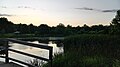
The park is one of many places in which supervised hunts have taken place as a means to curb deer overpopulation, [16] [17] with warning signs posted prominently. [18] In winter, ice sometimes covers portions of the trails. [18] In addition, the pond near Kitchell Road sometimes has been overrun with Canada geese, but efforts to discourage the geese have met with mixed success. [19]

Amenities

The trail features two types of surfacesan asphalt car-wide surface for bicyclists and packed gravel and limestone trails for horses and joggers. There are parking lots at three locations near entrances. The restrooms along the Loantaka Way Trails are cleaned daily during the summer and each rest area features a working water fountain except during the winter. In addition, there are picnic areas and grills near the South Street and Kitchell Road entrances. [3] There is a children's play area near the South Street entrance.

Community support

The Loantaka Brook Reservation is maintained by the Morris County Parks Commission and is currently in the process of being reviewed. There have been renovations such as a macadam surfaced trail and newly added picnic areas. [3] The park has been the venue for bicycle races, music, [20] and fund-raising events. [15] [21] There are annual cleanup events held in the springtime to remove invasive plants and to plant native plants, with volunteers wearing long pants and boots expected to get wet. [22] In 2010, New York Jets football player Jim Leonhard participated in an event on the reservation to raise funds to counter childhood obesity. [23]

Related Research Articles

<span class="mw-page-title-main">New Jersey Route 24</span> Highway in New Jersey

Route 24 is a 10.42-mile (16.77 km) state highway in New Jersey, United States, that begins at a junction with Interstate 287 (I-287) in Hanover Township in Morris County, passes southeast through Essex County, and ends at a junction with I-78 in Springfield Township in Union County. The route is a four- to six-lane freeway for its entire length.

Scouting in New Jersey has a long history, from the 1910s to the present day, serving thousands of youth in programs that suit the environment in which they live. The second Boy Scouts of America National Headquarters was in North Brunswick, although it was referred to in BSA publications as being in neighboring New Brunswick.

<span class="mw-page-title-main">Netcong, New Jersey</span> Borough in Morris County, New Jersey, United States

Netcong is a borough in Morris County, New Jersey, United States. As of the 2010 United States Census, the borough's population was 3,232, reflecting an increase of 652 (+25.3%) from the 2,580 counted in the 2000 Census, which had in turn declined by 731 (−22.1%) from the 3,311 counted in the 1990 Census. Netcong lies on the shores of Lake Musconetcong.

<span class="mw-page-title-main">Delaware Water Gap</span> Geological feature along the Delaware River

Delaware Water Gap is a water gap on the border of the U.S. states of New Jersey and Pennsylvania where the Delaware River cuts through a large ridge of the Appalachian Mountains.

<span class="mw-page-title-main">Cheesequake State Park</span> State park in New Jersey, United States

Cheesequake State Park is a 1,610-acre (2.52 sq mi) state park located in Old Bridge, Middlesex County, New Jersey, in the United States.

<span class="mw-page-title-main">Watchung Mountains</span> Group of three long low ridges in northern New Jersey

The Watchung Mountains are a group of three long low ridges of volcanic origin, between 400 and 500 feet high, lying parallel to each other in northern New Jersey in the United States. The name is derived from the American Native Lenape name for them, Wach Unks. The Watchung Mountains are known for their numerous scenic vistas overlooking the skylines of New York City and Newark, New Jersey, as well as their isolated ecosystems containing rare plants, endangered wildlife, rich minerals, and globally imperiled trap rock glade communities. The ridges traditionally contained the westward spread of urbanization, forming a significant geologic barrier beyond the piedmont west of the Hudson River; the town of Newark, for example, once included lands from the Hudson to the base of the mountains. Later treaties moved the boundary to the top of the mountain, to include the springs.

<span class="mw-page-title-main">Lake Hopatcong</span> Body of water

Lake Hopatcong is the largest freshwater body in New Jersey, United States, about 4 square miles (10 km2) in area. Located 30 miles (48 km) from the Delaware River and 40 miles (64 km) from Manhattan, New York City, the lake forms part of the border between Sussex and Morris counties in the state's northern highlands region. Lake Hopatcong was produced by damming and flooding of two ponds, known as the Great Pond and Little Pond, and the Musconetcong River, its natural outlet. Historically known as a resort lake for vacationing New Yorkers, it is now a mostly suburban residential lake.

<span class="mw-page-title-main">South Mountain Reservation</span>

South Mountain Reservation, covering 2,110 acres (8 km2), is a nature reserve on the Rahway River that is part of the Essex County Park System in northeastern New Jersey. It is located in central Essex County, New Jersey within portions of Maplewood, Millburn, and West Orange. It borders South Orange between the first and second ridges of the Watchung Mountains.

<span class="mw-page-title-main">Swartswood State Park</span> State park in Sussex County, New Jersey

Swartswood State Park is a 3,460-acre (14.0 km2) protected area located in the Swartswood section of Stillwater and Hampton townships in Sussex County, New Jersey, in the United States. Established in 1915 by the state's Forest Park Reservation Commission, it was the first state park established by the state of New Jersey for the purposes of recreation at the state's third-largest freshwater lake. Today, Swartswood State Park is operated and maintained by the New Jersey Division of Parks and Forestry.

<span class="mw-page-title-main">Mills Reservation</span> County park in Essex County, New Jersey

Mills Reservation is a county park, consisting of a 157.15-acre (0.6360 km2) protected wooded area located in Cedar Grove and Montclair, New Jersey, United States. The reservation is maintained by the Essex County Park Commission. The reservation has several walking and jogging trails, including the Lenape Trail, four major trails, and two smaller trails. One of the four main trails leads to a cliff that overlooks the New York City skyline.

<span class="mw-page-title-main">Watchung Reservation</span> Largest nature reserve in Union County, New Jersey, US

Watchung Reservation is the largest nature reserve in Union County, New Jersey, United States. Covering 1,945 acres, it is bounded by the city of Summit, the borough of Mountainside, and the townships of Berkeley Heights, Scotch Plains, and Springfield.

<span class="mw-page-title-main">Loantaka Brook</span>

Loantaka Brook is a tributary of the Passaic River in New Jersey in the United States.

The Lenape Trail is a trail through Essex County, connecting many county parks and reservations, wooded spaces, and historical sites. It begins in Newark, New Jersey and ends in Millburn, New Jersey. It was established in 1982. It is the fifth longest trail in the state behind the Delaware and Raritan Canal Trail, the Appalachian Trail, the completed section of the Highlands Trail in the state and the Batona Trail. The Lenape trail traverses Newark and its suburbs, as well as the Watchung Mountains and Passaic Meadows. Because of the steepness of the Watchung Mountains and the flood-prone nature of the Passaic Meadows, the former basin of Glacial Lake Passaic, these areas have remained much less developed than the rest of the northeastern part of the state. This trail therefore offers hikers an opportunity to see cultural and historical sites of an urban trail, as well as large natural and undeveloped areas. The trail's proximity to New York City and the various ridges it traverses, including Forest Hill, Orange Mountain, and Second Watchung Mountain, offer many views of the skyline. The Lenape Trail forms a segment of the Liberty-Water Gap Trail and incorporates the West Essex Trail, the Lenape Trail's only rail-to-trail section. The Lenape Trail also connects with Morris County's Patriots Path trail system on its western terminus.

<span class="mw-page-title-main">Morristown Green</span> Park in Morristown, New Jersey

Morristown Green, most commonly referred to as the Green, is a historical park located in the center of Morristown, New Jersey. It has an area of two and a half acres and has in the past served as a military base, a militia training ground, and an area for public executions. It is now a public park in which many community events are held.

<span class="mw-page-title-main">Patriots' Path</span> Trail system in Morris County, New Jersey

The Patriots' Path is a multi-use trail system in Morris County, New Jersey, open to cyclists, hikers, and horseback riders, consisting of a 55-mile main trail with 35 miles of spur trails. The main trail is marked with white blazes or a white circular blaze with a brown tree. The spur trails are marked with blue blazes or a white circle with a blue tree, while the side spur trails are marked with a red blaze or a white circle with a red tree.

<span class="mw-page-title-main">Indian Mills, New Jersey</span> Unincorporated community in New Jersey, United States

Indian Mills, formerly known as Brotherton, is an unincorporated community located within Shamong Township in Burlington County, New Jersey, United States. It was the site of Brotherton Indian Reservation, the only Indian reservation in New Jersey and the first in America, founded for the Lenni Lenape tribe, some of whom were native to New Jersey's Washington Valley.

<span class="mw-page-title-main">Washington Valley, New Jersey</span> Unincorporated community in New Jersey, United States

Washington Valley is an unincorporated community in the Whippany River valley within Morris Township in Morris County, New Jersey.

Lenape Park is a 450-acre wildlife reserve and park that is part of the Rahway River Parkway in Union County, New Jersey. The park is located in four towns: Westfield, Springfield, Kenilworth, and Cranford.

<span class="mw-page-title-main">Morris County Park Commission</span>

The Morris County Park Commission (MCPC) is a board of commissioners that manages parks, facilities, and historic sites in Morris County, New Jersey.

References

  1. Green Village Entrance
  2. Note: pronounced low-AHN-ih-kuh and rhymes with "harmonica"
  3. 1 2 3 4 5 Denise Copeland (July 12, 2010). "A dry post-rain ride on the Loantaka Brook Reservation Bike Trail, Morris County, New Jersey". nj.com. Retrieved 2012-07-24.
  4. Alvin M. Josephy Jr, ed. (1961). The American Heritage Book of Indians. American Heritage. pp. 168–189. LCCN   61-14871.
  5. Barbara, Hoskins; Foster, Caroline; Roberts, Dorothea; Foster, Gladys (1960). Washington Valley, an informal history. Edward Brothers, Inc. OCLC   28817174.
  6. "Collection: New Jersey Association for helping the Indians records | Archives & Manuscripts". archives.tricolib.brynmawr.edu. Archived from the original on August 8, 2020. Retrieved 2022-04-21.
  7. "The Brotherton Indians of New Jersey, 1780 | Gilder Lehrman Institute of American History". www.gilderlehrman.org. Archived from the original on April 21, 2022. Retrieved 2022-04-21.
  8. 1 2 Barbara, Hoskins; Foster, Caroline; Roberts, Dorothea; Foster, Gladys (1960). Washington Valley, an informal history. Edward Brothers. OCLC   28817174.
  9. "New Stockbridge Tribe". collections.dartmouth.edu. Archived from the original on May 20, 2022. Retrieved 2022-04-21.
  10. Cunningham, John T. (1994). This is New Jersey. Rutgers University Press. ISBN   978-0-8135-2141-1.
  11. Ring, Trudy; Watson, Noelle; Schellinger, Paul (2013-11-05). The Americas: International Dictionary of Historic Places. Routledge. ISBN   978-1-134-25930-4.
  12. "CONTENTdm". jfpl.contentdm.oclc.org. Retrieved 2022-10-22.
  13. NJ.com, Delaney Dryfoos | For (2018-07-05). "A true Fourth of July celebration: This town had a reading of Declaration of Independence". nj. Retrieved 2022-10-27.
  14. Lawrence Ragonese (November 8, 2009). "Morris County, Chatham land owners agree to preserve pre-Civil War era farm". The Star-Ledger. Retrieved 2012-07-24.
  15. 1 2 Denise Copeland (July 14, 2011). "Family friendly ride with Team Town Cycle at Loantaka Brook Reservation this Sunday". nj.com. Retrieved 2012-07-24.
  16. Lawrence Ragonese (July 14, 2009). "Morris County to allow deer hunting at four more parks". The Star-Ledger. Retrieved 2012-07-24.
  17. Sarah Schillaci (March 31, 2010). "Morris Township deer hunt killed 139 does, 32 bucks". Star-Ledger. Retrieved 2012-07-24.
  18. 1 2 Denise Copeland (December 7, 2010). "Early winter updates on the Loantaka Trail". nj.com. Retrieved 2012-07-24.
  19. Lawrence Ragonese (April 14, 2009). "Morris County plans to scare, not kill, Canada geese in parks". The Star-Ledger. Retrieved 2012-07-24. ... Canada geese returned in large numbers to ... Loantaka Brook Reservation in Morris and Chatham townships...
  20. "ON THE TOWNS". The New York Times. August 4, 1996. Retrieved 2012-07-24.
  21. "Kaleidoscope of Hope Walks Again in the Fight Against Ovarian Cancer". Boston.com. August 15, 2011. Retrieved 2012-07-24.
  22. Great Swamp Watershed Association (March 12, 2012). "Spring's Almost Here! Time To Get Out And Volunteer!". nj.com. Retrieved 2012-07-24.
  23. George (May 13, 2010). "Jets safety Jim Leonhard tackles childhood obesity on Saturday for 'Move it Morris Day'". nj.com. Retrieved 2012-07-24.

Coordinates: 40°46′27″N74°27′42″W / 40.774123°N 74.461663°W / 40.774123; -74.461663