Callander is a small town in the council area of Stirling, Scotland, situated on the River Teith. The town is located in the historic county of Perthshire and is a popular tourist stop to and from the Highlands.

The Stirling council area is one of the 32 council areas of Scotland, and has a population of about 94,330. It was created under the Local Government etc (Scotland) Act 1994 with the boundaries of the Stirling district of the former Central local government region, and it covers most of Stirlingshire and the south-western portion of Perthshire. Both counties were abolished for local government purposes under the Local Government (Scotland) Act 1973.

Loch Katrine is a freshwater lake in the Trossachs area of the Scottish Highlands, east of Loch Lomond, within the historic county and registration county of Perthshire and the contemporary district of Stirling. The loch is about 8 miles (13 km) long and 1 mile (1.6 km) wide at its widest point, and runs the length of Strath Gartney. It is within the drainage basins of the River Teith and River Forth.
Loch Lomond and The Trossachs National Park is a national park in Scotland centred on Loch Lomond and the hills and glens of the Trossachs, along with several other ranges of hills. It was the first of the two national parks established by the Scottish Parliament in 2002, the second being the Cairngorms National Park. The park extends to cover much of the western part of the southern highlands, lying to the north of the Glasgow conurbation, and contains many mountains and lochs. It is the fourth-largest national park in the British Isles, with a total area of 1,865 km2 (720 sq mi) and a boundary of some 350 km (220 mi) in length. It features 21 Munros and 20 Corbetts.
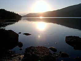
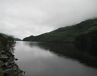
Loch Lubnaig is a small freshwater loch near Callander in the Stirling council area, Scottish Highlands. It lies in the former county of Perthshire. It is part of the Loch Lomond and The Trossachs National Park.

The Trossachs generally refers to an area of wooded glens, braes, and lochs lying to the east of Ben Lomond in the Stirling council area of Scotland. The name is taken from that of a small woodland glen that lies at the centre of the area, but is now generally applied to the wider region.
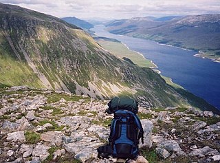
Loch Ericht is a freshwater loch on the border between the former Perthshire, now Perth and Kinross and the former Inverness-shire, now Highlands Council areas of Scotland. It has a north-east to south-west orientation. The village of Dalwhinnie lies at the north east end of the loch. Loch Ericht is the tenth largest freshwater lake in Scotland and has a good reputation for its trout fishing and Ferox trout.

Loch Ard is a loch, located in Loch Lomond and the Trossachs National Park, Stirling council area, Scotland.

Ben Ledi is a mountain in Stirling, Scotland. It is 879 metres high, and is therefore classified as a Corbett. It lies about six kilometres northwest of Callander, near the village of Kilmahog. It is situated in the Trossachs, an area often regarded as having some of the most romantic scenery in the Highlands.
The Gryffe Reservoirs, also spelled 'Gryfe', take their name from the River Gryffe, name deriving from the Gaelic garbh meaning "rough stream". are two reservoirs, known as Gryffe No. 1 and Gryffe No. 2, located in Inverclyde in the west central Lowlands of Scotland.

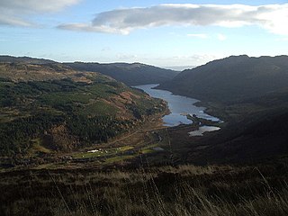
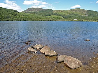
Loch Achray is a small freshwater loch 11 km (6.8 mi) west of Callander in Stirling district, Scotland.
Kilmahog is a hamlet situated half a mile to the west of Callander, Scotland.
Loch Eck is a freshwater loch located on the Cowal peninsula, north of Dunoon, Argyll and Bute, Scotland. It is seven miles long. Along with Loch Lomond, it is the only naturally occurring habitat of the Powan (fish). The loch also has salmon, sea trout, brown trout and arctic charr.
Loch Chon is a freshwater lake situated west of the village of Aberfoyle, near the small village of Kinlochard, Stirling, Scotland, UK. Loch Chon lies upstream of Loch Ard and to the south of Loch Katrine.

Loch Drunkie is a small freshwater loch in the Trossachs near Aberfoyle in the Stirling council area, Scotland.

Dunalastair Water is an entirely man made reservoir in Scotland which lies between Loch Rannoch and Loch Tummel in Strath Tummel in Perth and Kinross council area. The loch provides water power for the Tummel hydroelectricity power station and has the reputation as one of the best wild trout fishing locations in the United Kingdom.

Benvane is a mountain in the Trossachs, in Stirling council area, Scotland. It lies within Loch Lomond and The Trossachs National Park and the Queen Elizabeth Forest Park, and the summit is on the western boundary of the Trossachs National Nature Reserve. It is 821 metres (2,694 ft) high, and is classified as a Corbett, being joined by a ridge to the neighbouring Corbett of Ben Ledi.

Loch Affric is a freshwater loch within Glen Affric, in the Highland council area of Scotland. It lies about 25 miles (40 km) southwest of Beauly. The loch sits in a national nature reserve known for being home to a number of rare species and the loch itself is popular for trout fishing. An annual duathlon is held on the banks of the loch in May and the loch has been widely used as the backdrop in films.

Ben A'an is a hill in the Trossachs in Scotland. The pointed peak of its west top resembles a small mountain.
Queen Elizabeth Forest Park is a 19,665-hectare (48,590-acre) forest park in the Scottish Highlands which extends from the eastern shores of Loch Lomond to the mountains of Strathyre. The forest park is one of six such parks in Scotland, and was established in 1953, the year of the coronation of Elizabeth II. It is owned and managed by Forestry and Land Scotland.