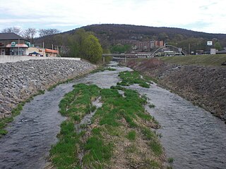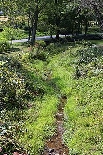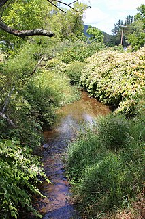
Mahoning Creek is a tributary of the Susquehanna River in Columbia County and Montour County, in Pennsylvania, in the United States. It is approximately 10.6 miles (17.1 km) long and flows through Madison Township in Columbia County and West Hemlock Township, Derry Township, Valley Township, Mahoning Township, and Danville in Montour County. The watershed of the creek has an area of 39.6 square miles (103 km2). Its tributaries include Kase Run, Mauses Creek, and Sechler Run. Mahoning Creek is designated as a Trout-Stocking Fishery and a Migratory Fishery for part of its length and as a Warmwater Fishery and a Migratory Fishery for the remainder.

West Hemlock Creek is a tributary of Hemlock Creek in Montour County and Columbia County, in Pennsylvania, in the United States. It is approximately 3.7 miles (6.0 km) long and flows through West Hemlock Township, Montour County and Hemlock Township, Columbia County. The creek has at least one unnamed tributary. West Hemlock Creek and its unnamed tributary are considered by the Pennsylvania Department of Environmental Protection to be impaired. The watershed of the creek has an area of 2.80 square miles (7.3 km2). The creek is designated as a coldwater fishery. Rock formations in the watershed include the Catskill Formation and the Trimemrs Rock Formation.

Long Hollow is a tributary of Catawissa Creek in Columbia County, Pennsylvania, in the United States. It is approximately 2.5 miles (4.0 km) long and flows through Roaring Creek Township and Beaver Township. The watershed of the stream has an area of 2.84 square miles (7.4 km2). The stream has a neutral pH and is considered to be a coldwater fishery. The main rock formations in the stream's watershed are the Mauch Chunk Formation, the Spechty Kopf Formation, the Pocono Formation, and the Buddys Run Member of the Catskill Formation.

Little Roaring Creek is a tributary of the Susquehanna River in Montour County and Northumberland County, in Pennsylvania, in the United States. It is approximately 4.4 miles (7.1 km) long and flows through Mayberry Township, Montour County and Rush Township, Northumberland County. The watershed of the creek has an area of 5.98 square miles (15.5 km2). The creek is considered to be a coldwater fishery and a migratory fishery. At least two mills historically existed on it. Additionally, a number of bridges cross the creek.
Gaskins Run is a tributary of the Susquehanna River in Montour County and Northumberland County, in Pennsylvania, in the United States. It is approximately 2.1 miles (3.4 km) long and flows through Liberty Township, Montour County, Mahoning Township, Montour County. The watershed of the stream has an area of 1.04 square miles (2.7 km2). At least one bridge crosses the stream. It is considered to be both a Coldwater Fishery and a Migratory Fishery.
Raups Run is a tributary of the Susquehanna River in Northumberland County, Pennsylvania, in the United States. It is approximately 0.7 miles (1.1 km) long and flows through Point Township. The watershed of the stream has an area of 0.54 square miles (1.4 km2). The stream is considered to be a Coldwater Fishery and a Migratory Fishery. It was entered into the Geographic Names Information System on August 2, 1979.

Wilson Run is a tributary of Kipps Run in Northumberland County, Pennsylvania, in the United States. It is approximately 3.6 miles (5.8 km) long and flows through Rush Township and Riverside. The watershed of the stream has an area of 3.27 square miles (8.5 km2). The drainage basin is considered to be a Coldwater Fishery and a Migratory Fishery. At least three bridges cross the stream and a mill historically existed on it. Sandstone has been observed in its vicinity.

Packers Run is a tributary of the Susquehanna River in Northumberland County, Pennsylvania, in the United States. It is approximately 2.2 miles (3.5 km) long and flows through Point Township. The watershed of the stream has an area of 1.58 square miles (4.1 km2). The stream is designated as a Coldwater Fishery and a Migratory Fishery. There is at least one bridge in its watershed.

Gravel Run is a tributary of the Susquehanna River in Northumberland County, Pennsylvania, in the United States. It is approximately 4.4 miles (7.1 km) long and flows through Rush Township and Upper Augusta Township. The watershed of the stream has an area of 6.33 square miles (16.4 km2). A number of bridges cross the stream and a mill was also historically present along it. The stream is considered to be a Coldwater Fishery and a Migratory Fishery. It has a number of unnamed tributaries.

Lithia Springs Creek is a tributary of the Susquehanna River in Northumberland County, Pennsylvania, in the United States. It is approximately 3.2 miles (5.1 km) long and flows through Point Township. The watershed of the creek has an area of 8.96 square miles (23.2 km2). It has a named tributary known as Johnson Creek. Waste of various types is discharged into Lithia Springs Creek from a variety of sources. At least one bridge more than 20 feet (6.1 m) long crosses the creek. The creek is considered to be a Coldwater Fishery and a Migratory Fishery. It is inhabited by wild trout and possibly a few other species of fish.

Lick Run is a tributary of Little Fishing Creek in Lycoming County and Columbia County, in Pennsylvania, in the United States. It is approximately 5.2 miles (8.4 km) long and flows through Jordan Township in Lycoming County and Pine Township, in Columbia County. The watershed of the stream has an area of 4.40 square miles (11.4 km2). The entire drainage basin is considered to be a Coldwater Fishery and a portion of the stream is considered to be Class A Wild Trout Waters. At least one bridge crosses the stream.
Long Run is a tributary of Nescopeck Creek in Luzerne County, Pennsylvania, in the United States. It is approximately 3.0 miles (4.8 km) long and flows through Butler Township. The watershed of the stream has an area of 4.62 square miles (12.0 km2). Land uses in the watershed include forested land, agricultural land, and barren land. The waters of the stream are slightly acidic, but this is not caused by acid mine drainage. It is considered to be Class A Wild Trout Waters, a Coldwater Fishery, and a Migratory Fishery. The stream has two unnamed tributaries and at least one bridge crosses it.

Hunlock Creek is a tributary of the Susquehanna River in Luzerne County, Pennsylvania, in the United States. It is approximately 7.8 miles (12.6 km) long and flows through Lehman Township and Hunlock Township. The watershed of the creek has an area of 32.5 square miles (84 km2) and is situated in northwestern Luzerne County. It has one named tributary, which is known as Roaring Brook, and a number of unnamed and unofficially named tributaries, such as "West Branch Hunlock Creek".

Lick Creek is a tributary of Shamokin Creek in Northumberland County, Pennsylvania, in the United States. It is approximately 2.7 miles (4.3 km) long and flows through Shamokin Township. The watershed of the creek has an area of 2.46 square miles (6.4 km2). The creek is not designated as impaired and its watershed is designated as a Coldwater Fishery and a Migratory Fishery. It supports some aquatic life.

Bennys Run is a tributary of Shamokin Creek in Northumberland County, Pennsylvania, in the United States. It is approximately 3.8 miles (6.1 km) long and flows through Shamokin Township. The watershed of the stream has an area of 6.12 square miles (15.9 km2). The stream is not designated as an impaired waterbody and it has a relatively high level of water quality. It is a small, shallow stream and its watershed is designated as a Coldwater Fishery and a Migratory Fishery. A few bridges have been constructed across the stream.

Boile Run is a tributary of the Susquehanna River in Northumberland County, Pennsylvania, in the United States. It is approximately 4.7 miles (7.6 km) long and flows through Lower Augusta Township. The watershed of the stream has an area of 5.97 square miles (15.5 km2). The stream is not designated as an impaired waterbody and is a relatively small stream. There was a mill on Boile Run in the second half of the 1800s and several bridges have been built over the stream. Its watershed is designated as a Warmwater Fishery and a Migratory Fishery.

Swale Brook is a tributary of Tunkhannock Creek in Wyoming County, Pennsylvania, in the United States. It is approximately 2.9 miles (4.7 km) long and flows through Tunkhannock Township and Tunkhannock. The watershed of the stream has an area of 4.01 square miles (10.4 km2). The stream is not designated as an impaired waterbody. The surficial geology near it consists of alluvium, alluvial terrace, Wisconsinan Outwash, Wisconsinan Till, Wisconsinan Ice-Contact Stratified Drift, fill, and a wetland.

Crab Run is a tributary of Mahanoy Creek in Schuylkill County, Pennsylvania, in the United States. It is approximately 2.5 miles (4.0 km) long and flows through Barry Township. The watershed of the stream has an area of 3.50 square miles (9.1 km2). Despite being listed as impaired by abandoned mine drainage, the stream is not impacted by this; no mining has been done in its watershed. However, some stream reaches in its watershed do experience agricultural impacts. The stream is not far from the Western Middle Anthracite Field. Its watershed is designated as a Coldwater Fishery and a Migratory Fishery. As of 2001, the stream contains macroinvertebrates, but no fish.

Glade Run is a tributary of the West Branch Susquehanna River in Northumberland County and Lycoming County, in Pennsylvania, in the United States. It is approximately 6.5 miles (10.5 km) long and flows through Lewis Township in Northumberland County and Muncy Creek Township and Muncy in Lycoming County. The watershed of the stream has an area of 7.63 square miles (19.8 km2). The stream is not designated as an impaired waterbody. An Indian path known as the Wyoming Path was historically in the stream's vicinity. More recently, a number of bridges have been constructed over Glade Run. The stream's watershed is designated as a Warmwater Fishery and a Migratory Fishery.
Bargers Run is a tributary of the Susquehanna River in Perry County, Pennsylvania, in the United States. It is approximately 5.9 miles (9.5 km) long and flows through Greenwood Township, Liverpool Township, and Liverpool. The watershed of the stream has an area of 13.0 square miles (34 km2). The stream has two named tributaries: Spruce Run and Barger Run. A number of bridges have been built across Bargers Run. Its watershed is designated as a Warmwater Fishery and a Migratory Fishery.


